
Before I jump into it: this post covers my trip to my twenty-first American national park. That’s insane to me. When Elizabeth and I first conceived of our trip to Guadalupe and Carlsbad 6 summers ago, I’d been to 9 of them with my family. Even as recently as the middle of 2020, my count was still back at 11. And now I’ve officially been to 1/3 of all of the parks the US has to offer. That’s wild.
This trip started like all of the other trips over the last year or so: with me bored at work and looking for a weekend to plan a getaway. Memorial Day weekend is a bold time to take off if you work at NWS Norman, but I realized that I had a three-day weekend exclusive of Memorial Day. If someone was willing to take my day shift the Friday before Memorial Day, I could revert that shift to holiday leave and have a four-day weekend with zero annual leave used. Meanwhile, Elizabeth was on an alternate work schedule at OEM and had Memorial Day itself off, so she had the same four-day weekend. It was like the stars were aligning.
Where to go? I briefly looked at Yosemite/King’s Canyon but ruled those out as too expensive and crowded. Lake Tahoe? Nah. Well, where does Southwest fly to that we could use our expiring-at-the-end-of-the-year companion passes on? Ah, of course. Montrose! Why the heck does Southwest Airlines service Montrose, Colorado? I’m honestly not entirely sure. But I’m glad they do. After a little wrangling with Elizabeth, a little bit of saving of some gambling winnings in early April, and some creative AirBNB booking, we found a cabin to stay at in Montrose from May 24-27 that worked well with Southwest’s flights. And it was on.
I actually had a lot of trouble figuring out an itinerary for the holiday weekend. Montrose sits in an interesting spot at the northern “foot” of the San Juan Mountains, near a spot where multiple rivers come flowing out into the Colorado Valley. There’s a whole lot to see – the famed San Juan mountain towns of Ouray, Silverton, and Telluride; the beauty of the Uncompaghre Valley; and of course, just outside of town, Black Canyon of the Gunnison National Park. Figuring out roughly how to plan for this on a busy holiday weekend literally kept me up at night trying to crack the code. It basically took me until the day before we left to have something that felt like a plan.
The morning of May 24, 2024 dawned bright and early. I would know – my alarm went off at 4:00 am. It had been an extremely long couple of weeks of severe weather at our office, culminating in an hour-long strong tornado that I was the warning forecast literally the previous night. So no matter what else, this was going to be a welcome break from constant working and exhaustion – although the early wake-up call might contribute more to exhaustion than otherwise. Elizabeth was a little hard to coax out of bed, but eventually we both stumbled our way on into the car and made it to the airport with at least 15 minutes to spare (enough time for a customary pre-flight frappecino).
Our first flight of the morning was a trip up to Denver, in which I got to experience some fun weather:
The other great adventure of the flight came as we were nearly on the ground, when all of a sudden the plane pulled up. Elizabeth did not enjoy that; her knuckles were white from clenching on to the armrests during the maneuver. The pilot sounded unperturbed as he informed us that they’d had to abort the landing because an American Airlines plane was taking too long on the runway, but pilots never sound perturbed about anything. What I did find out after we circled and landed was that the minimum elevation we’d reached was 5,500 feet. A full mile up? It sure didn’t feel like that. Then I thought about where we were – the Mile High City – and realized that FlightAware altitudes are in MSL.
So that was fun!
We had a decent-sized layover in the Denver Airport – long enough to get breakfast burritos from La Casita and take them up to the second level of the C terminal, then long enough for me to take a quick nap at our gate.
The second flight was a lot more interesting to track than the first one. For one, I was a lot more awake by late morning. For another, instead of flying over a stratus deck and approaching back down onto the Palmer Divide, we were flying just south of I-70 across some of America’s tallest mountains – The Front Range, the Collegiates, the Maroon Bells and the Elks. It was a short little puddle jump of a flight too, which meant we cruised along at barely higher than the tops of the mountains, and the initial descent put us right onto the level with them. All of a sudden, the mountains opened up into a semi-desert valley with big old salt flats and lush wheat fields in close proximity – a classic piece of the American West here as we landed in Montrose.
Montrose Airport was about what I expected – it was a little more modern and a little less rustic than Great Falls, Montana (and served by all four of the major domestic airlines!), but roughly the same size. Instead of bear stuff everywhere, signs all over the airport extolled the skiing in Telluride. Here in late May nobody was arriving to ski, but everyone in the short rental car line at Hertz chatted about their upcoming plans in Telluride for the holiday weekend regardless. It seemed that Elizabeth and I were the only ones actually staying in Montrose for the weekend. That probably explained why our cabin was so cheap.
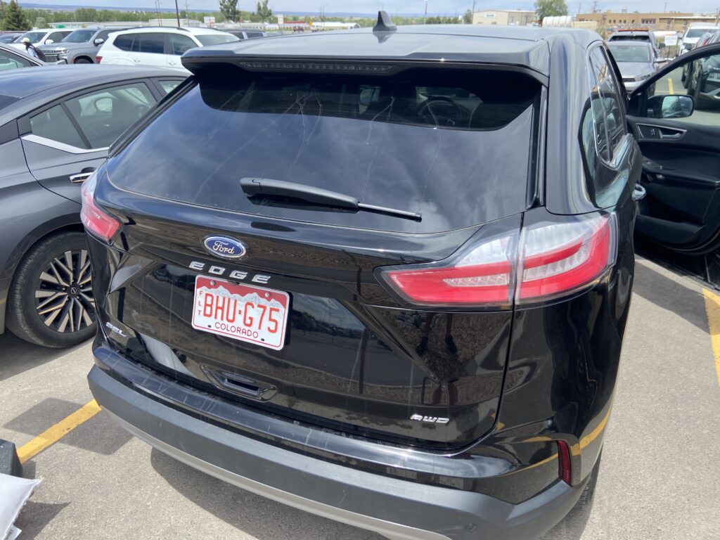
The rental car process was quick and easy – all we had to do was take the keys out into the parking lot and hit the panic button until we found the car. It wasn’t that big a parking lot, either – it’s Montrose, after all. This was our introduction to another in a long string of excellent rental cars Elizabeth and I have acquired in our year and a half of being Southwest Companion Pass fliers. I introduced you to the BHUGmobile.
Elizabeth had recently been lamenting the lack of good Indian food in Norman (she’s right), so it had been a priority for me to find us an Indian restaurant somewhere this weekend. There were a few options, but by far the most promising was Guru’s in downtown Montrose. At 4.1 stars on Google Reviews and on Main Street heading toward Black Canyon, it was our best bet. I’ll admit that there was some concern in my mind when we walked in and there were no other customers in the restaurant at all. I shouldn’t have been; all great Indian restaurants draw their power from their sketchiness. This one was no different. Elizabeth’s biryani was pretty good, and my chana masala really hit. Our server (who was probably also the owner) was watching an Indian soap opera on her phone. The vibes were immaculate. The vibes continued to be immaculate at the San Juan Coffeehouse a few doors down, where Elizabeth got her requisite iced latte to keep her going. It was a beautiful spring day in Montrose – already by late spring, Norman is getting so damn humid, so for temperatures to be in the 50s in the afternoon was a treat.
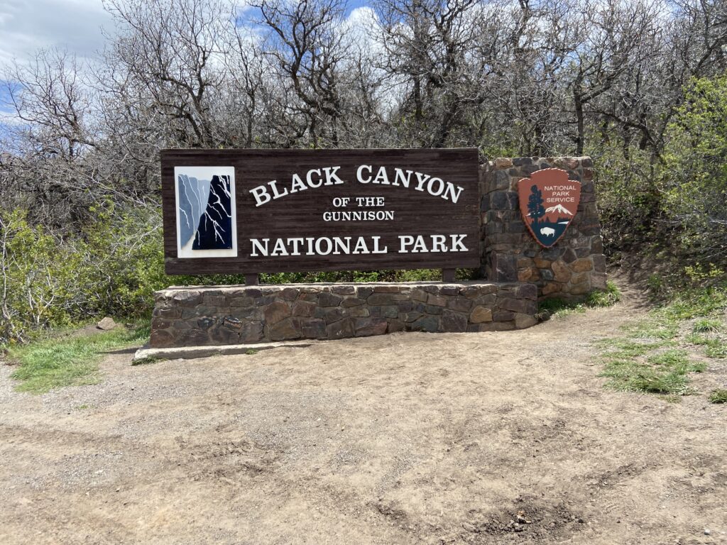
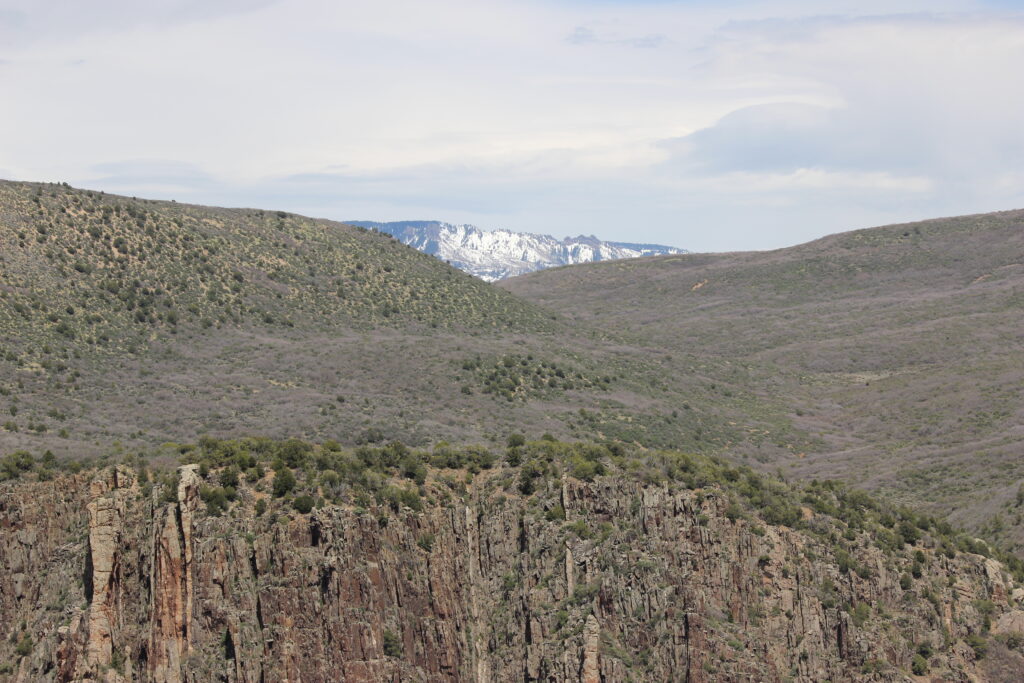
Black Canyon of the Gunnison National Park (isn’t that a long name) is located legitimately no more than 10 miles outside of Montrose. There’s a big ridge on the east side of town with a smaller ridge in front of it; as you drive east on US-50 you gradually realize those two ridges form the two rims of the canyon. Then there’s a left turn onto a Colorado State Highway that winds its way up the near ridge, and all of a sudden you’re gaining elevation fast. The views quickly became breathtaking – particularly along the southern horizon, where the San Juan Mountains loomed craggy and snow-covered. I was already so excited to see those mountains, but we still had a national park before then? This was the kind of stuff that I dream about on quiet shifts at work!
To give you a sense of how quickly we got there – the rental car was picked up at 12:15, and here’s a picture of the park entrance sign at 1:30.
That was the conclusion of 10 minutes of somewhat-stressful uphill driving to get to the top of the ridge on the South Rim. That’s the rim that maintains a much higher tourist presence compared to the remote North Rim. It’s 3 hours to get from one rim to the other even though the canyon is only a few hundred meters wide!
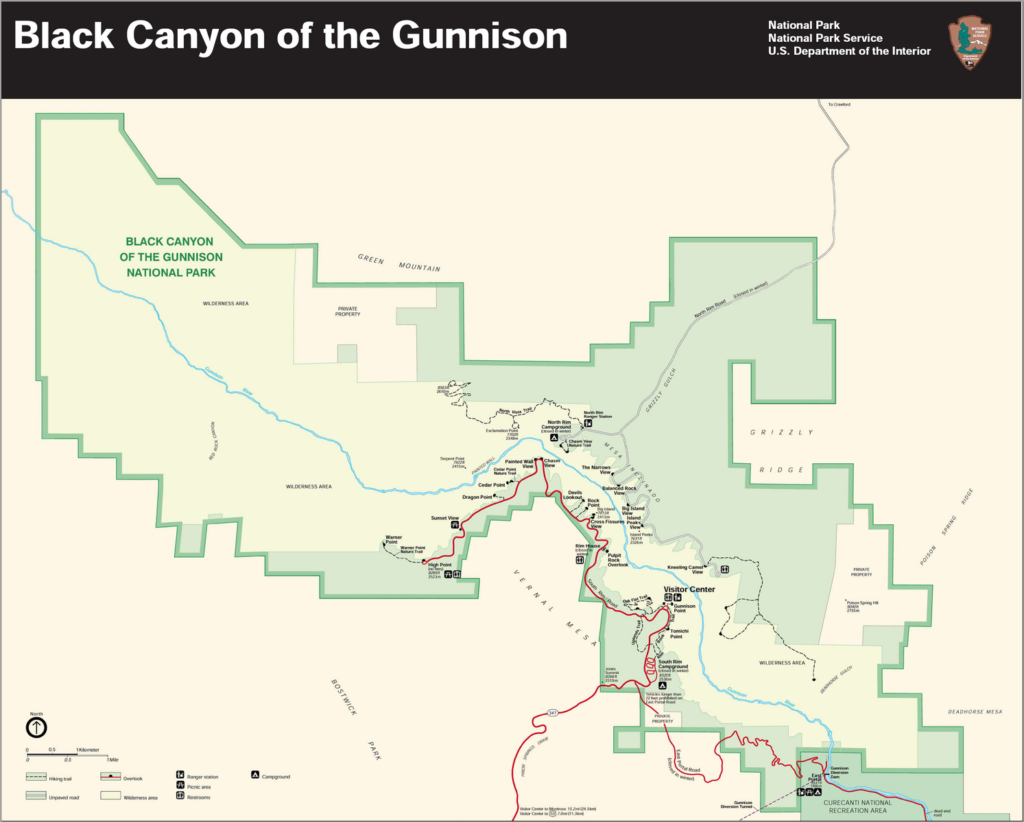
Here’s the obligatory map
The park road comes in from the south, and the entrance station is just past the intersection with another road called East Portal Road (more on that later). By now, Elizabeth and I were fully up on the rim, and I realized that just off to the right was the canyon proper. Being the dork that I am, I resolutely kept my eyes on the road all the way to the first pull-off at Tomichi Point, while Elizabeth “oohed” and “ahhed” in the passenger seat. But you only get one first view of a place like this, so even after parking, grabbing gear, and putting contacts in, I refused to look until we got to the railing.
Whoa.
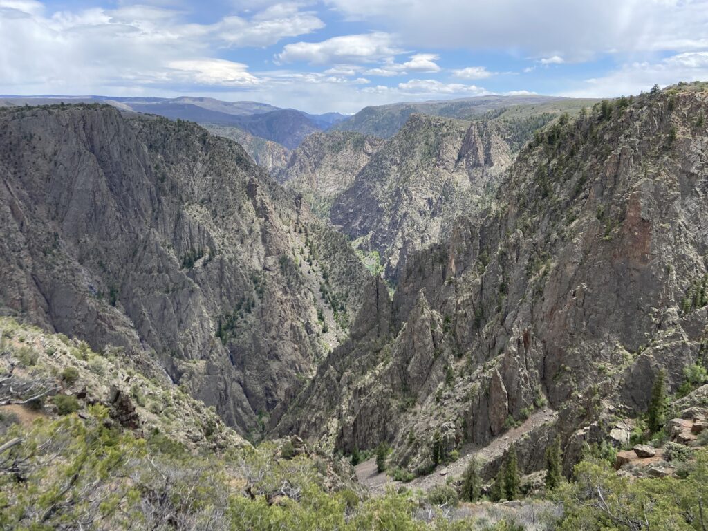
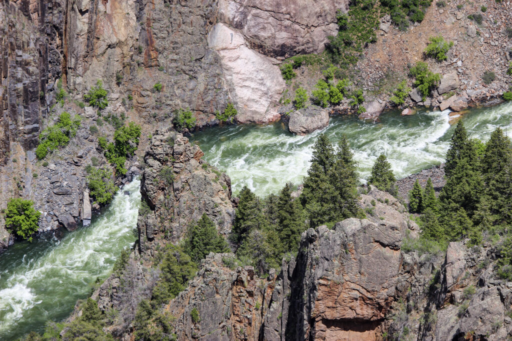
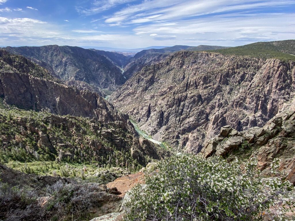
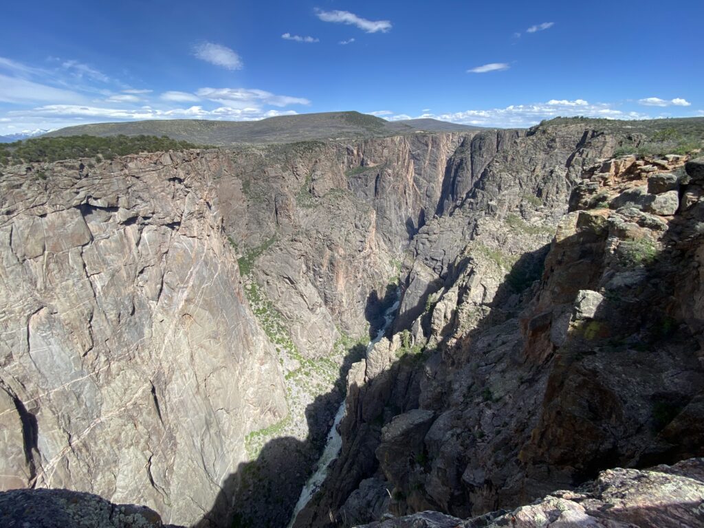
It was almost disorienting to look at this upper section of Black Canyon, because you lose both vertical and horizontal senses of scale. Those little spires in the picture are several miles away and likely the size of the tallest building in a good-sized city. That’s kind of trippy to think about. Like most national parks, there was a grandeur to this natural beauty, but it was also… almost daunting to look at.
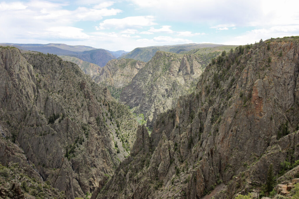
In this camera shot alone, there are so many different things to see. There’s the walls of the canyon closest to me, which at the time I thought were a side canyon but realized while driving further in that this is actually looking at the northward bend of the Gunnison River. There’s the far walls, and even a narrow strip of blue-green river. Then there’s the far-off Elk Mountains, and above that, there were signs of wispy convective showers. It was mountain meteorology for us this weekend.
One way you could avoid feeling that near-vertigo sense – look away from the canyon instead. Elizabeth wanted us to get our picture taken by some of the other tourists picking along the trail at Tomichi Point, so we swapped phones with another couple and got their portrait before they got ours. Then it was time to move along.
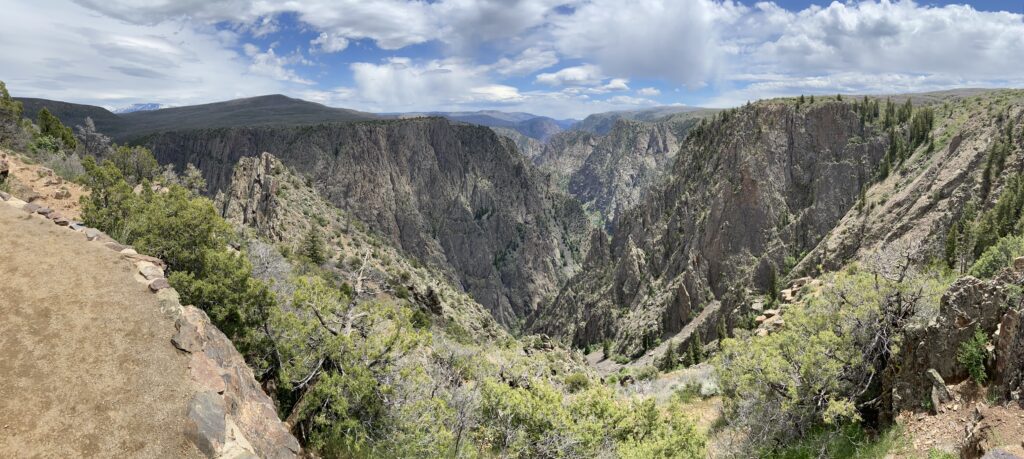
The Black Canyon Visitor’s Center was just around a big bend in the road. The NPS was doing a hefty bit of maintenance on the roads in the park, especially the South Rim Road around the visitor’s center. On top of that, whoever had designed the parking lot for it clearly had not anticipated the explosion of popularity that national parks would go through in the 2020s. To be fair, it was the Friday of a holiday weekend, but still… youch. It took Elizabeth 3 or 4 times circling back for us to land a spot.
But the views from the Visitor’s Center made it all worth it.
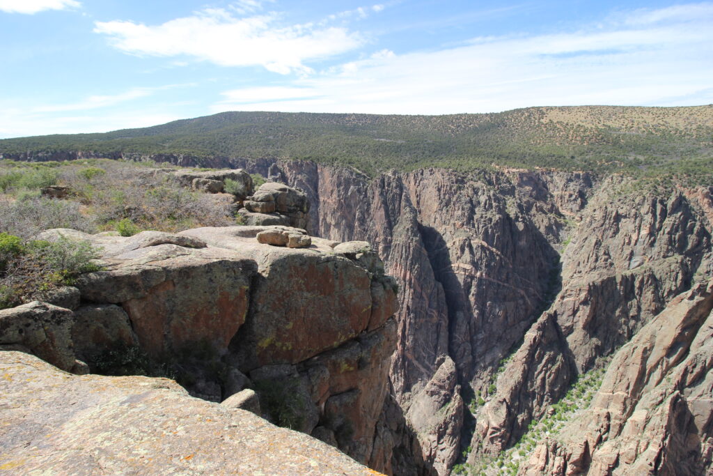
You see, as the Gunnison River winds northwestward, it embeds itself ever deeper into a ridge of uplifted volcanic rock that was left behind long ago. That means that subsequent canyon becomes ever narrow and ever deeper. Gunnison Point is behind the Visitor’s Center, and it’s pretty incredible. We took the short boardwalk down to the point. Even this was wild because of the increasing depth of the canyon on either side of this narrow, exposed point. All of a sudden you looked down and the boardwalk was actually a bridge crossing a narrow side defile that was 50 feet deep. Unsettling, and yet very cool.
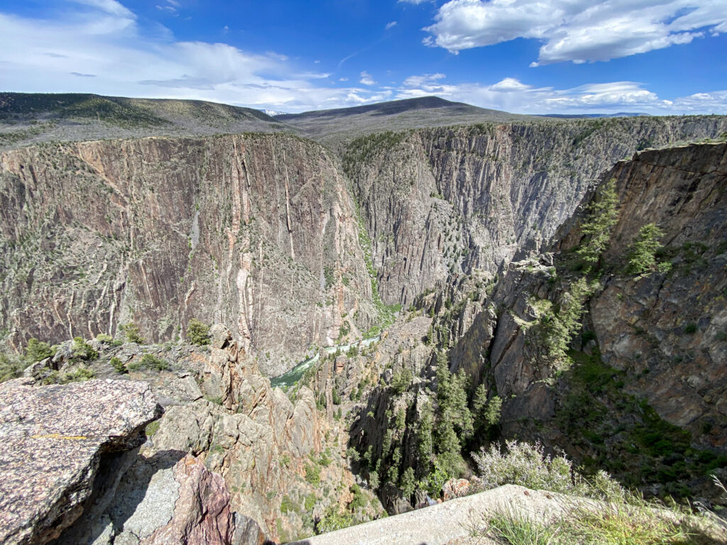
Here’s a brave look over the edge that shows you just how steep this canyon is:
As I told anyone who would listen (and presumably even those tourists who wouldn’t listen), this view beat the absolute hell out of the Grand Canyon. One of the biggest reasons why, in my opinion, was because you could actually see the bottom from the rim. You could hear the bottom, too. The Gunnison River was absolutely 1,840 feet below us.
And yes, there were snow-covered mountains in the distance.
Maybe the dream of scrambling to the bottom of Black Canyon one day was one of those things that should remain a dream.
After taking in the sights and scenes of Gunnison Point, Elizabeth and I returned to the Visitor’s Center. It was on the smaller end, but the big benches that surrounded it with sweeping views of the canyon really made up for a lot of the lack of space. The inside had some pretty neat educational content, as well. For example, you could see just how much narrower Black Canyon was relative to its height than other famous canyons in the US such as Grand Canyon, Yellowstone, and the Columbia River Gorge. Long story short: it’s way steeper. Meanwhile, Elizabeth managed to do some impressive damage at the gift shop. She got a sticker, t-shirt, and a magnet in the time it took me to choose my pin. That’s some truly efficient shopping.
All in all, I’d give the South Rim Visitor’s Center a 9/10 for the view, a 2/10 for the parking, and a 6/10 for the content.
The only major time constraint the two of us had was imposed by the RV park we were staying at that night, whose main office closed down at 6:00. It was still only 2:30, so we still had a few hours before needing to leave, but it was at least enough of a concern that we both agreed it made the most sense to drive the South Rim Road all the way to the end. Which, thanks to Elizabeth’s car anxiety, really meant that I got to relax and read the park map while Elizabeth drove along the rim. The road mostly stayed away from the very edge. Mostly.
High Point at the end of the road is well over 8,000 feet in elevation. You aren’t exactly on a mountain on the South Rim, but you aren’t exactly not on a mountain. This becomes apparent when you get a view way down to the Uncompahgre Valley below.
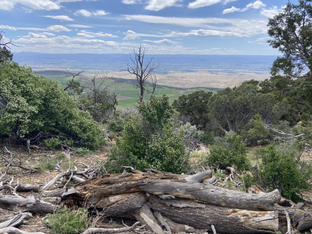
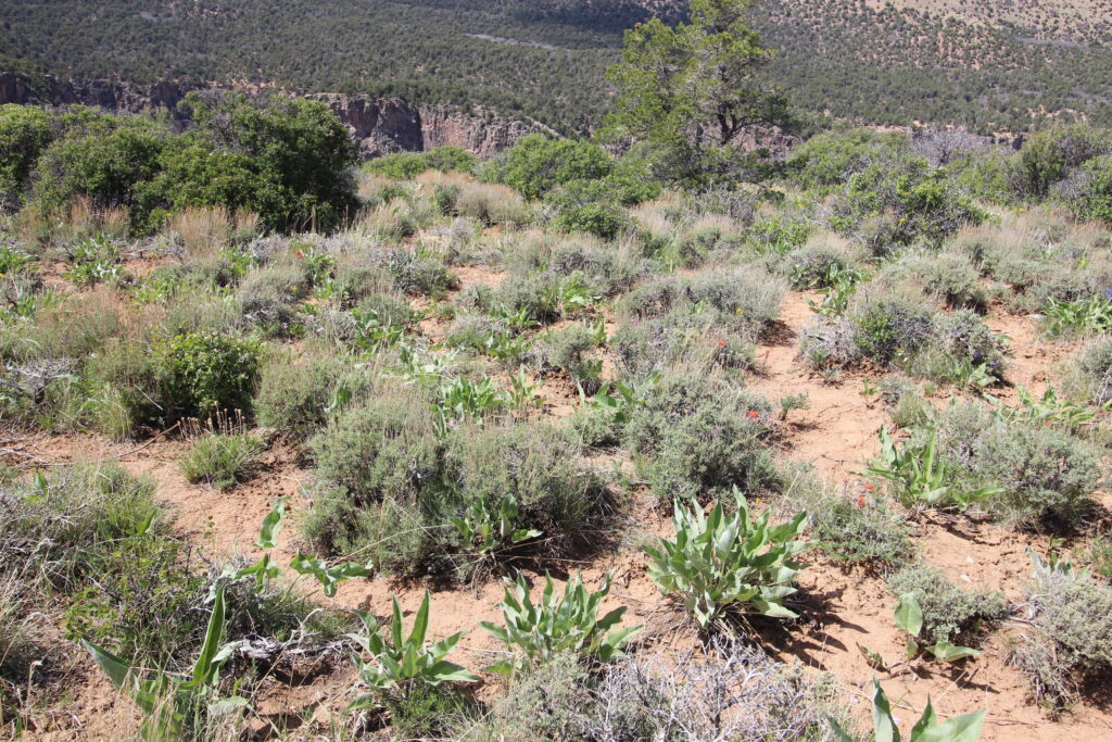
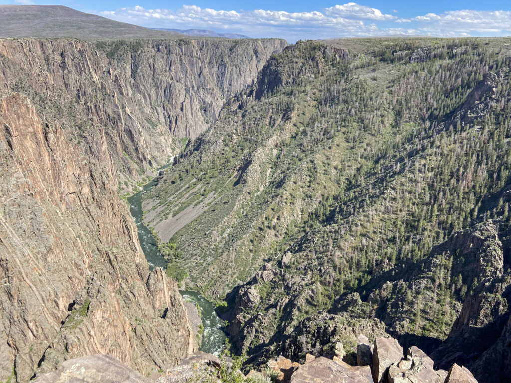
Elizabeth and I tried to wander down the trail from High Point toward some sort of view of the lower reaches of the canyon, but gave up after a few minutes because the grade was steep and we didn’t want to blow all of our energy on that. There were definitely going to be plenty of insane views on the drive back toward the Visitor’s Center. I did notice on the way back into the car how varied the ecosystems seemed to be at Black Canyon. Here way at the top of the rim, it was sort of a short-growth, scrubby forest with lots of oaks and junipers. In other spots, it seemed a lot more like a chaparral desert. And way down by the river, a cold riparian environment thrived. Big elevation changes are always fun when they cause big biodiversity.
The first stop I told Elizabeth to make as we headed back east was at Sunset Point. As the name implies, Sunset Point is a great spot if you’re looking to get a big, panoramic view to the west. Only one other group was there, which meant we got to wander right up to the edge of the viewing area and drink it all in.
It’s an extremely bizarre feeling to look all the way down to see birds of prey wheeling in flight.
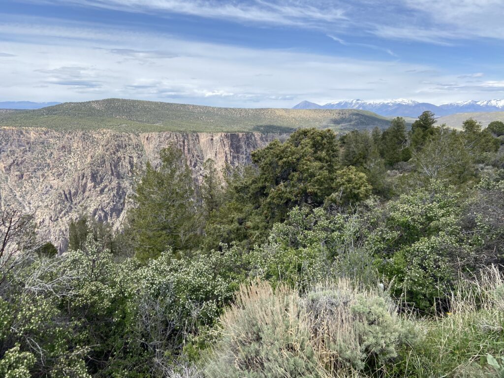
From there, the road continues northeastward until it reaches a hairpin bend around one of the steepest and deepest parts of the entire Black Canyon of the Gunnison. Here, it really does feel like you can reach out and feel the opposite rim. There are several viewpoints leading into this region – Dragon Point, Cedar Point – but in the interest of time I made the executive decision to navigate Elizabeth up to the Painted Wall View.
Once again, the fauna was fascinating in the short walk up to the railing.
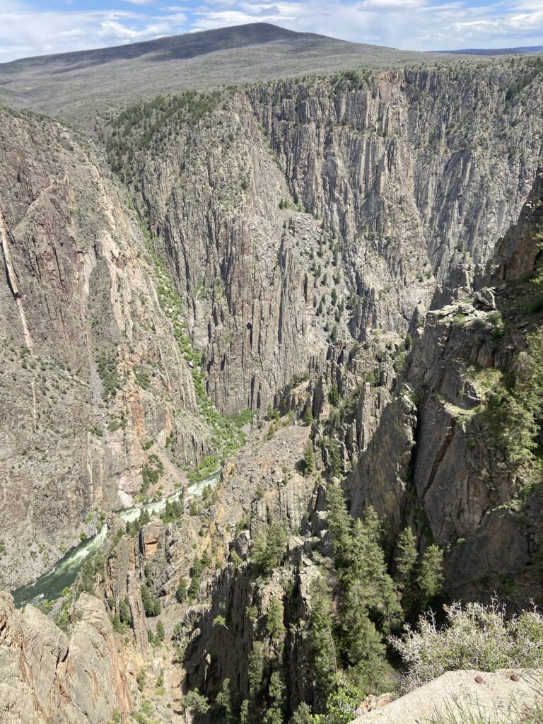
But once again it was the canyon that stole the show.
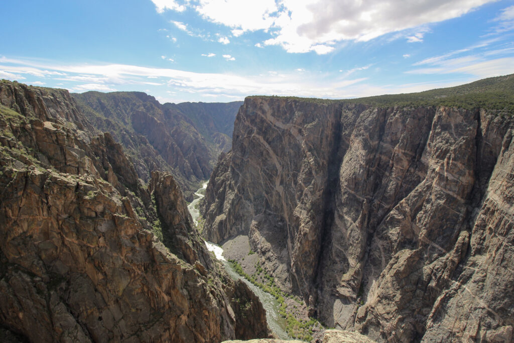
It almost seems miniature until you look at those tiny little trees at the bottom. And then the scale of a 2,000-foot deep canyon becomes apparent. The National Weather Center is probably 150 feet tall. That means you could stack 10 of them into the Black Canyon of the Gunnison. Or, to think of it another way, you could put the NWC next to that scree pile down by the river and it would probably be smaller. No wonder neither of us was eager to go all the way to the edge of the railing.
The depth of the canyon was even more on-display just around the corner at the aptly-named Chasm View.
Chasm? Check. With a view? Check.
Looking here, you can finally start to get why the national park is so-called the “Black” Canyon of the Gunnison. It’s not because of that purple-ish tint to the rocks. It’s actually because there are parts of the floor of the canyon where the angle of inclination is so steep, those spots are in 24/7 shadows almost year-round. The view from Chasm View also showed why Black Canyon is a dream spot for rock climbers. There certainly isn’t a shortage of steeply inclined volcanic rock to try to scale.
I would never actually do this, especially since there are signs posted to prevent it, but I’m so sure that if I threw a rock as far as I could from Chasm View, it would hit the opposite wall before reaching the floor. Elizabeth does not believe that, but I’m so sure of it.
If there’s two major negatives to the Black Canyon of the Gunnison, they’re both related to the geography and go hand in hand. The first is the lack of good hiking/recreational opportunities unless you’re an extreme sports enthusiast. You can get a wilderness permit to hike all the way to the canyon floor from the Visitor’s Center on the Gunnison Route, but this is considered to be extremely treacherous with no chance of rescue in the event of an incident (also these permits are notoriously difficult to score). And if you aren’t down for something like that, the park is a little… lacking, I guess?… in stuff to do.
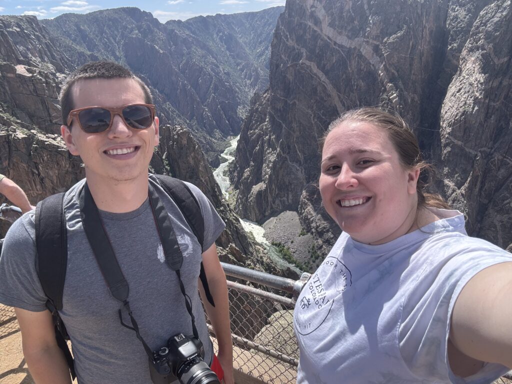
Case in point: Elizabeth and I were already on our way back toward the Visitor’s Center. The final stop we made was at the Pulpit Rock overlook. This one required a couple of minutes of walking from the pull-off to the actual point, but the reward was well worth it. Pulpit Rock probably gave the best overall view of the canyon and the river at the same time.
On the right lip of the canyon, where it’s a little “less” steep, is the Gunnison Route. Looking at that, I felt far less confident that I’d ever be able to hike straight down and straight back up that thing. Maybe one day I’ll return and hike it with someone; probably not Elizabeth (foreshadow to a future blog post from Ouray).
Pulpit Rock also ended up being an ideal spot for us to get some pictures of the two of us. As always, Elizabeth’s iPhone 15 Pro Max was the preferred camera for pictures of both of us instead of my old iPhone 11. Crazy, right? So those photos will go unshared unless I ever come back and edit this post.
It was now about 4:00. We’d been in Black Canyon of the Gunnison National Park for about 2 and a half hours, and we needed to be to our cabin on the far side of Montrose in about 2 hours. There was still time to explore another unit of this massive gorge, but I’ll save that for another blog post – the East Portal area.