Elizabeth and I spent all morning waffling back and forth about whether or not it would be worth it. Despite the fact that James was waiting to go, the storm outlook on May 13 was a bit “meh”. More than anything, I was unenthusiastic about weak deep-layer wind shear that would prevent storms from maintaining long-term supercellular structures. Still, it was May, and the rest of the month looked pretty bleak, and we had just spent the previous day doing nothing much, so… Elizabeth and I picked up James and headed west on I-40.

Our first stop of the day was at an all-time favorite location:
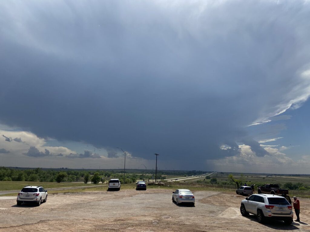
Nothing says “great day” like Elizabeth ordering a quesarito as storms slowly form on the Caprock. As we sat in the parking lot, a storm developed near Shamrock, blessing us with the view of its anvil slowly overtaking the Panhandle sky.
The storm tried to split and started drifting northwest toward us, so we moved to the south side of Shamrock to the town country club to let the updraft pass us by. The only problem was that, as time went on, it became harder to define what we were looking at as an updraft.
It was 5:00 and I was already thinking in terms of a day wasted. Becoming more bored by the moment, Elizabeth got out of the car and found a giant dandelion.
Tyler and Spencer eventually pulled up alongside us, and we spent some time chatting underneath the orphan anvil. They were about as discouraged as me and thinking of heading back. Somewhere south of Shamrock, Jason and Sam were considering the same thing. Come to think of it, so was I. But we were already three hours away from home, and there was a relatively robust cluster of storms coming out of the Lubbock area to the southwest. I wasn’t really feeling any rush, but figured if we were going to stay out here, dropping south from Shamrock to Childress was probably the smart thing to do. We said our good-byes to Tyler and Spencer, who were retreating east on 40, and dropped south on US-83 through partly sunny skies dotted occasionally with the towering cumulus of small storms.
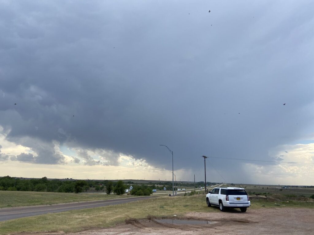
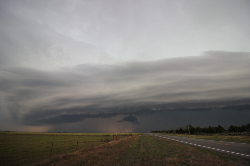
When we did get to Childress around 6:00, storms were still organizing from single cells into multicell clusters to our southwest. After a small mishap parking on an overgrown dirt road (we started smelling smoke beneath us), we found a spot just southwest of town to watch the storms slowly organize.
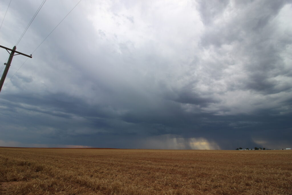
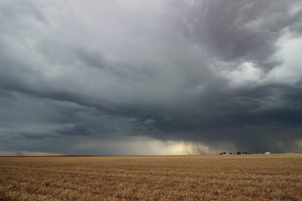
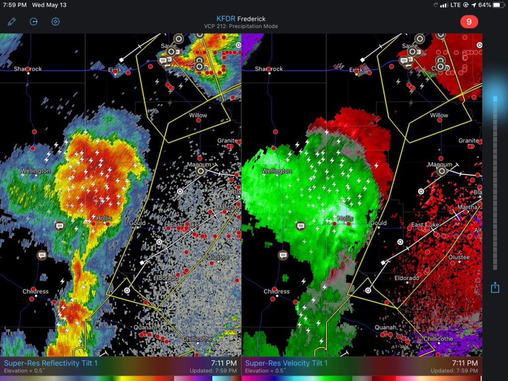
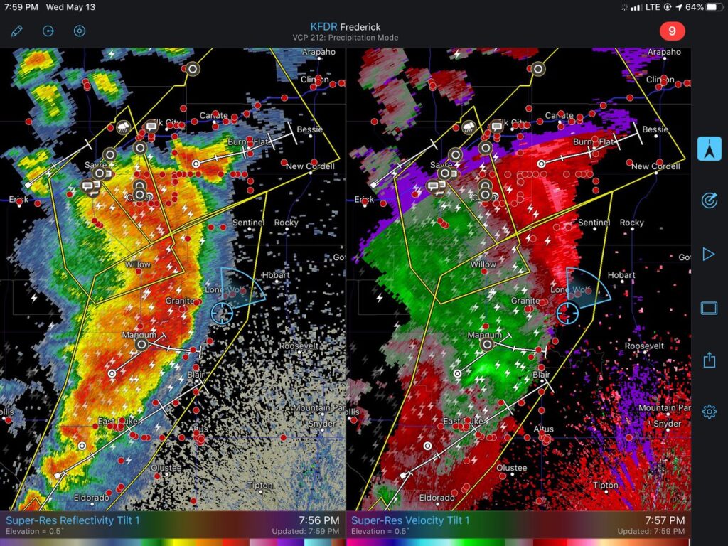
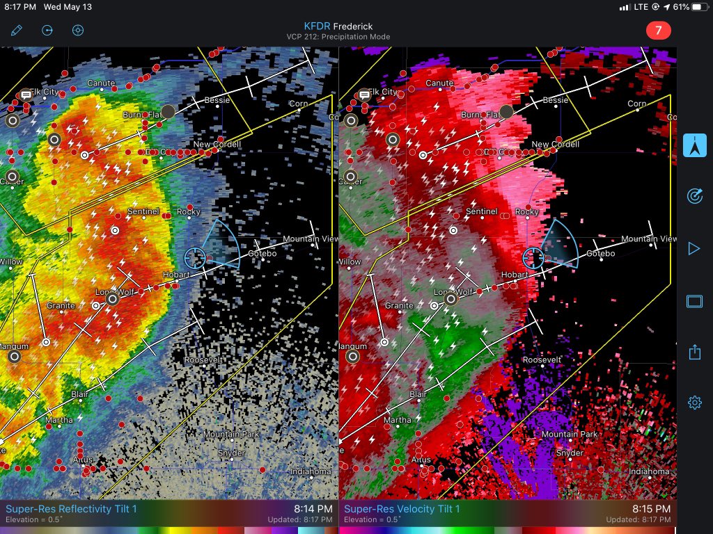
The charitable description for what we saw was “they were storms”. The multicells off to the west were loosely organized at best with a transient shelf cloud. Perhaps of more interest was to our north (second picture), where a cell was developing a decent downburst that started kicking up dust. This storm threatened to cut off our route back to the north and east, so I snapped a few more shots and plotted a course back through Childress.
Given the difficulty in finding crossings of the Red River in the area, and the general northeasterly motion of storms, we figured it was probably best to get north of the river early and reposition out in front of the cluster. While we did so, the dust clouds from the storms to our north continued to get stronger. At first, I jokingly called what we were looking at a haboob, but as the outflows coalesced just west of US-62 we realized that the storms were probably going to impact us before we could get east.
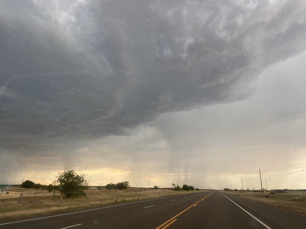
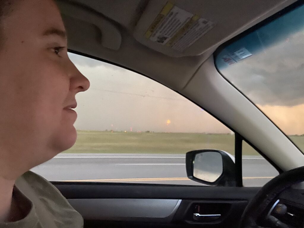
Elizabeth gripped it and ripped it through a couple of blustery downpours. Even in the short residence time that 62 must have had by the time we passed by, water was already starting to pond on the side of the road, so I’m glad we didn’t wait any longer. Visibility dropped down to a few hundred meters briefly before we reached the turn on 62 to head east toward Hollis. Elizabeth claimed that she received some flashbacks to TORUS as we started to slowly pull ahead of the rain currents west of Hollis, as the wind was driving the rain curtains northward over the road. Honestly, I was a bit stunned at how suddenly the entire storm complex had begun to translate east. We’d been lollygagging around near Childress with slow-moving cells, but from here on out the storms would move 40 mph northeastward and require near-perfect navigation to keep up with.
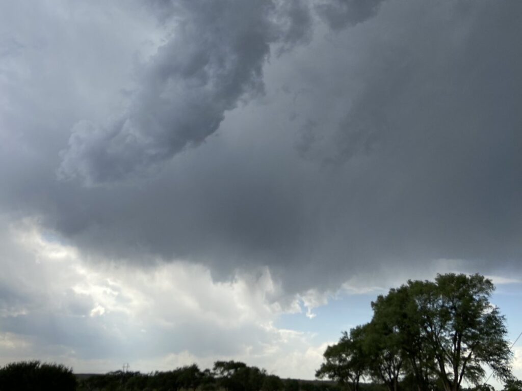
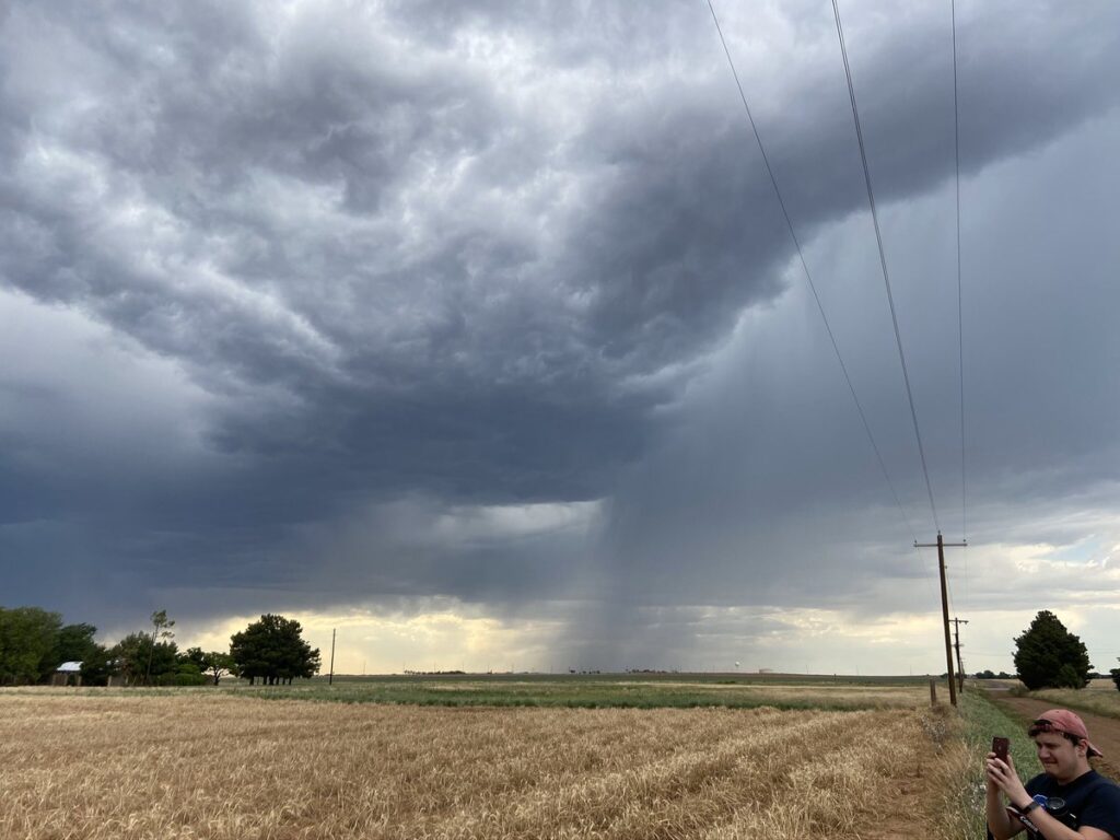
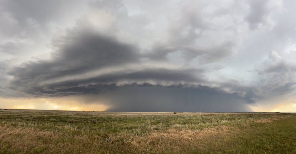
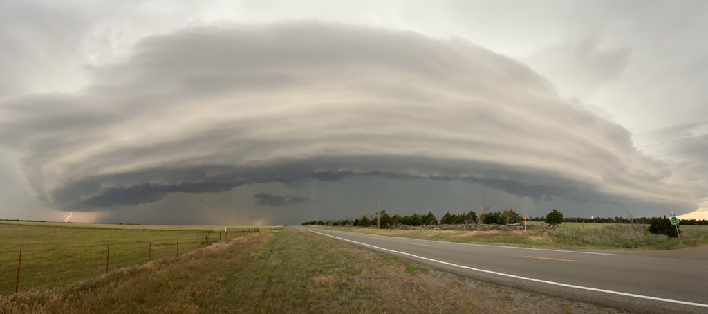
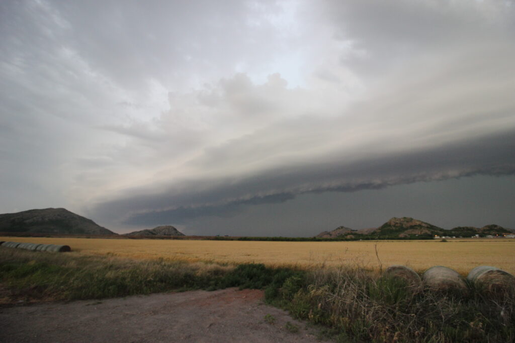
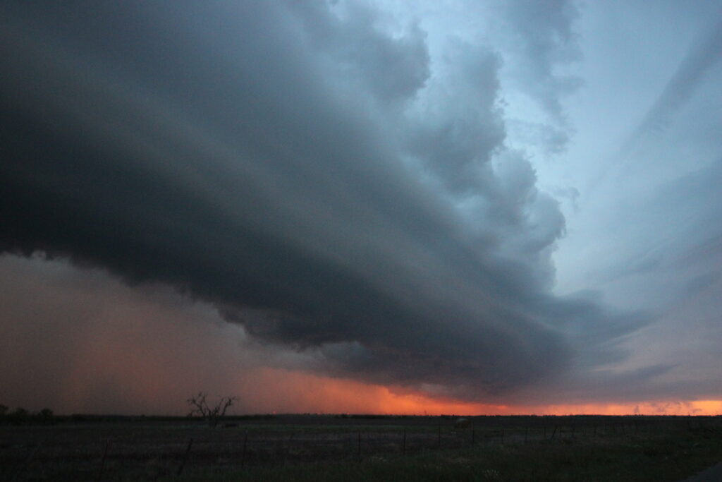
We managed to get through Hollis while James and I were craning our heads to get a look. “Holy cow, look at that shelf!” The storms had coagulated cold pools remarkably quickly and were in the process of forming a small bow echo in the southwest corner of Oklahoma. With most other chasers to the north filming an updraft near Sayre, the shelf was ours to share with just a few others.
East of Hollis, I realized that we would have to get north of 62 to keep up with the apex of the bow. Fortunately, my trusty Delorme’s had a paved north option out of Gould (790) and then a paved east option (155) that would lead to OK-34 south of Mangum. A mile west of Gould, we left the highway to cut off a corner and turned left to go north. The view was shocking.
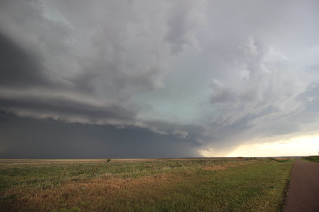

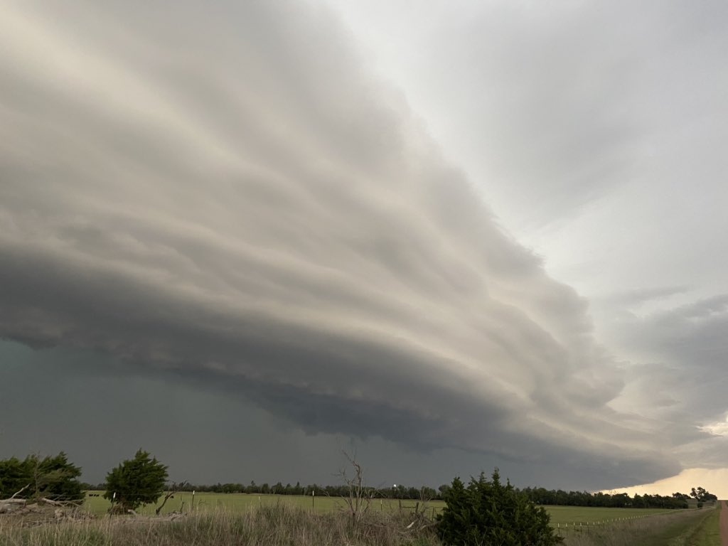
From there on out, we were constantly in a race to stay ahead of the shelf cloud. Elizabeth wasn’t a huge fan of the county road we were on, so the logical decision was to take OK-34 all the way to Mangum and cut east on US-283 toward OK-44. As we were zipping up 34, I had James roll down the window and try to use my wide-angle lens to take some pictures of the shelf cloud to our left. For whatever reason, this clown thought that meant he should stick his head outside of a vehicle moving 65 mph while wearing a hat. I happened to be looking back at him the moment his ever-present OU hat ripped off of his head and went tumbling out the window. We stared at each other for a few seconds. Then I started roaring with laughter. Elizabeth asked, “Can we go back for it?” “No”. The shelf cloud was too close. I told him I’d get him another hat through the tears of laughter. Worst part for James was that the pictures didn’t even come out well because the camera had too long of an exposure time. My iPhone would have been a better choice.
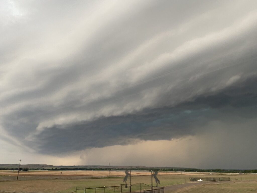
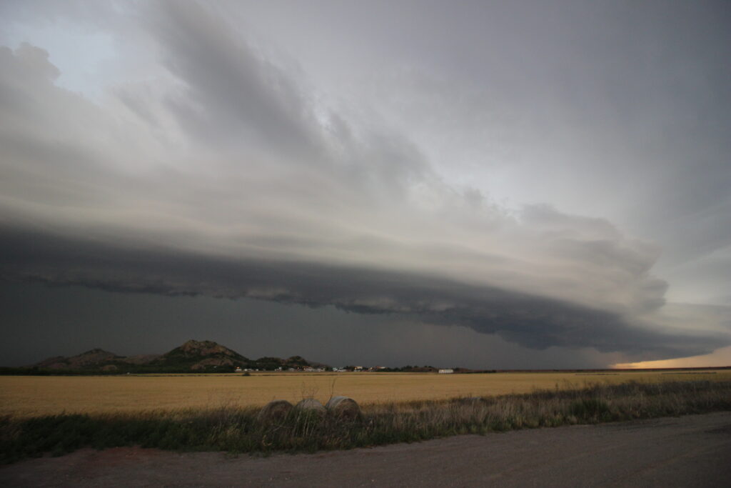
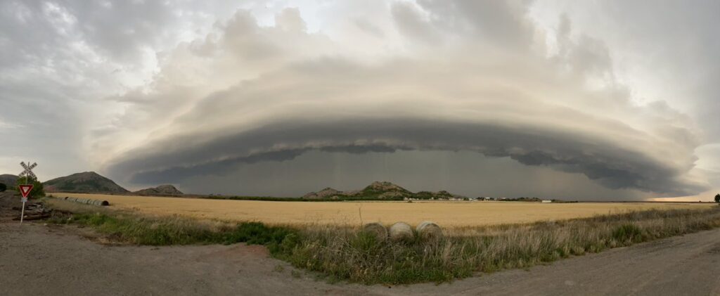
We made another brief stop along US-283 just west of the Quartz Mountains. It was getting toward 8:00, and with a rather monster shelf cloud behind us, darkness was looming. For now, though, we had the perfect lighting.
The only thing better than a killer shelf at sunset is a killer shelf at sunset with terrain features in the foreground. We looped around the southern side of Lake Altus-Lugert and I saw my opportunity to get just that. First, though, Elizabeth had to get through the Quartz Mountains.
We rounded the southern tip of the lake and were treated to our shelf friend with the Quartz Mountains in front of us. And train tracks! It was like a smorgasbord of all my favorite things wrapped into one.
I dawdled a hair too much at this stop. To Elizabeth’s credit, she knew as much. I invited her to get out of the car (who stays in the car when you’re stopped?) and she said that it was time to get going. Given OK-44’s northward bend toward Lone Wolf, she ended up being exactly right.
We were briefly overtaken by the outflow near Lone Wolf before we turned eastward on Highway 9. The shelf cloud was incredible as it churned above us, with a spectacular whale’s mouth fanning out in either direction. Moving back eastward, we saw the surreal scene of the gust front’s dust cloud appearing to suspend in place as we caught back up to it.
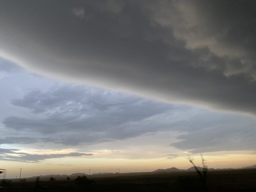
We reached Hobart right at sunset. Eerily enough, one could actually see the sun setting through the core of the bow. To my immense pride, the three of us had managed to keep right with the apex of the bow. Those chasers that were with us on 62 earlier had primarily ended up on the southern end of the bow, and the ones that were on the Sayre storm earlier were primarily on the northern end of the bow. We had a relatively unique angle, and we had earned it. I figured we would get east of Hobart to near Gotebo and take one last look at the storm before heading home.
Our last angle of the day provided an intense salmon-colored post-sunset glow near the shelf. It was a bit hard for the cameras to pick up, but so worth the effort.

Elizabeth had been driving like a trooper for hours, so I took over behind the wheel and plotted a course for home. The storm weakened in intensity pretty rapidly after dark once the cap started building in, leaving us relatively free to eat at the Anadarko McDonald’s. The last bit of excitement for the night came when a cloud-to-ground lightning strike near Verden must have had somewhere upwards of a dozen return strokes a mile or so to our southeast.
Considering I had been iffy on whether or not I even wanted to chase on May 13, the day was a complete success in my book. The storm had produced one of the better shelfs I have ever seen, and we played the road network nicely to maintain a good view. To bring back a favorite cliche of mine, it had been great structure with great friends.