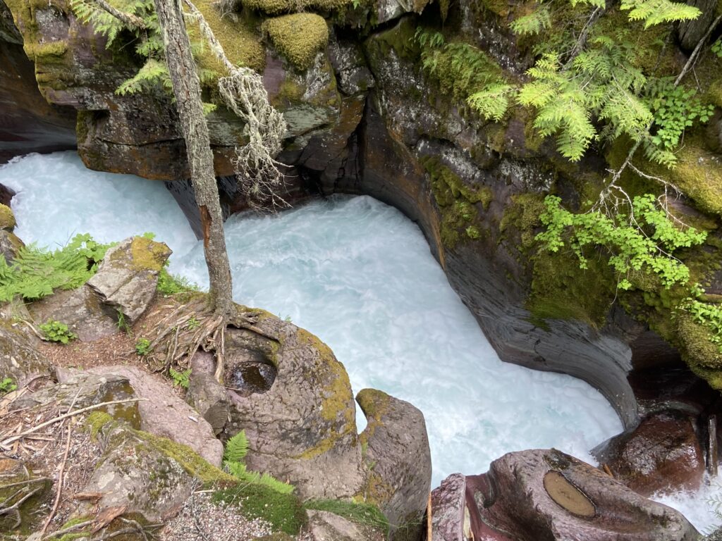
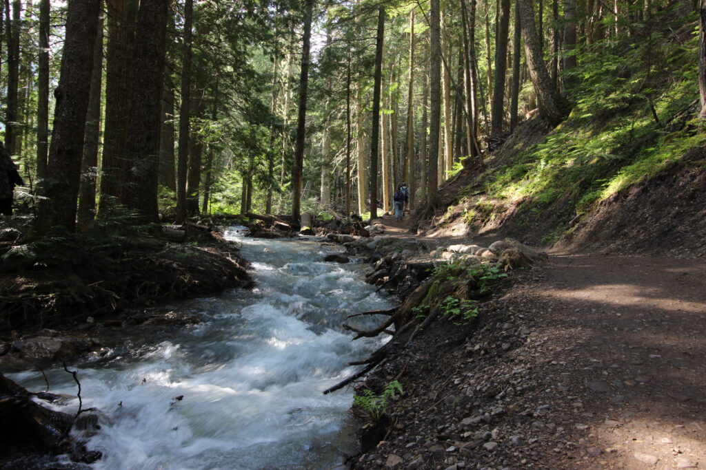
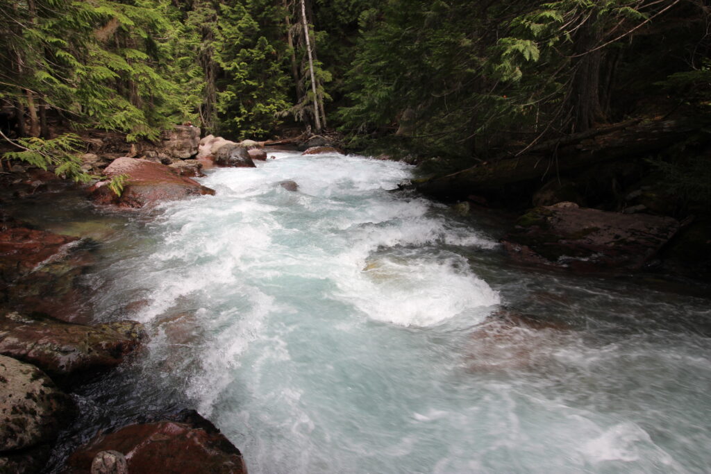
Below me, Avalanche Creek boiled through its gorge. Obviously it was swollen with runoff, but I didn’t really expect there to be this much water in one of the little creeks way up in the mountains. It was quite loud. As a natural lover of creeks and rivers, I loved it with every fiber of my being. In fact, my picture from the top angle was arguably more interesting than my shot from down the canyon.
We’d only been walking up the Avalanche Lake Trail from the Trail of the Cedars Junction for about a minute. This was the first elevation we’d encountered on the hike – a rather gentle, steady uphill that would characterize most of the trail. The crowds, rather to my dismay, did not thin out significantly if you continued on to Avalanche Lake. That makes sense – it’s about 5 miles round-trip from the GTSR to the lake, with about 800 feet of elevation gained in a mostly steady incline. It’s a good day hike for families and others who want may not be able to achieve anything harder-core. And those people, who Elizabeth and I had an excessively derogatory name for by the next morning, clogged up the trail. We’d make do.
The exposition of the hike was along the right bank of the frolicking Avalanche Creek, through a forest that could only be described as “Pacific northwest”. There were big, leafy ferns everywhere that added to the rain forest vibes. The creek sometimes gurgled, and sometimes outright roared, but it was a constant presence. The perfect day was generally remaining perfect.
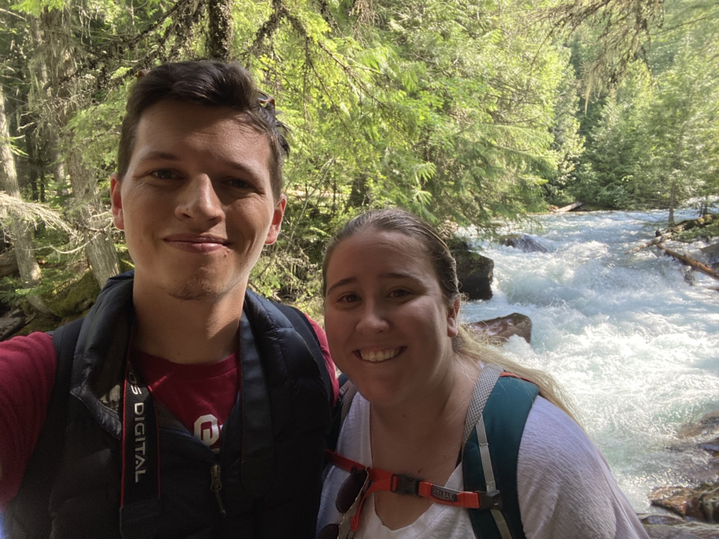
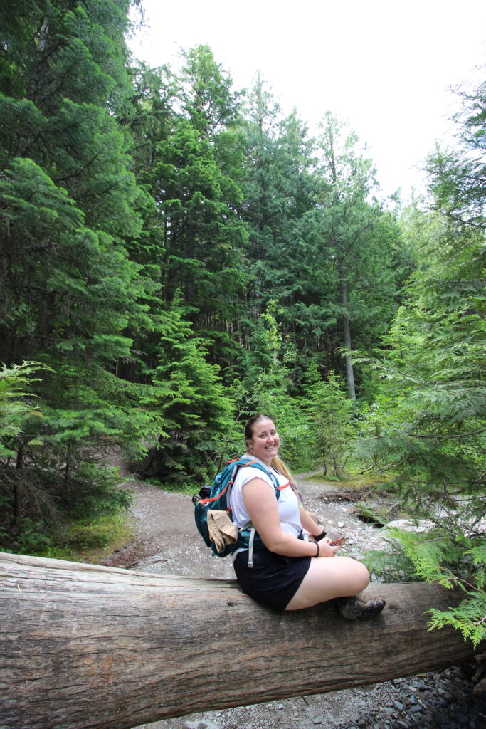
Not only was everything else going perfectly this morning, but the weather was really showing out as well. It had been so delightfully cool in the morning (a perfect break from the heat wave back home). The showery few minutes at Logan Pass notwithstanding, right now we were experiencing sunshine and perfect temperatures. Look! I was even wearing my puffy vest! Mostly as an affect, but I wasn’t actively sweating while wearing it. And the vest was so lightweight that when I got warm a half hour later, it folded into a gap in my incredibly overstuffed camera bag. Sam’s Big Dog lens really took up a lot of space, and the bag really only closed if I wore the camera around my neck. Over the coming week, I was going to pick up a hell of a tan line from the camera strap. This was the opening salvo, so to speak, although the forested nature of the trail and the early time of day (it was somehow still only 10:00 a.m) kept us from getting too crispy.
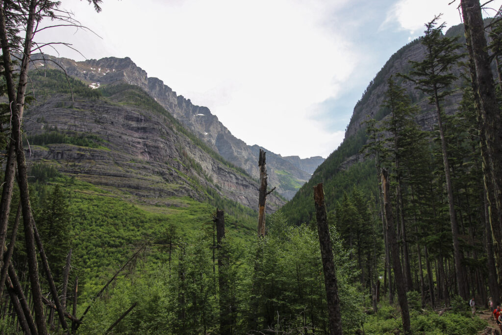
The trail gradually veered toward the right and entered a little swale where a trickle of water tumbled from right to left into the roaring creek below. It was here that I got some of the first views of the mountains around us that I’d had the chance to see since we got down into the McDonald Creek bottom. They were spectacular – large, vertiginous peaks of a rusty purple-red hue that were carpeted by the fuzzy green of countless trees. Up toward the tops of the sheer cliffs, I could see the snowdrifts that were feeding Avalanche Creek thousands of feet below. It was an awesome display of color and size.
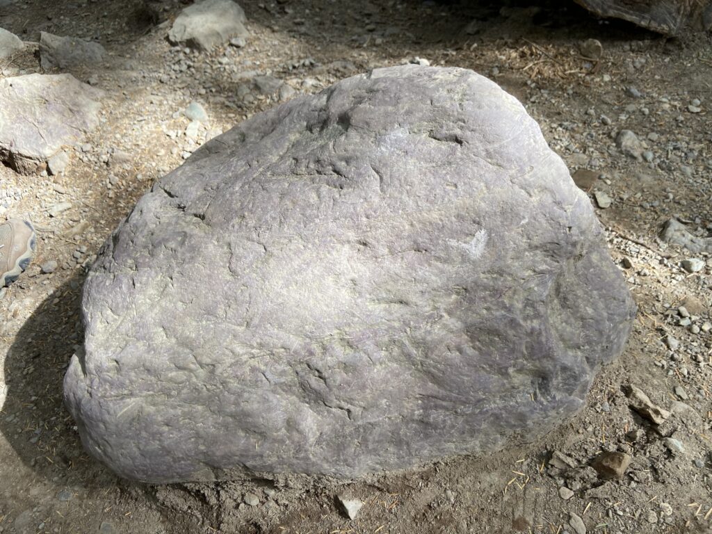
I didn’t even need to look that far to see spectacular colors displayed. So far, in my first 24 hours inside of Glacier, one of my very favorite features was the rocks. I was quickly coming to learn – aided by the streambed to my left and the chunks of boulder strewn about the trail – that there were several dominant colors in the rock of Glacier. There was a faded rusty maroonish red that showed up prominently in the mountainsides. There was a violet hue that many of the larger boulders on the ground and in the streams displayed. And then there were two other shades that were much less common, but rather striking in feature – a faded yellow and a turquoise color. For someone who grew up in Michigan and has spent years among the uniformly red clay of Oklahoma, this was like hiking in a wild kaleidoscope.
About halfway up, Elizabeth and I stumbled upon a wildlife discovery that was much less stunning than the day before. Ahead of us on the left side of the trail, a mule deer was casually wandering through the forest in search of delicious undergrowth. Oblivious to the increasing numbers of people who were gawking at it from just a couple of yards away, the deer crossed the trail to the right side and proceeded to parallel Elizabeth and myself for several minutes. I apparently did not get a steady picture of it, but here is the deer in all of its glory walking alongside us.
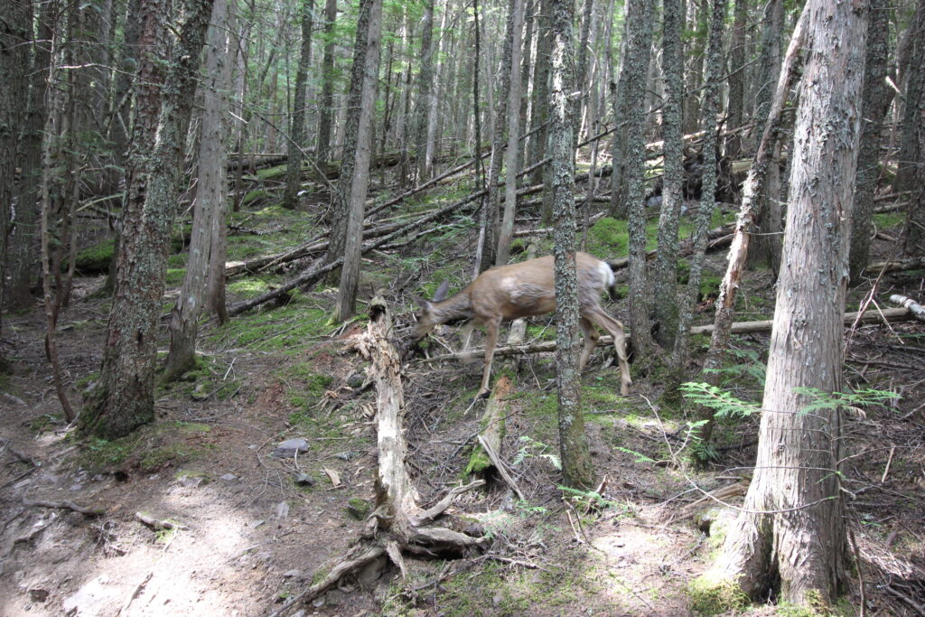
Eventually, the deer peeled off and left us alone (with all of the other hikers, of course) to continue the steady ascent.
The latter half of the trail after that slight rightward jog actually got pretty tough. There was nothing *too* difficult about it, except for the fact that Elizabeth and I might be unaccustomed to being a mile up in elevation, but the steady uphill eventually left us puffing and huffing just a little bit. Maybe we’d just underestimated the words “800 feet of elevation gain”, but it was mildly surprising to be working as hard as we were. The trail itself continued through some of the largest trees I’ve ever seen – I have video of Elizabeth passing felled trunks that were as wide in diameter as she is tall.
Finally, the long ascent was over and we passed into one last meadow prior to the final stretch out to Avalanche Lake. This meadow provided some of the only views of the mountains outside of the one swale above, but there wasn’t much time to stop and take pictures. That’s because there were massive ferns that grew so close to the trail that you basically had to go single-file through there. With the lake so close, we decided to push on.
The trail became muddy at the very end, with multiple spots where planks were laid across wallows directly in the middle of the path. To me, this was a sign that we were right along the lakeshore, and indeed, to the left a placid body of water showed itself. It sounded like there were many people in this little left-side part of the lake, so Elizabeth and I continued along the trail as it followed the shoreline for a while. This was smart – we eventually popped out at a red clay beach in front of Avalanche Lake.
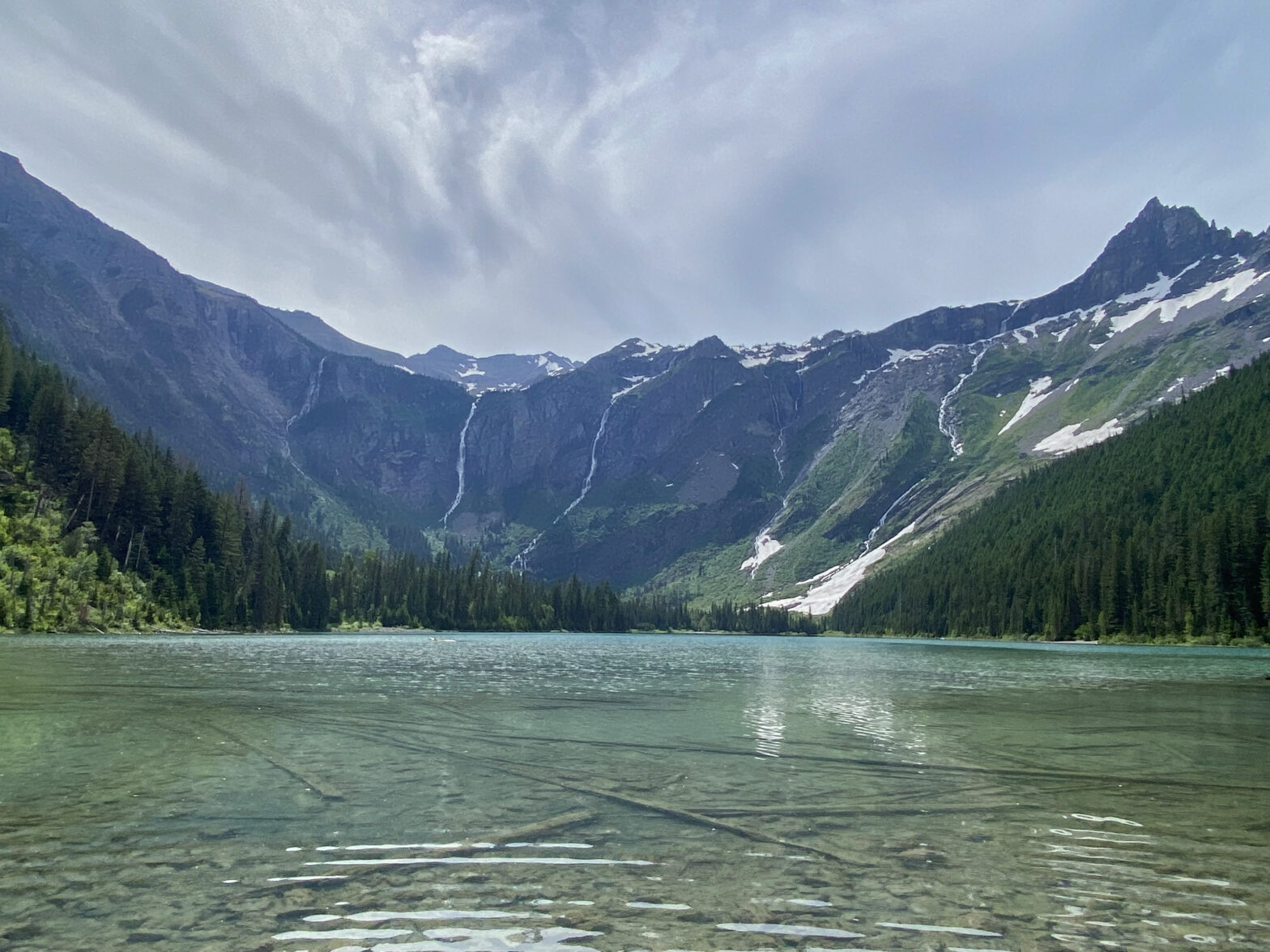
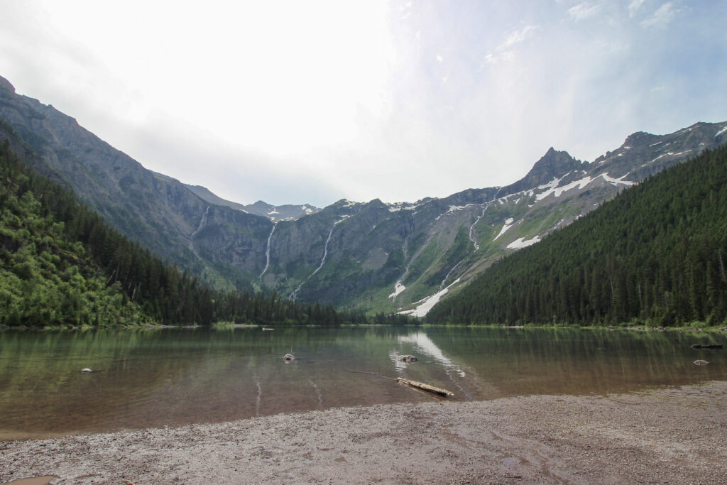
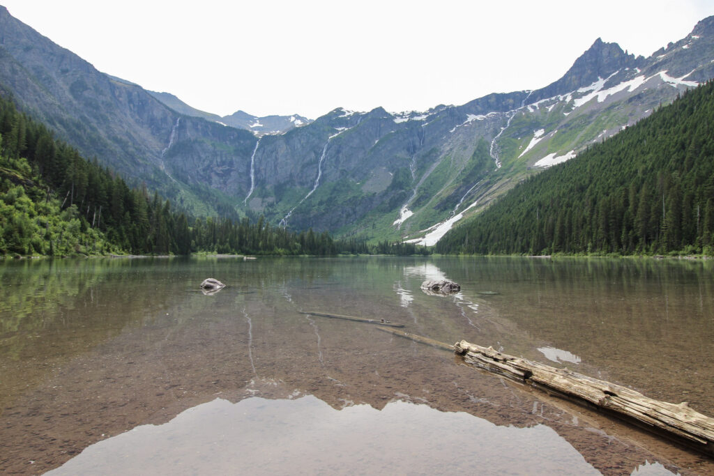
Avalanche Lake is cut into a big old cirque with mountains pressing in on three sides around it. On the left of you at the lakeshore, those mountains press all the way to the shoreline with dramatic cliffs. A similar thing happens to the right, although less dramatically. But immediately to the front, Avalanche Lake is ringed by a uniform, treeless slope, with a semicircular false peak. Off of the false peak is an arc of waterfalls bringing snowmelt from Sperry Glacier and several other large snow features up in the alpine terrain. Its otherworldly. Even on this side of the lake, where the waterfalls had to be a kilometer distant, you could hear the roaring of the water plummeting hundreds of feet and all converging upon one point. Or at least you could if kids weren’t frolicking and screaming in every direction.
I wrote all of those words about Avalanche Lake’s surroundings without mentioning the lake itself. It’s wider than most lakes that form at the foot of glacial mountains. The water contained a hint of the cobalt blue that is iconic of characteristic of glacial lakes, but just a hint. Maybe it was the time of the day that Elizabeth and I visited, and maybe it was the weather, which had broken from our earlier sunny skies into a bout of wispy off-white cirrus, but most of the surface of the lake actually appeared to be red, especially up close. Upon closer inspection, this was because the lakebed itself was a brilliant red, and Avalanche Lake was so clear you could see the bottom easily up to a depth of several feet. In the distance where the water deepened, the refraction of red disappeared and that’s why you could see the blue there.
After a moment of contemplation of the beautiful scene, I started to take my hiking boots off. Elizabeth informed me that I was crazy for wanting to wade into such cold water, but when I dipped a finger in to check the temperature it turned out that Avalanche Lake wasn’t really that cold. Elizabeth was undeterred and predicted that when I went deeper than 3 inches in, the water would get frigid in a hurry.
She was right. She’s always right. Once I went into my calves, the water *was* frigid. But, for my hiking-worn toes, a chance to take a standing ice bath wasn’t the worst thing. Plus, the shoreline did not make for an enticing foreground for Avalanche Lake shots, and getting into the lake a ways was a boon. Plus, I was further away from those shouting kids. Elizabeth sat on a log amid a bunch of fluttering butterflies and enjoyed the vantage while I stepped out into a photographic frontier, so to speak. You can decide which of us was wiser, if any.

One more advantage Elizabeth had over me – she didn’t have to put her socks and hiking boots back on without squelching through the muddy beach. I solved my problem by placing my shirt on a log that stuck out of the water, and then while standing one-legged in the lake, drying my foot off with that shirt before putting one sock and one waterproof hiking boot on, and then repeating the whole process. If that run-on sentence sounds complex, just know it worked. My feet were returned cleanly to inside the hiking boots.
Elizabeth and I stayed up at Avalanche Lake for maybe 20-30 minutes – not too long, all things considered. Because of how crowded it was, and how the lighting seemed to work against us, and maybe just compared to the incredible sights from GTSR, I think Avalanche Lake fell a little bit short of expectations that we’d had prior to the trip. That’s a long way away from saying it was boring or overrated. It was still, as I’ve said a couple of times, an otherworldly sight to behold all of those waterfalls tumbling ad nauseam down the mountainside. I would 100% bring my parents to Avalanche Lake if I ever returned to Glacier with them. But if just Elizabeth and I go again, I think we might look elsewhere for our warm-up hike.
I’ll spare most of the details on the descent back down to our car. For the most part, it was an uneventful hike that the two of us sped through because breakfast had been a heck of a long time ago. We did stop briefly along the lower reaches of Avalanche Creek just so I could take in the sights and sounds of the roaring, cataracting water. I’m not going to stop and edit any of these pictures, but it was a picturesque watercourse pretty much the entire length of the trail. Go during snowmelt season.
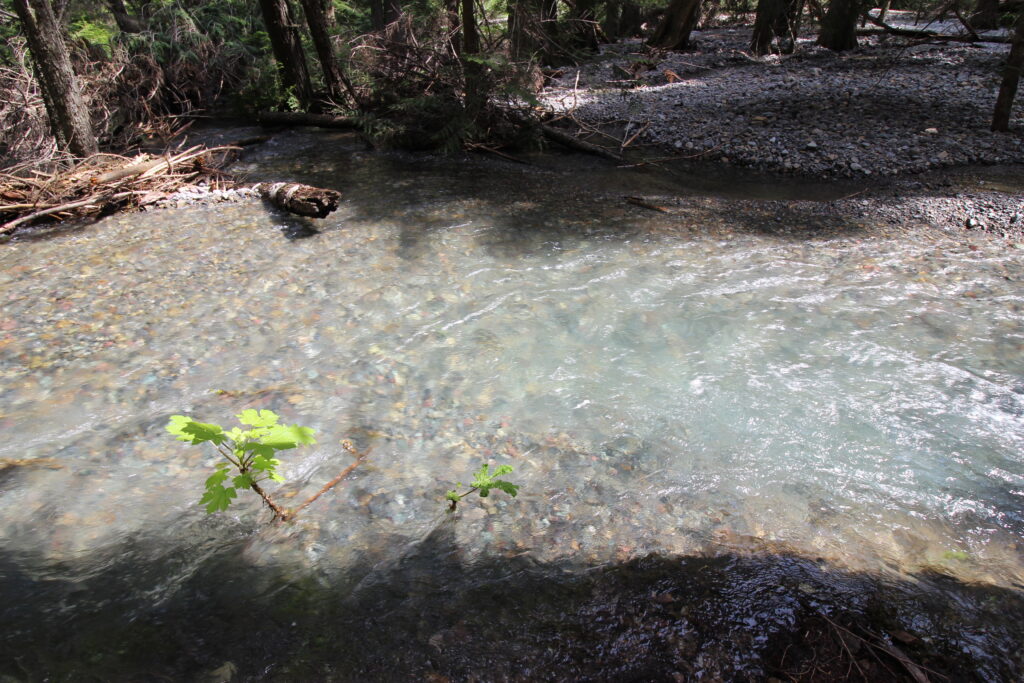
Look at the pretty rocks!
In no time at all, the two of us had popped out at the Trail of the Cedars once more. I made one more bathroom stop along the way back. Sometimes random little moments stick in your head from a hike, and for me, one of the enduring memories of the end of the Avalanche Lake hike will be passing by little ampitheatre that the Avalanche Campground uses, listening to other repeated-visitor hikers talk about the area and gawking at Heaven’s Peak way above the cedar trees to our west. We got back to the RAV4 and I pulled up a map of Glacier Park. A little further down GTSR toward the West Glacier entrance, McDonald Creek would empty into Lake McDonald, which was our date for the afternoon.