Grey pre-dawn light filtered into the tent. The air was perfectly still at Sprague Creek. There wasn’t a sound – except for my phone alarm, which had woken me up not long after 5:00 a.m. just like it was supposed to. Outside of the fact that I did not wanted to be awoken from my slumber, and Elizabeth would want to be woken even less once I rolled over and shook her awake, it was an entirely peaceful scene. Notably: no bears. The presence of bear spray inside our tent had not led to an angry grizzly ripping things apart, which I suppose is good.
The two of us quietly packed up our tent and other goods, taking care not to disturb the nearby sites of last night’s revelers. A few other sites were beginning to stir, but the absence of sound from Going-to-the-Sun Road filled me with cheer. We would be the first, or very nearly the first, travelers up to Logan Pass from the west on the morning of July 15. At exactly 5:59 a.m, one minute before the road opened behind us, Elizabeth and I slipped out of the campground and into the gathering daybreak.
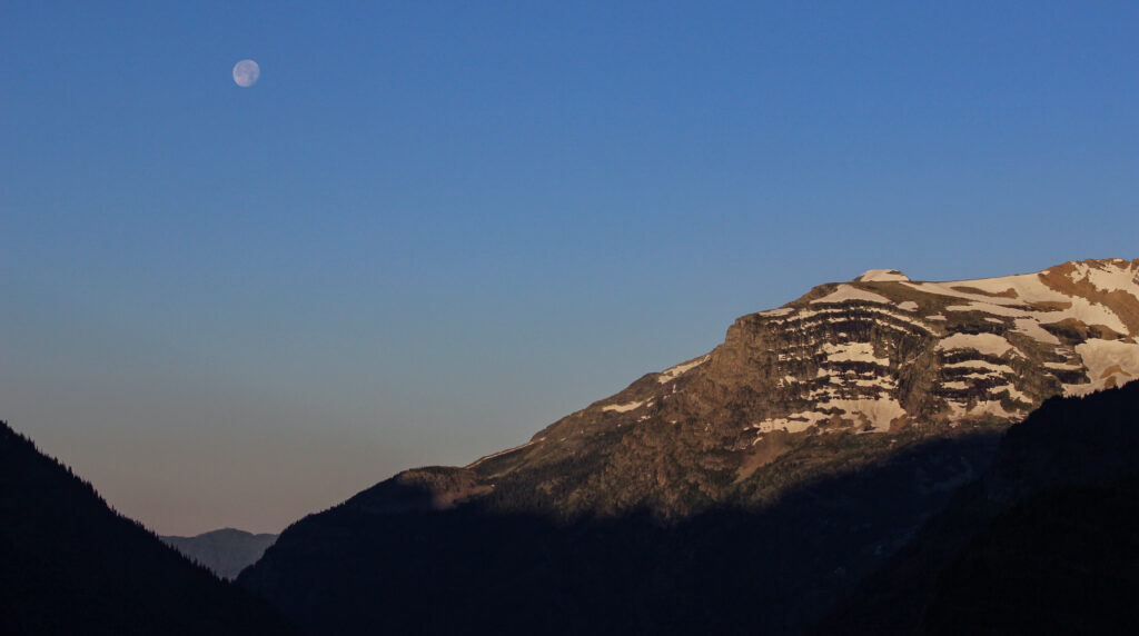
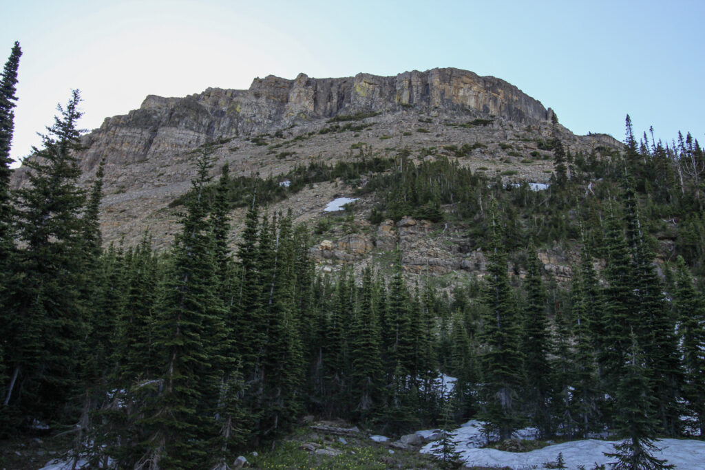
The drive up to Logan Pass from the west to the east was every bit as awe-inspiring as the drive had been in the other direction. The stretch from The Loop up to Logan can’t be beat in just about any national park or any road I’ve driven. We were even treated to the sight of a nearly full moon setting over Heaven’s Peak right after winding past The Loop:
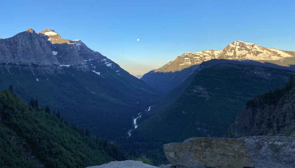
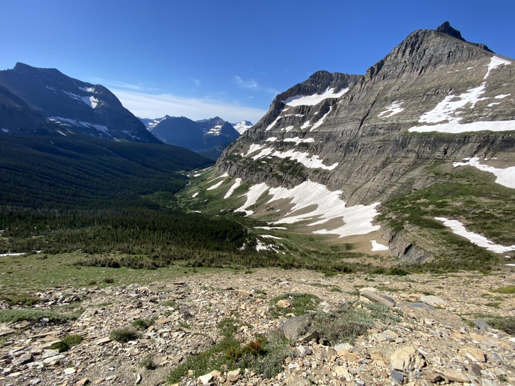
Far below us in the valley, McDonald Creek flowed toward its eponymous lake in the dawn glow. A narrow ribbon devoid of trees next to it marked Going-to-the-Sun Road, where dozens upon dozens of cars were charging up to the alpine section as fast as they could in an effort to get somewhere as early as possible. It was here that I dubbed the masses in Glacier National Park the “little piggies” looking for their slop. The phrase “little piggies” would stick for the rest of the week.
Elizabeth drove us up and over the continental divide, past the Logan Pass visitor’s center, and downhill a short way to Siyeh Bend. Here, as the road climbs westward toward Logan Pass it is forced to make a northward jaunt to avoid losing all of its elevation as Siyeh Creek comes tumbling down from the continental divide. There’s no parking lot at Siyeh Bend, just a wide shoulder on the westbound lane that can accommodate a few cars at a time. We were there early; so early, in fact, that only one other car was parked at the bend. We had plenty of space and time to execute a U-turn and park behind the first car. A third one joined us shortly thereafter.
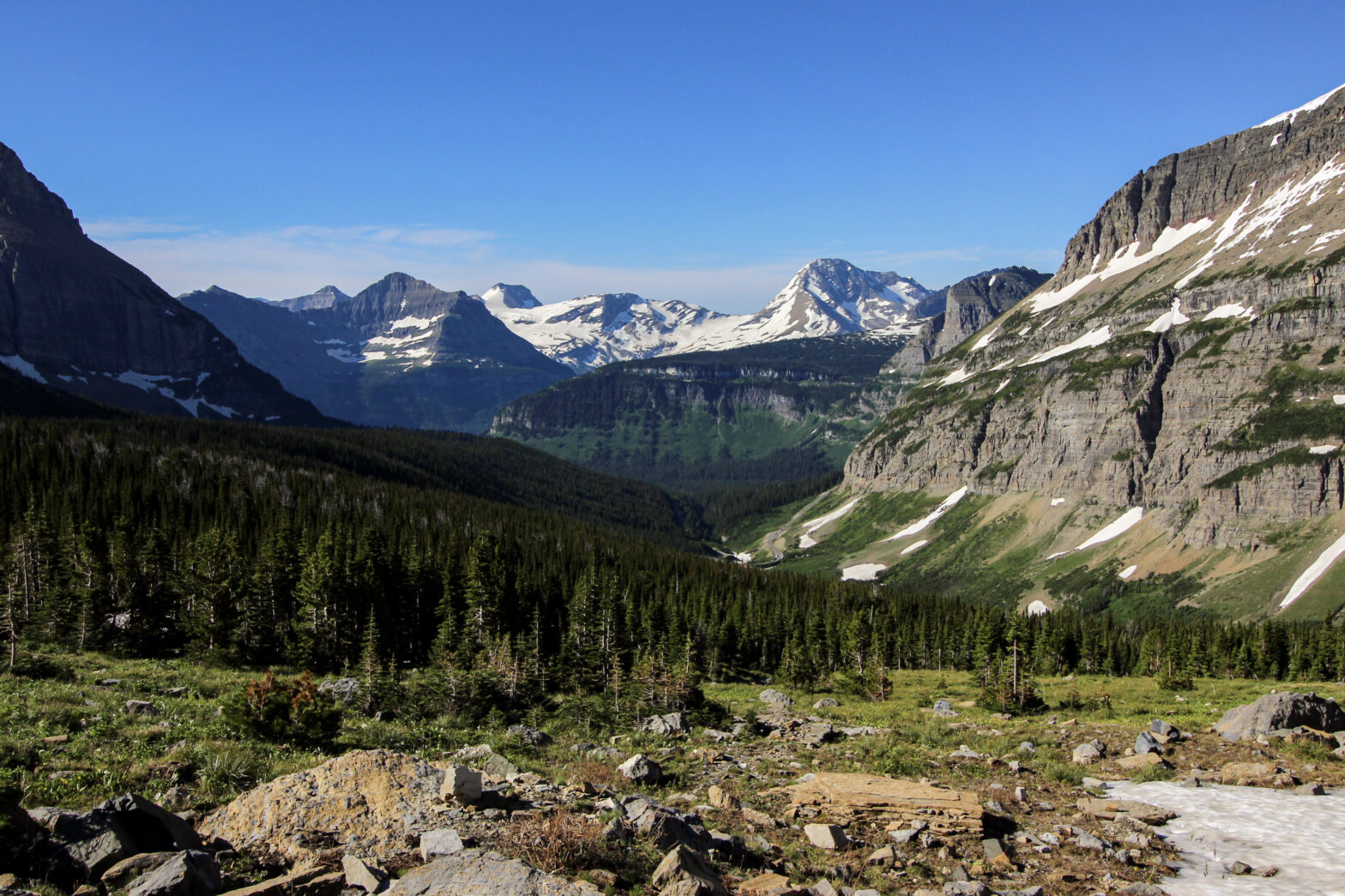
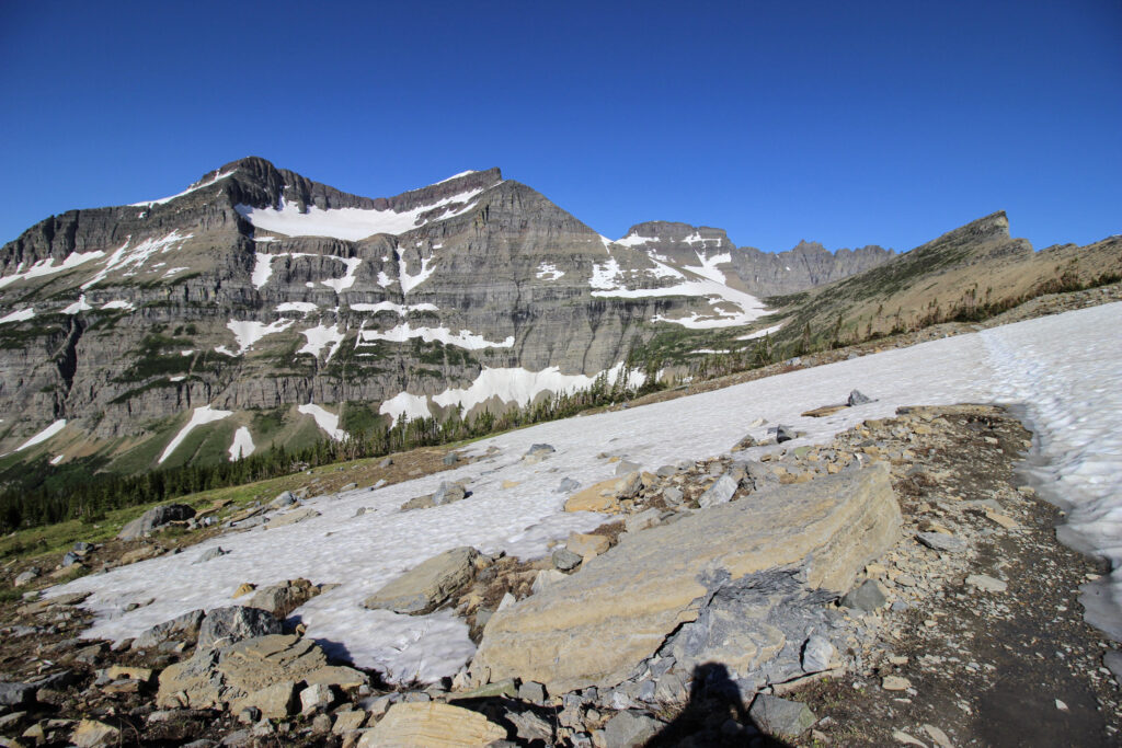
There’s a trailhead at Siyeh Bend right at the cobblestone bridge that allows the roaring waters of the creek to flow under GTSR. The trail follows the creek northward for a few hundred yards before veering off sharply to the right and entering a thickly forested hairpin bend back to the southeast that allows the hiker to gain elevation gently along the side slope of Going-to-the-Sun Mountain. This continues on for a while before the hiker hairpins back to the left at a trail junction. A couple of miles in, hikers from Siyeh Bend reach their decision point. Straight ahead is Mount Siyeh, and the trail diverges left and right beneath it. To the right you follow the creek up to Siyeh Pass; to the left, you hike along the flank of Cataract Mountain to Piegan Pass in the saddle between Cataract and Piegan Mountains. Based on our latest info from the park ranger at Apgar two days ago, Siyeh Pass was nearly unreachable due to high-elevation snowfields. There were still several of them on the way to Piegan Pass, but they could be crossed with an excess of caution. So it was Piegan Pass to which we planned to hike.
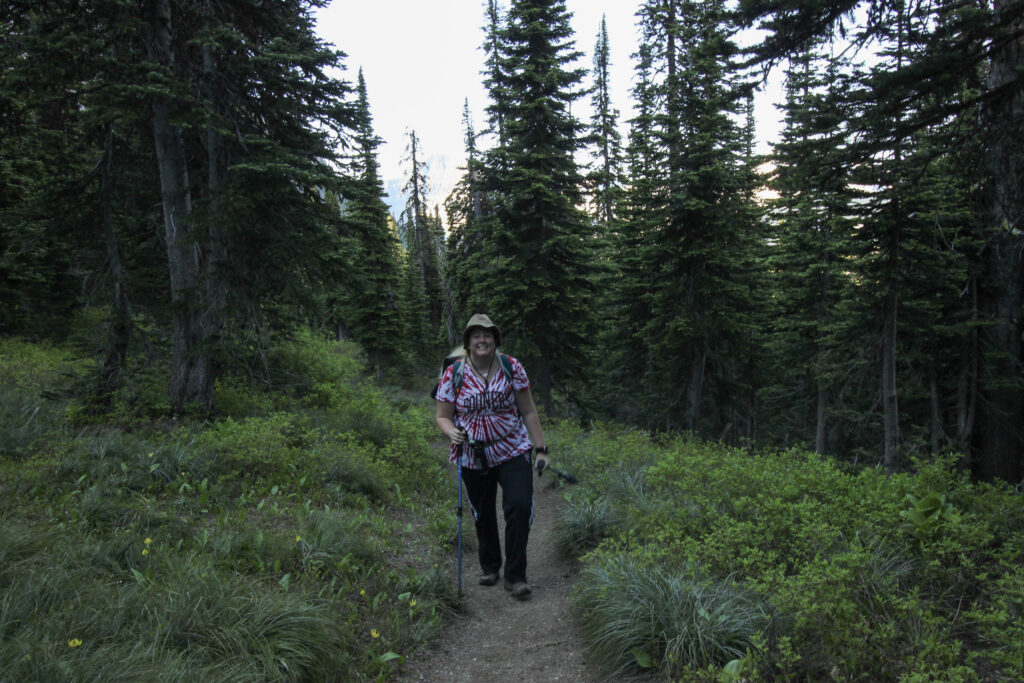
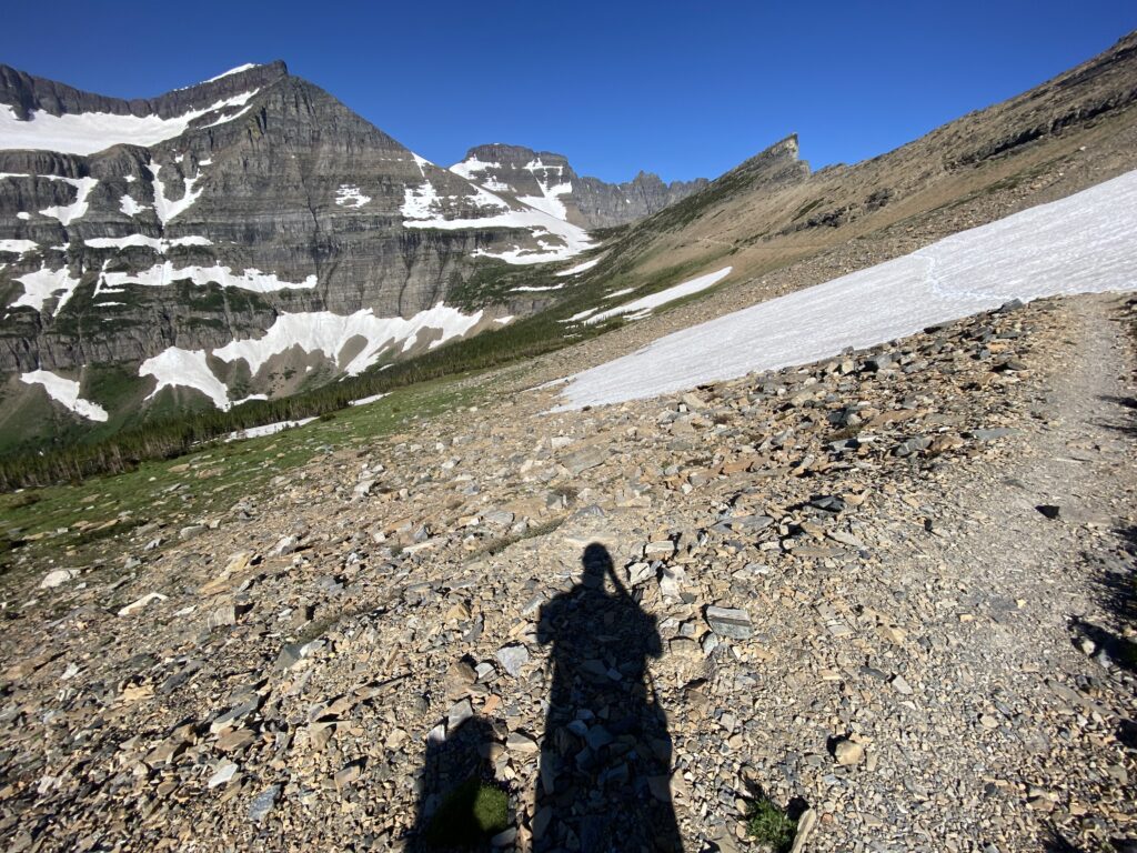
If we hiked at all. Elizabeth was acting somewhere in between sullen and downright churlish while we prepped for the hike. It was hard to tell what had gone wrong in the last thirty minutes since our triumphant and peaceful drive up GTSR. With the benefit of hindsight, I can pretty confidently say that she was grumpy both from sleep deprivation and fear that if we were out on the trail so early, we’d be the ones to spot a bear. I was tired myself, and that made it a little more difficult to deal with her mood, but not so tired that I couldn’t push through it. We each had a Go-Go squeeze, granola bar, and Pop-Tart (for me) breakfast in the front seat of the car while the two guys behind us prepped for their hike. As they departed, I got out and loaded up the backpacks with everything we needed, taking care not to get too wet from the meltwater openly flowing over the road. Elizabeth continued to grumble but slowly got ready to hike. By about 7:30, we had everything we needed, and the two of us walked down the shoulder of a quiet GTSR to the apex of Siyeh Bend and officially began the trail.
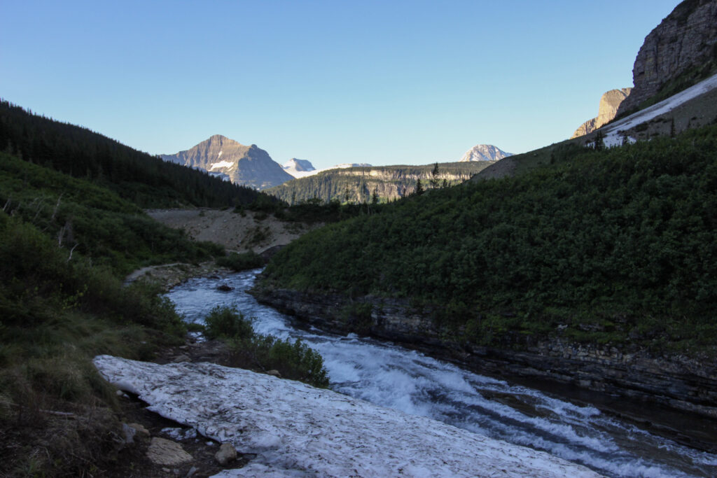
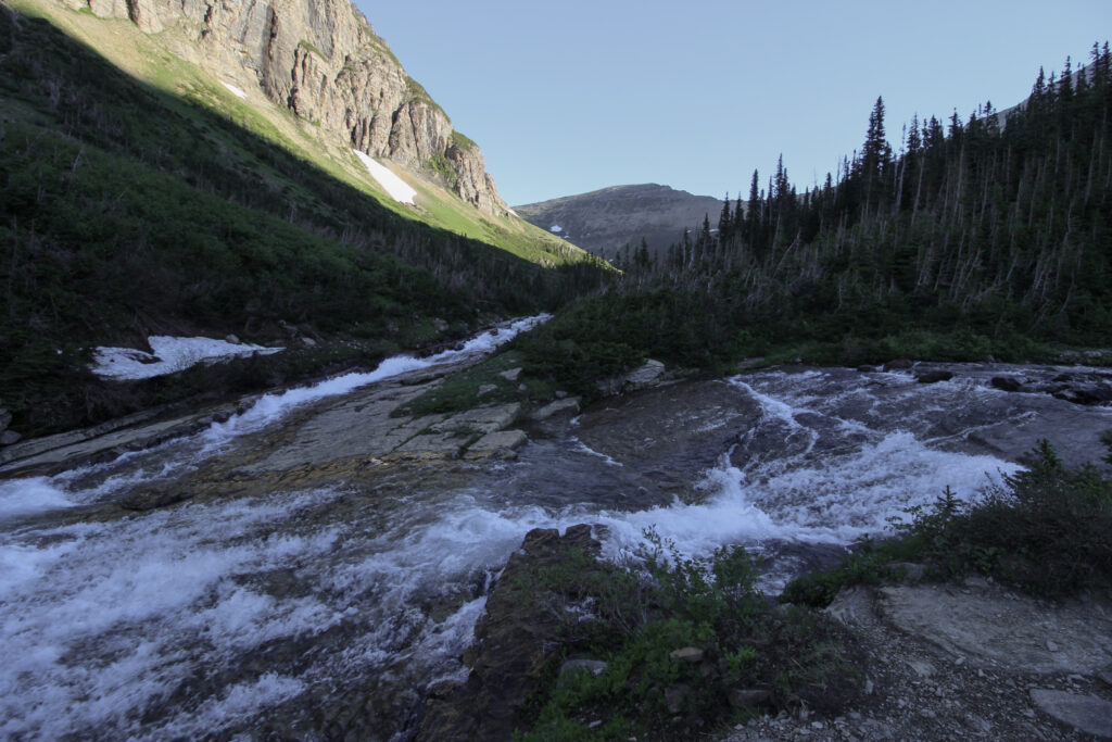
It was easy for a grand total of 50 yards. In those 50 yards, the trail sloped down from the road to Siyeh Creek. Then the hike immediately put out its first challenge for us – a snowfield along the eastern bank of the creek. Unlike Hidden Lake and Foys Lake, which had been snow-free, this hike would occasionally contain snow that we had to cross. Bear in mind that this was in the middle of July. Even with late-season snowstorms, that snow had been baking in the summer sun for weeks at the very least. Therefore, the snow on the trail was in a constant state of melting during the day, and if not refreezing totally at night, at least developing a crunchy icy glaze that any northerner would recognize from snow that’s been out for a long time. Traction was at a premium. Elizabeth stabbed the ground with a hiking pole to get an extra point of contact.
With that said, it was a stunningly beautiful beginning to a hike. The water absolutely roared past our snowy trail. It was still shady down in the valley between the mountains, but the sun was beginning to shine over mountain slopes ahead. There was a lot of peace and solitude and “Hey, bear!”
If it isn’t already clear, it was incredibly difficult to get a good image while shooting on manual exposure in the early morning light. I could either wash out the background, or completely darken the foreground and hope that shadow enhancement would fix it in the future. Obviously, the above photos are attempts at number 2. This is a good reminder to take iPhone pictures occasionally as well, because those damn people at Apple know how to auto-expose really well.
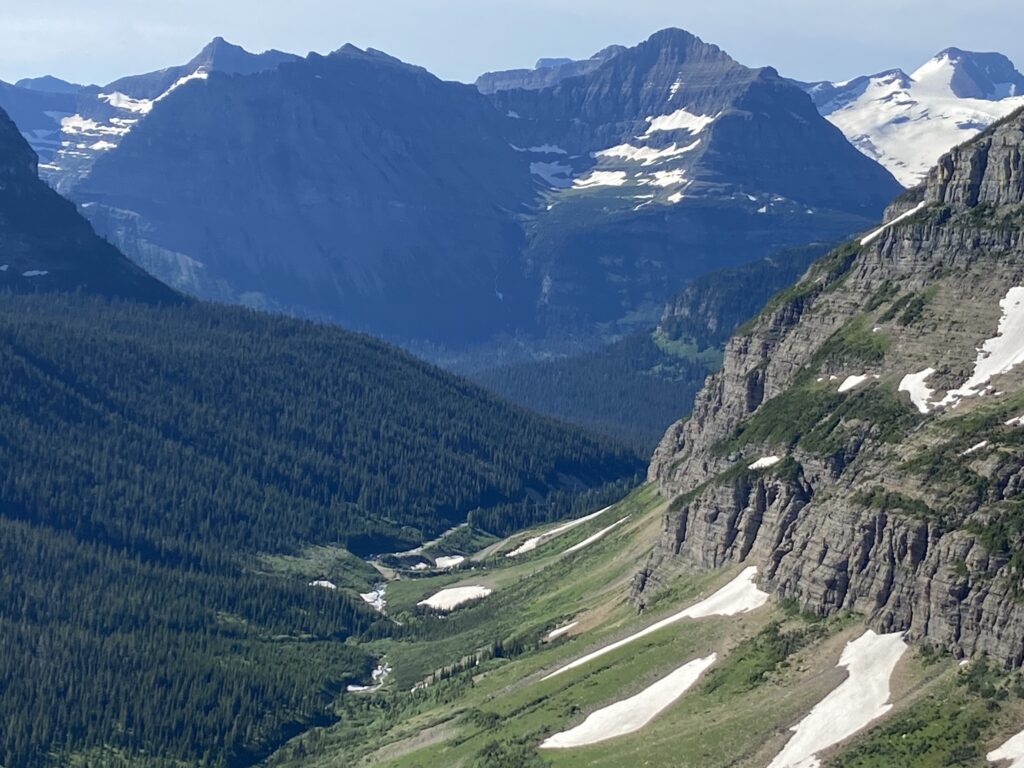
In the bottom picture, you can see that there are actually two streams coming together at the bottom left. The one directly in front of us is Siyeh Creek, while the one directly in front is the unnamed (I guess?) creek that drains Piegan Glacier. While our hiking goal was ahead and to the left in that shot, this was the location where we took a hairpin bend back to the east and then south.
Almost instantly, the open alpine valley we’d been hiking through was replaced by a thick subalpine forest. There were ferns, shrubs, and green leafy things all over the floor and giant, towering pines sticking up above. The sweeping vistas I’d been enjoying taking photos of were replaced by forest floor views with extremely limited visibility. As disappointing as this was for me, I could feel Elizabeth tensing up for an entirely different reason. What kind of visibility would we have if there was a bear nearby? Would we unwittingly stumble right into the lap of a grizzly around the next corner?
There’s a sense of loneliness that pervades when you’re all alone on a hike in grizzly country. It’s almost like you’re watching a scary movie and at any given moment the chainsaw-wielding maniac may pop out. But then you remember that the odds are that the chainsaw-wielding maniacs aren’t even going to bother you today, and you have to internally chuckle at yourself for the conceit to spend your entire time in the most beautiful place in the continental US being nervous about something that most likely wouldn’t happen. And so it went through the brush, singing a remix to David Guetta’s popular song (“So many bears in here, where do I begin. Where the bears at, bears at”) to disguise any nerves.
Right when we passed a small opening into a valley far below to the right where I thought “Wow, I might have some visibility to see a bear if it’s down there”. And at the bottom of the open terrain, maybe 50 or so yards below us, I got what I was asking for.
“Bear”.
Elizabeth was a couple of steps behind me, and no doubt wondering why I stopped. “What?”
I repeated myself, this time pointing. “Bear.”
The bear was sitting on a log and staring at me just as I was staring at it. I was relieved to discover that rather than descending into a puddle of neurosis in the presence of North America’s apex predator, I could maintain my wits. No, the bear was too close to stop and take a picture of it with the Big Dog, especially since its curiosity was clearly piqued by the two humans far above. But the last thing we wanted to do was run away. Instead, I calmly told Elizabeth to grab the bear spray and back away slowly. Then I began calling out “Hey, bear”, just as you’re supposed to do. Then, I triggered a squawk from Elizabeth when I whipped my phone out and took a quick video.
And *then* I turned away from the majestic bear, which based on the scant evidence provided by that video appears to have been a grizzly. Elizabeth was already scurrying up the trail ahead of me and exhibiting signs of hyperventilation. I followed her until we were around several more corners, then we stopped for a breather. It definitely was one of those times where you need to take multiple deep breaths.
A pair of hikers came around the corner. Elizabeth called out, “Did you see the bear?” They did a comical double take which sort of answered the question without words. I informed them that yes, there was a grizzly just off the trail back a hundred yards or so. They thought that was pretty damn cool. We chatted with the two of them for a while, and found out that they were climbing Mount Siyeh on a whim. I’ll never know whether they managed that grueling climb, but I hope they did. The views up there are supposed to be incredible.
Elizabeth intentionally dawdled a bit to let the two guys in front of us. I could practically read her mind: now these two were bear bait. The downside was that they were hiking much faster than us. Elizabeth made a valiant effort to stay within sight range of them for 10 or so minutes before having to take a break of her own. However, that did put a lot of distance and a couple of pretty fun trail bridges in between us and the bear, all the way back to the junction with the trail leading down to the Jackson Glacier Overlook that put us back on a northward tack.
I was starting to settle back down emotionally. The adrenaline had worn into a sort of “Damn, that was really cool” emotion, although I didn’t have a desire to repeat it within these dense woods. I continued to sing “Where the bears at” around every corner, but gradually the little things started to come into focus again on the hike. Around so many corners, there were little trickles of snowmelt. Each one of them was a new opportunity to splash through a rocky rill. The lush, ferny undergrowth was replaced by a more bare-bones grass/snow mix underneath the towering pines. Visibility was improving a little bit which would help with – dammit, my mind was wandering to bears again.
Elizabeth’s mind wasn’t wandering. It was plainly racing. She gamely continued on for a while before the prior events came crashing down on her in one big panic attack. Hikes are like anything else: some moments stick in our brain forever, while the many more in the middle quietly get flushed away with the erosion of time. This was not a moment I’ll forget. We were standing in a small clearing with snowpiles on the side of the trail around us. The sun was still hidden behind Matahpi Peak to our east, so the whole clearing and the pines around us were buried in a deep shade. I was slightly ahead of Elizabeth on the trail, looking back to the south at her as she began to sob out of remembered fear. The worst part was I didn’t know what to tell her. You can’t pretend you won’t run into a bear again right after walking by a bear. All I could do was tell try and be a minor comfort. When Elizabeth said she wanted to turn around and head back, I also didn’t know what to do. Obviously I didn’t want to give up on the hike. Piegan Pass could be a once-in-a-lifetime view. But also, I couldn’t drag a plainly broken-down Elizabeth up the mountain. That would go against every code of relationship ethics ever created. So if she wanted to turn around, we’d just have to do that. Of course…
“If we turn around, we have to go past the bear again”.
I watched Elizabeth chew on that obviously true statement. Not what she wanted to hear, but maybe if we just kept going we’d give the bear time to bed down during the heat of the day when we got back to that spot? The loneliness of the back country had once beckoned to me during the latter stages of my thesis. Now it mocked us as we were alone in the closest thing two suburbanites will ever come to being in a life-or-death situation.
And then a group of guys came by. They were all middle-aged, dad hiker types. They were on their way to Siyeh Pass from this side. Just like the pair of hikers on their way to climb Mount Siyeh, these dudes were moving at a pace that Elizabeth and I couldn’t hope to match. But that loneliness, that panic? The spell was broken. Elizabeth took a deep breath and we pressed onward into the thick of it.
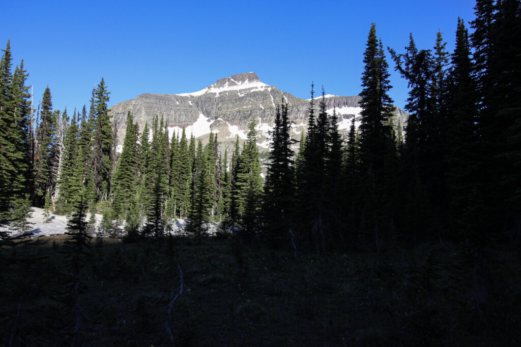
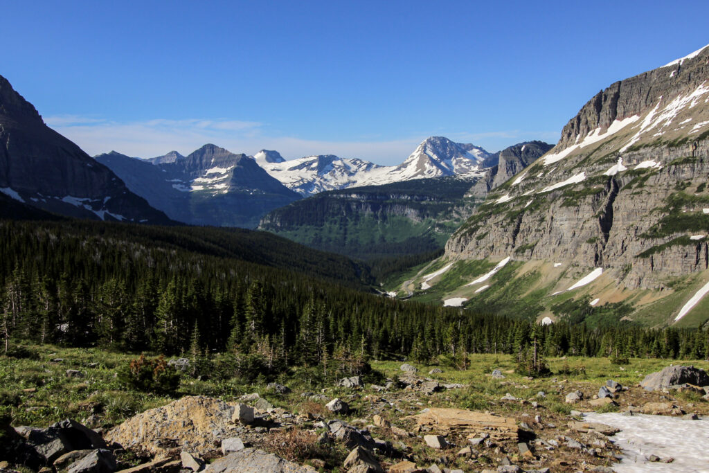
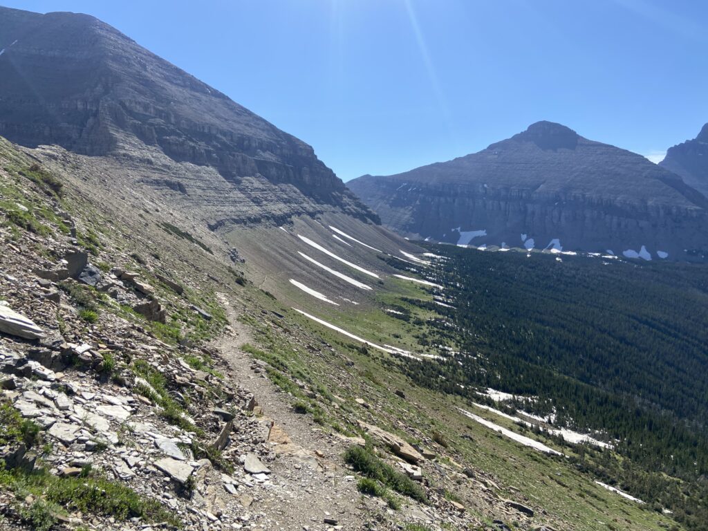
All this while, the scenery was constantly evolving. Now that we were hundreds of feet higher off the valley floor, Piegan Mountain to our west was coming into frontlit view. A brilliant white expanse of snow slowly rotated into view near the top of the right side of the mountain as we hiked north – Piegan Glacier. Matahpi Peak glowed backlit to our east far, far above. All of this could be seen in bits and pieces when the pines cleared.
There were so many other spots on the trail that deserve remembrance and have already or will soon be sucked into the memory drain. There was the bridge over Siyeh Creek at last, far above where we’d last seen it at the foot of the valley. There was the first glimpse of what looked like a treeline ahead and to the left where the trail would widen out into a broader range of view. There were dozens of other creeks, streams, and trickles that Elizabeth and I crossed.
But one spot stands out among all of them in my head. It was past Siyeh Creek, but I believe it was before the parting of the Piegan and Siyeh Pass trails. The trail was continuing north toward that Sisyphean treeline where Elizabeth could finally relax without worrying about a bear crashing into us unseen. We emerged into a meadow maybe one hundred yards across with the northern lodgepoles standing guard around each edge like security guards. For the first time that day, Elizabeth and I stepped into the comforting warmth of the sun. The meadow was carpeted in scruffy patches of bright-green grass poking out of muddy ground. A tiny brook babbled through the middle from northeast to southwest, tumbling in miniature cascades over individual rocks as it made its way toward a tiny part of the St. Mary River watershed. But what I will never forget about that meadow: it was carpeted with little yellow flowers. Each of them drooped from lack of sunlight, but it was plain that when they bloomed later that day it would be spectacular to see. A few days ago, while watching footage from July 15, I commented that I’d love to be buried in that meadow. I stand by that statement.
This meadow marks roughly the transition from the first half of the hike to the second half. The first half was marked by a gentle uphill grade through trees and underbrush with limited views. The second half of the trail was the alpine section. The Piegan Pass trail didn’t become purely alpine right when it diverged from the Siyeh Pass trail just beyond another impressive creek-spanning bridge. There was still another long half a mile or so to go through forested sections and ever-increasing amounts of slick snow over the trail. But it became clear after a while that the trees were thinning out and Elizabeth and I had almost succeeded in reaching the wide-open flank of Cataract Mountain.
We had one last scare to conquer in this transition zone. While picking our way across one of the numerous snowy reaches, Elizabeth noticed a track in the snow that was certainly not human. I bent down to look at it. Whatever bear had made that track was absolutely *massive*. Once again, this seemed more cool than scary to me, but I don’t necessarily think Elizabeth’s reaction towards fear was less reasonable than mine. Her voice edged toward panic one last time for a few minutes. This time, unlike the hour before, I felt no qualms about telling Elizabeth to keep going. It was only a few more minutes before we got onto the rocky face of the mountain. No way would we run into a bear then!
A few more nervous, arduous minutes crossing some of the deepest and widest snowfields we’d see the entire trip led us to the promised land. The last few trees were gnarled in the wind, straining to live in a place where there was more granite than soil. And the views – oh my god, the views.
So unbelievably worth the hike and the bear scare.
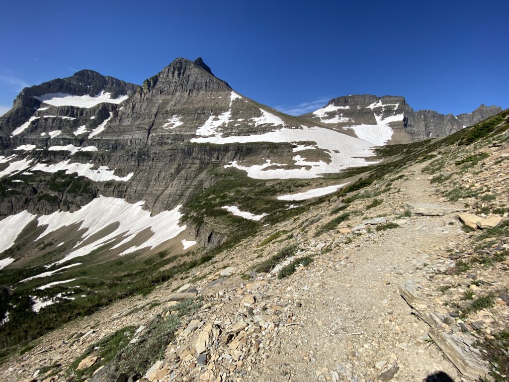
Not that we were done with our trials and tribulations for the hike. So far, the actual exercise/walking part of the Piegan Pass trail had been remarkably easy. In fact, it was 9:30 am, a scant two hours since we had departed the car a solid 3 miles and over 1,000 feet of elevation behind us. But now, instead of worrying about bears, the concern above the treeline was more in the range of footing. The trail was literally carved into the side of the mountain within a scree field. That’s not the most confidence-inspiring location for footing, and indeed the hike was narrow. At least the scree had been scrubbed from the trail for the most part. The one thing that couldn’t be avoided were the three highly angled snowfields that still pitched directly across the trail within the mountainside. The brilliant white snowfields each cooked in the morning sun. If you’re wondering why that seems like a big deal, these were not just snowfields. They were fields of melted/refrozen snow that stuck out at 45 degree angles. Hikers had worn an extremely tentative path through each one, but there was no way you’d want to take this treacherous of a stroll without a hiking pole firmly planted in the ground with each step. And so Elizabeth and I did that – slowly, step by step, shuffling back to bare ground on the other side.
This last part of the hike went westward, with the sun shining at our backs and illuminating the landscape. From a picturesque/scenery perspective, I think you could be forgiven for thinking that the direct shots down the valley to our south, head-on toward Piegan Mountain, or wide toward the far-away peaks are the best vista on this side of Piegan Pass. I think that’s accurate. But for me, the trail was so much wilder and more intense near the end. Cataract Mountain stuck up like some sort of weird sand sculpture feature, leaning out precariously over other side of the wall. Piegan dominated the view far above us. There was a waterfall coming off of the glacier, thundering into the creek far below. And the snowfield right on the northern flank of the mountain where it touches Piegan Pass? We walked right by it. This snowfield maybe is a remnant glacier; maybe it was never anything but a snowfield. Either way, it seemed immense. Several acres of snow gleamed white on a summer day, with faint streaks of red showing where rocks had fallen and slid across it.
That description gets ahead of myself ever so slightly, because 15 or so minutes before Elizabeth and I reached the pass, we saw the first two hikers of the day to reach Piegan Pass on their way back down the other way. It was a tight squeeze to get past each other on the narrow ledge, but what a sense of satisfaction those two must have felt seeing their first signs of humanity all day. Hell, it was such a cool feeling to be in one of our most-visited national parks and be the *second* group up to the famed Piegan Pass on a day. The guys got a quick picture of Elizabeth and me (on her phone, unfortunately) and while Elizabeth recounted our bear story for the third time that morning, I took some pictures of the scenery quickly on my phone.
The last few minutes before reaching the top were wild. The wind increased as we approached Piegan Pass and entered a more exposed spot. That snowfield loomed directly above our left, looking like it could be the world’s wildest sled run from the grooves left behind my surface rivulets. Cataract Mountain didn’t necessarily dominate above our right; I felt like it would take no effort at all to summit it from where we were. Marmots flitted in and out of the rocks surrounding the trail. At last, the terrain flattened out… and it turned out that Piegan Pass was a couple hundred flat yards wide at the top. I could see the iconic Garden Wall directly in front of us, but not the valley that sprawls beneath it. The previous two hikers had warned us. Elizabeth followed me through the tundra path as the broad valley on the Many Glacier side of Piegan Pass unfolded beneath.