When I set out to start writing this close to two weeks ago, I’d planned on a super-post covering everything my parents, Elizabeth, and myself did on October 14, 2023 in Oregon. Over 2,500 words later, I realized that that was a fool’s errand. We just did too much, saw too much, and I have too many great pictures. So this is a post that covers our drive up the coast from the morning through the mid-afternoon. Enjoy!
The October 14 narrative begins as all great narratives do: in bed, waking up, and realizing that I’d just slept for over 10 hours. For some people (including my wife, sawing wood in the hotel bed next to me), sleeping 10 hours is a normal occurrence. For me, it’s a sign of the probable apocalypse. But after a sleep-deprived week of midnight shifts and then a sleep-deprived travel day, it was amazing how much better-suited to take the world on I was.
The Holiday Inn was socked in with low cloud cover, which was a real bummer considering we were in the direct path of an annular solar eclipse that morning. A bummer, but not a surprising bummer when you consider that it was October on the Oregon coast. We still had plenty to look forward to, starting with the hotel pancake-making toaster oven. Those things are fun.
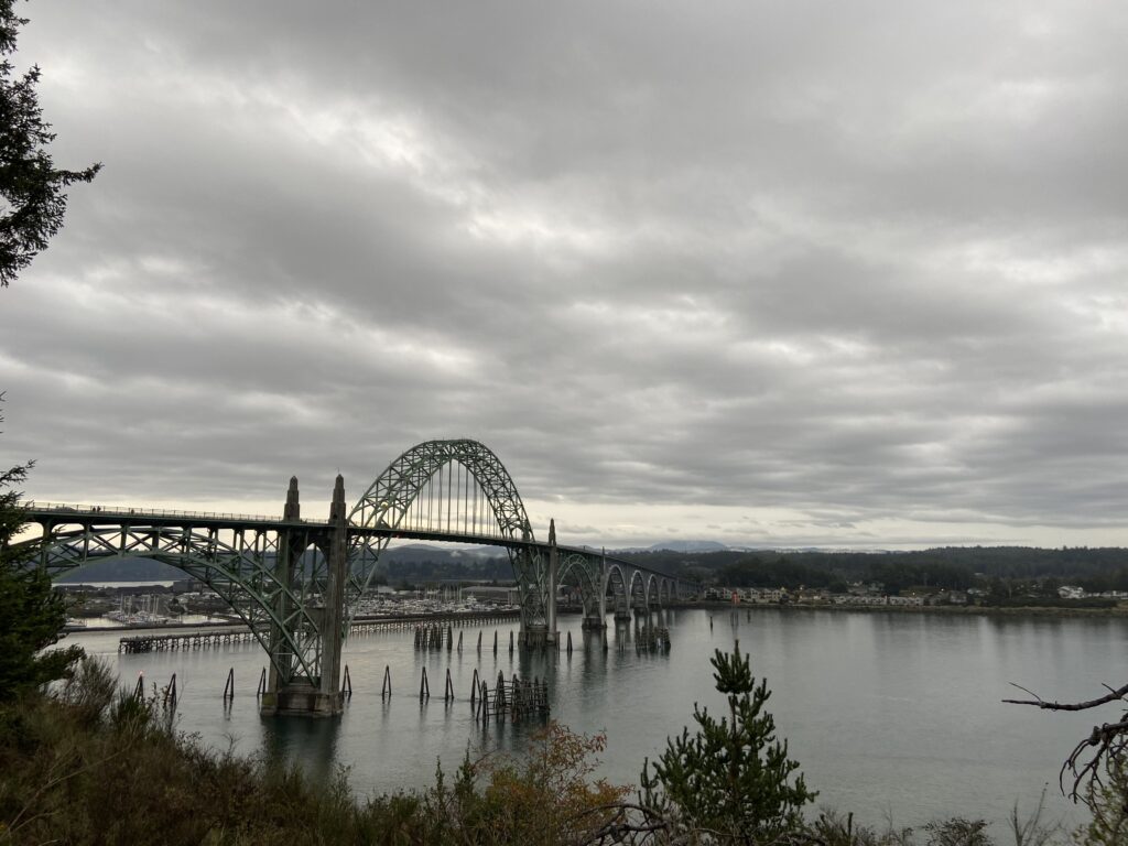
This Saturday was the day my dad had delegated to Elizabeth and myself to set the itinerary, but with the absolutely hectic stretch we had in September, the itinerary-drawing had fallen to me. Fortunately, I had some great ideas. Knowing my mom’s love of lighthouses, my dad’s love of wildlife, my wife’s love of waterfalls, and my love of coastal scenes, I’d crafted a drive north from Newport to Pacific City to start early that morning at Yaquina Head, a small point on the north side of town that boasted a lightning, a volcanic cobble beach, and some gnarly coastal scenery. I thought that the Yaquina Head Lighthouse would make for a great spot to view the eclipse; however, I didn’t convey to my dad that there was a Yaquina *Head* Lighthouse in addition to the Yaquina *Bay* Lighthouse, right at the end of the big bridge we’d driven over yesterday in Newport. So thanks to that mixup, we ended up getting a really cool view of the Yaquina Bay Bridge from the east this time while a lot of people around us pretended to themselves that the sky got darker at the peak of the annular eclipse.
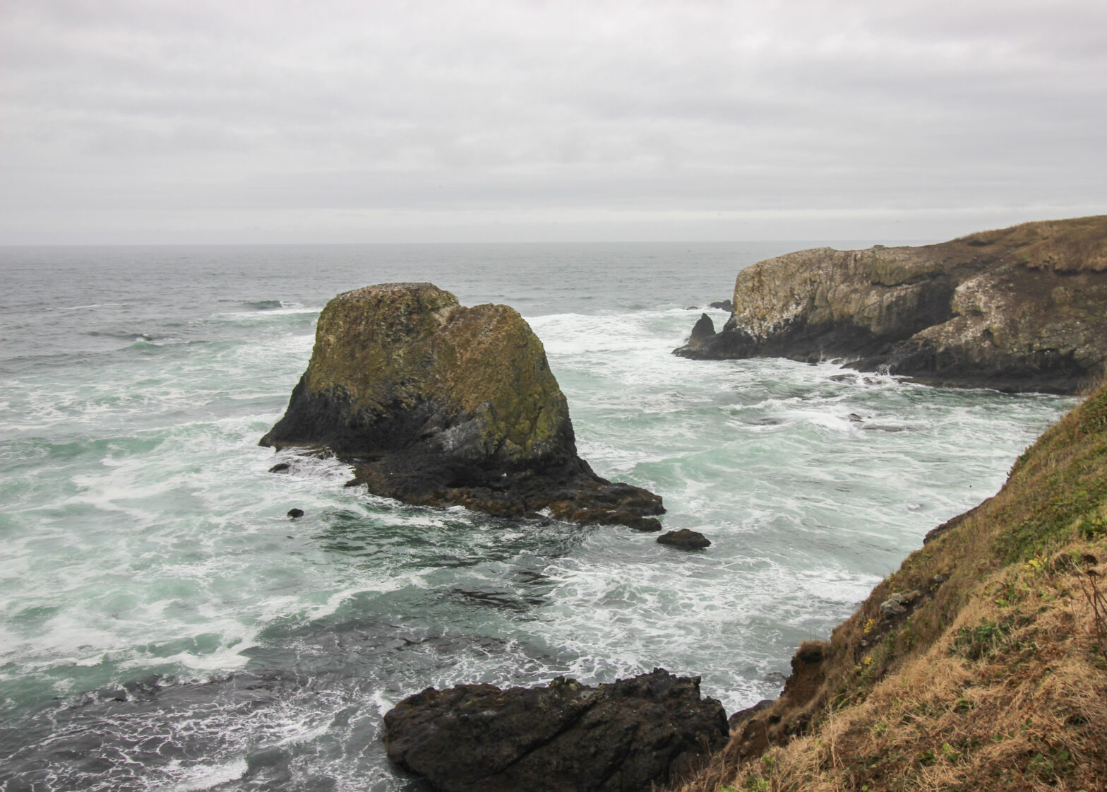
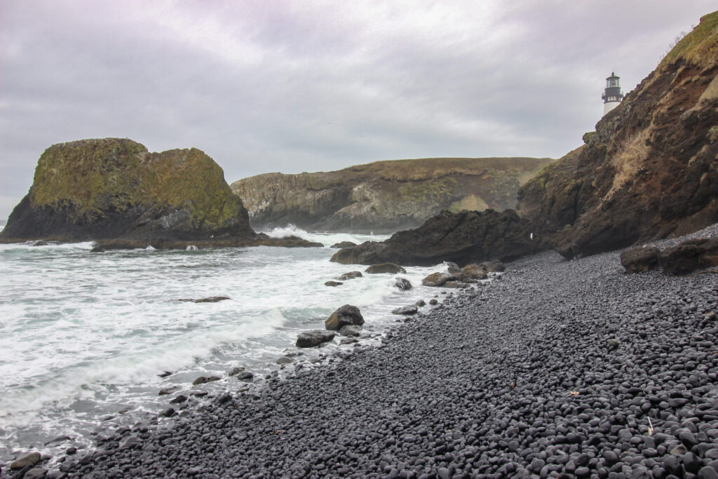
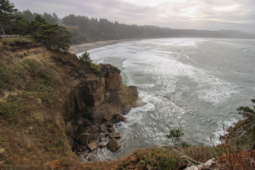
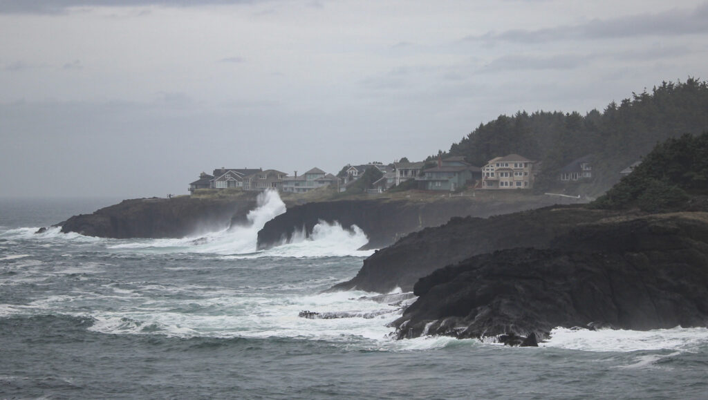
A few miles up the road, I was gratified to learn that my parents’ America the Beautiful pass applied to much of the coastal region we were visiting, including Yaquina Head. That saved us a lot of time, hassle, and some money, I’m sure. The road into Yaquina Head was short, with towering cliffs above the Pacific off to the right. From the parking area, you could see a small grassy dune to the east, the lighthouse to the west overlooking the water, and a ramp down to the Cobble Beach to the south. We chose to visit the beach first and come back up to check out the lighthouse itself afterward.
“Wow! It’s like Iceland!” Elizabeth exclaimed. And, well, yeah – it was extremely reminiscent of the Djúpalónssandur beach in Iceland – black, craggy cliff faces leading down to a beach of smoothed black stones. Until this exact moment, I had not considered that the volcanic history of Oregon might extend all the way to the coast (extremely dumb thing to not consider in Cascadia). But my gosh was it pretty.

If I walked right down to the water (ignoring the dead seal that was right behind me in the above picture, which was sort of traumatizing to look at), I could listen to the waves crashing through the stones. Especially after a big one, as the tide washed back out, the noise the stones made was almost musical, like the world’s largest moroccas.
Dead seals = gross. Live seals = extremely cute. And in fact, people started pointing towards a seething section of water right in front of me. There, near a battered-looking rock sticking up from the water, was the telltale grey head of a harbor seal. It took a little bit of tracking (and a little regret at not having Sam’s Big Dog), but eventually: jackpot.
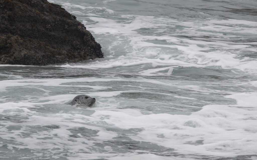
So we’d already found sea lions AND seals here in Oregon. All we needed was to see a whale and we were basically batting 1.000.
Back at the top of the bluffs sat the Yaquina Head Lighthouse. I don’t know that I have much to say about it, other than that it is indeed a lighthouse.
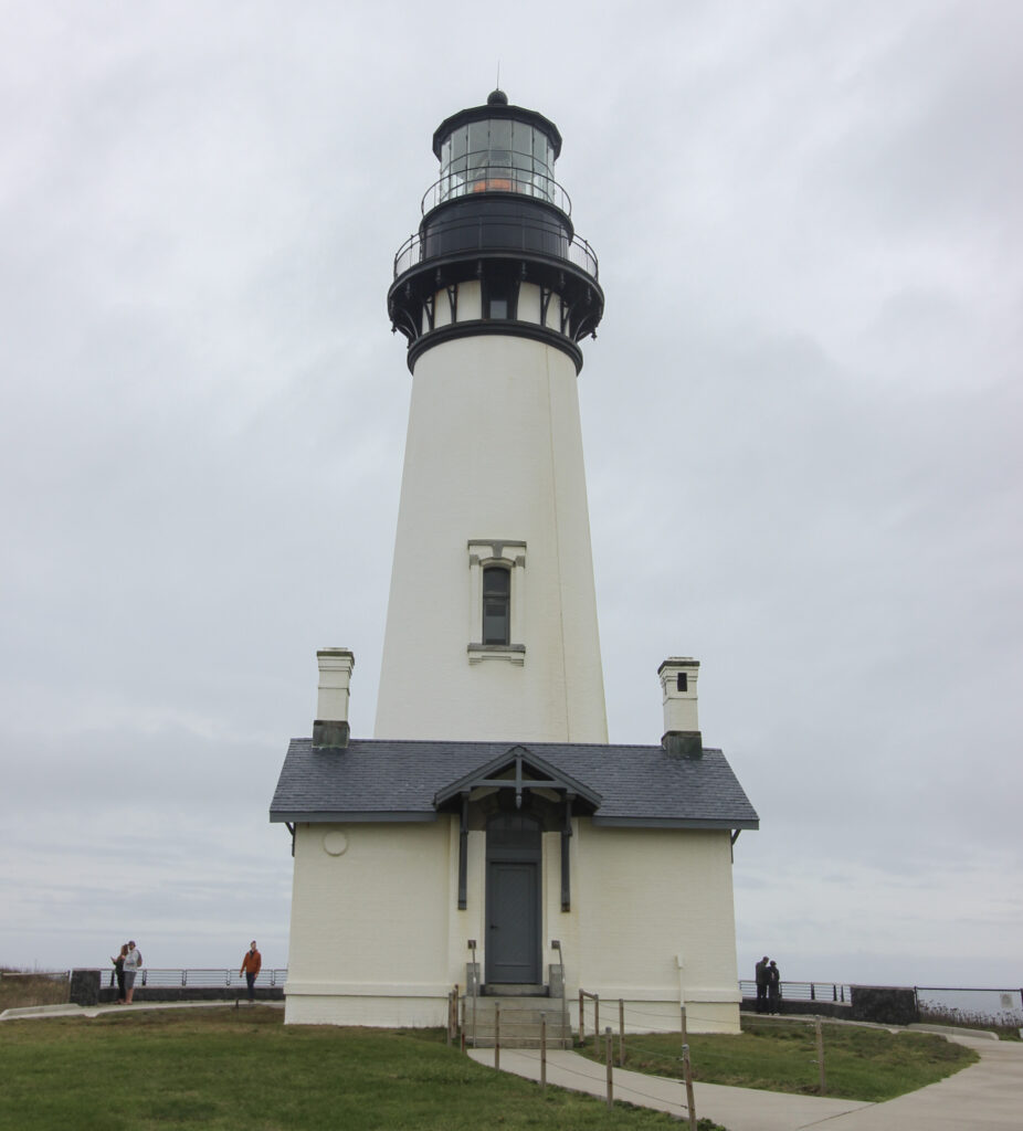
5/10 lighthouse, no further comments.
So that first stop had really set the tone for what the Oregon Coast could be: craggy, beautiful, and a little bit aloof. I can’t speak for the rest of my compatriots, but I was enchanted.
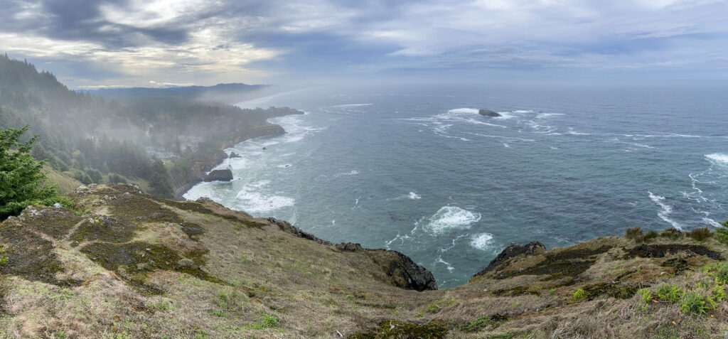
The next stop up was just a few miles further to the north within the tiny coastal town of Otter Rock. Otter Rock is situated on an outcropping west of the Oregon Coast Highway. It’s a couple of blocks wide, max, and is defined by the area at the dead-end of 1st Street (just past a Mo’s Seafood because of course): Devil’s Punchbowl State Natural Area.
The Natural Area is so-named because of the Devil’s Punchbowl – a double rock arch that is open to the Pacific, so that when breakers get caught in the bowl formed by the arches, there’s a nice swirly churn.
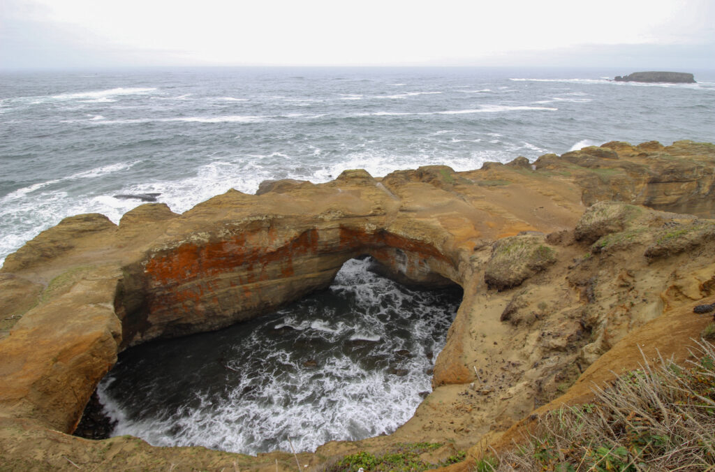
Pretty cool stuff. Off to the right, there was a panoramic view of the churning Pacific:
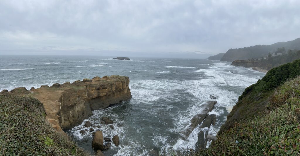
And off to the left, there was a little cove full of breakers and a litany of surfers out catching morning waves.
The spray had pushed out this mixture of mist and fog that the sun struggled to penetrate through. It made for a scene that, if it wasn’t spooky, it certainly was a moody vibe.
After walking around the bluffs near Devil’s Churn, we returned into the town of Otter Rock. My mother and Elizabeth were looking for some coffee to jump-start themselves, and they stopped inside Cliffside Coffee and Sweets. For some reason that was unknown to me (coffee-drinkers are a mystery), they decided not to get their caffeine, but Elizabeth and I purchased a chunk of blueberry cheesecake fudge that turned out to be absolutely delicious. We nibbled on that in the car for the rest of that Saturday.
My parents’ beloved GPS program “Guy GiPS” had led us down an offshoot of the Oregon Coast Highway called the Otter Crest Loop to get to Otter Rock. It paralleled the highway for a few more minutes before reaching the Otter Crest State Scenic Viewpoint, a towering vantage point on a bluff a few hundred feet above the water far below. From the viewpoint, you could look back south toward Otter Rock, Devil’s Churn, and maybe even Yaquina Head in the distance.
There was also a visitor’s center and gift shop at the top of this bluff. Here, we were able to ask a (way too enthusiastic) guy behind the desk a few pressing questions. First of all, were those giants things we’d seen floating in huge rafts in the water otters? No, they were not. In fact, despite the name Otter Rock, otters have been extinct in Oregon for a long time. We were seeing floating kelp forests. Second of all, where were the whales? October isn’t really prime whale-spotting season along the Oregon coast, but here in Cape Foulweather (an apt name) the guide assured us that if they weren’t visible from this viewpoint, they would most likely be visible up ahead at the Rocky Creek Viewpoint. We thanked him for his knowledge and moved onward.
The Rocky Creek Viewpoint was just down the road, past a stop I had totally missed on my itinerary (the Rocky Creek Bridge – a bridge where the creek tumbles over a waterfall and into the ocean). This viewpoint was much closer to the level of the ocean, down in the mist layer. Who knew where the whales were at an umanned viewpoint like this? I shrugged my shoulders and set out across the grass toward where people were congregating by the water with cameras. The old adage along the coast goes “Where the people with $1,000 lenses are, the whales are”. And sure enough, as we approached, I thought I caught a glimpse of motion in the ocean that wasn’t tied to the roll and pitch of the waves. Whatever it was, it was only a hundred yards out or so, but it was gone in a flash. I kept my peace as we stood in the gloom for a minute or two. Until…
“There!”
I don’t remember who pointed it out (it may have been multiple of us at once), but once we did, the whale sightings became obvious. There must have been anywhere between 3 and 8 of them all hanging out in this stretch of the coast. They seemed to be cruising sedately (or, as the kids say, “chilling”), and every time a whale surfaced it was only a tiny portion of the animal, and only for a second. This made for some tough photography, but persistence paid off (I guess?):
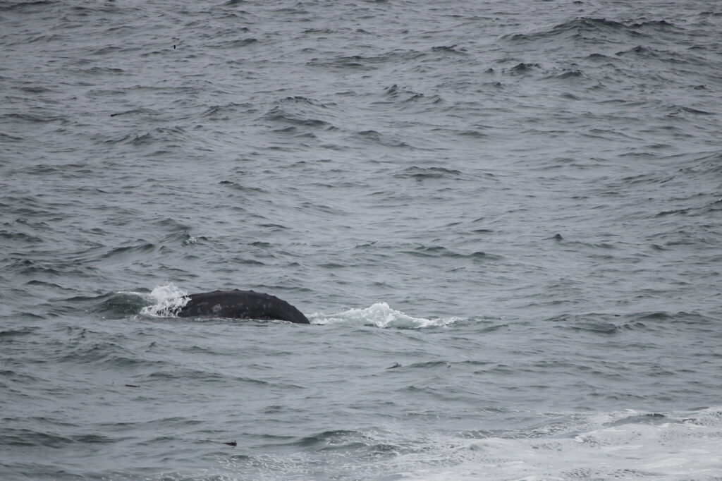
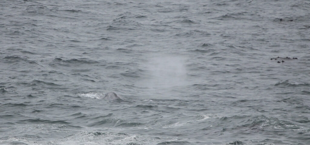
The blowhole shot wasn’t exactly what I wanted, but it was close enough. Sometimes you get what you get when you’re with 3 people who are just there to enjoy the scenery, and as a photographer you have to be smart about that. Plus it was cold.
Rocky Creek Viewpoint did have a nice view across a little cove (aptly named Whale Cove) to the outskirts of the little town of Depoe Bay.
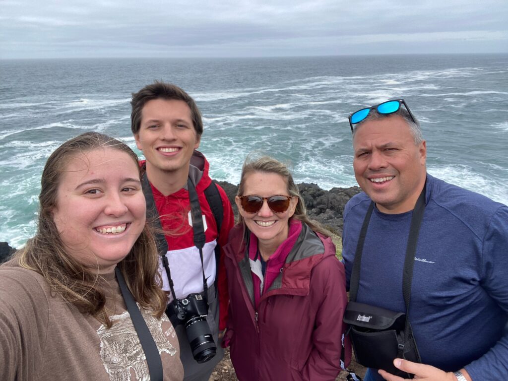
All in all, it was a pretty cool unplanned stop. Shoutout to the excited guy back at Otter Rock for making it happen. Also, a shoutout to the three travel companions with me, who may not have been quite as exhausted, but were certainly fighting through travel fatigue as well. We all seemed to be having a pretty good time in spite of it!
Back in the car, I got a small disappointment upon discovering that the Rocky Creek Falls were already behind us. No use in turning around, though. It was already late morning, my mom and Elizabeth had been asking for coffee for a while, and I realized to my chagrin that the lunch restaurant I had picked out was still well up in Pacific City. So there would be no turning back. We drove through Depoe Bay and into the net stretch of coast, the sprawling town of Lincoln Beach. At its southern extent we found what we desperately needed – Big Mountain Coffee Roasters. Great timing! The inside of the cafe was a little too Harry-Potter-themed for me, but I guess that fits the overall vibe of the kind of person who owns a coffee shop on the Oregon coast. Nobody complained about their drinks, so I guess the stop was a success.
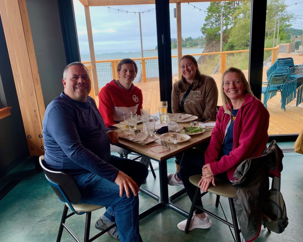
Originally, I had planned for us to get lunch in Pacific City, but that was still in Pacific City, 30 miles and several stops away. It was already past noon, so it was time to audible. Fortunately, the brewery in question, Pelican Brewing, appeared to have multiple locations in the area. One of them was just ahead at the mouth of Siletz Bay. Silently praying that there wouldn’t be a long wait, I headed inside alone to get on the waitlist for a table. A miracle: the hostess said she had a table available for us literally right as my parents and Elizabeth came in. I was looking like a genius instead of the chump like I could have. And if there’s one thing my mom wanted to do, it was “eat by the water”. This Pelican Brewing literally sat right on Siletz Bay, close enough that you could see a miniature tidal bore from our table as the high tide poured back up into the river. Winning.
The brewery wasn’t amazing, but it was solidly “pretty good”. I got a burger and the suggested paired IPA and didn’t regret either. Elizabeth ordered a salad and only just narrowly avoided ordering an “India Pale Ale”. My parents seemed pleased enough with their food too. Given the fact that we still had much ahead of us on the day, it was good to fuel up AND fulfill my mom’s request for a meal by the water.
Only 3 more stops on this drive’s itinerary, at least. The first of those three had the chance to go down in Meister Family Lore as one of the weirdest, wackiest, and randomest tourist attractions we’d ever seen. Behold:
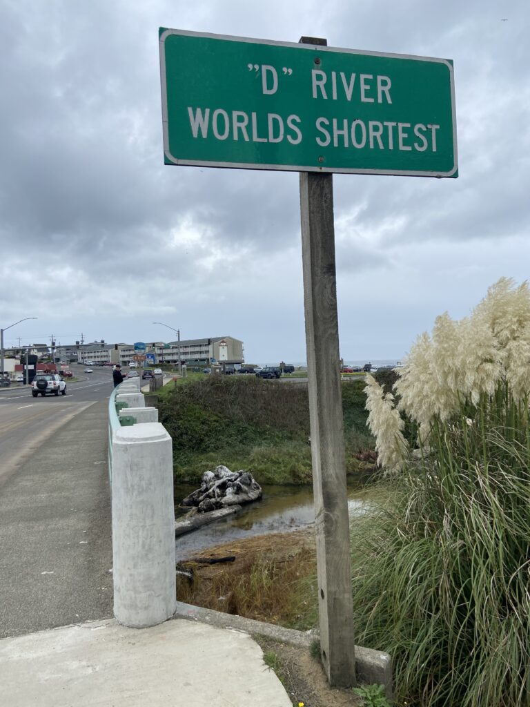
Yes. The D River previously was in the Guinness Book of World Records as the World’s Shortest River. Then they had a nasty dispute with the Roe River up in Montana, which somehow managed to be shorter than the D River’s 440 feet in length. There were remeasurements, and there was mud-slinging, and the Book of World Records decided they didn’t want that smoke. So now the D River only has an unofficial designation.
The highway passes over the “headwaters” of the D River as it empties out from Devil’s Lake on the east side of the Oregon Coast Highway. Then it passes through its little channel on the way to the ocean. And that’s it. You’re looking at the whole river here.

It was glorious.
Back on the road, we drove through the town of Lincoln City, a tourist-y destination stretched along the water. During peak season, you could just imagine that town to be full of Little Piggie traffic, but on a wet offseason Saturday it seemed pretty tame.
The Oregon Coast Highway takes a bit of an inland jog on the north side of the Devil’s Lake/Lincoln City area to go around a big hill/mountain known as Cascade Head. I would have loved to have visited or driven up Cascade Head, but the road was closed in October due to a 2022 landslide, so that was out of the question. Our next stop (weaving in and out of areas that were marked ominously as TSUNAMI EVACUATION ZONES) was just on the north side of the headland in a small town called Neskowin. There on the south bank of the mouth of Neskowin Creek are a bunch of tree stumps, embedded in the sand. Centuries ago, this area was a forest before the latest Cascadia Subduction Zone earthquake causes the entire region to subside. When saltwater flooded into the marshes where those trees lay, they instantly fossilized and eventually became mostly buried in the beach sand. It’s a pretty cool story that I was excited to see, but unfortunately the tide had been rushing in all day and the normally ankle-deep Neskowin Creek was up to knee-deep. None of us had any real desire to wade across it to see the Ghost Forest (which mostly appeared to be underwater, anyway).
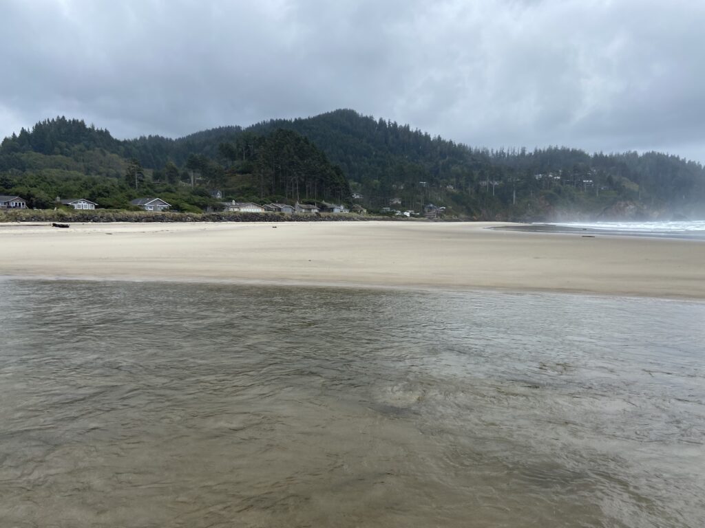
But there was a headland known as Proposal Rock that was getting flooded into an island rapidly by the rising tide, and that was pretty cool to see.

So it wasn’t all a loss.
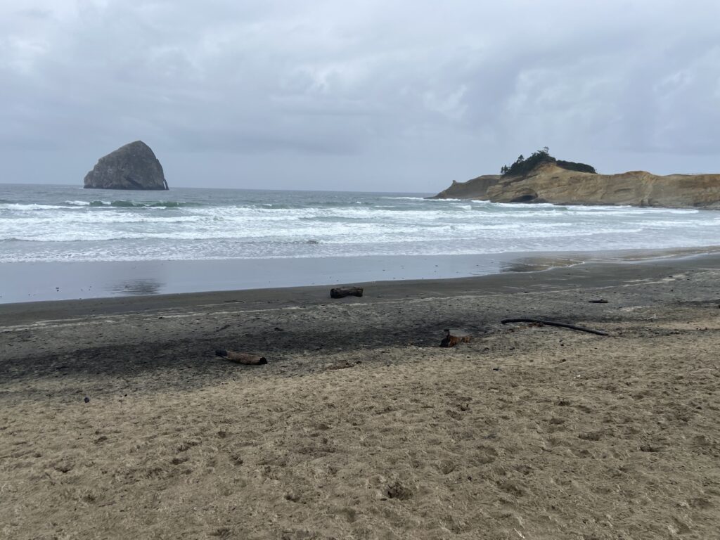
From Neskowin, it was just another couple of minutes up the coast to the final stop along the Oregon Coast Highway: Pacific City. There’s a state park up there called Cape Kiwanda that features a massive sand dune and some cool rock formations, as well as the Pelican Brewing location I’d orignally planned on us eating at. But when we got there, our plans got thrown all out of whack by reality. Namely, there was a driving rain coming in off of the water that just didn’t feel great to stand outside in. At least we hadn’t gotten lunch at the Pelican Brewing here, because there was a wedding taking place when we parked alongside it.
The Oregon Coast pretty much managed to live up to the lofty expectations I’d set for it, although I wouldn’t go crazy and say our drive had exceeded expectations or anything (just wait for the next day). But even then, there was no time to be reflective or sad or even just to drive slowly back to Newport. It was getting into mid-afternoon, and we still had an epic hike ahead of us: Drift Creek Falls.