Dawn light filtered into the cabin Elizabeth, Stephen and I shared. After a surprisingly decent sleep given how much I’d shivered, this morning felt like one to jump out of bed and greet the day with enthusiasm. I checked my phone and realized it was only 6:00 am. Now, you have two choices when it’s 6:00 am on vacation and you’re with two absolutely-not-morning-people. You can risk your life to get up and do the thing you all said you were going to do. Or you can go for a walk outside and try to enjoy the morning, all while stewing about how your plans may be ruined by not getting to the parking lot on time on a holiday weekend. I chose door number 2.
Out the front door, I got my first look at Pinnacles National Park – sort of. It turns out that if you’re tucked into the Coastal Range, you end up getting coastal weather features, including the marine layer. Fog clung thickly to the hillsides around the campground, which looked sort of like the arid oasis I expected. Everything in my brain had prepared me for typical California arid weather, so the fog seemed out of place with everything else. I had hoped against hope that we might get some lush vegetation after the notoriously wet winter of 2022-2023 in California, but it looked like we were out of luck. In fact, if the marine fog didn’t lift out, our hike wasn’t going to be too fun either…
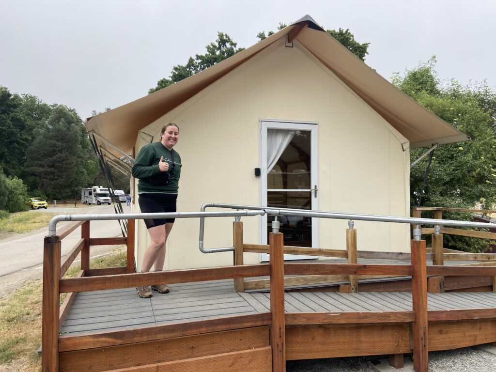
I could only stand letting Elizabeth and Stephen sleep for another hour until about 7:00. To be fair, we were only able to remain in Pinnacles until mid-afternoon, then we had to drive up to San Francisco in time to make our dinner reservation. On top of that, they had gotten like 7 hours of sleep. Enough is enough. I rousted them from bed and we got to packing up the cabin we’d only been in for a few hours.
Pinnacles is split into two by the impassable High Peaks region in the middle. A road services the west side of the park and a road services the east side, but the two don’t link up. It takes several hours to get all the way around outside the park from one side to the other.

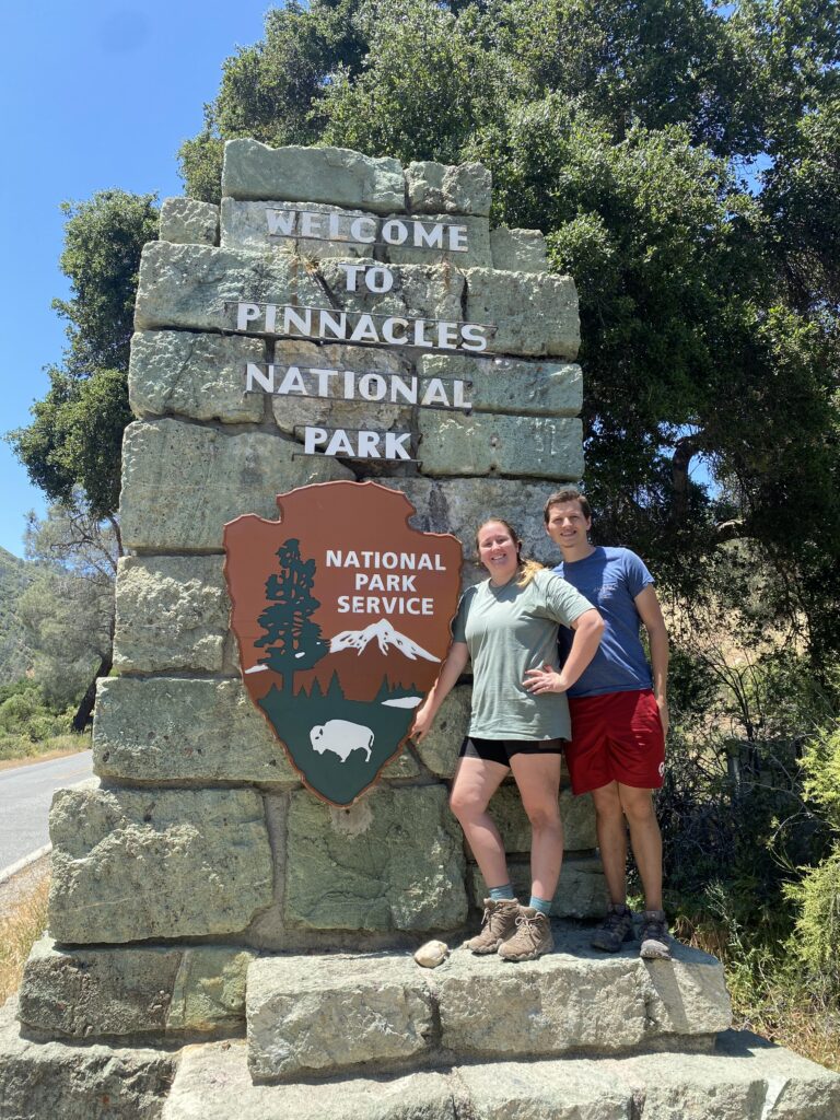
We were on the east side of the park, having stayed at the Pinnacles Campground. The basic plan was to drive to the Bear Gulch area and hike a loop consisting of a couple of trails – up to the High Peaks region via the Condor Gulch Trail, up to the famed railings and exposed sections within the High Peaks, then down to Bear Gulch Reservoir and finishing with the Bear Gulch Caves. All told, it would be moderately strenuous at over 1,600 feet of elevation gained within about 6 miles.

The fog seemed liked maybe it was starting to thin out along the drive to the Bear Gulch Fay Use area. Also, while the area around the campsite had been nothing but scrub brush, the road showed *flowering* scrub brush that was more green than yellow. It was promising! Small breaks in the fog deck showed more dramatic peaks than the hills that seemed to be around the campsite. You might even get away with calling them mountains, though it was hard to tell.
The parking situation at Bear Gulch was beginning to become crowded, but not to the point where we had any real trouble finding a spot for the rental car. Another half an hour and we may have been in trouble. After all, it was a holiday weekend in California. I not-so-quietly felt triumphant for having woken the gang at just the right time.
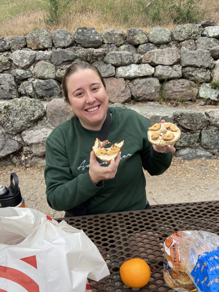
The three of us stopped for a bootleg breakfast of all of Target’s finest goodies at a picnic table at the day use area. When I say “NPS meal”, this is what I mean – everything bagels with Nutella scooped by everything pretzels, some oranges, and brown sugar cinnamon Pop-Tarts.
Then the three of us started walking away from the day use area down the trail. Until about 3 minutes later, when we realized that we were accidentally taking the whole loop clockwise. Elizabeth had read trail reviews that said the High Peaks section specifically should be done counterclockwise, and she successfully won her protest. We reversed course.
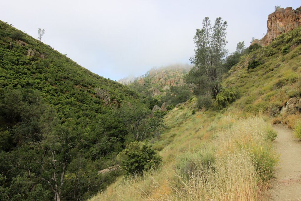
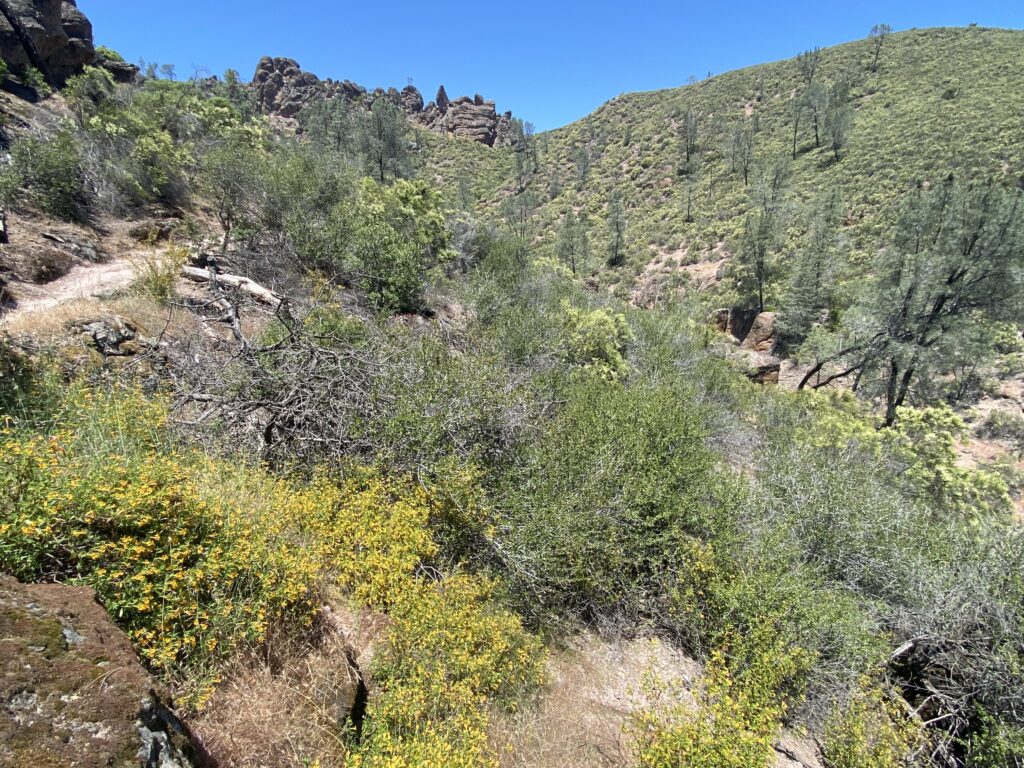
Now we were actually underway, heading northwest up Condor Gulch. It was a beautiful morning if you could get rid of the fog – which by now was definitely beginning to lift. The temperature was probably in the 50s with no wind. The trail started up the right side of a ravine that was dotted with trees and shrubs. It was a bit of a revelation to see the trees – this desert landscape was quite green indeed!
So far, the trail was busy but not crowded. Most people were going the same way as us, which helped. I saw all types of hikers represented – middle-aged couples, granola girls, legit hikers, and then our motley crew of three. Not that this trail was anything incredibly difficult, but I thought the barrier to entry may have been a bit higher than I was seeing.
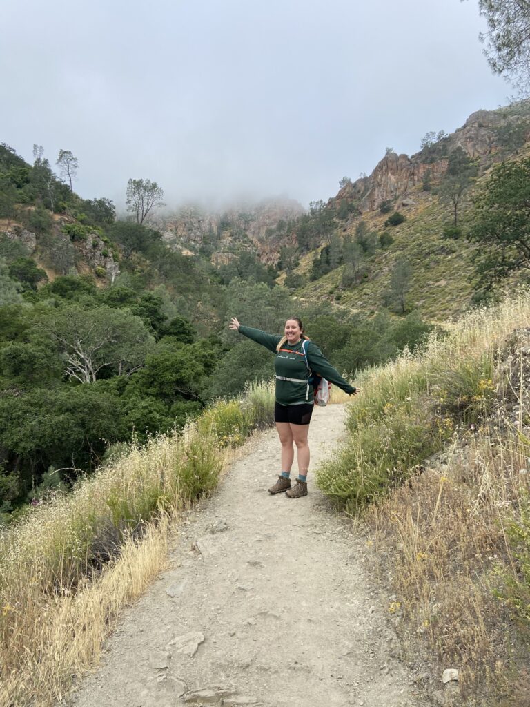
And then, around 9:00 a switch flipped at Pinnacles National Park and the fog disappeared.
I kid you not. The last two pictures were taken mere minutes apart, and already the marine layer was obviously beginning to lift. The picture of Elizabeth was at 8:57. Here is a shot from a little further up the trail at 9:13.
Welcome to Pinnacles National Park, for real this time! It was a wonderland here in late spring. The day rapidly began to warm – Elizabeth shedded her sweatshirt, and I shed my vest, leaving Stephen to roast in his blue jeans (???). There was the famous red rock of Pinnacles. And somewhere in front of us, the High Peaks loomed above, very high indeed. Any fear that this was a park of Mickey Mouse little hills (a fear that had been in my fogged-in brain) disappeared. No, this was a delightful contrast of brilliant greens and reds and a blue, blue sky that made the typical California haze seem like a distant afterthought.
Even better, now we could begin dreaming of seeing California condors. Pinnacles is probably the most famous of the refuges for the condor, which is famous for its massive wingspan (up to 9 feet across) and for their extreme rarity (they’ve recovered from a population of 27 to about 550 as of late 2022, but that’s not exactly a resounding populace). Condors like to glide along the cliffsides of the Coastal Ranges where they can ride thermals all day long and look for carrion to eat. The catch? There are some giant vultures (“only” 6 feet in diameter) that also love to do the same thing. You have to either compare the size of a bird that may be 1,000 feet above you, or look for the distinct white markings on the wings that signify a condor. Before we’d even gotten above the plentiful valley shade, Elizabeth was already claiming to see condors far, far above where my poor eyes could see (and probably hers).

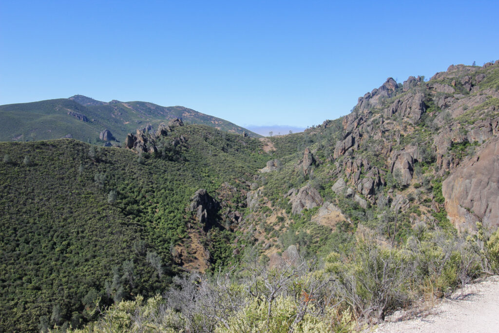
Pretty early on in the hike, the Condor Gulch Trail reaches an overlook. You get a baby taste of what the High Peaks have to offer here by having to traverse a slick rock area along a railing, but then there’s a great view back down Condor Gulch once you get there.
Once again: NOT what I expected to see from the California permanent mega-desert or whatever. If you’re more astute than me, you can start to realize why this place is called “Pinnacles” National Park from the above pictures.
The Condor Gulch Trail looped back to the east up the mountainside you can see on the left of the above picture. This part of the trail ceased to be quite so shady, but it did not cease to be an uphill grind. The morning got warm pretty fast. So did the rate with which Elizabeth and Stephen needed to stop for breaks. But the view was making it all worth it in my eyes.

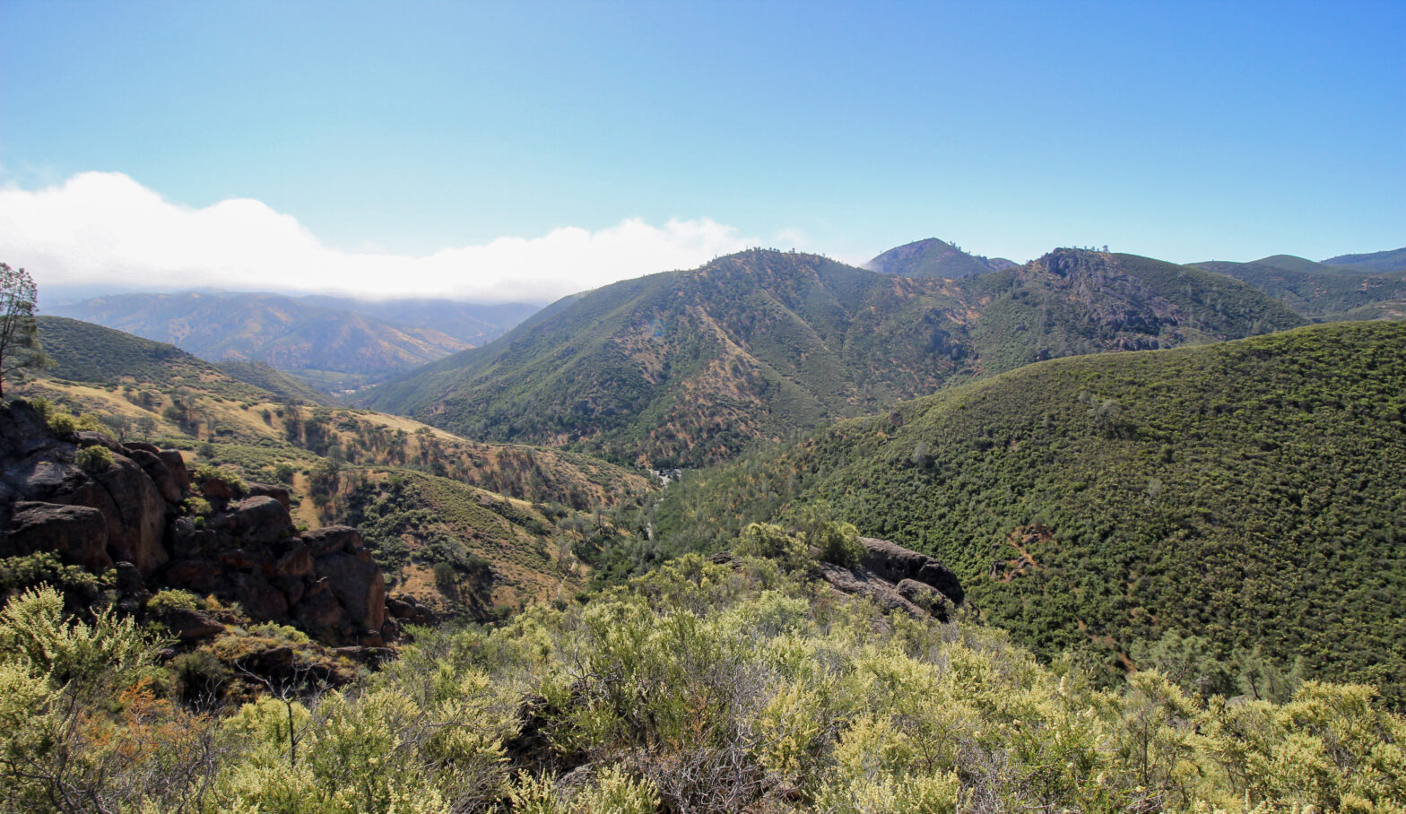
We came up to a large bend in the trail that overlooked the entirety of Condor Gulch back to the parking lot. Beyond that, more mountains loomed. And beyond that, there were miles and miles of ridges and valleys still-buried in fog, all leading to the higher, barren peaks of the Diablo Range in the distance. This is where I got my favorite landscape shot of the day.

A shadow passed over us. There weren’t any clouds, so it had either been a plane, or…
Elizabeth pointed. “It’s a condor!”
It sure seemed like one. The wings had the specific white markings that sure looked like the ones I’d seen on a sign at the campground, promoting the differences between vultures and condors. It had a huge wingspan and an ugly pink head. The bird was soaring low above us on the mountaintop, making lazy counterclockwise circles that looped right in front of us. I dropped my camera bag and got the zoom lens on in record time.
Locate the bird, wait for it to swing around, wait, wait, wait…
Click.
I repeated that process for about half a dozen of the bird’s lazy circles. Then I looked at the camera, zoomed all the way in. And yes. I had scored.
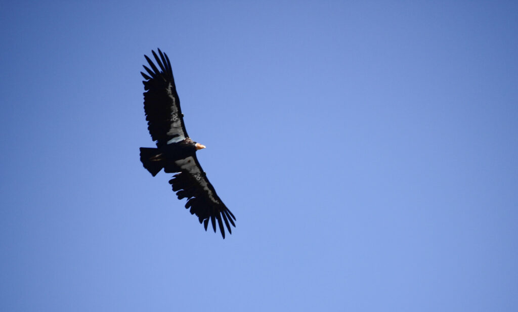
It wasn’t until we got all the way back to the car and I zoomed in on the picture that I noticed the wings were tagged. This was bird number 26. And it wasn’t until then that I felt sure that Elizabeth, Stephen, and myself had done it. We’d captured a picture of the California condor, one of the rarest birds in the world.
This alone would have made the entire trip to the national park for many people, but we still had a long ways to go on the trail.
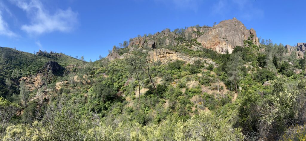
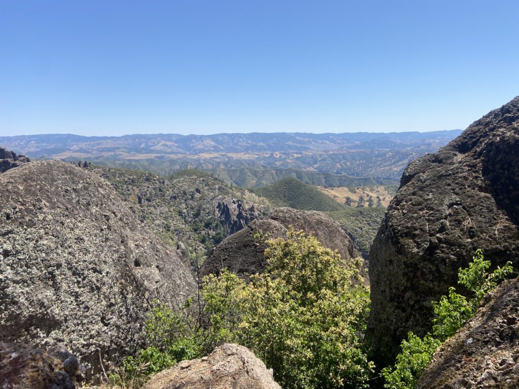
The next stretch wound back northwest through an exposed section above what I guess you could consider the “treeline”. There was an overlook where the lightbulb went on for why this national park was called “Pinnacles” National Park. It wasn’t just the mountains, which were really just like any others within the California Coastal Ranges. Instead…
It was those black monoliths of volcanic basalt jutting out from the mountainside that earned the park its name.
In fact, we were heading on up into that land of pinnacles on the right. First, the trail had one more grueling uphill stretch, this one north and then west around a junction. We’d already climbed about 1,000 feet above the Bear Gulch lot in the first 1.5 miles, and this next 0.4 miles would go up another 400 feet. I was feeling shockingly good – maybe the low overall elevation helped, but compared to much “easier” hikes like Avalanche Lake in Glacier or Phelps Lake in Grand Teton (which I would hike with Stephen the very next weekend at my bachelor party!) felt more difficult than this relative to the overall grade. Elizabeth and Stephen were much worse for the wear. They clamored to take a break and sit on a rock underneath the meager shade of a lone, gnarled tree at the junction. The three of us sat there, watching dads with four-year-olds on their shoulders push by us. Not one of my prouder hiking moments.

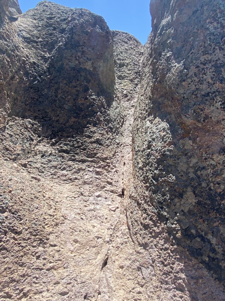
And finally, we were up in the High Peaks portion of the trail. This part, where the trail bends back south for quite a while, is relatively flat, but has to wind around all of the craggy outcroppings, juts and abutments of pure rock. In a few spots, the trail has no room to operate around or over a rock face, so enterprising NPS employees cut into the rock to create staircases or ledges with railings. This is the most famous stretch of trail within the park. I’d been looking forward to it since the beginning, and now that we were close, I felt like the anticipation rivaled that of waiting in line to ride a roller coaster for the first time. From the looks on their faces, Elizabeth and Stephen disagreed with that assessment.

The staircases and railings are all so primitive that they can only be ascended or descended one at a time. Naturally, on a holiday weekend just one hour from the Bay Area, this meant that lines of little piggies were queued up, awaiting their turn. I took the back of the group so that I could film Stephen and Elizabeth as they climbed. Then I let them get a little ahead of me so I could scramble up like the mountain goat I imagine myself to be. This ought to give you a gist of what the railings section was like:

After the staircases, the trail actually gets carved *under* one of the Peaks in a tight overhang with a hell of a lot of exposure on your left. I didn’t take any pictures because I was busy with video, but you can see what that sort of looked like from the perspective of my vacation video, which should be coming out very, very soon (I’ll probably never come back and link it).
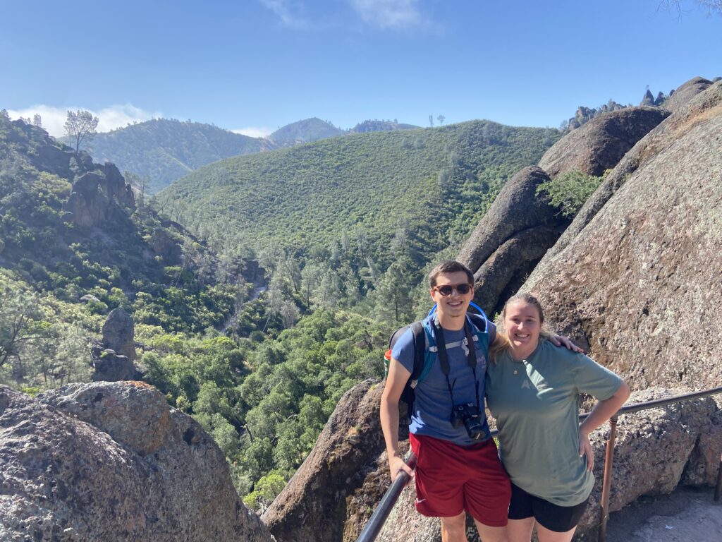
There was a nice little shaded area up on top of the High Peaks to take a rest and enjoy the view once we’d gotten through the exposed section. I think Stephen and Elizabeth needed a break both physically AND mentally.
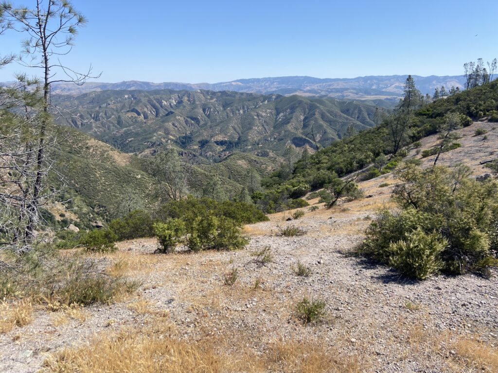
The trail, to my surprise, didn’t immediately begin to descend upon reaching the other side of the exposed section. Instead, it continued along the top of the ridgeline of the mountain we were on for several hundred more yards. It was pretty cool – from up here, you could actually see across the roadless divide through the center of Pinnacles and to the western side. It looked much tamer – just a road to a parking lot, really, with some trails leading up into the High Peaks section from that side. Beyond that, a valley continued to be socked in by fog, and beyond that another ridge of the Coastal Range loomed. California scenery was sort of capturing my heart, I had to admit.
We reached a trail junction on the far side of the ridge, where our loop would descend back down via Bear Gulch to the Bear Gulch Reservoir. Believe it or not, our hike was far from over. Up here at the trail junction, there was a logbook. Elizabeth signed it with a note for the wedding we’d be attending in two days.

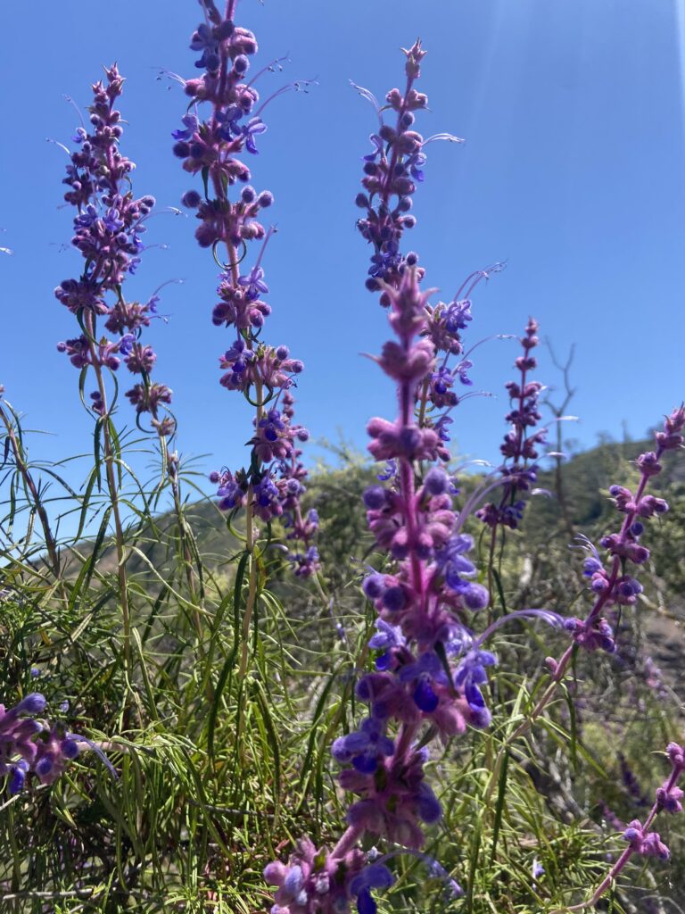
Then it was down a steep, switchbacky, and at times treacherously slippery trail through lushly flowered hillsides. The superbloom had clearly ended before we got there, but what was left of the flowering in Pinnacles was probably a sight to beat the other 11 months of the year. No regrets in my eyes.
By now, we’d reached the downhill portion of the hike where Elizabeth begins complaining about some sort of mysterious ailment in her leg. This time, it was her hamstring. That necessitated several more stops on the way down. I always find it interesting how much I enjoy the start of the hike, and love the views up top, and then am so ready to be back down at the trailhead basically right after reaching the top.
That was even true here, where there were actually fun things to do on the way down. The downhill stretch included two tunnels bored into the side of the mountains, plenty of views of those weird black pinnacles, and a rock that looked exactly like Scipio in profile. There was another rock with a slabby face that looked perfect for Stephen and me to boulder on. Elizabeth walked away, too stressed to see us climb up this massive sheer rock face.
We made it after a long (ten seconds) struggle.
Then it was back to the long, hot downhill toward the Bear Gulch Reservoir. We passed what looked like (and the Internet has assured me is) some world-class rock climbing slabs with lead rope positions already bolted into the cliffsides. Gradually, we moved into more shady spots as trees began to grow alongside the trail again. And finally, in the distance, I caught a glimpse of water. We’d made it to Bear Gulch Reservoir!
The lake was tinted a truly vile shade of brown for some reason that I have never quite learned. The reservoir was created in the 20th century as a flood control mechanism for the valley floor beneath Bear Gulch. A steady trickle of water flowed from the dam in a smelly, manmade waterfall into a little slot canyon far below. There was another steady trickle – this one of little piggies, who swarmed around the reservoir in a show of the worst kind of crowding the NPS has to offer. I immediately lost my cool and used my one Yell At Someone of 2023 while watching some six-year-old feed a squirrel as their dipshit parents stood next to them in blithe indifference. Stuff like that *really* gets on my nerves. We only have a few natural places left in the US. Certainly this is true in the fucking Bay Area. Why ruin it by taming the wildlife? I try not to judge people’s actions, but I feel very strongly that this makes you Bad.
Funny enough, I didn’t take any phone shots of the reservoir. I must have taken them all on my camera in my haste to get out of this tourist hellhole, and none of the pictures made the cut off of the SD card into the Lightroom editing dump. You will not get to see Bear Gulch from this blog post. You can, however, see the staircase leading down into the slot canyon/cave section of the trail.

The part of the caves that we accessed were this amorphous blob of boulders and openings and an ill-defined trail that sort of wound through it. It was all very confusing. The Bear Gulch Caves are renowned as a habitat for bats in the area, and as such they’re closed for much of the year. This included when we were visiting, with the actual Caves closed. What we were in was like… fake caves or something? But this was all so ill-defined, it was hard to know what was what. Were we somewhere we weren’t supposed to be? Off-trail? On? Were we supposed to climb through this ledge?

Eventually we wandered back onto the trail and discovered the REAL caves, which were in fact closed. A bit of a humbling moment, to be honest.
The rest of the trail was smoothly downhill through the shady creekbed drawing out of Bear Gulch Reservoir. Pedestrian traffic was as high here as it had been all day. So was the level of fatigue and the complaining coming from our group (not naming names). I felt more than a little relief to get back into the picnic area we’d accidentally started the wrong way into earlier in the day amid the fog. Just a few more minutes, and we burst our way back into the parking lot where the rental car – and blessed air conditioning – were ready to cool us off in a hot California sun.
It was about 1:30. We’d hiked the High Peaks via Condor Gulch in a little under 5 hours, covering 6ish miles and 1,600 feet of elevation during that timeframe. The High Peaks definitely makes my top 10 list of hikes I’ve ever done, but it wouldn’t crack into some of the glacial hikes in the Northern or Central Rockies. It was unique, though – unique scenery to see the California Coastal desert in bloom, unique to hike the exposed section, and unique to see a freaking California condor. Our time in Pinnacles National Park had already come to a close, but I felt secure in the fact that I’d made fond memories of this park that I’ll carry with me forever.