Artesia, New Mexico. A town of a little over 10,000 people in the southeastern corner of New Mexico. A pretty town, in fact, but undoubtedly one that qualifies as “in the middle of nowhere”. It’s seated in the middle of the Chihuahuan Desert, and outside of town scrub brush and rocky terrain rise as far as the eye can see. In the middle of July, when we were there, high temperatures in the valleys frequently reach the mid-90s with monsoonal moisture making thunderstorms likely.
In other words, I thought it was one of the coolest places I’d ever been.
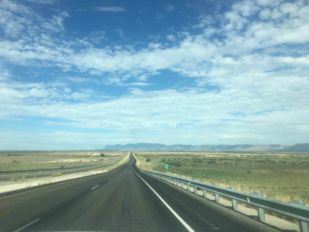
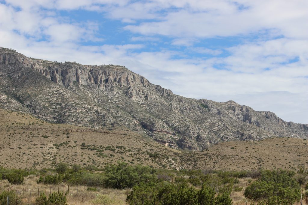
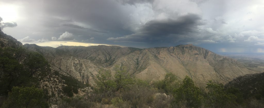
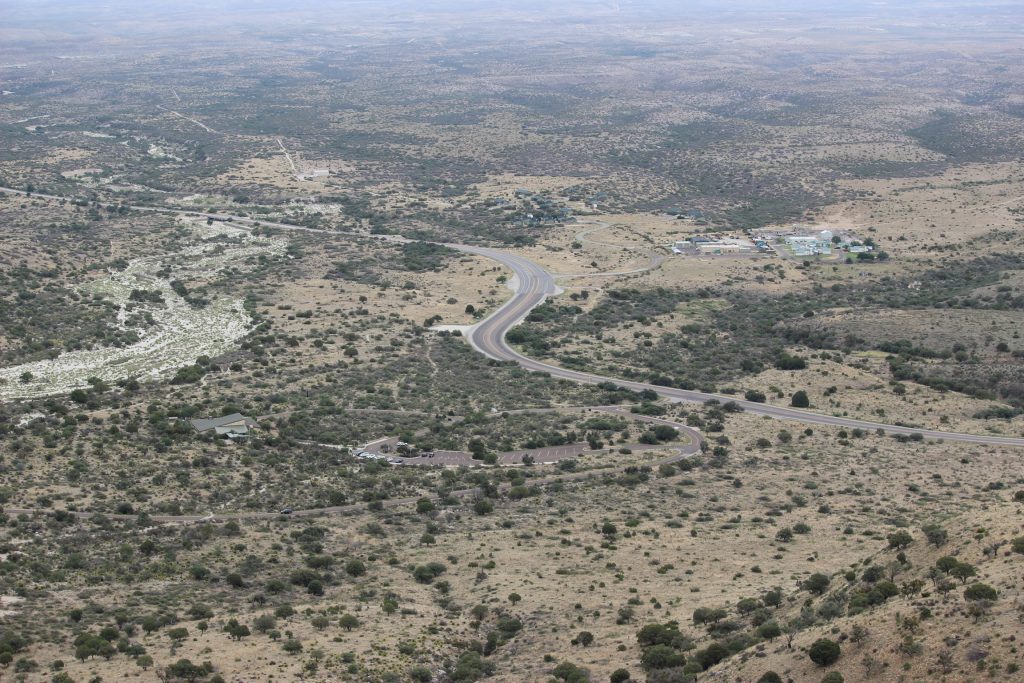
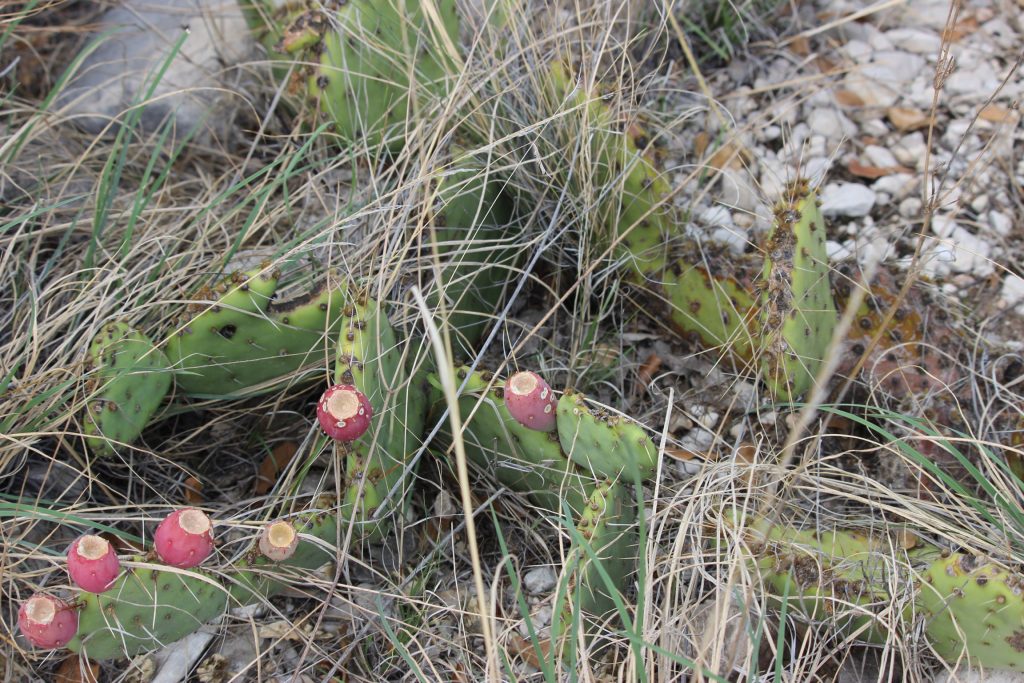
Elizabeth and I woke up on the Saturday morning of our national parks weekend as early as we could. Artesia is a cool hour and a half from Artesia, and with an all-day hike of Guadalupe Peak ahead of us, time was of the essence. Along the way, we were treated to the sights of the Permian Basin, with the town of Carlsbad, NM, an island floating in a sea of sand. The terrain grew gradually more and more rugged until we were astonished to be driving around the edge of the Guadalupe Mountains themselves.
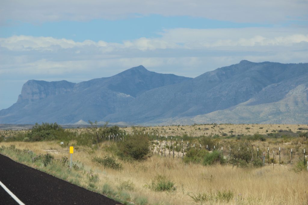
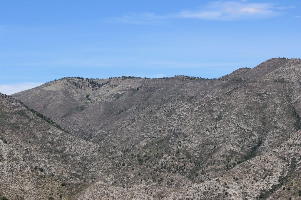
The far edge of the mountain range pictured above is the approximate location of Guadalupe Mountains National Park. The peaks loomed larger and larger as we wound closer along the desert floor.
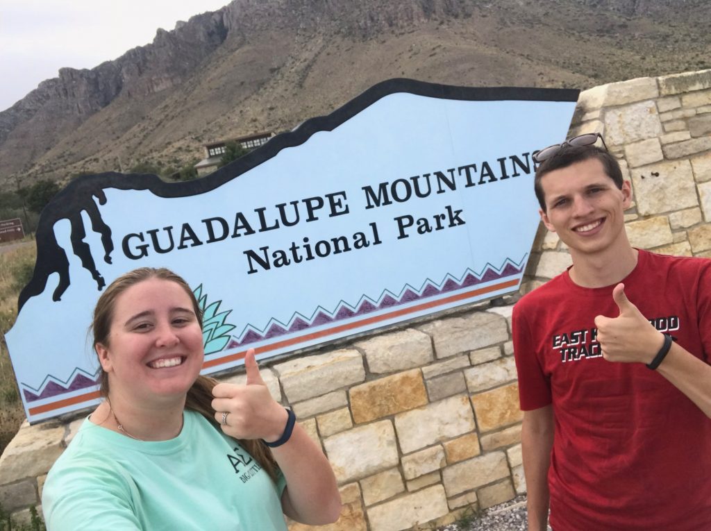
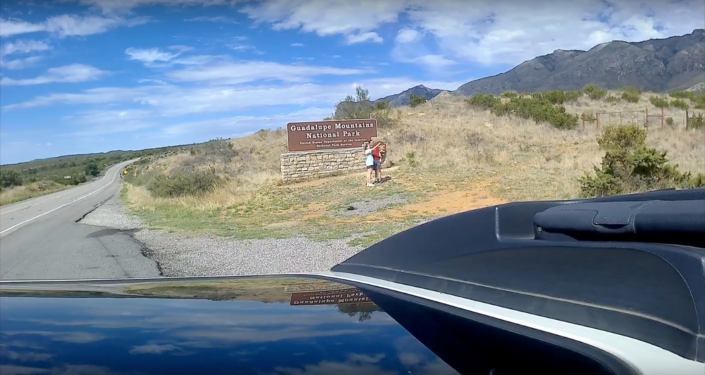
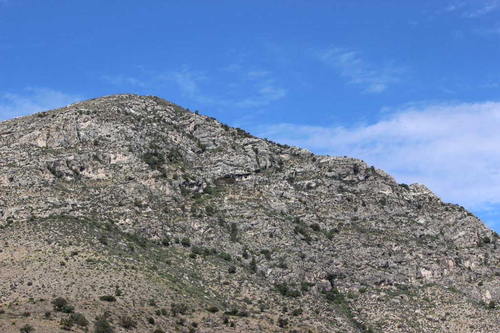
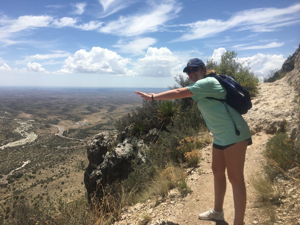
After a quick detour into Carlsbad Caverns National Park so Elizabeth could sign us up for a stargazing event that night (more on that later!), we continued a short bit westward to GMNP. Finally, we reached the park sign itself. Our goal was to hike to the top of Guadalupe Peak, starting at an elevation of 5,700 feet and reaching an elevation of 8,751 feet – the highest point in the state of Texas – over an 8 mile out-and-back trail. Sounds nice in theory, right? We’d even practiced walking on an incline on the treadmill, and done some stair work at OU’s Physical Science Center. But Elizabeth didn’t really take my concern about the strenuousness of the hike seriously, until we were looking all the way up the mountain.
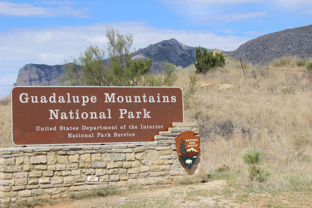
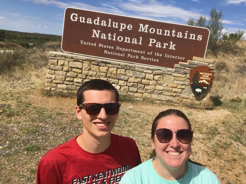
Is the sign tilted? Or are we? The world may never know.
Looking up… I was daunted. The day was already well underway, sunny, and heating up. Puffy clouds threatened to bring monsoonal storms later (not what you want when you’re climbing the highest mountain around). Before we could begin our trek, we went into the ranger station. Gotta get our stamps, after all. The rangers were friendly, helpful, and offered practical advice: keep an eye out for the weather and make sure you have plenty of water. They were also excited that we were meteorology majors, because they thought maybe we could help them fix their faulty rain gauge on the other side of the park. That was a little bit outside of our purview, though.
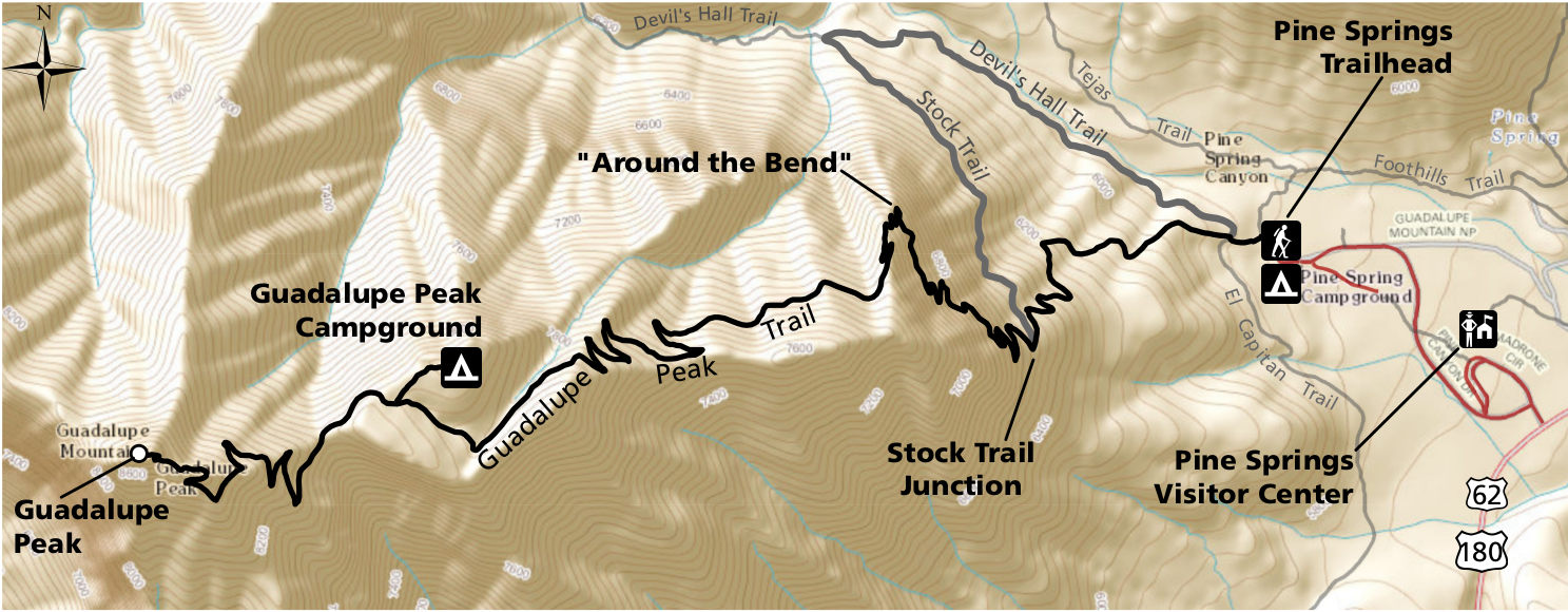
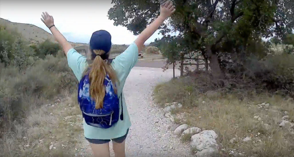
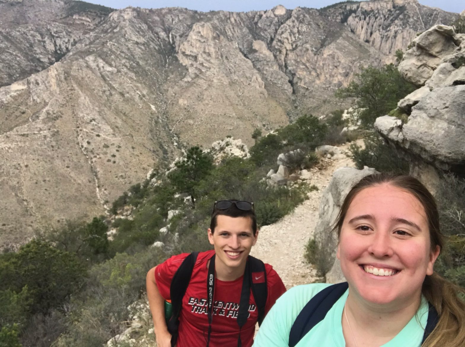
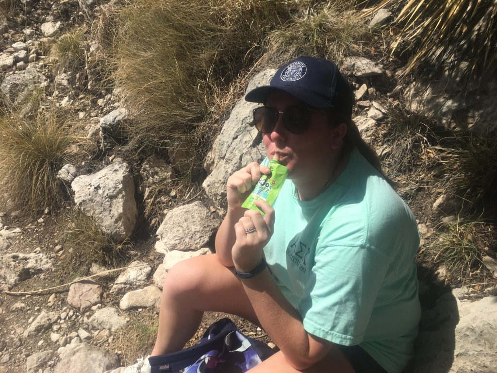
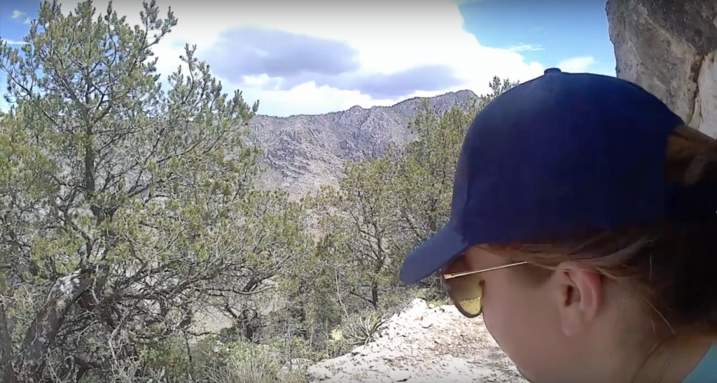
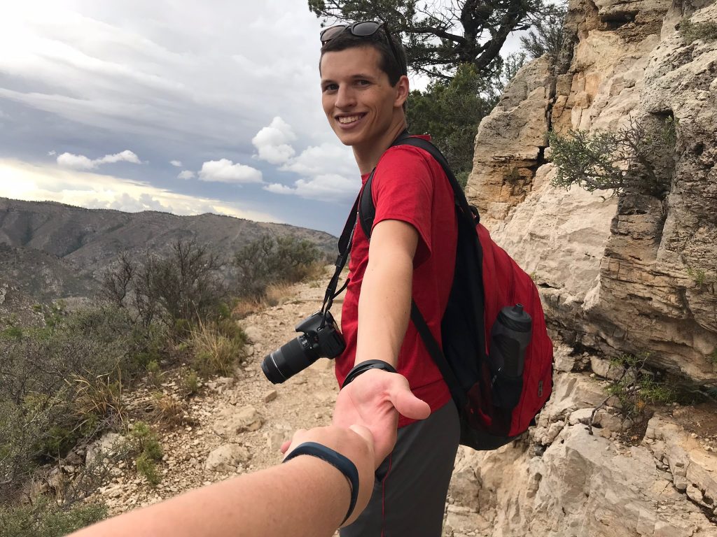
The above images help put some perspective into our hike. Elizabeth was immensely annoyed that we arrived late enough in the day that we were forced to park at the Pine Springs Visitor Center and walk up to the Pine Springs trailhead, despite their being parking at the trail head. As we began our hike, the first thing I noticed was that although the trail was well-marked, the inevitable step up from rock to rock was going to be difficult for Elizabeth. It would have been quite a bit easier if there were shorter, more frequent steps. Within the first half mile, I quickly realized that I couldn’t set the pace or I would keep running way out in front. Here is our view shortly after passing the trailhead, and Elizabeth eating a go-go-squeeze 22 minutes (!) into our hike.
The park rangers had told us the first mile or so up to the Stock Trail Junction were the hardest. I think that was probably accurate. The elevation gains were most punishing in that stretch, particularly just before the switchbacks leading up to the Stock Trail Junction. Elizabeth and I took a break at about the mile mark in this area. The sun was beating down and I thought there was no way she’d be able to make it to the top.
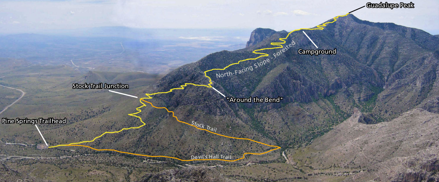
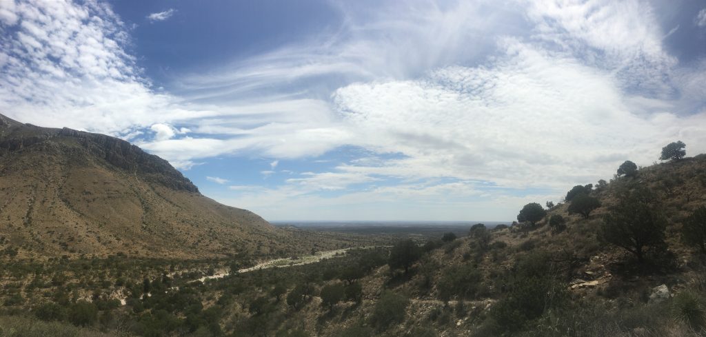
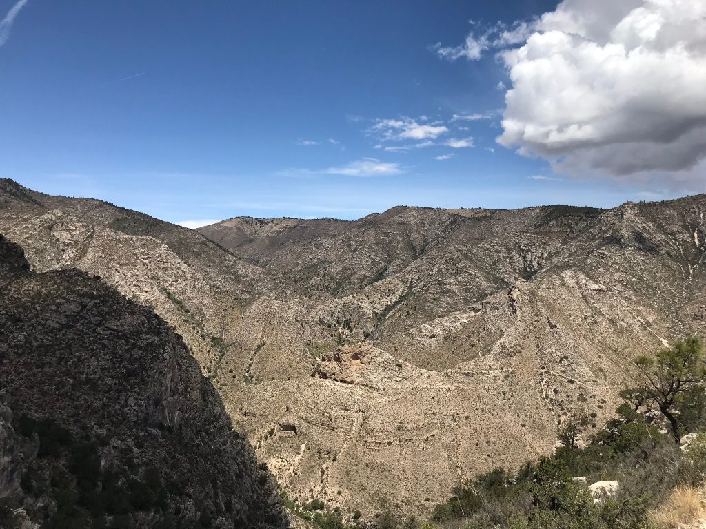
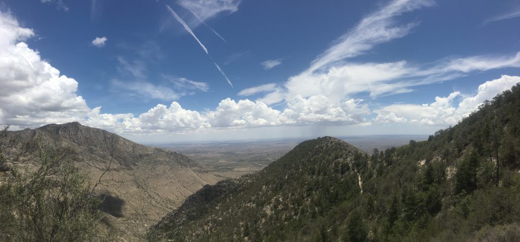
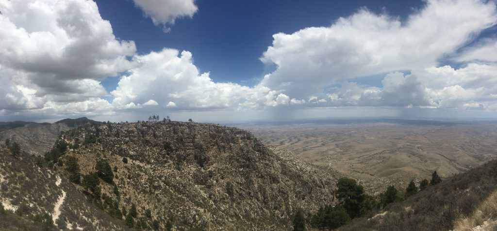
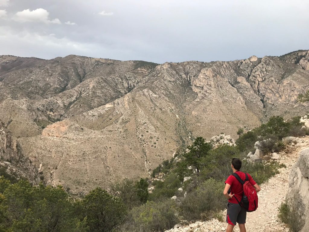
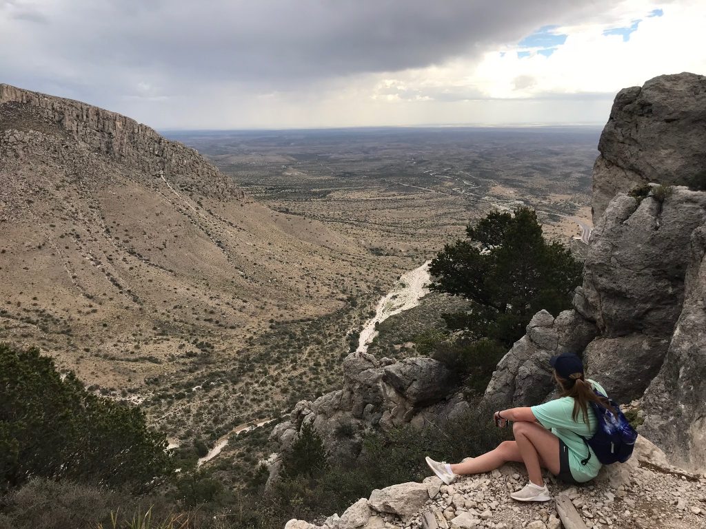
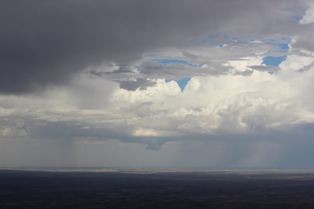
This picture is taken after we’d been hiking for a little over an hour, so we were likely a little beyond the Stock Trail Junction. Already, the view to our south was incredible! (Those puffy clouds did cause me some concern though). Each switchback gave us a wider panorama of the desert floor beyond us, as well as a better look into the mountain range itself.
The next stretch of trail was mostly northward-facing, with a steep drop-off to our right and the sun at our back. Fortunately, it was no longer a terraced trail, but a steady and somewhat gentler inclined path. Elizabeth and I started to find our groove. Occasionally, we passed hikers heading back down the mountain. Inevitably, they offered some variation on “You have a looooong way to go”, or some other half-encouragement. We finally reached the “around the bend” phase, with a beautiful vista deeper into the mountain range along with the valleys. We stopped for a break under a little rock overhang near there, and I boldly asserted that “if we made it this far, we’re going to make it all the way”.
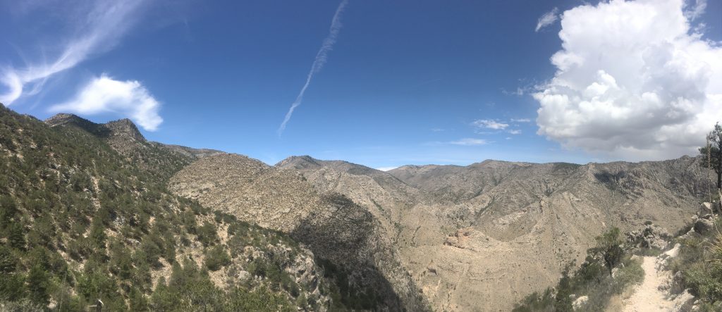
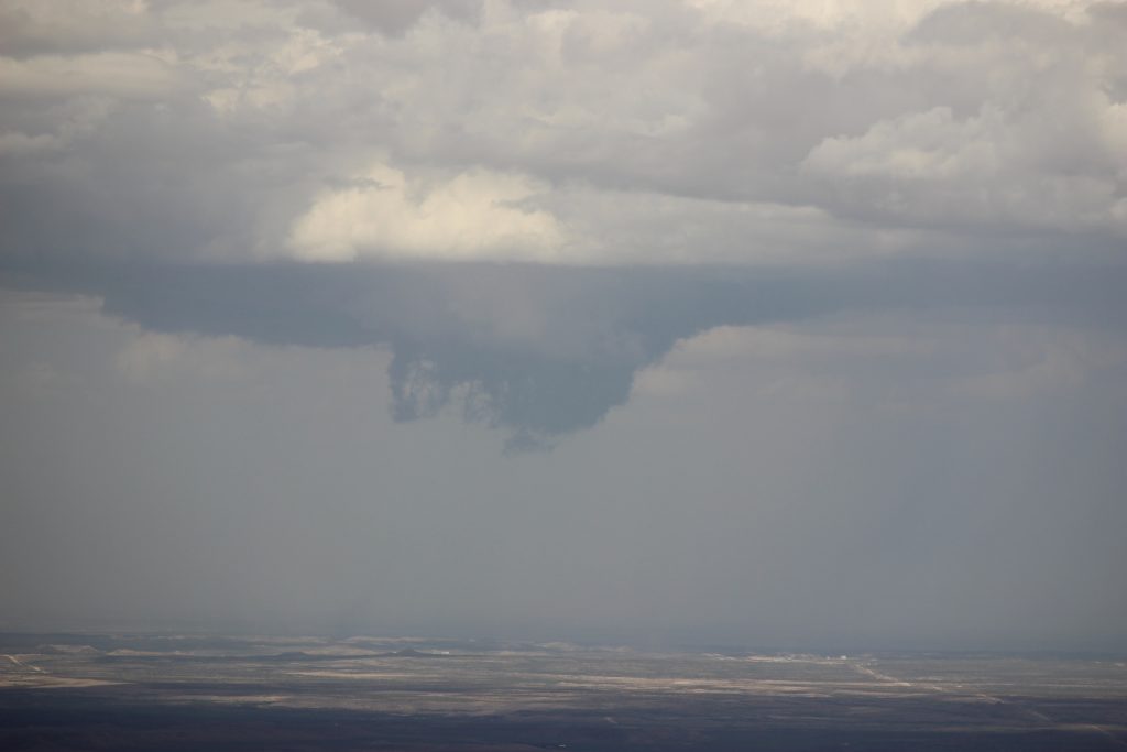
The last picture is looking back on the “Around the Bend” from further up. Notice that at this higher elevation that there were now trees – a much-welcomed sunblock. We continued the interminable march upward. The encouragement from hikers heading back down started to get somewhat more sincere. I started measuring our progress in estimated travel distance (easier because we had a map that showed milage and elevation relative to larger features). 2 miles. 2 and a quarter. 2 and a half. Those puffy clouds continued to get larger, and I was pretty sure a storm was just to our east, drifting northward. Without service, it was impossible to tell, of course. As we straightened out following another series of long switchbacks, the trail became a bit rougher. We trudged on in silence as a couple of hikers walked down toward us.
“Y’all want to watch out up ahead, we saw a rattlesnake about a 1/2 mile back.”
Nope. No sir. No way. I was in shorts with exposed ankles, and there’s no quick way down the mountain. In the hopes that maybe that couple was mistaken, we asked the next person we saw, a park ranger. She informed us that she had seen the rattlesnake just off the edge of the trail also. So did the next couple we saw. I decided that that meant it was socially acceptable to freak out. Elizabeth was exhausted and not really in the mood to deal with me jumping every time I heard a bush rustle. I’m not proud to admit it, but I may have made her go first for a while.
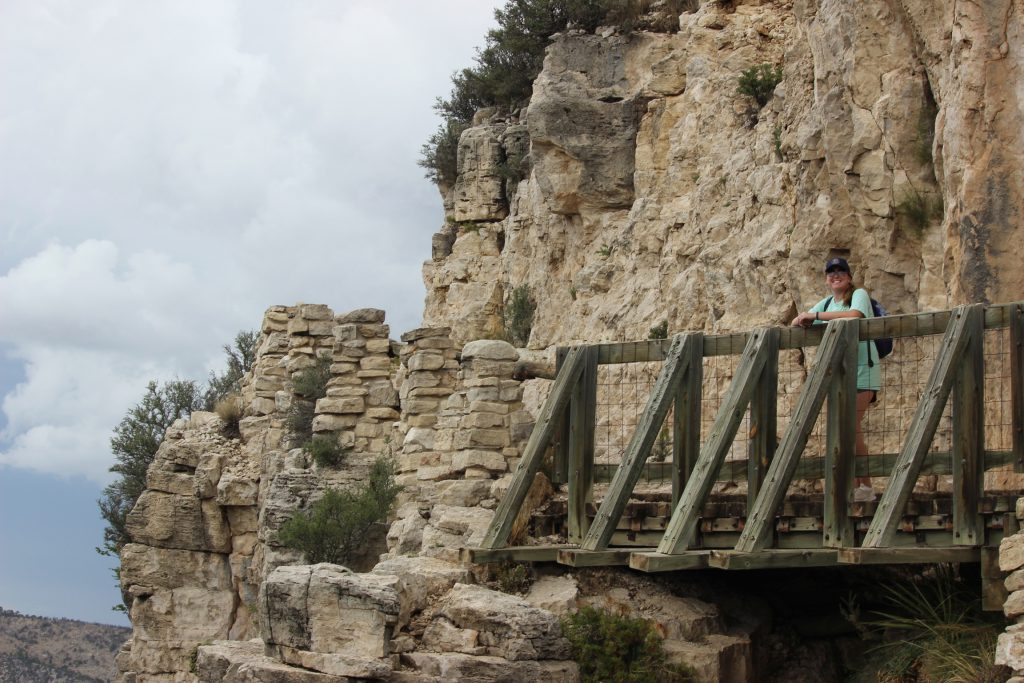
Past the campground we hiked. The trail briefly dipped down as we left the north face we’d been hiking up for the actual peak itself. We crossed a bridge and hit some of the most brutal switchbacks of the entire hike.
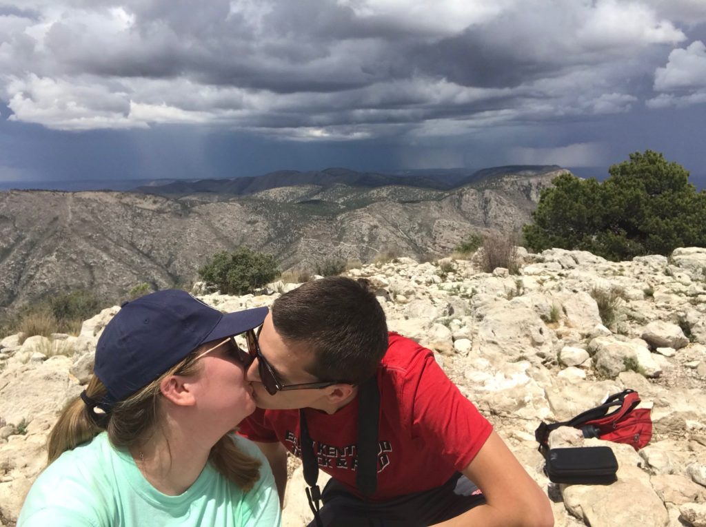
This was it. Somehow, we’d avoided the rattlesnake (though I was still on maximum guard), and we were on the face of Guadalupe Peak itself. We’d been hiking for close to three hours, and had emerged into a forested area near the peak (the 270 degree right turn on the map). Only three issues:
- I was still terrified of the rattlesnake.
- Elizabeth was dead tired. In fact, within the forested area she burst into tears and told me she couldn’t go on any further. After a few minutes break, we quietly discussed the situation and agreed that we’d made it so far and would always regret it if we couldn’t make the top. I reminded her that she had taken differential equations in 4 weeks, and after such a difficult class, she was capable of anything. We pushed on.
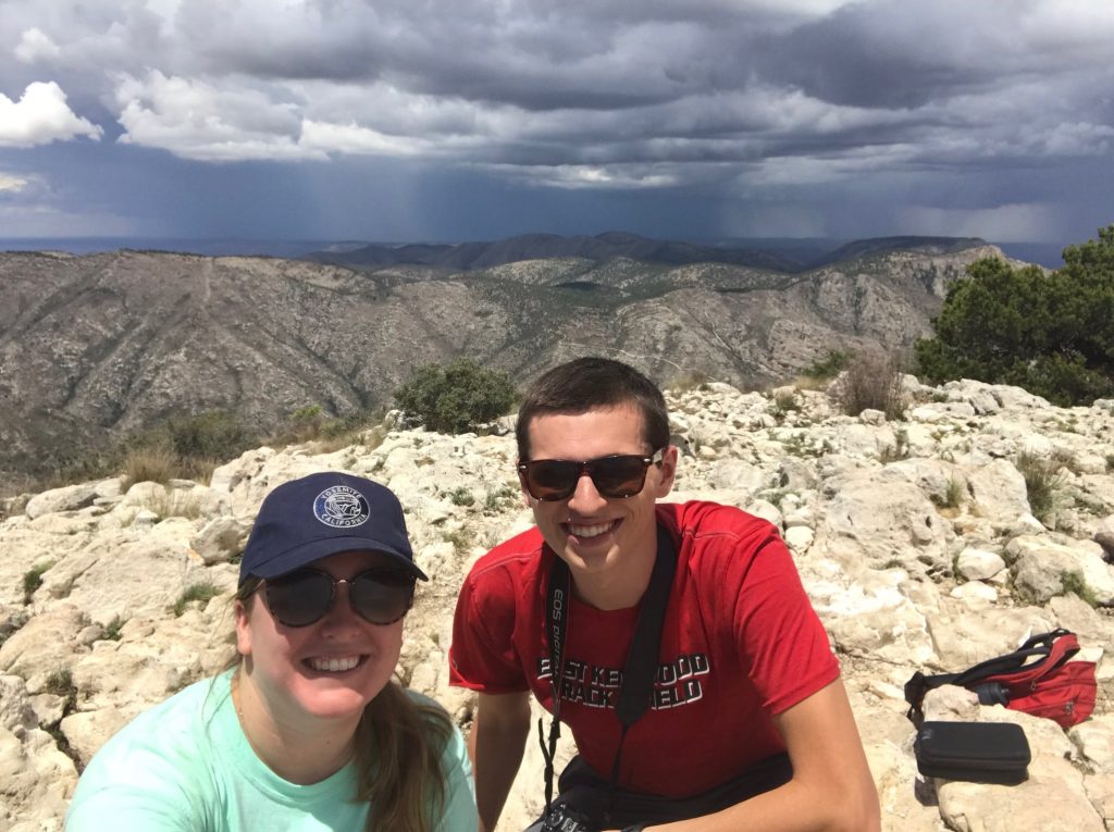
- Those puffy clouds had finally erupted into storms. We could hear the distant reverberations of thunder echoing like cannon shots through the Guadalupe Mountains. Although my guess was that the storms were still 20-30 miles away, it was not an encouraging thought that we were climbing literally to the top of the highest object around.
The final ascent. Our nicely paved trail gave way to something for akin to a rock scramble, with each forward push requiring an effort to climb the next boulder. All of this with a drop-off to our left that… you wouldn’t want to fall down. We reached a particularly vicious stretch, with a climb so difficult that there was a detour for horses. We scooted over the rock and carefully picked our way back down to solid footing. To keep encouraging Elizabeth, who basically needed to be hauled up each climb, I counted down the number of mini switchbacks I saw left on the map. Four… three… two… one…
Finally, a climb ahead of us where the next rock was close to waist high. I sighed and turned to Elizabeth. She looked at me, and I saw defeat in her eyes. There was a sheer rock face to our right, and no way to tell how much further there was to go. Elizabeth opened her mouth, and I prepared for her to tell me that she couldn’t go on. We were right there! The map said we should be at the peak any moment.
A voice floated down from somewhere above us, and then another. They sounded close. I called up, “Is that it?” and somebody responded, “Yes!” Electricity jolted through me, and I bounded up the next three rocks. The peak!
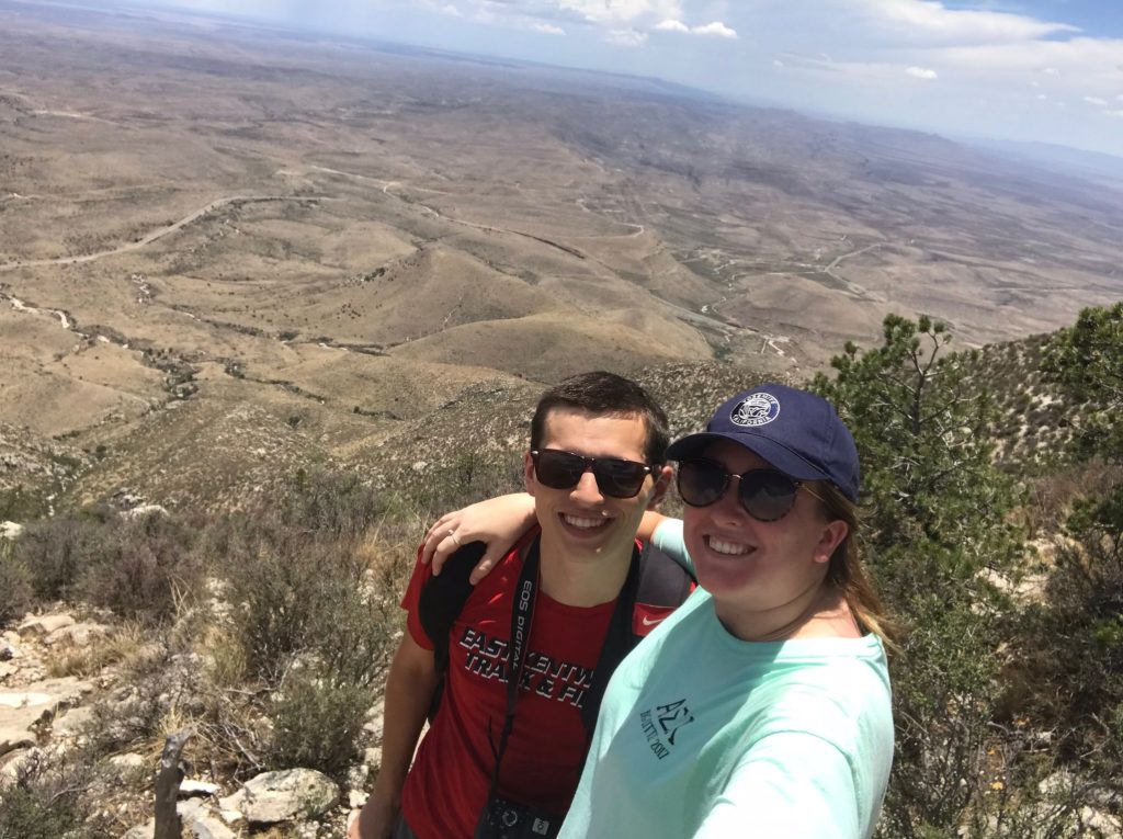
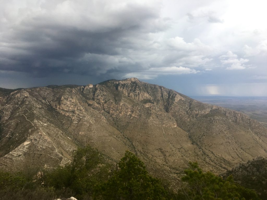
The peak held a stunning 360 degree view – mountains in the northern half, and desert in the southern. I could see (and ducked instinctively when I did) the storms whose thunder had been haunting us for the past half hour. We were here.
Elizabeth emerged into view, literally crawling up the last climb, and immediately plopped on her behind and drank her water bottle dry. She looked just like a baby that had just learned how to sit up straight.
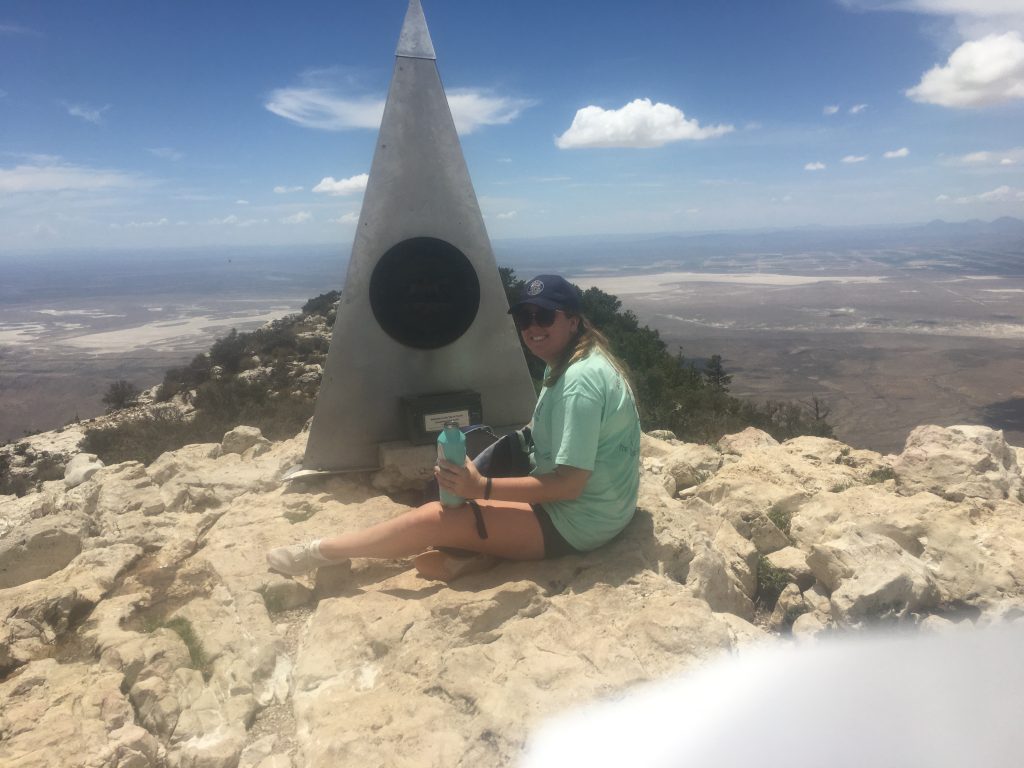
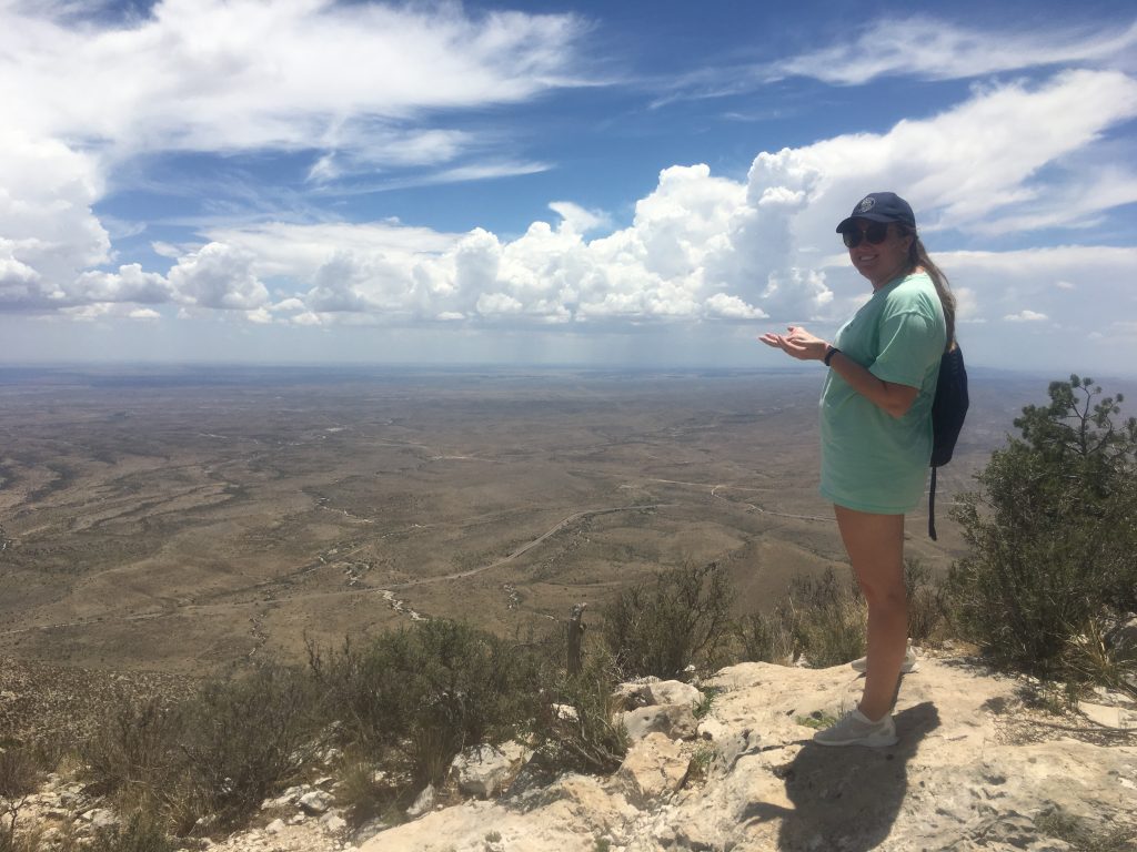
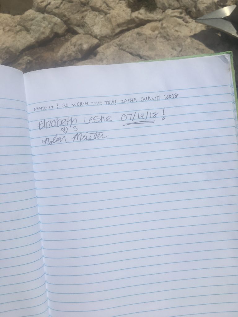
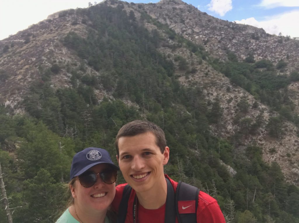
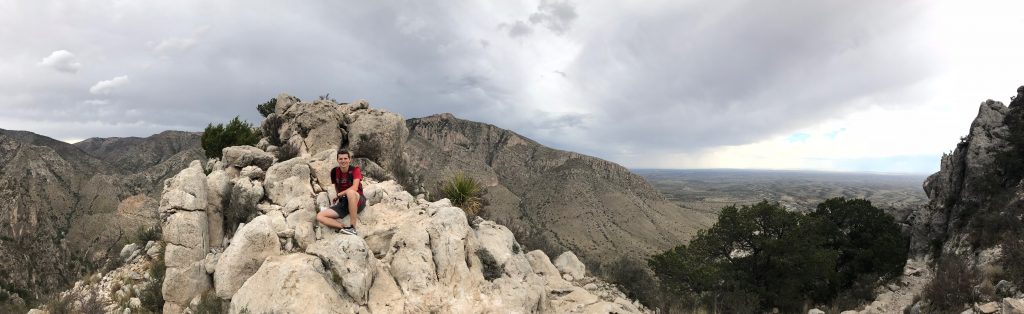
We had a lunch of peanut butter sandwiches and snacks in our backpacks, ready for a picnic at the top. After quick consultation, and a few more ominous rumbles of thunder, we decided that maybe we shouldn’t stay near the top for long. The peak marker (behind Elizabeth in the picture above) had a log book, and she signed our names in it.
I couldn’t quite shake the thought of a headline screaming “Meteorology students killed by lightning while hiking”, so after about 20 minutes we began our descent. Fortunately, cloudy skies cooled the day immensely, and it turned out that going down was a lot easier than going up – at least at first. We have a lot of pictures from the peak and the descent, so I’m going to stack them all right here.


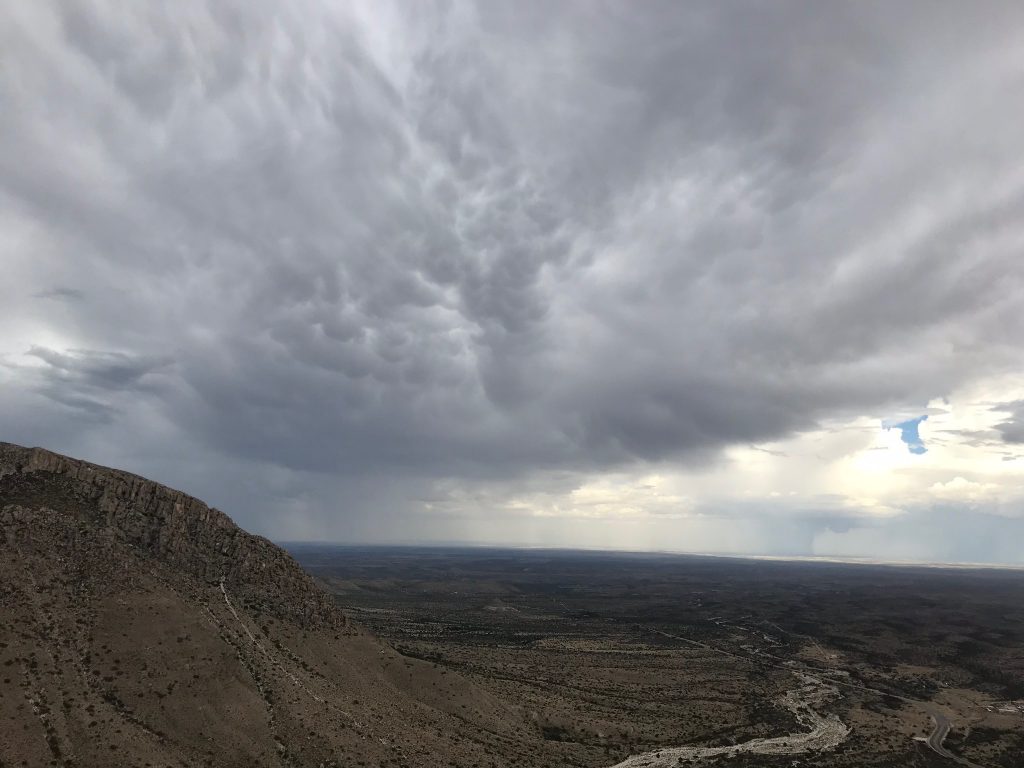
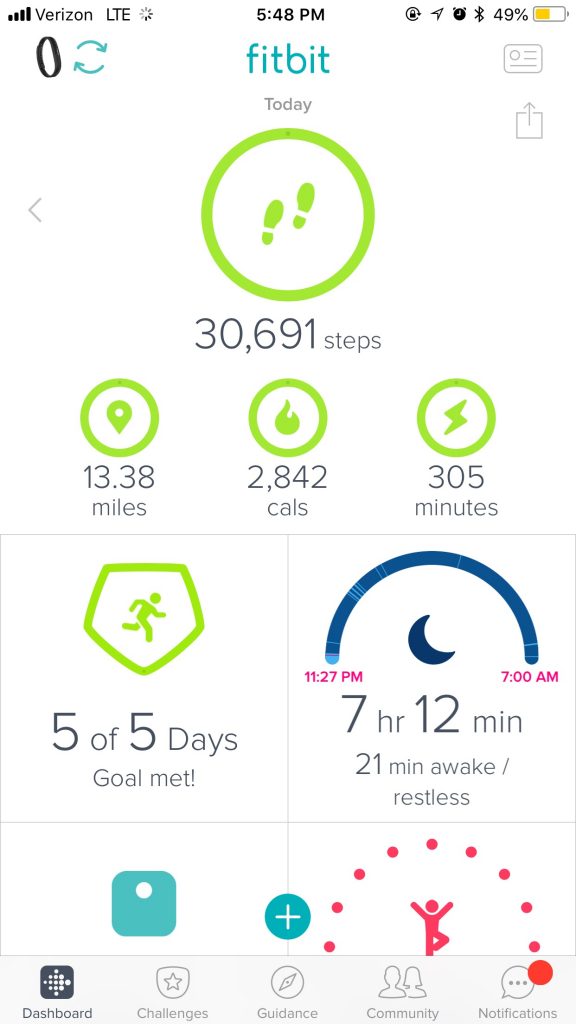
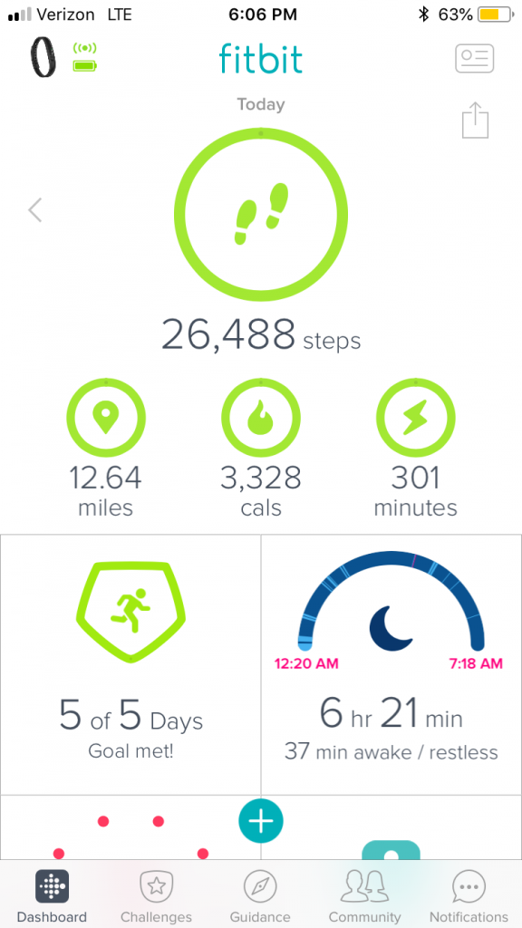
If you stuck with me through all of those pictures, you’ll notice that we saw a storm with a little wall cloud-like thing off to the east as we neared the bottom, as well as some neat mammatus! While the ascent was a somewhat tortuous 3 and a half hours, going back down was much quicker – we were at the bottom in about 2 and a half hours. On the flipside, while my quads had disliked the uphill, my calves and feet were less happy by the time we finally reached the desert floor again. Everything felt a little like jelly. But the whole trip down (especially once we were low enough that lightning felt like less of a concern) was so much more bearable – we were triumphant. We had conquered the tallest peak in Texas.