A conundrum, expressed in chart form:
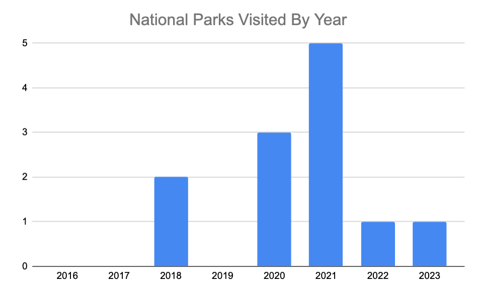
There are 63 American national parks. Elizabeth and I want to visit each of them. After a slow ramp up, we really got going in the post-graduation pandemic times when the outdoors was the only escape. And then in August 2021, we made a huge mistake: we got engaged. 2022 and 2023 were spent planning, paying for, and executing a wedding and honeymoon that took all of our time, money, and vacation. We’ve only got a few kid-less years less if all goes according to plan – and about 51 national parks to go entering 2024.
Which brings me to December 2023, as I tried to wrap up shopping for Our First Christmas As a Married Couple (TM). Thanks to an excellent end of 2023 sports betting, I had the money to easily afford a trip somewhere for a weekend, and thanks to an involuntary coverage of a coworker’s midnight shift from Wednesday, January 31 to the morning of Thursday, February 1, I had Thursday to Sunday off with no vacation time necessary. The question: where to go? Big Bend National Park beckoned, but so did Sedona. I researched and agonized and finally late on Christmas eve decided to book a hotel, rental car, and wine tour in Sedona. From there, Elizabeth and I expanded our plans to include a one-night stay in Holbrook, 2.5 hours to the east, and a visit to Petrified Forest National Park. That way we could make a dent in the remaining 51.
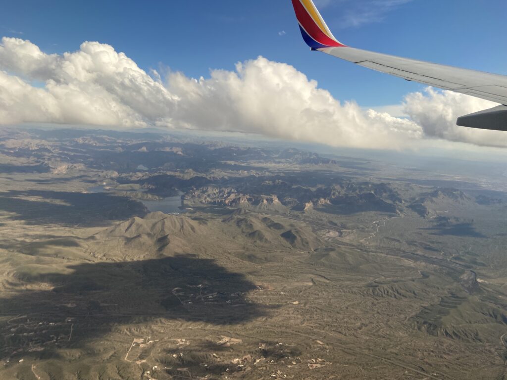
And with that, our third trip of 2024 was off (following a week in Michigan to visit our new baby nephew Wyatt and a weekend in Williamsburg, Virginia to go to Elizabeth’s high school friend’s wedding). Unlike the previous two, this would be exploring a new state and a new area of the magical land out West that we love so much. All it was going to take was a direct flight from OKC to Phoenix to get us on our way. It was a 2:20 pm flight that originally appeared to be complicated by a job interview Elizabeth had at 12:30, that she carefully planned to conduct from a library near an airport – up until the interview got moved to the next week. So Elizabeth was not in the best of moods as we boarded our Southwest flight westbound out of OKC.
Fortunately, her spirits rose in proportion to longitude gained along the flight. By the time the pilot pulled back below the cloud deck to make our approach into Sky Harbor, we were both avidly looking out the window at an unfamiliar mountain range and beautiful alpine valleys.
It was a bumpy landing into PHX and a long train ride from the C terminal to the rental car center. Fortunately there was no line at Hertz; the two of us were out into the warm Phoenix air and choosing our never-before-driven Kia Forte for the weekend in no time.
Elizabeth volunteered to drive the first leg of the three-hour journey from Phoenix to Holbrook; indeed, given that I was coming off of a midnight shift, she would end up driving the whole way. The drive started and it finished in annoying traffic. The beginning traffic was a byproduct of Sky Harbor being the size of a small city, so that Elizabeth actually had to drive several miles across the airport just so she could dump out on the equally annoying Highway 202. After a Starbucks in Tempe (yes, there were sorority girls in line in front of us), she continued on to Highway 87 (the Beeline Highway!) northeast across the Maricopa Indiana Community.
It was like a switch had flipped. One second we were in metro Arizona State territory, with Elizabeth hollering at dumb vehicles for dumb merges, and the next second we were out in the desert foothills. There was scrub brush and rocky, mesa-filled terrain and… were those saguaros? They were! Suddenly the entire roadside was dotted with saguaros towering over the landscape. If you think they only live around the national park in Tuscon, you would be wrong. Apparently saguaros thrive in the foothills northeast of Phoenix. Did we stop at a pull-off so we could take pictures of them?

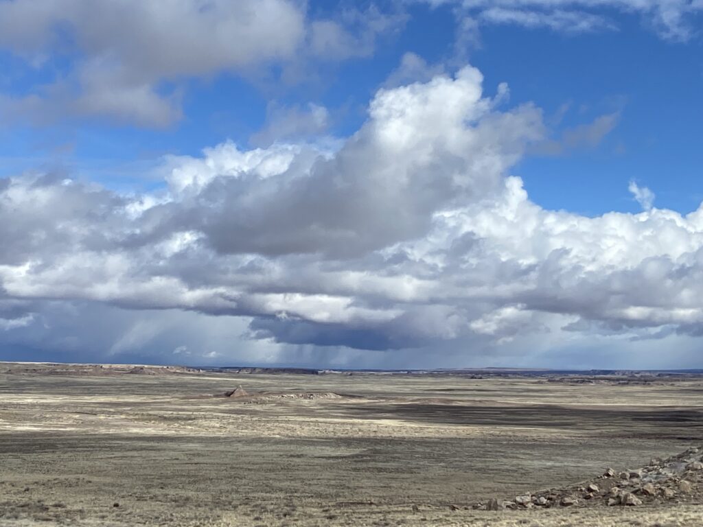
My hope was that we would clear as much of the mountainous terrain as possible while it was still light out. This was especially true in light of the fact that a winter storm was expected this weekend. Winter storms are a nuisance down in Phoenix at 2,000 feet, where the temperature may drop to the mid-50s with a healthy dose of rain. Up in the Matzatzal Moutains, which we were now ascending, or along the Mogollon Rim in the distance, a winter storm is going to draw a casual winter storm warning for 2 feet of snow. That’s right – winters in Arizona can be pretty damn brutal at elevation. We managed to clear the first obstacle – the Matzatzals, dotted in saguaros until they just completely cut off near the ridgeline – and descended into a broad valley just as the sun was setting. The storm was approaching out west, and some weak convective elements were leading their way in the dying Thursday daylight.
By the time twilight was fading from the sky, we had made it to Payson, at the foot of the Mogollon Rim. This was the only decent-sized town between Phoenix and Holbrook, so it made an obvious location for dinner. I’d scouted out a place encouragingly titled “Rim Country BBQ and Wood-Fired Pizzas”, which Elizabeth was more than down for. It turned out to be one of the best culinary choices we made all weeekend – maybe in all of 2024. The staff at Rim Country was super nice and prompt in service, and they had a sampler platter that allowed us to try all of their barbecue items AND all of their sides.
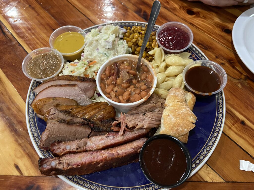
Official Nolan Meister Barbecue Rankings: Pulled pork > ribs > cheddar jalapeno sausage > brisket > turkey. None of it was spectacular, but it was all pretty good. And because Elizabeth doesn’t eat potato salad or baked beans, and because the waiter helpfully brought me a cup of “cowboy candy” (pickled jalapenos), my stomach was feeling gloriously full by the tie he came by to ask if we were interested in dessert. The two of us found space for some homemade apple cobbler, which the waiter insisted on not charging us for given that it was our first visit. The verdict: if you’re ever in Payson, Arizona, go to Rim Country BBQ.
About an hour and a half of driving remained between Payson and Holbrook. This hour and a half led up from our current position at 5,000 feet (still well above Phoenix at 2,000) to the top of the Mogollon Rim at 7,500 feet, then back down to the desert steppe of Holbrook at 5,000. I was willing to take the nighttime mountainous driving, but Elizabeth volunteered to keep going given how tired I was. She soon had cause to regret that; although it wasn’t snowing at the top of the rim, there was snow on the ground and a lot of it, and a light rain was creating fog, reduced visibility, and an absolutely miserable drive. When she finally turned left onto 270, the weather cleared up, but a line of obnoxious semis kept her white-knuckling all the way into Holbrook.
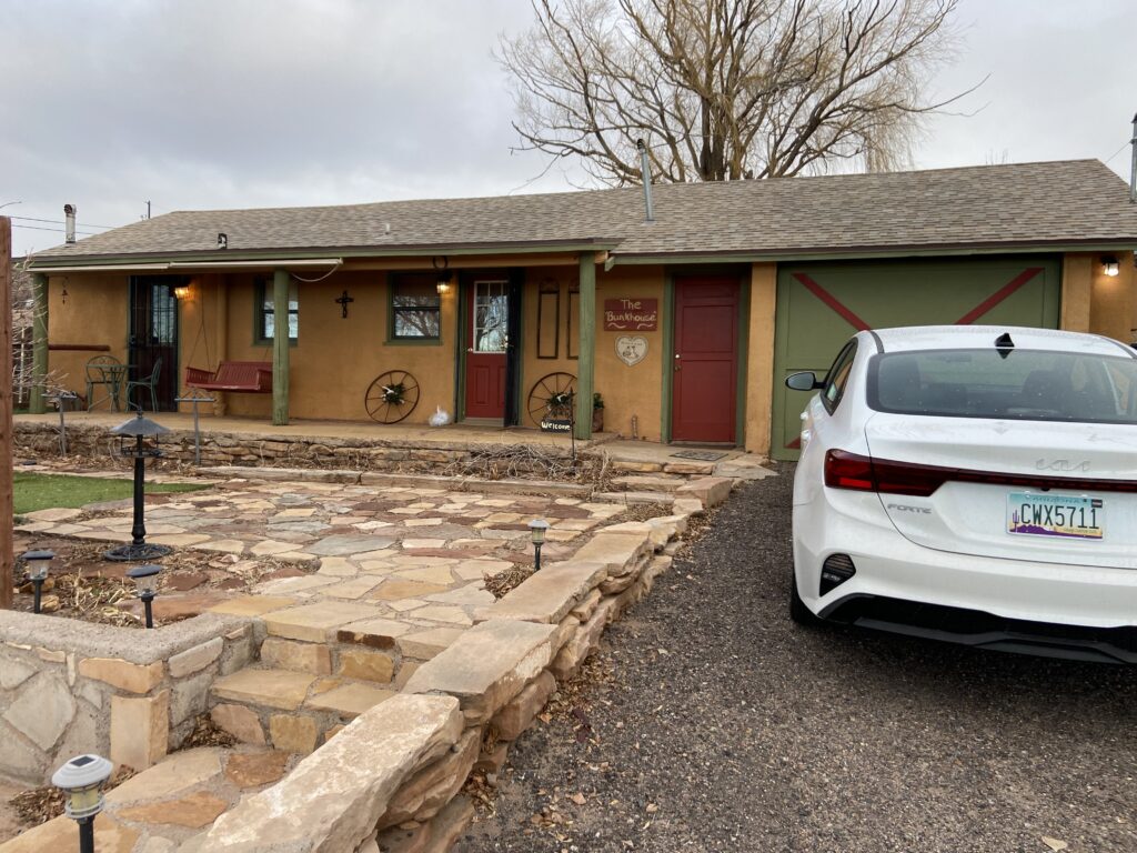
We arrived at our AirBNB at a reasonable hour, but given the excitement of the evening and my mid-shift crash, I was so ready to sleep. Even before Elizabeth had finished reading the host notes and getting bags set up, I’d fallen asleep facedown on our bed still fully clothed. Eventually I managed to drag myself into the bathroom, brush my teeth, and then promptly fall right back asleep. Even the double BNSF tracks on the south side of town weren’t enough to prevent a much-needed night of rest to prepare for the next day.
Petrified Forest National Park would be a beautiful park to visit at sunrise, with the low sun angle bathing the Painted Forest unit in a fiery sea of oranges and reds. I say “would” because this is the rare national park that isn’t accessible at all hours of the day – the park opens at 8:00 am and closes at 6:00 pm daily. It sort of makes sense when you look at the map:

I-40 essentially cuts directly through the park, so I guess they want to keep the nightly security/law enforcement issues to a minimum. It’s still quite weird. Either way, there was no rush to wake up early for sunrise – which doesn’t mean that I set my alarm to go off after sunrise. On the contrary. Elizabeth and myself were up and packing our bags early on this Groundhog Day. The AirBNB was decorated in Southwest style, with lots of woven rugs and the like. It was cute in a rustic way, if not overly flashy. And who really needs flashy when you’re staying in Holbrook?
In spite of the town’s slightly down-on-its-luck vibe, there were several restaurants that leapt out on Google Reviews, especially for breakfast. When I was planning the trip, the clear winner seemed to be Studio 66 Cafe, a Route-66-themed diner that had a long and Elizabeth-friendly latte list. This turned out to be another one of those gems in a trip where it seemed like every meal was a gem. The diner was rustic:
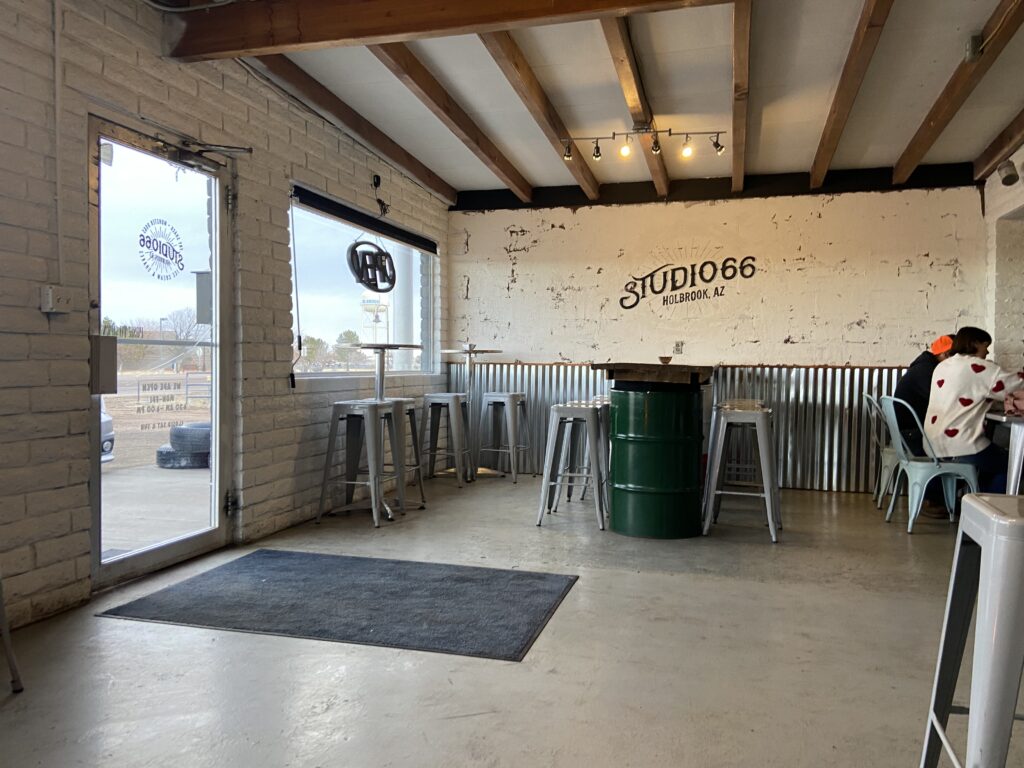
The countertop was the chassis of a 50s-style auto, and the breakfast food was muy bueno. It was a little sparse, but not so sparse that there wasn’t a breakfast sandwich calling my name. And, on top of that, there was an absolutely massive cinnamon roll sitting in the display case waiting to be shared. Look at this thing:

It tasted *better* than it looked.
From Studio 66, the road led northeast up to I-40. This was our first look at the desert we had emerged into last night past the Mogollon Rim – a barren, steppe-like environment with scrub brush everywhere. In the distance, rain/snow showers dotted the mountain ranges, though I wryly noted that it was dry as could be here in the middle of the desert.
Maybe I shouldn’t have had that thought, because a drizzle started to fall about 15 minutes later as I approached the exit off of I-40. The drizzle slowly intensified into a steady rain throughout the morning.
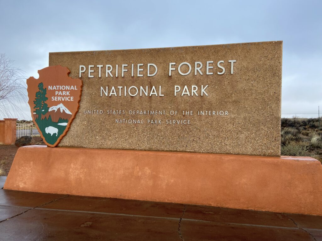
There was nobody at the entry gate. The national park sign was a solid 8/10 – big, solid font, a bit unflashy but also a strong color match for the park.
We had time for a selfie or two before the next couple of cars came rolling in, even.
If you look at the map above, you can see that there’s really only one road through Petrified Forest – the aptly named Petrified Forest Road. We were taking it from north to south, starting at the Painted Desert Visitor’s Center. It always feels very wrong to start off at a visitor’s center and get your stamps/gifts immediately. This seems especially true in hindsight, now that I know the southern end of the park had a gift shop to be reckoned with. But the whole park seemed so remote that it was a little spooky to not be smart and get our stamps and pins and magnets. After doing that, and sinking like 20 minutes into the park video (note: this is TOO LONG), we got into our car and went through the entrance station. National park number 20: it was official.
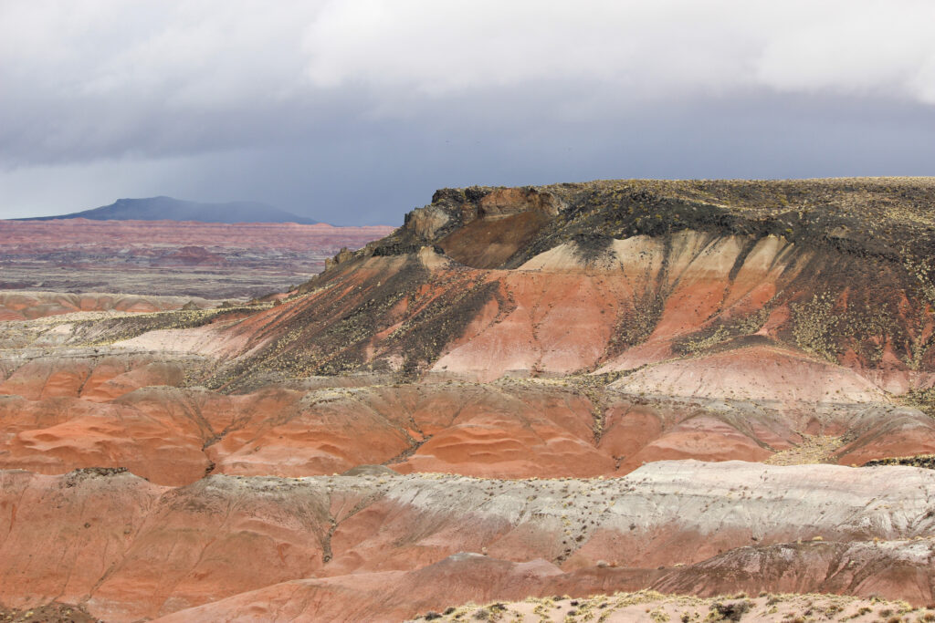
On the north side of the national park, the road winds counterclockwise around a tight loop along the rim of an escarpment leading to a vast desert. This desert is known as the Painted Desert for its brilliant shades of red and pink, and the road passes by multiple stunning vistas. At Tiponi Point, around the first bend, we got a sense of what that was like.
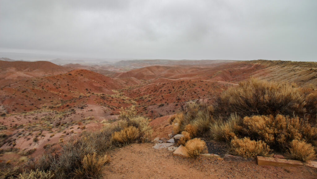
In spite of the still-intensifying rain, and the cold wind that drove the drops into our backs, it was a beautiful site. This vista’s predominant color seemed to be “salmon”. It sort of reminded me of something you might see in Oklahoma or Texas – Roman Nose, say, or Palo Duro Canyon – if only the color saturation was turned way up and the vegetation was turned way down.
The next stop was about a half of a mile further up the road at Tawa Point. Here, a trail called the Painted Desert Rim Trail leads from a parking area to the Painted Desert Inn, with supposedly stunning views the whole way. Given the cold rain, we were content to just stop and enjoy the vista before driving up to the Inn. The big draw of Tawa Point versus Tiponi Point was the added height we had off of the desert floor, plus the 180-degree panoramic view. Now it was possible to see the little Badlands-style mounds that dotted the desert floor, as well as the cherry-red rivulets of water spilling off of them and joining into ephemeral streams the further down the floor they flowed.
The weather was undoubtedly crappy, but Elizabeth wasn’t entirely coping when she said it was cool to be in a place like this when it was raining. How many other people get to see such a barren desert flowing with water? And, as the lady inside the visitor’s center gift shop had longingly said, it had been a bone-dry winter in these parts. It wasn’t so much of a sacrifice to lose some of our view so that she could get her flower bloom in early spring.
The loop road next brought us to the Painted Desert Inn. As most of I-40 west of OKC does, the stretch of interstate through the Painted Desert follows the old Route 66 corridor. Petrified Forest was a real tourist draw (it was the second national monument ever created!), and in the years before it achieved national-parkhood in 1964, a motor inn was built overlooking the Painted Desert. This pueblo-style inn has been preserved wonderfully by the NPS – right down to the doorway made out of petrified wood. We walked among exhibits showing the history of Route 66 and the building as well as a recreation of the Inn’s soda fountain.

Pretty neat. And it gave me an excuse to use my “1950s radio announcer” voice.
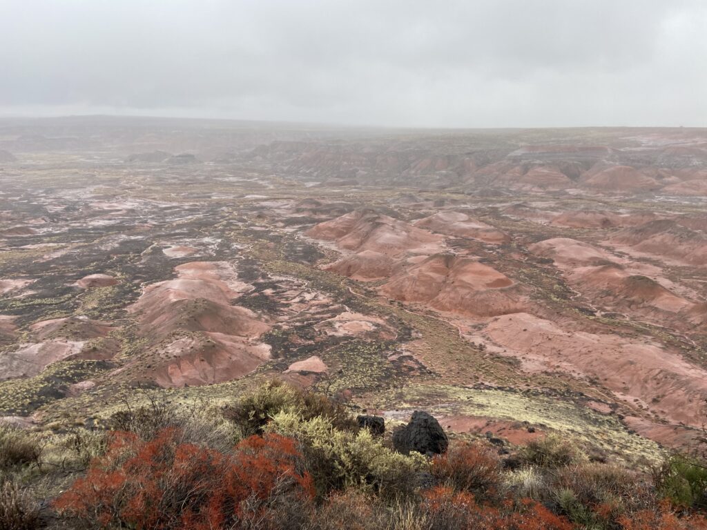
The next stop was at the northernmost extent of the Petrified Forest Road – Chindo Point. Of note here was the jet-black volcanic rock that formed the gravel of the parking lot. Also of note: a look deep into the Painted Forest, which extends for hundreds of square miles within and to the north of Petrified Forest.
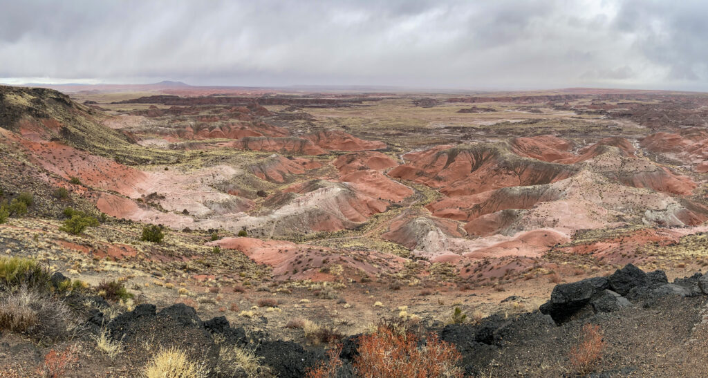
And then another mile or so to the west (at the edge of the mesa you see on the far left of the above image), we arrived at Pintado Point. I don’t know if Pintado Point has the best views of the Painted Desert, but when we got there the gloom and the rain started to lift. All of a sudden, there were blue patches in the sky. The sun even shone on the distant valley floor in spots, all while a dark squall raged by to our north. I tried my best to capture it photographically, but I am a pleb. Here’s my best effort:

And here came those bluer skies!
This park was definitely growing on me.
There were three more viewpoints along a final westward bend of the road in rapid succession – Nizhoni, Whipple, and Lacey Points. We didn’t stop very long at any one of them, but it was kind of cool to get an added depth layer with Pintado Point overlooking the expanse of the desert floor.
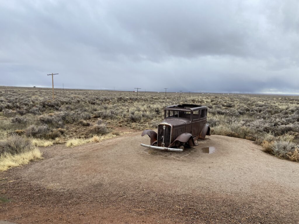
Our final stop in the north unit was the historic Route 66 marker. Like most of it, this stretch of highway has long since been removed. But there’s still a long line of lonely power poles that nobody bothered to remove, standing guard over the steppe and marking a line directly into our not-so-distant past. That plus the hulk of another one of those 50s-era autos made for a bit of a nostalgic vibe.
And with that, Elizabeth was driving us up and over I-40 (with no exit this time) to bring us from the north unit of Petrified Forest National Park into the south unit.
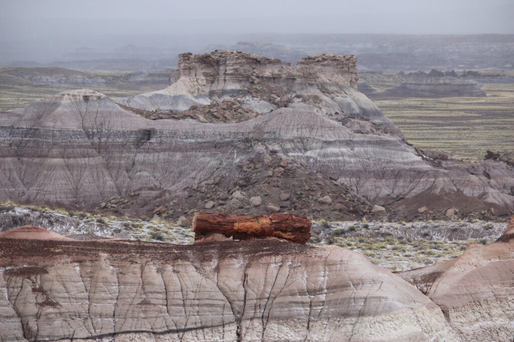
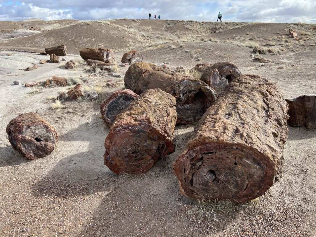
As you might have inferred from the name, the main draw of Petrified Forest National Park is NOT the Painted Desert. Instead, it’s the widespread remnants of a huge-growth forest from the Triassic Period that were buried so quickly that they fossilized, then were unearthed millions of years ago. These petrified logs dot the landscape south of I-40, and Elizabeth was super excited to see one.
Unlike the saguaros, it was going to be impossible for petrified logs to sneak up on us on this vast, treeless plain.You could see all the way to the horizon in every direction. There, in the distance, was the BNSF track, with a train chugging along against the morning sky.

And just beyond the tracks was the bleached-out wash that normally demarcates the dried-up Puerco River. Similar to what we had felt in the Painted Desert, it was pretty cool to see such an ephemeral stream flowing with honest-to-god water.
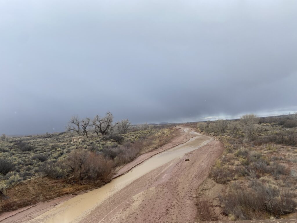
In the distance, another squall loomed over the western desert. If this weather was still rather abysmal, at least showery squalls sounded a lot better than dealing with the steady drizzle we’d encountered when we first got into the park.
The shower was ready to break over us any second by the time Elizabeth and I reached out next stop – Newspaper Rock. A blustery breeze kicked up and the skies started to darken, almost like the clouds were sinking on top of us. Given this, it’s no surprise that there was literally nobody else at Newspaper Rock, usually one of the bigger tourist attractions within the park.
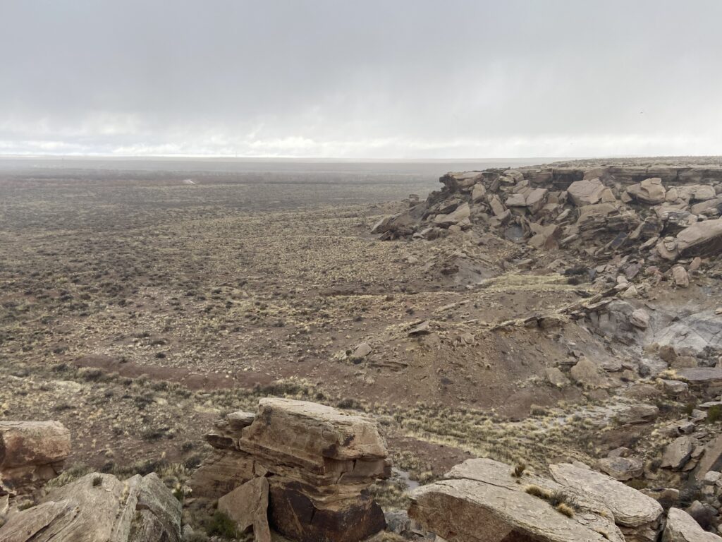
The rock itself can be seen in the bottom foreground of the above image. Because of the ease with which the red could be chiseled off of the rock, the Pueblo people used the rock to carve petroglyphs. And it wasn’t just a few. You could look through a telescope and see them all crammed up against each other – people, animals, little spiral-y things.

I vibe with the artistic stylings of the Puebloan people from about 1,000 years ago.
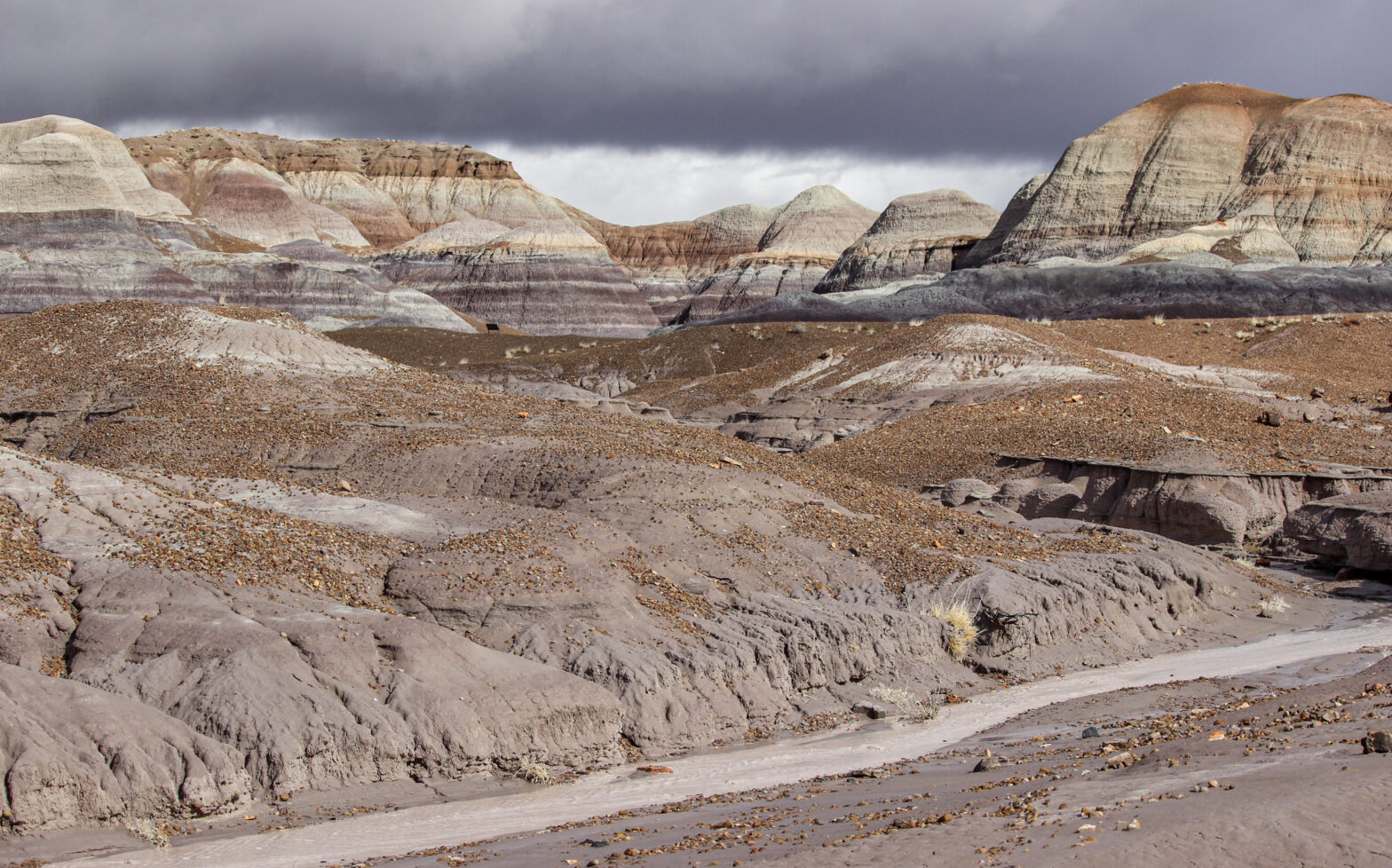
After a couple of minutes, the sky stopped threatening to open up on us and instead actually did so. A big downpour of rain, wind, and – was that graupel? It sure was! Laughing, we beat a retreat back to the rental car and threw it open. Ice pelted down on the car as Elizabeth drove it through the Teepees, a section of badland hills that feature unique white and bluish-purple stripes. Finally, we pulled over to let the storm pass.
It turned out that “storm” was the right word for it. As the sky once again began to clear up, I realized that we’d been under what was essentially a miniature convective cell. It felt like the moment at the end of a storm chase when the sun starts to set and a rainbow pops out, except it was late morning so there was no rainbow.

Unique. That’s the best word to describe Petrified Forest.
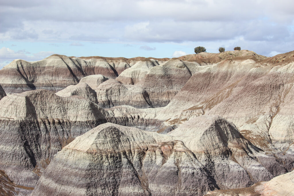
By now you have probably noticed that pretty much our entire itinerary within the park was driving so far. There aren’t a whole lot of opportunities for good, true-blue hiking inside Petrified Forest (although you can get a backcountry permit and pretty much hike at will, as I understand it). The closest thing to a true popular “hiking trail” is the Blue Mesa Trail, a one-miled paved loop that drops down into a field of blue badlands. Elizabeth turned off the min road onto the aptly named Blue Mesa Scenic Road, which led slightly uphill to the rim of another mesa. Below us were some elephant-textured mesas, miniature hoodoos peeking off of them, and… was that… petrified logs! Our first petrified wood encounter in the park was occurring. That wasn’t the only impressive thing. The modest increase in elevation was apparently enough that:

See snow in Arizona: check.
See petrified wood at Petrified Forest: check.
Finally, after an up-and-down day, the weather gods turned decidedly in our favor the moment we got up to the top of the parking lot at Blue Mesa. The snow stopped falling, the sun came out, and the dark clouds moved off to maraud the desert further to the east. In its wake, a coating of snow painted surfaces that were shaded from the sun, and there sat an entire desert running with little trickles of water.

The trail was to the left of the above image, where the mesa gradually gets cut out by steep gullies further and further, leaving behind the classic badlands-style topography of hills and channels. To our delight, the trail descended straight down into the channels.

A further cause for delight: badlands everywhere are created by erosion. That implies that the ground is easy to erode. While walking down the trail, I touched one of the mounds to see how solid it was and was surprised to see my finger come away with a coating of gray sludge. So these badlands were not at all full of rigid rock. This was pure, wet clay, which explained why the little rivulets of water running alongside the path looked to be about the color of an elephant.
As we descended through the geologic layers, the colors went from a rusty red to a brown-grey that you always see with clay. Then, finally, the vaunted blueberry shade of Blue Mesa.

I don’t even think the pictures capture just how blue that layer was. It legitimately was like Veruca Salt from Willy Wonka.
Down at the bottom of the trail, Elizabeth and I chose to do a counterclockwise loop around. This let us admire up at the mounds, which shone in the sudden sunny day.

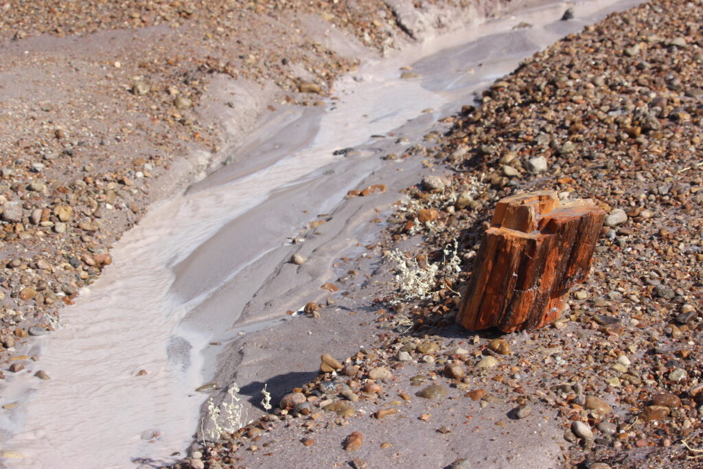
And because I am who I am, I was also obsessed with the little trickles of meltwater coming out of each gully. They gathered into little streams on the valley floor, which washed west-southwest back towards the main park road eventually. When we got below the blue layer, the water took on an element of “milk in the cereal bowl after you’ve had 2 bowls of Boo Berry in October”.
And there was even some petrified wood to look at and touch!
There was a window here to get a completely unique picture – the main wash inside these badlands running with the sunlit wall of the mesa in the background. Clouds started approaching right as I ran over to the perfect place to get my shot. Quickly, quickly –

Now that’s nifty.
On top of the clay and the petrified wood, it was hard not to notice the amount of pebbles that just accumulated along the floor of the wash. I suppose it makes sense when you’re sitting in a giant pile of clay that sooner or later those pebbles are going to make their way downhill, but still, the sheer amount of them was astonishing.

I wouldn’t say anything crazy like “Wow, this was the coolest thing I’ve ever seen” or “this was the most alien landscape I’d ever been in”. But… it definitely exceeded any expectations for Petrified Forest that I’d previously had, and it definitely did not feel like being on the surface of Earth. Blue Mesa alone made Petrified Forest well worth the day-long detour away from Sedona.
After a short, brisk 10-minute walk (that became very chilly the moment we stepped out of the shelter of the buttes and into the wind), the two of us reached the end of the loop and started the steep walk back up the slick trail to the parking lot. Elizabeth was particularly delighted by the sign that told visitors to leave by 5:30 (otherwise, you might be eaten by a coyote!). Along the way back to the main road, there was one more overlook that let you see the entire loop we’d walked, as well as all of the surrounding badlands.
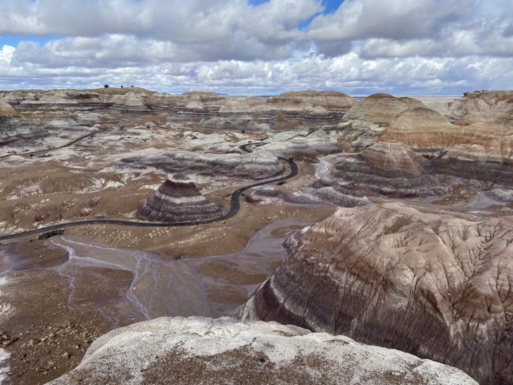
Pretty epic.
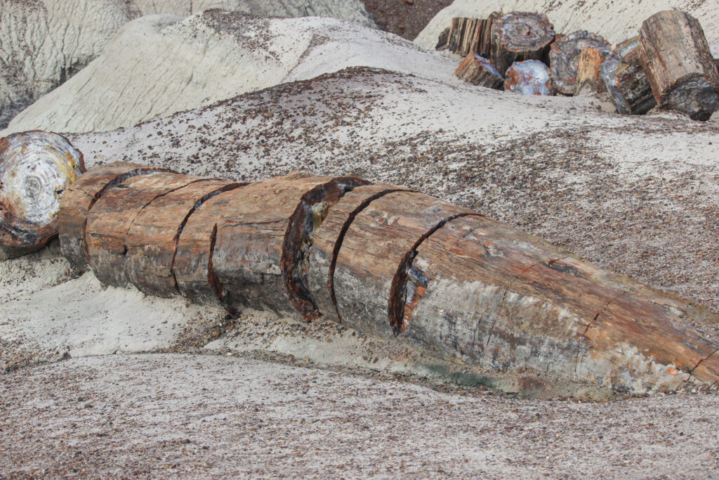
That wasn’t quite it for our tour of the park, although it was getting close to noon and both of us were hungry. We had one other short walk (I won’t dignify either that or the Blue Mesa Trail with the term “hike”) and two other quick stops to make as we drove south. The first of these stops was a very quick one at the so-called “Agate Bridge”. Here, a big old petrified log got unearthed as a wash was carved in the desert at some point, and the log gradually started to form a bridge. The Agate Bridge today is supported by concrete emplacements from the CCC, but who knows how long those will last against erosion?

Meanwhile, a lone storm off in the distance could trick you into believing this was the Texas panhandle instead of Arizona:
We’ve got one more walk to talk about, so I’ve now got one more group of pictures to go through. This last major stop in Petrified Forest was the Crystal Forest trail, about 2/3 of the way from I-40 to the southern entrance of the park. The name sort of implies it, but the Crystal Forest was a petrified-log-rich segment of the desert with a short loop trail. Elizabeth was so excited to see the petrified wood, and we really hadn’t had a chance to see much so far. This trail had so much that you could just imagine stepping off of it, picking up a piece of the wood, and slipping it into your pocket. Not that you should do that – you really should not do that.

So petrified wood actually becomes quartz over the millions of the years. What I wasn’t really ready for was how shiny AND colorful that quartz could be. Every picture of petrified wood I’d seen had shown the outside of it, where it kind of just looked like someone had taken a log and put it into a hard rock exterior. When we walked down the trail, there were plenty of logs that had been split neatly into pieces like someone was cutting hot dogs up for a kid. And the inside of the those logs were full of pinks, purples, yellows, and oranges. It sort of reminded me of the colors of the rock in Glacier National Park.

Once again, you felt like you could just reach out and take it. But I didn’t.
The trees that were still mostly intact apart from where they’d split apart were among my favorite.


Even though Elizabeth wouldn’t let me off the trail, and even though it was way too windy up there, the Crystal Forest was well worth the stop. I think it may have been her favorite part of the park. Outside of the signs warning you of the coyotes in the parking lot.

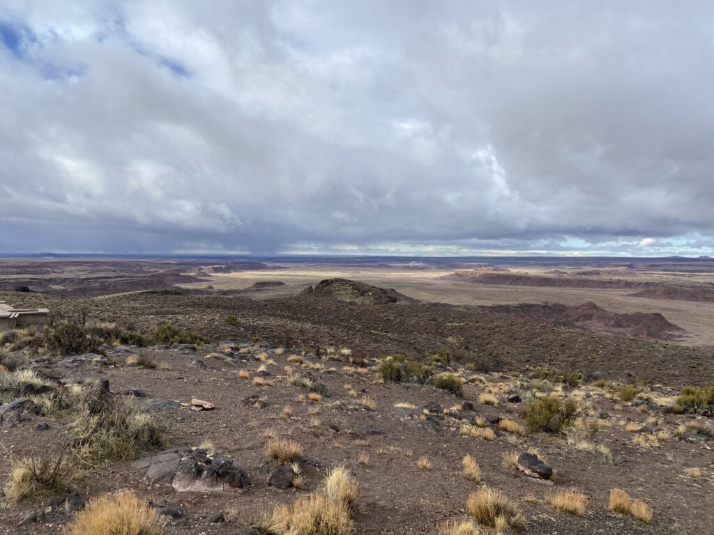
From here to the end of the park, I took a turn driving to give my lovely wife a break from the trauma she’d suffered the night before. The southern part of Petrified Forest feels like an extremo version of the Texas panhandle – mesas, prairies, buttes, and sightlines that run for dozens of miles. Otherwise, it’s miles of emptiness.
Our final stop inside the park was the Rainbow Forest Museum and Visitor Center. I didn’t take any pictures, but they had a pretty cool exhibit of the prehistoric creatures – including dinosaurs! – whose fossils have been found within park boundaries. That was the second-coolest thing inside of the visitor’s center, after an exhibit of letters written from people returning petrified wood to the NPS because they believed stealing it had cursed them (this is really there). And with that, our morning inside the national park was coming to an end.
We’d only spent about four hours inside Petrified Forest National Park. Unless we were backpacking in the backcountry of the Painted Desert, I don’t really know how you could spend that much more time there. It’s just not a Yellowstone-type park where you can spend weeks there and continue to see new stuff. But that’s okay! As Elizabeth said as we were leaving, “A morning inside an average national park is better than 99% of other days”. And that was certainly true here. I really liked the Blue Mesa, the unique topography, and the brilliant colors. Elizabeth in turn really liked the petrified wood. The unique location of Petrified Forest along I-40 makes it the perfect roadside stop if not the centerpiece of its own vacation.
20/63 national parks visited, and our weekend was just getting started. It was only Friday and we still had 48 hours left in Sedona – the centerpiece of our vacation.