
Sometimes, you embark on a chase knowing everything has to time exactly right for you. I’ve had a lot of chases like that, and they never worked out for me before. That almost kept me home on April 22, but after leaving on a whim, I ended up scoring big.
After a long day before (see Canadian 4/21/20 chase log), I had an early morning with work and an online class on Wednesday the 22nd (PDEs. Ugh). On top of that, Elizabeth and I had a virtual apartment tour scheduled for 1:15 on Wednesday, and our last OWL meeting of the year was at 7:00. Based on that, I figured James, Moriah and I had time to post up on a storm, and as soon as it passed I-35 we were done for. Forecasts called for a potentially big day, but I was getting a bit lost in the sauce.
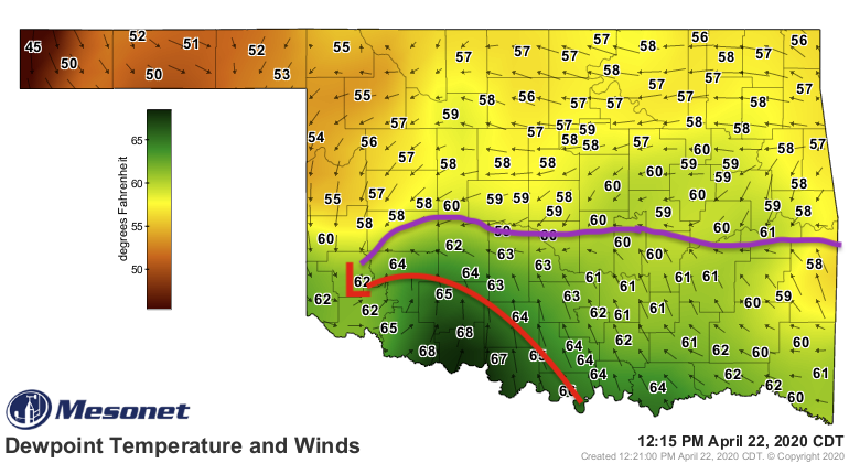
It’s not the first time I’ve ever discounted tornado potential due to poor hodographs near the triple point. Hopefully it’s the last. Even after tweeting that the 22nd was “all about the boundaries”, and analyzing a map around 12:15 to show surface obs, I still found myself lacking situational awareness early in our chase.
For reference, that purple outflow boundary was still sagging southward, but most importantly, the low wasn’t traveling ENE like short-term CAMs anticipated. Instead, due to the sagging front, the low was almost moving south of due east. And it was hauling ass.
Despite that, James, Moriah and I headed down 44 in the direction of Chickasha, with a few of cutting off storms rapidly developing near Altus. Obviously, there was some flawed thinking there, most notably that the storms were to the west of the surface low. I guess I expected them to catch up, but by the time we got along the longitude of US-81 I was using every swear word in the book under my breath. Chasers were reporting CI west of Ardmore, well to our south. Only one thing to do in a moment like that. I told James to take OK-19 to the southeast, and stat.
By the time we reached Pauls Valley and I-35, I was starting to feel confident that we would be ahead of supercell development near Wilson. It was just a question of which updraft to target, and how to do so with the Arbuckles and a time limit against our backs. I can’t find a radar archive, but essentially I was watching two updrafts. One, that most people had been watching, was drifting east-northeast of Wilson toward Springer. The other, a rapidly developing updraft to its north, figured to end up crossing I-35 somewhere near Wynnewood. I got a glimpse of the northern updraft as we headed south on 35, and the chase just seemed to lock in for me then. The initial misstep didn’t matter anymore, we were in the moment and it was time to make a good decision. These kind of decision moments have plagued me in years past. I’ve outsmarted myself, relied on others to inform my thinking, etc. way too many times, and this year I want to live and die by my own knowledge. So I took a look the Mesonet observations, had James pull off at the Chickasaw Travel Stop west of Davis, and began pacing and watching the storms to the west. Moriah probably thought I was crazy, muttering to myself and pacing in the parking lot. James had disappeared to go to the bathroom. It was just me and the updrafts:
Fortunately for me, the decision became clear as the northern storm (shown at right above) was visibly less intense and struggled to develop. James got back from the bathroom just in time for me to finish muttering to myself. As much as I hated the terrain to our south, there was only one option.
“Let’s head south”.
We pulled back onto I-35 and headed into the Arbuckles. For reference, the terrain just south of Davis is actually quite rugged, especially in the Turner Falls area. I really wanted to get south of the storm before it snapped across the highway. We managed to do so (and beat the chaser train!) and get a pretty prime pull-off on OK-53 just west of I-35.
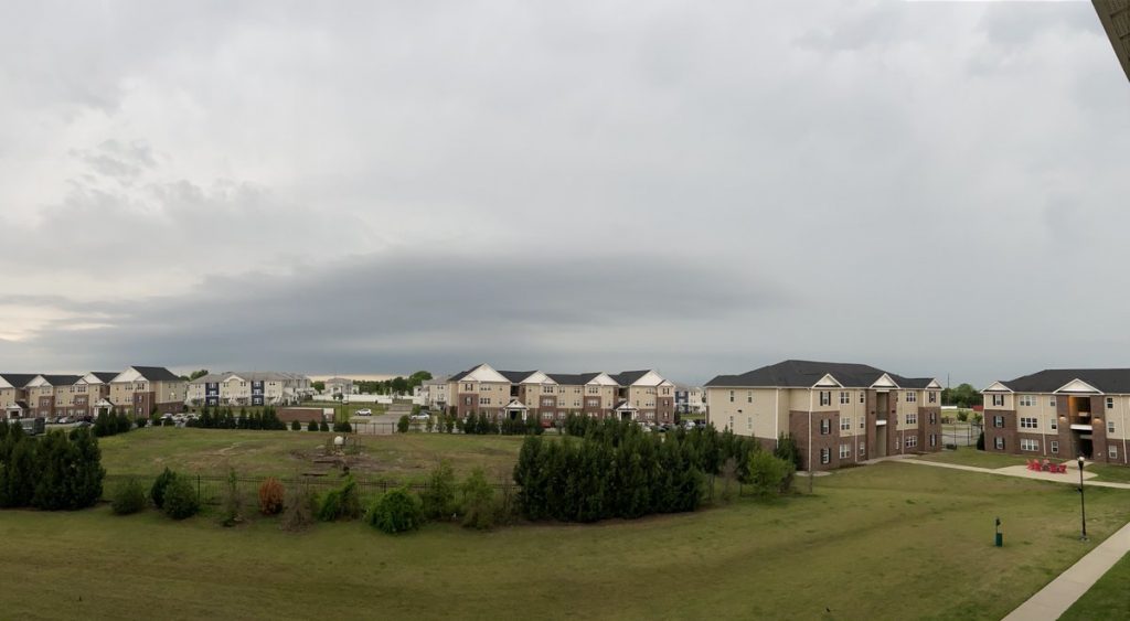
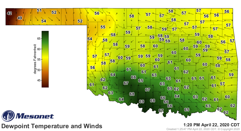
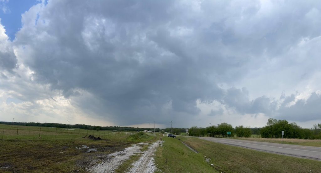
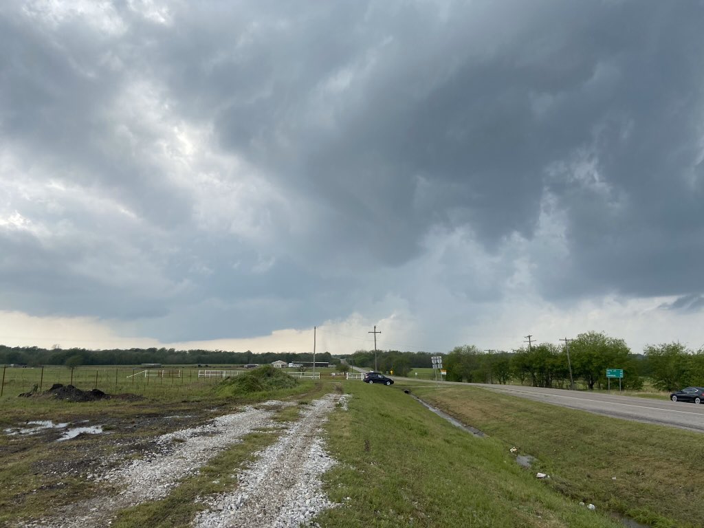
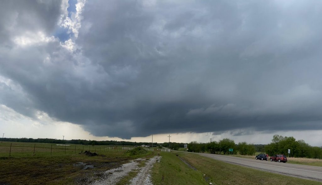
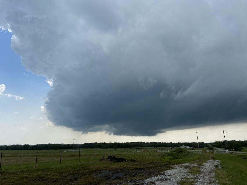
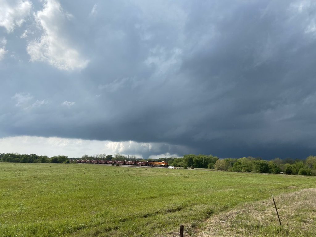
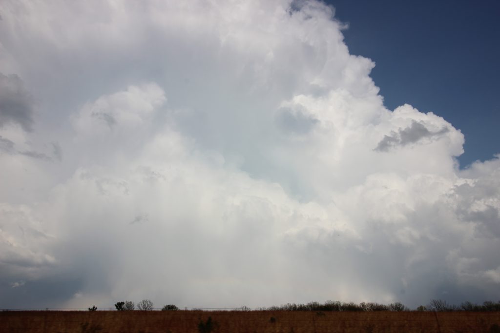
The storm was… meh. It had been developing for a while, and the immediate assessment James and I made upon looking at it was that it was elongated.
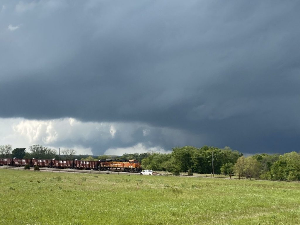
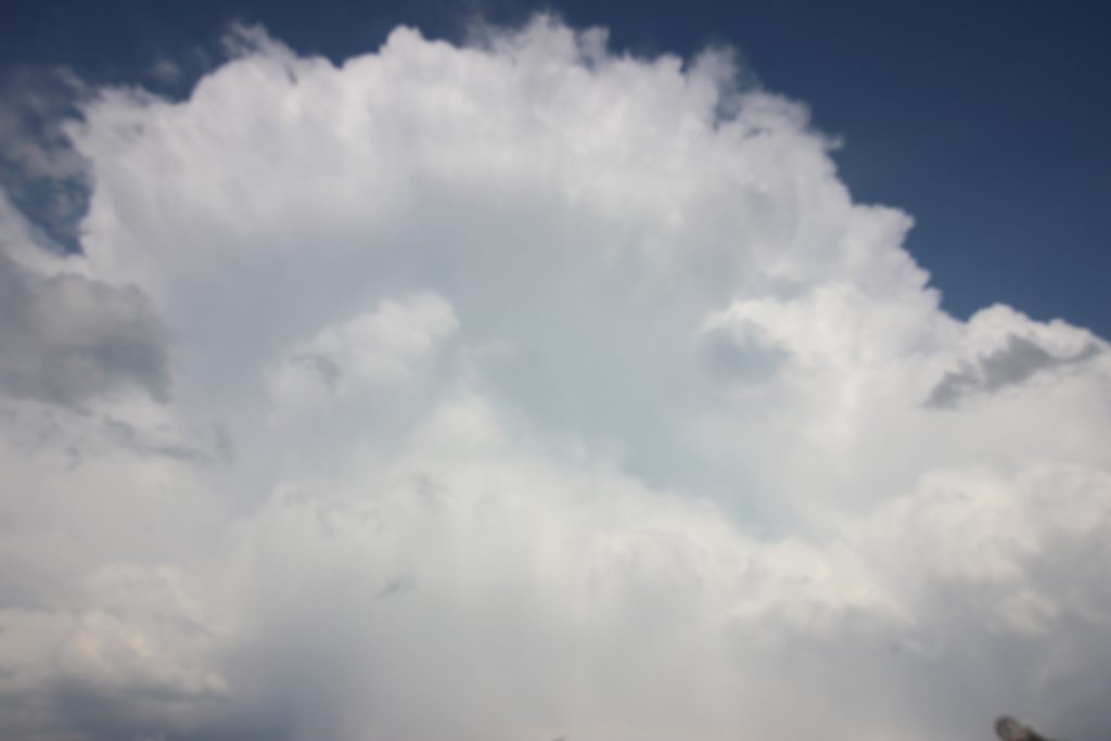
Sometimes I’m a bit reactionary when it comes to chasing. The day before, near Canadian, our storm had been churning pretty well and I thought it was going to produce a tornado right in front of us. I said so, but it was not the case – the RFD was too cold. That memory probably colored my attitudes toward the Springer storm – although, admittedly, at this point it was still developing. It wasn’t even severe as of the image above (3:37), but radar showed a pretty robust mid-level meso on the backside of the elongated meso. From here on out, I’ll try to include a few images at a time over a few minutes, so the development of the low-level meso can be visualized.
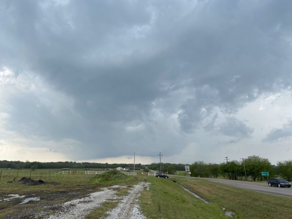
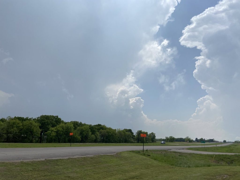
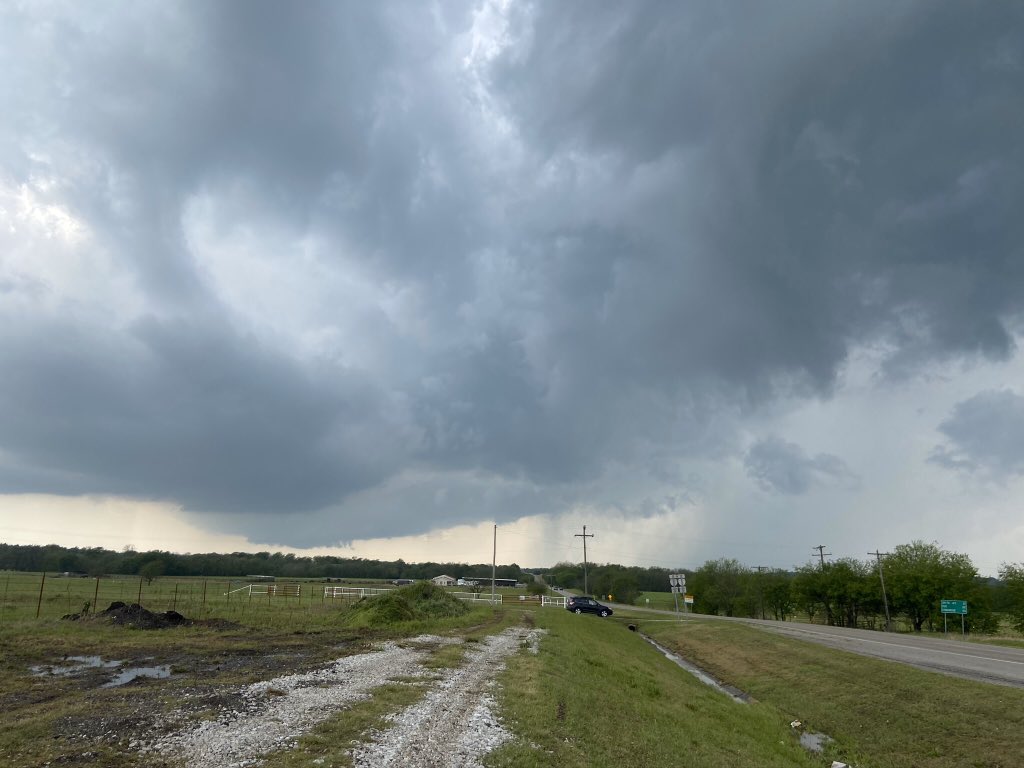
These pictures are just before NWS Norman issued a severe thunderstorm warning, the first one for this storm, at 3:47 pm. When I saw that the warning was issued, I remember sarcastically thinking that it would be for a tornado possible and sub-severe hail. Turns out, along with 70 mph winds, I was exactly correct. About this point, we were joined at our pull-off by a couple of chasers who considered themselves “old-timers”. Amid their vape clouds, they kept exclaiming about how the storm was “Rapidly developing! Look at that wall cloud!” I kept muttering under my breath to James and Moriah, something to the effect of “where?” I even went far enough as to tell them that if the storm produced a tornado in the next 15 minutes, I’d venmo each of them $20.
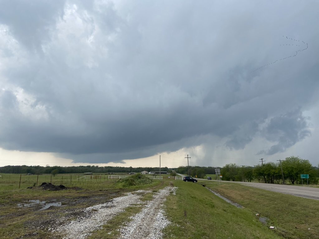
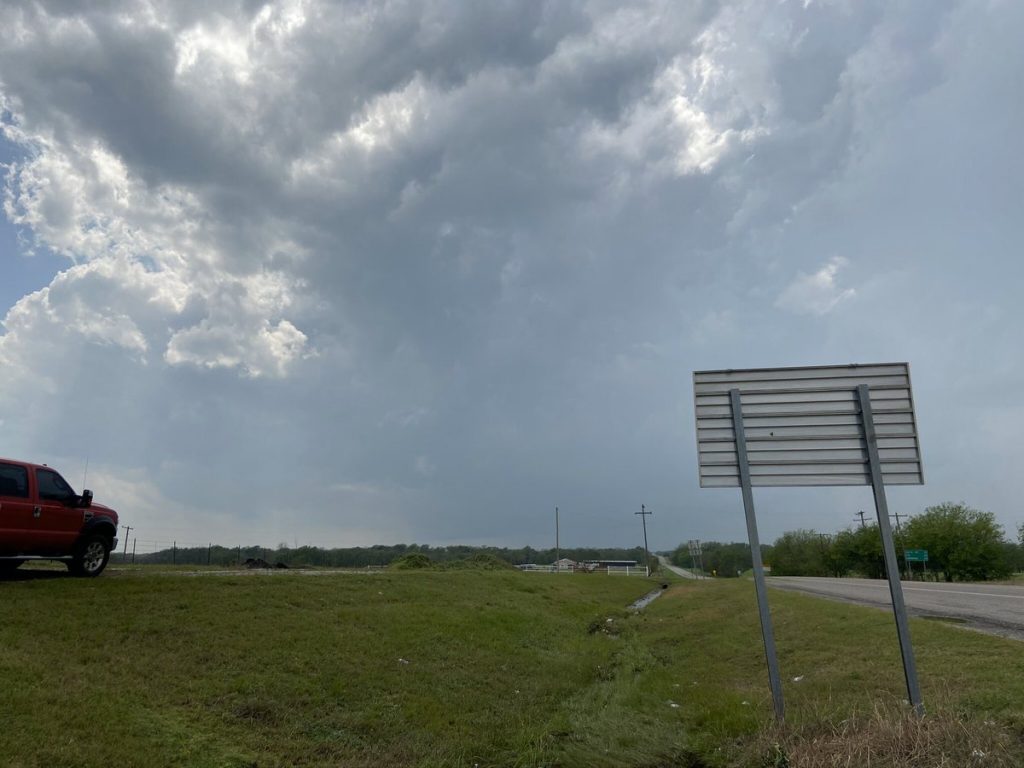
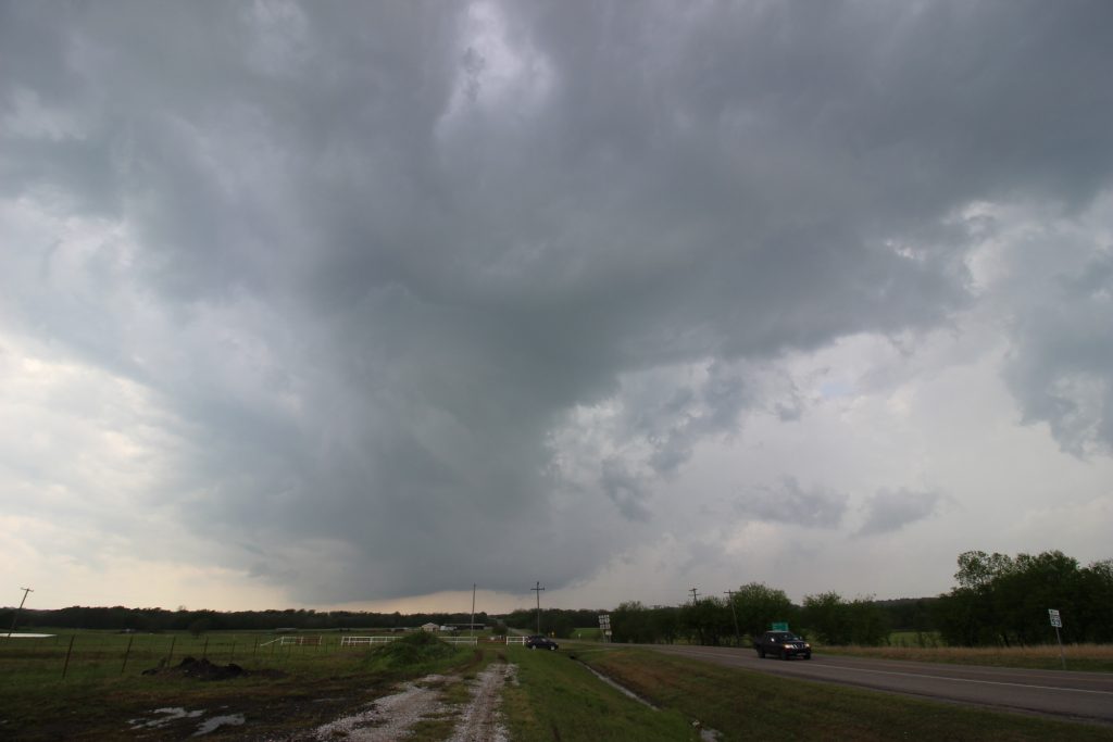
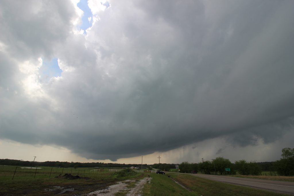
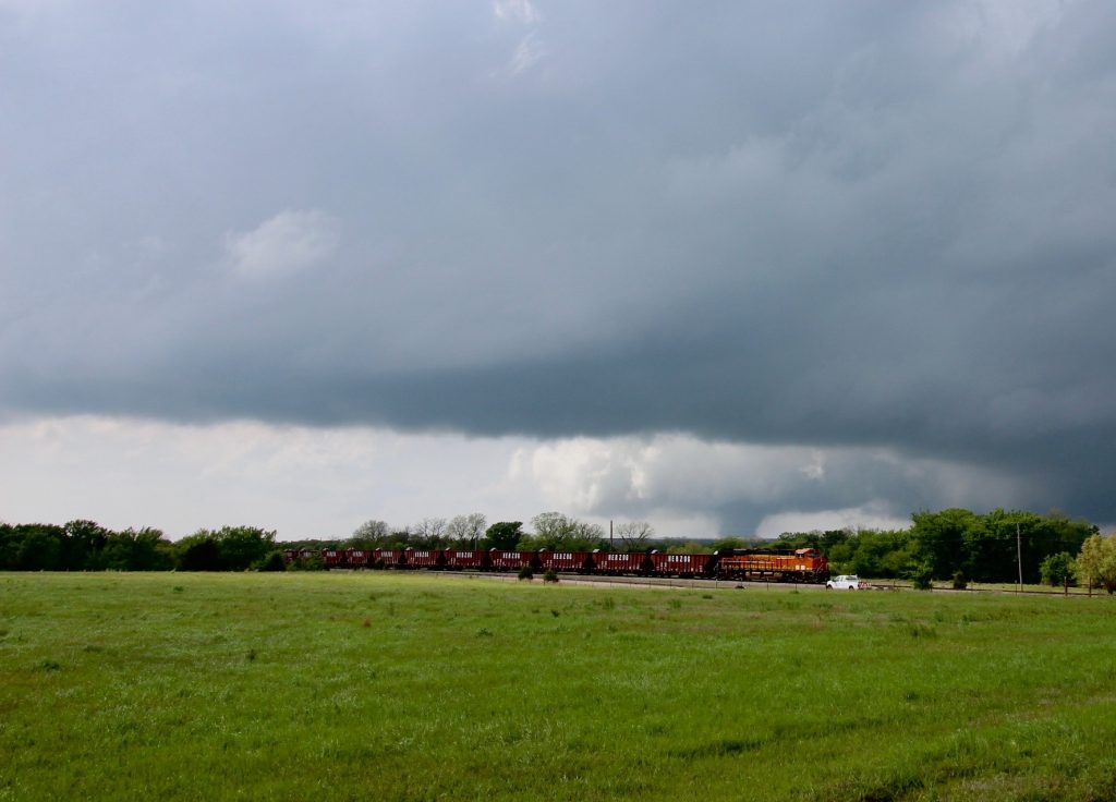
Over the next ten minutes, the storm clearly organized itself. James and I had been watching the scud along the forward flank gust front. Early during our stop, it actually appeared that the scud was moving away from the base in a storm-relative sense. After a while, it became clear that the storm was beginning to draw inflow. For a while, the scud appeared to hold steady in the sky, and then, suddenly when I looked over, it was traveling back toward the updraft base. The low-level mesocyclone itself formed on the far southwest side of the original disorganized updraft, and steadily began to grow. The storm structure became prettier as well. The storm was heading right toward us, and with my timelapse running I was in no hurry to get anywhere. Just let it keeping coming to us.
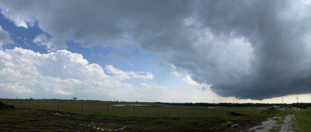
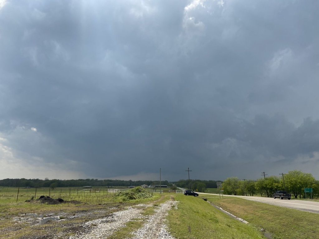
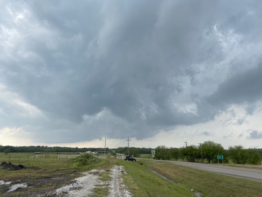
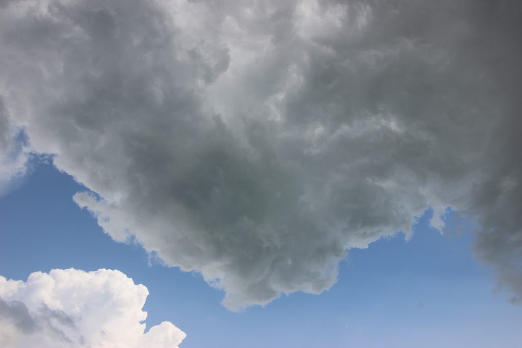
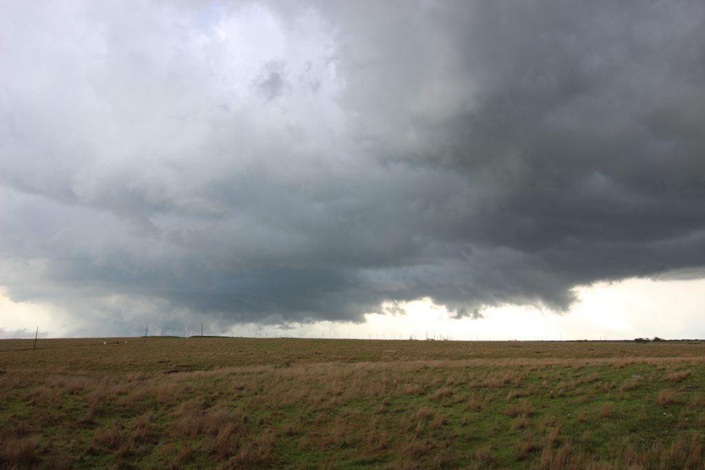
I made the mistake of looking at radar, and noticed that to our north, a well-defined couplet was forming right around Wynnewood. After years of Jason missed Wynnewood jokes, I would have preferred not to miss one. I briefly looked at the possibility of cutting north on 35 toward it, but with our storm getting closer and looking better, I didn’t seriously consider it. The last image is looking south, where you can see a gathering storm on the left (that would eventually produce an EF-2 tornado near Madill). It also fulfilled my 2020 desire to look at all parts of the storm, not just the meso.
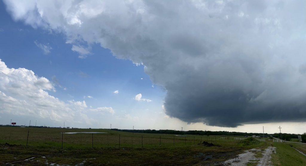
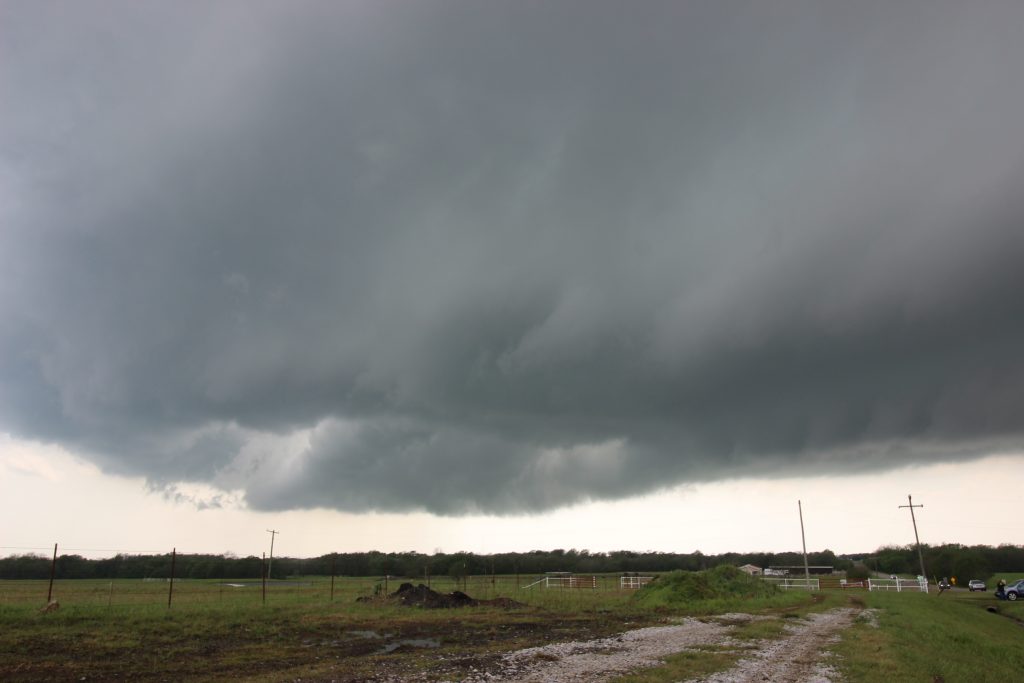
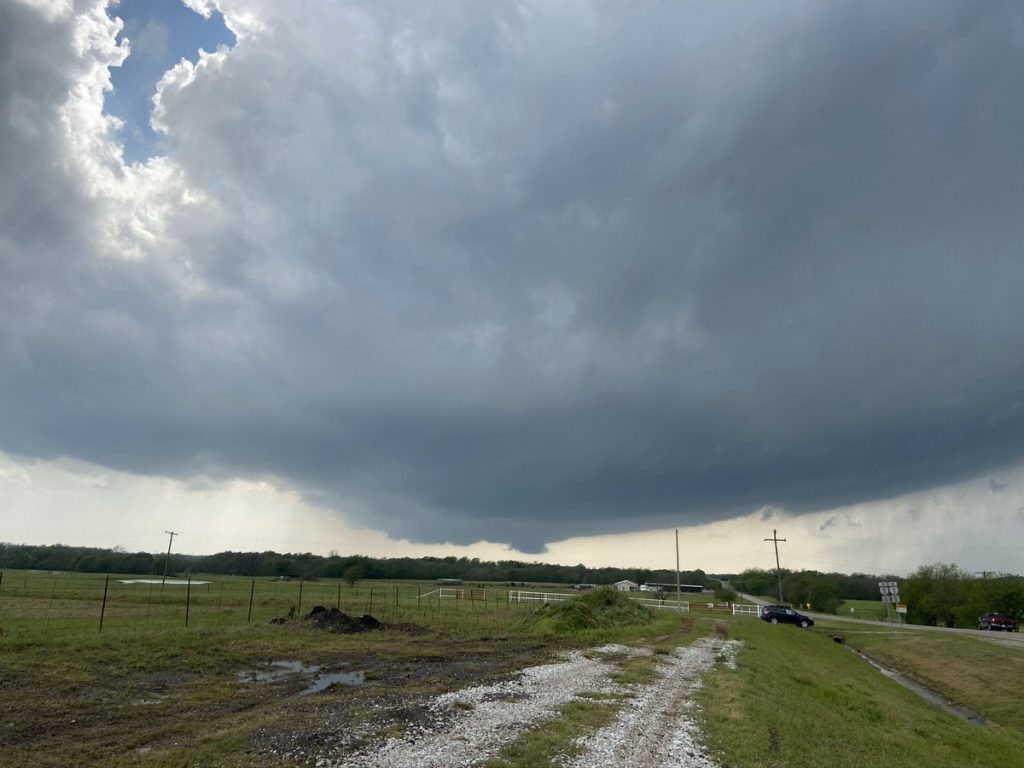
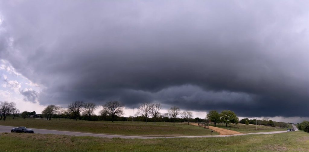
Now, finally, I began to realize that maybe this thing was going to try to do it. I still hadn’t seen much evidence of an RFD cut, but a powerful updraft was going up directly over our heads (see the updraft at 4:10 versus 4:12). I began to think toward the future. There was no option that let us stay with the storm. Either we had to let it cross 35 and try and view it from behind, or we would have to go 10 miles east to 177 and go north for the next play on the storm. Thinking it was still a ways away from tornadogenesis, and wanting to get a timelapse, I made that call. We sprinted back to James’ car and headed east on 53. James was getting annoyed at chaser traffic, particularly a family that clearly had no idea what storms were right in front of him. Meanwhile, I was texting Jason, who was in the RFD back along 35. Even at 4:21, I was still looking toward Wynnewood.
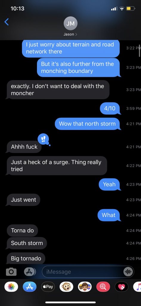
“Jason says big tornado. Moriah, can you see anything to your left?” Our view to the north was obscured by trees, but I got a brief glimpse of an absolutely beautiful vault with a cone sticking out of the bottom.
“BIG tornado. We gotta get a view”.
I immediately directed James to take a north at the end of Ardmore Municipal Airport, and started scanning through the trees to the northwest. We got a view, and James slowed way down to exclaim at the tornado.
“James… just pull off here!”
He threw it in park and I sprinted across the street to a fence. The tornado was about 6 miles to our northwest, and even from here you could see the whole thing spinning. On James’ video, you can hear me exclaim, “Holy shit, look at that motion”, but otherwise the three of us were transfixed by the tornado. Meanwhile, we were joined by construction workers in hard hats and reflective vests, out gawking calmly at the classic Oklahoma twister as it churned away. To add to the overall aesthetic of the scene, there was a train parked directly in front of the tornado. It was surreally quiet apart from the construction guys and ourselves.
Within just a minute or two, the tornado had receded eastward into the trees. Whooping and hollering, we sprinted back to James’ car, and, after a quick balk at the airport, cut eastward out of Gene Autry to get back north onto the storm. We were able to catch occasional glimpses of its majestic rope-out through the canopy.
Unfortunately, by the time we had hustled about 177 to get back in front of the storm, it was rather disorganized:
I was struggling to figure out where the low-level meso even was. On KTLX, we should have been right with an intense meso, but I couldn’t find it. We followed the storm for a bit longer on Old Mill Creek road (and cracked James’ windshield on a pebble), but by this point it was after 5:00 and I didn’t think we could catch up and be back in time for a 7:00 meeting. So we stopped the pursuit, and I ended up free-handing one of my favorite shots of all time from a moving vehicle:
Along with a few others:
It had been an intense day. For some, it was not over: Jason and Sam would end up just meters away from another tornado near Wapanucka. But the mood inside our car was ecstatic – we were coming away with some pretty good shots of the clearest view of a strong tornado (EF-2) any of us had ever seen. And, best of all, I was back in Norman in time for my 7:00 meeting.