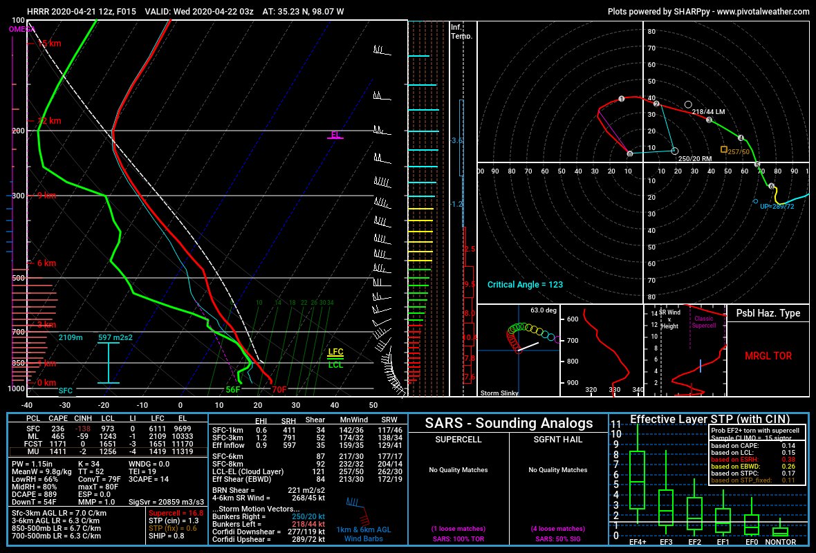
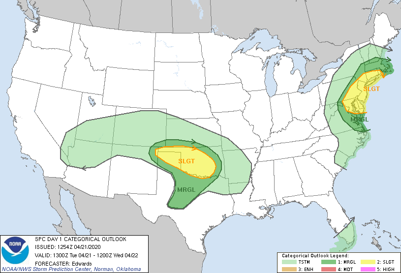
I was bored. It was already mid-to-late April, and we were trapped in a pattern that encouraged absolutely beautiful weather and not much moisture from the Gulf. Naturally, I was losing my mind in quarantine. I didn’t need much encouragement to get out and chase, and a low-moisture, high-based supercell threat in “God’s country” of the eastern Texas panhandle and northwestern Oklahoma was all I needed to get out the door. Short-range CAMS suggested supercells developing around dusk in the area of Arnett, OK with giant hodographs encouraging large hail. As part of my effort to enjoy all parts of the storm, not just the meso, I decided to dub the day a “sig hail” chase. It would be a success if I measured a 2-inch hailstone.
Around 1:30, I drove over to pick up Tyler, James, and Moriah. After a false start (I had Elizabeth’s laptop charger and had to return it to her), we were on our way toward the Northwest Passage and an initial target of Arnett, Oklahoma. As I drove, storms began developing in the Very High Plains around the Raton Mesa. I was hoping we’d have a classic Raton runner moving across the northern Texas panhandle, but alas – those storms evidently weren’t moving much. With little else to do but wait and hope that the target area would initiate, we reached Seiling and headed west.
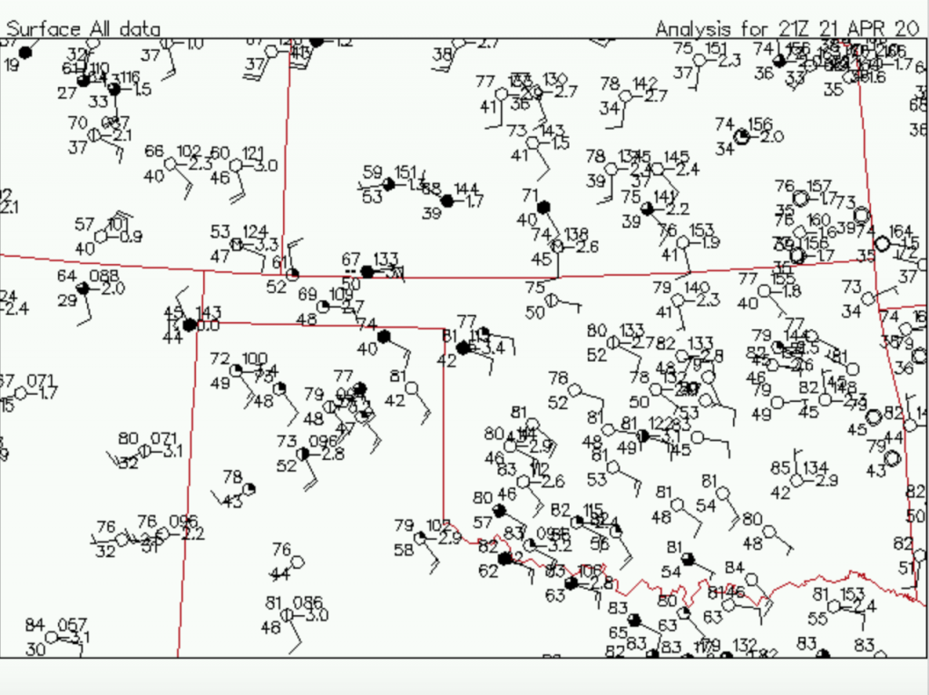
According to James and Tyler, CI occurred in the central Texas panhandle as we crossed the northwest Oklahoma prairie to meet it. Again, I was driving, so I can’t confirm it, but apparently the early life of these storms was somewhat uninspiring. That’s probably not surprising given the fact that dewpoints of 45 generally don’t lead to explosive convection.
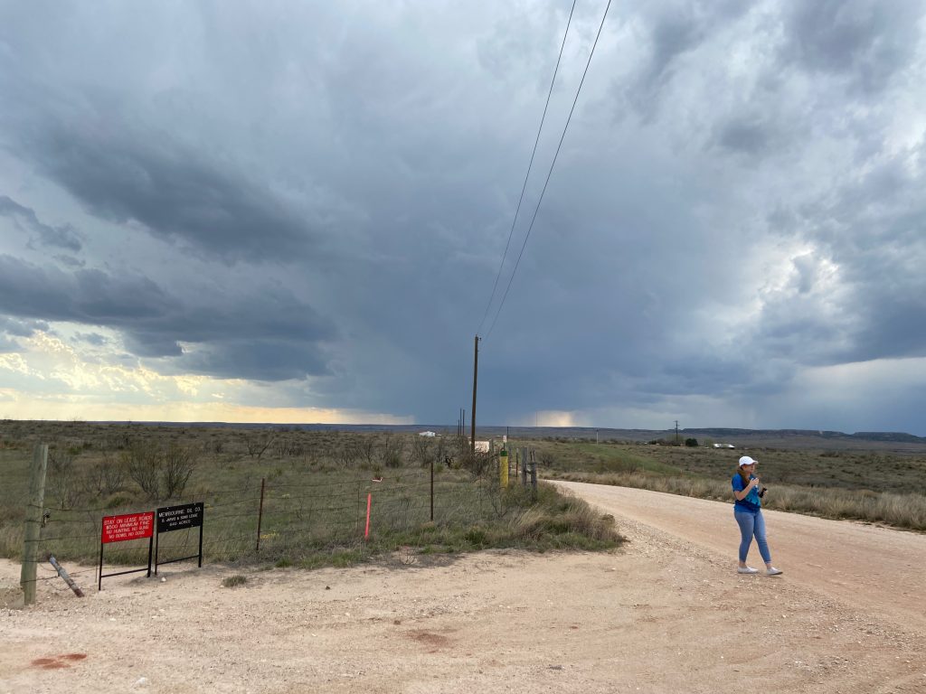
We passed on through Arnett, now heading toward Canadian, Texas. The clear blue sky slowly gave way to a field of agitated boundary layer cumulus, with deeper ice blue patches showing where convective showers were trying to form. Between that and the newborn cows that were everywhere, I thought the drive on US-60 was rather serene. By the time we reached Canadian, I could see the deeper shadow of a storm to the west, which James and Tyler had picked out as a potential winner. Near Stinnett, it had recently pulsed up from “updraft” to “definite thunderstorm” and was even showing signs of trying to split. We viewed this as a providential development. It was about 5:00, and without feeling much urgency we decided to gas up at the Allsup’s on the south side of Canadian (Tyler got a burrito. True chaser life there).
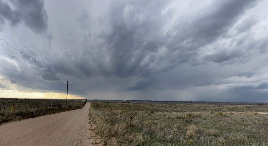
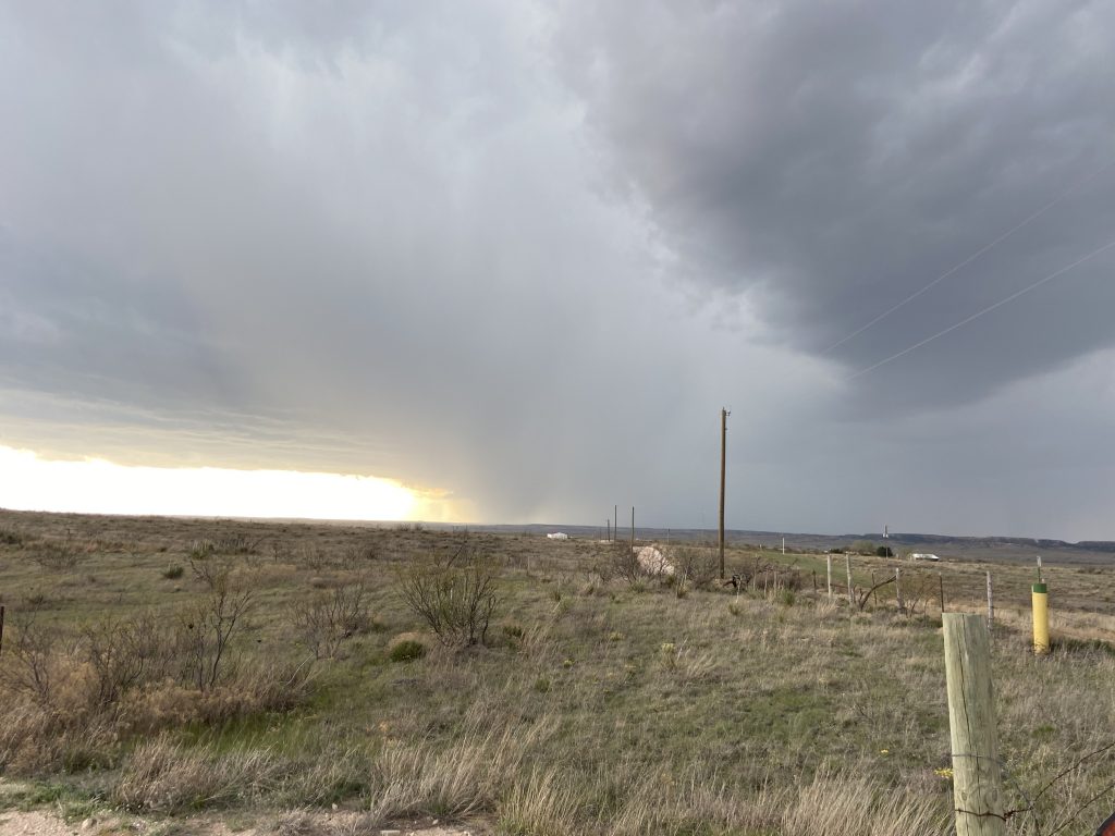
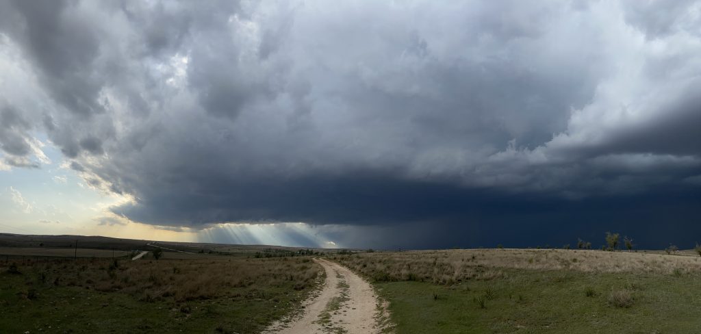
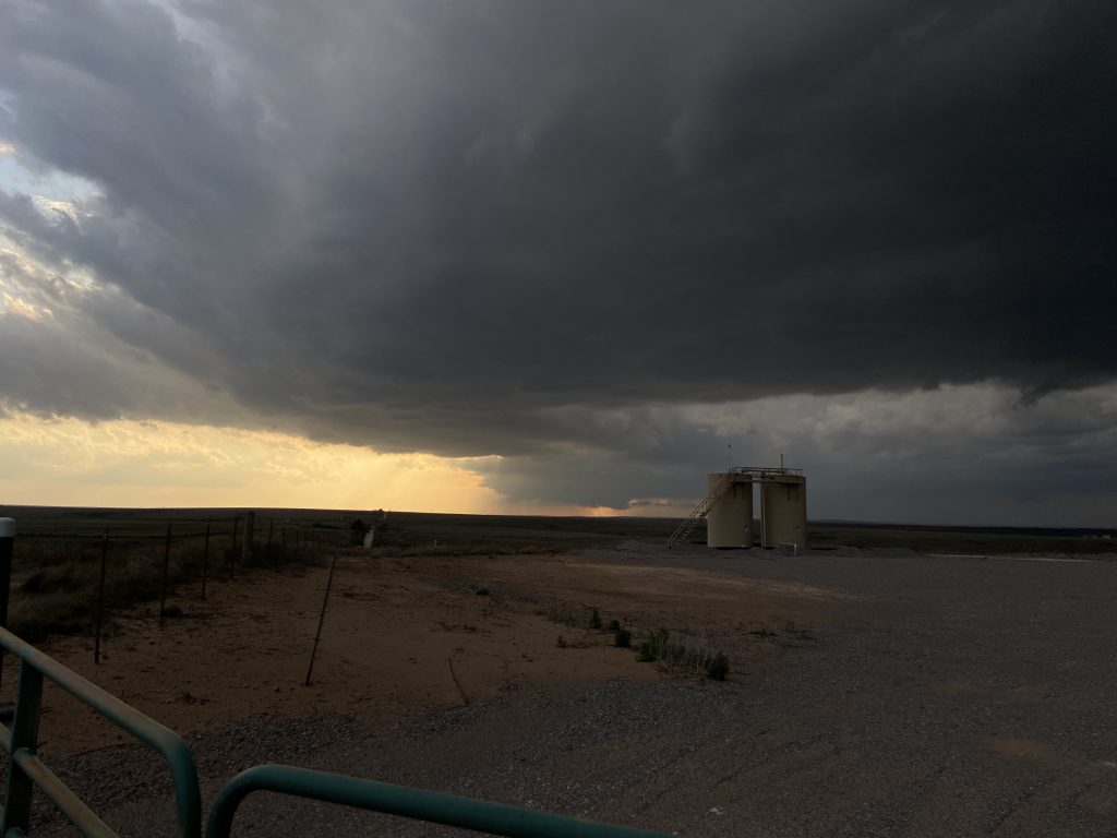
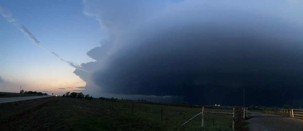
I wandered around for a few minutes, stretching out and keeping an eye on the gathering darkness to the west. There wasn’t a whole lot else going on in the panhandles, so I figured we were probably okay to head a little south of town and try to get a vantage point on it. James found us a road (County Road N) that, while paved, was barely so. It wound its way through the oilfields near Canadian, eventually cresting a plateau with a sweeping view west toward the Caprock. The view itself was stunning:
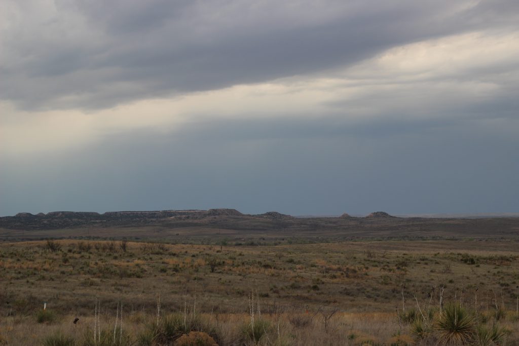
Add in a storm and you’ve got a fair approximation of what I think heaven looks like:
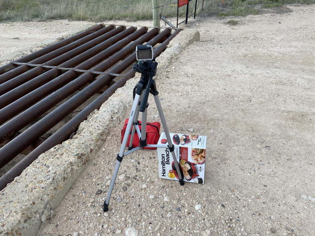
We were on top of County Road N for about an hour. I set up a timelapse, but with ripping inflow wind into the storms (hello High Plains) my crappy tripod kept falling over. Being the inventive soul that I am, I created a “stand” for my tripod:
We met another chaser while pulled off as well. His name was Brent, and he said he was stuck in quarantine in OKC away from his hometown. He didn’t appear to know the most about storms, but he was nice and enthusiastic. I hope his chase went well and that he gets home soon.
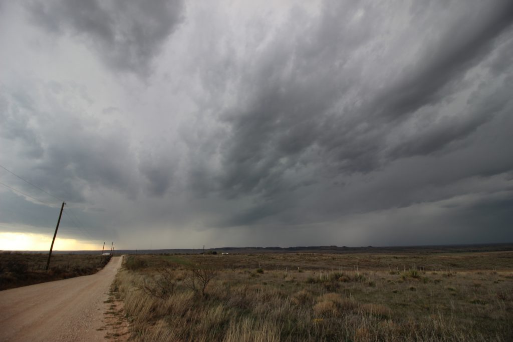
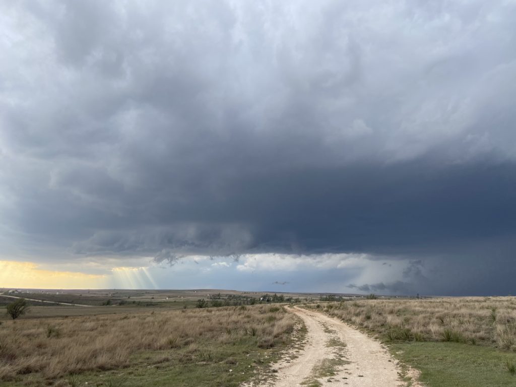
The storm drifted our way pretty gradually. Lightning was off to our north, first from some leading cells and then eventually from the forward flank. I tried (unsuccessfully?) to capture a lightning strike over the broad river valley to our right, wandered around the dirt road (waving at the lady who drove past us in each direction), and snapped occasional pictures throughout this hour. The core seemed to be spearheaded right at us, and so we knew our time in our current spot was limited. Given the general lack of any useful roads east of Canadian due to the river, we figured we would drop south and east. The storm was generally more organized and this didn’t seem like the worst thing in the world. Some nice pictures from this spot:
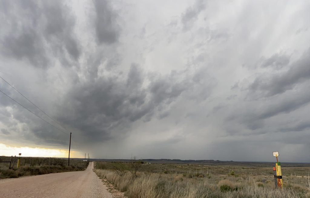
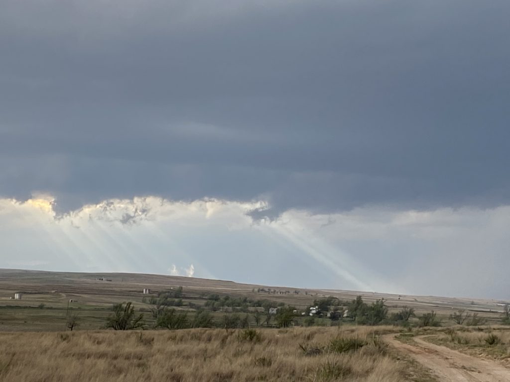
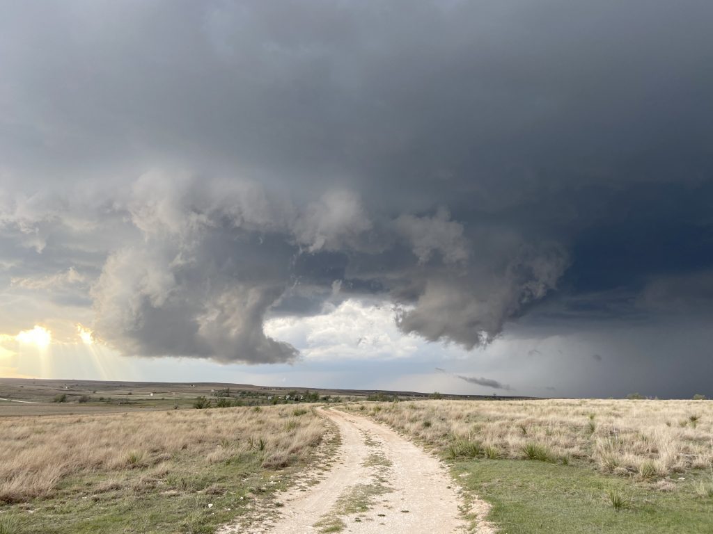
You can see from those last few images that a grungy lowering is starting to become visible through the rain on the backside. Given our location, in the path of the core, it was a bit hard to see. Deciding when to end a timelapse that’s been running for so long is always a delicate one, but I felt the clock ticking – particularly when a few in-cloud lightning strike occurred close enough for the thunder to reverberate. We all piled back into the Mariner and darted south on 60. James wasn’t sure whether he wanted to go west on 83 at all, and we ended up turning around and pulling south of the intersection.
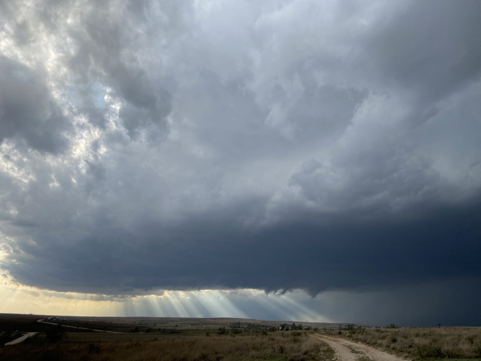
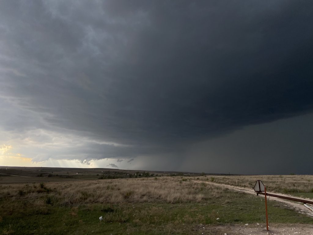
When we got out, I was a bit stunned. We had a clearly rotating base to our west-northwest, and a really well-established forward flank gust front with that gently sloping, smooth look to the FFGF that makes the storm look so much more powerful. The lowering was ragged, but still. You saw those dewpoints earlier. I get that hodographs were good, but… that good?
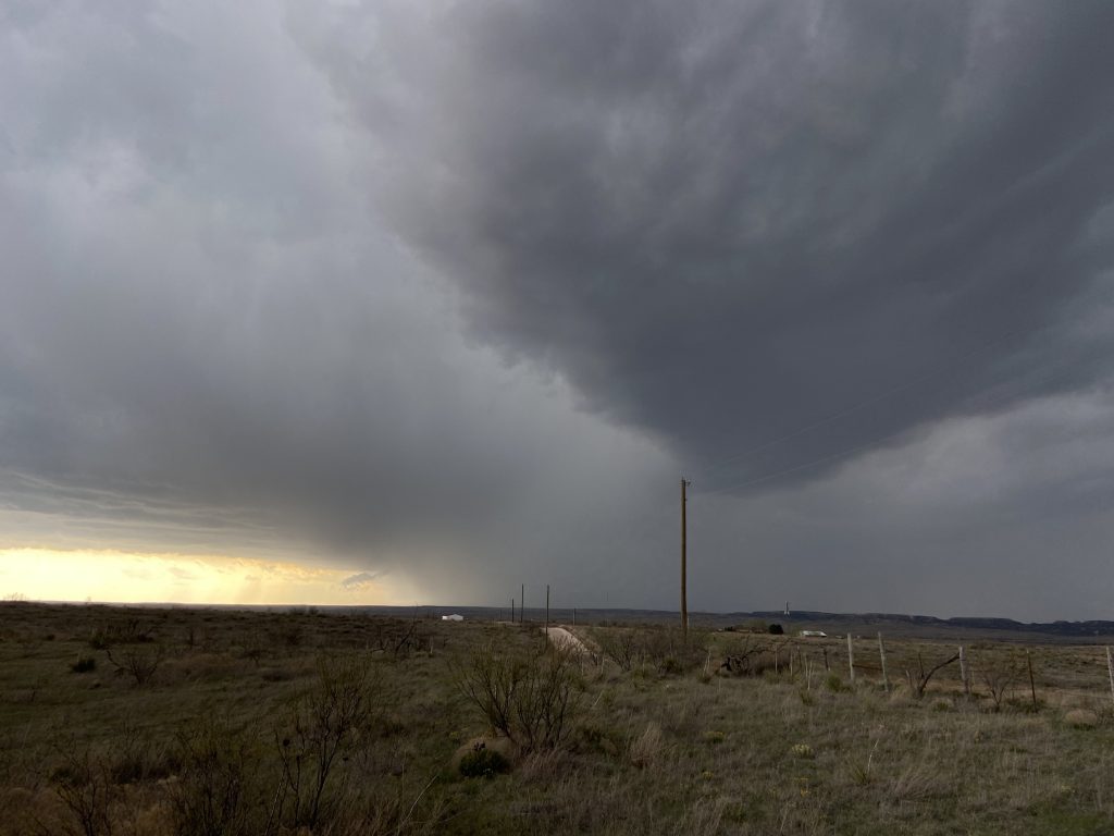
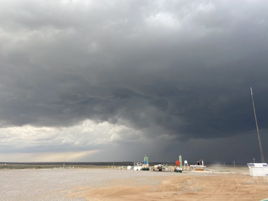
Indeed, this storm was about to deviate hard to the south. Already, the sound of thunder was making me as uncomfortable as it had several miles further to the north. I was still a bit stunned and coming to grips with the fact that our scenic storm had become a powerful, classic Plains supercell. James pulled us south a few miles, and we pulled off at yet another scenic ranch. By this point, the inflow was absolutely ripping. Even my professional, well-designed wind breaks weren’t keeping my tripod from tipping over, so I had to physically hold it in place (except for the stretch where Moriah did. Big shoutout to her for doing so).
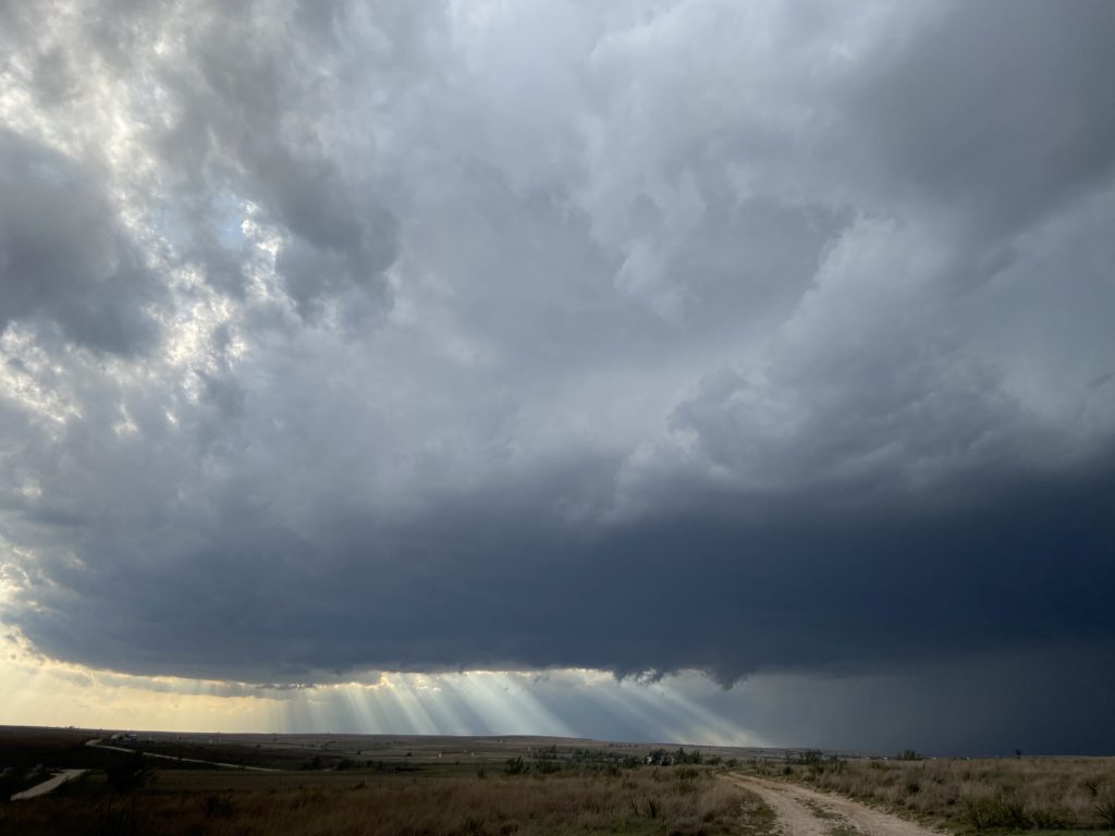
The base of the storm continued to churn due south, with scud rising and rotating into it. At times, the sun’s backlighting would illuminate pure white scud near the surface. We were basically waiting for someone to report a tornado from that scud to Spotter Network.
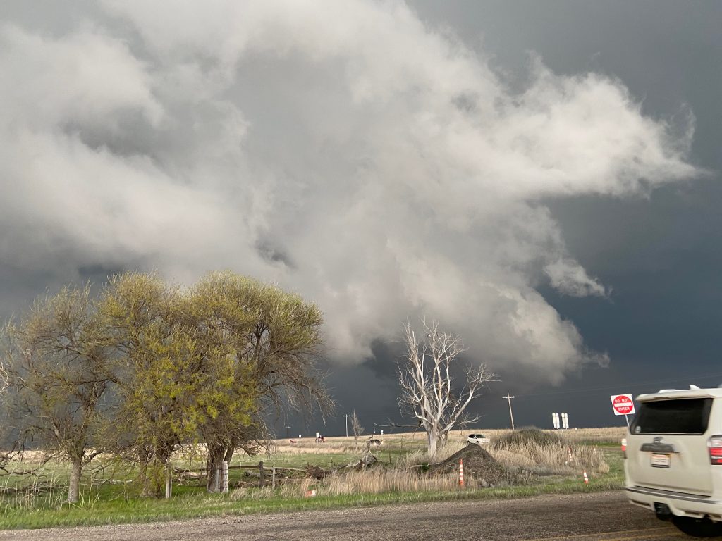
It didn’t happen, but the base drifted closer and I started to think that a tornado was a legitimate possibility. The base wasn’t that high, and that continued elongating process wherein inflow to the backside of the base stretches it out continued to happen. For a few minutes, we could make out the entire updraft above the base, and the storm structure was actually kind of glorious.
Next up was the wild arrival of the RFD. It’s pretty easy to tell when it arrived base on pictures. A little gust front formed on the southeast corner of the base, and started surging northward. We were close enough to see individual rolls of scud with horizontal vorticity get slowly tilted so their rotation was at a constant elevation. I’ve never seen that before and it was so cool. At its peak, the storm’s chaotic wall cloud had to have been within a mile of us:
My dumb ass had ended my timelapse because my GoPro’s battery was about to die. This was a pretty devastating loss, because ho boy, would this attempt at tornadogenesis have been phenomenal to capture. Jason and Sam were to our northwest, and they said that the RFD was quite cold when it blasted over them. Well, a few minutes later we got blasted by that RFD too, which from our position is not a great sign for the longevity of a mesocyclone. Dust was flying everywhere and visibility briefly dropped to zero as I tried to drive back out to the highway.
It was a little after 7:00, and the sun was starting to go down. James decided to move us south and east toward FM 277 (this is where I learned that James can’t read google maps. He told me my turn was in half a mile. I drove for four minutes at Texas highway speed). A new supercell had gone up west of ours, and we could see what looked like a pretty well-defined base in the rearview mirror. The scene in front of us, and the scene off to the west, had me thinking a jump to the west was probably the right decision by the next time we stopped:
And this is really where I had lost situational awareness. A new base was developing on our storm off to the east, closer to the Oklahoma border. While we dawdled and I entertained the notion of backtracking west, our storm developed a powerful mesocyclone that threatened to get the job done somewhere west of Reydon. Once James and I realized our mistake, we were off to the east. While I focused on the road, James and Tyler were getting crossed up by radar versus visual. I could hear them becoming more confused by the moment, and briefly lost my cool in a classic Nolan outburst: “Go by f***ing visual!” After receiving a laconic affirmative from James that that was what he was indeed doing, I pulled to a stop at the intersection with 2654 so we could get a sense of what was going on.
The stop lasted 15 seconds. I opened my door, saw the rotating base to our northeast, looked at James, said “We gotta go”, and that was that. We continued to hunt down 2124 toward the Oklahoma line.
When we take Tyler’s videos, we accept potato quality.
Just inside the state line, I felt like we had caught back up to the storm. After all, this thing had been nearly stationary earlier, how fast could it be moving now? The base was so low that, from our vantage point just a couple of miles south, I couldn’t really tell what was happening at the surface. James claimed that we had a north route and pavement again in 4 miles. It looked to me like that was the play, and I swung a left.
Almost immediately, the base jumped into view much closer than it had been before. My car was buffeted, and the low cloud deck hung over us. As best I can tell, from the moment that we turned north off of SH-47, the bear’s cage had taken a huge deviation to the south much like it did earlier near Canadian. Only this time, instead of being a developing classic/LP supercell, the storm had more classic/HP, well-defined characteristics. It rapidly became clear that we weren’t going to make the 4 miles to the next paved road before we bonked some giant hail. Not without regret, I whipped the car back around.
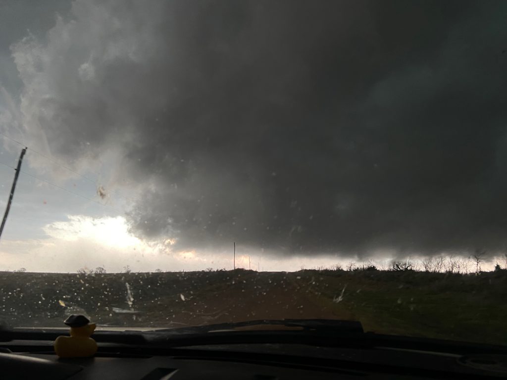
I could sense trepidation in the car at this moment. That left edge, just east of the road, was caroseling all the way back north. The RFD was absolutely ripping along the length of the gust front, and I’m not sure anyone had a view right above us. I couldn’t see any intense rotation where I would expect it to be, so I wasn’t overly concerned, just on high alert. “Okay, okay, we’re fine. We’re dead center in the bear’s cage. We have a good visual. Let’s get south”.
We headed back south to 47, but couldn’t turn back onto the highway because a beater car with Colorado plates was in front of us. The windows were taped up, and they were hanging out and blocking the intersection. Scorn rapidly rising, I laid on the horn, and they pulled through to the opposite shoulder. Just as I was getting ready to blaze by them, Reed Timmer popped out of the driver’s window and flashed us a manic grin and thumbs up.
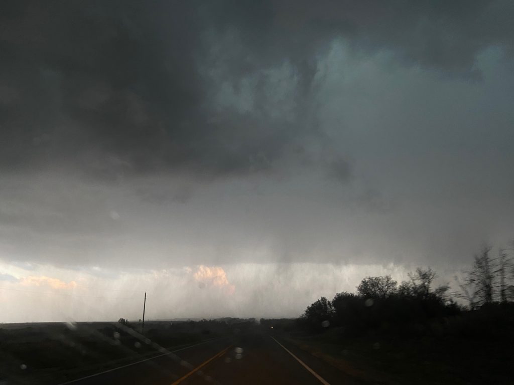
We drove east on 47 into Reydon, punching through a brief heavy burst of rain as we sliced back through the hook. At this point, we got out for a second and I was treated to texts from Elizabeth saying that David Payne had issued his own tornado warning for the storm. To our view, it looked a bit outflow-dominant for that, but to each their own. At this point, sick of hook slicing, I decided that we should cut back south and get out of the meso altogether.
A few more tight-gripped minutes of driving later, we emerged into the setting sun between Reydon and Sweetwater. A storm to our east-southeast was tornado warned, and we could see the majestic backside of its updraft. James thought we could intercept it, so we set a course of 283 to meet it. Before getting there, though, I remembered my goal for this year: less focus on the base, more focus on everything else great about chasing. So, right at the OK-6 and US-283 intersection, I decided to call it a night and try to film supercells in the dying light. Looking back a week later, I’m happy with the decision – knowing the setup, the amount of light, and the environment, I should have been aware that the tornado risk was quite low, and an argument could be made that we should have called it even earlier.
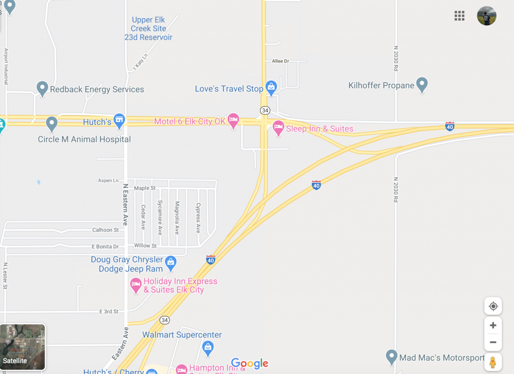
The night wasn’t over, though. I still had to find my significant hailstone. We did have a few storms to choose from. In the end, it appeared that the original supercell, now accelerating past Cheyenne toward Elk City. As the last night of day faded, we posted up west of Elk City and waited as the storm slowly churned past us. Then, with rain still falling, we took Business 40 into town to assess what had happened. Our hunt for hail eventually took us to the east side of town, where Business 40 merges onto I-40. There’s a Love’s there, and I pulled in with rain still falling so we could inspect the gleaming white hailstones for ourselves.
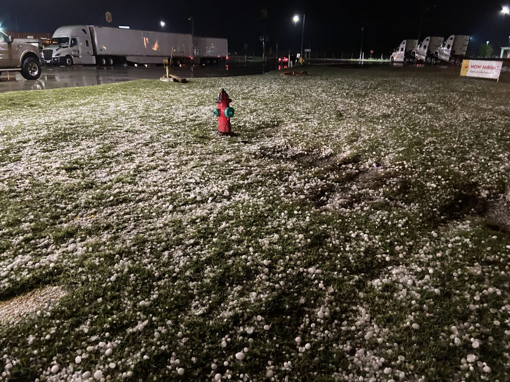
The stones had clearly melted some before we arrived, but we still found numerous quarter-to-golf-ball sized hailstones. My goal of a two inch stone?
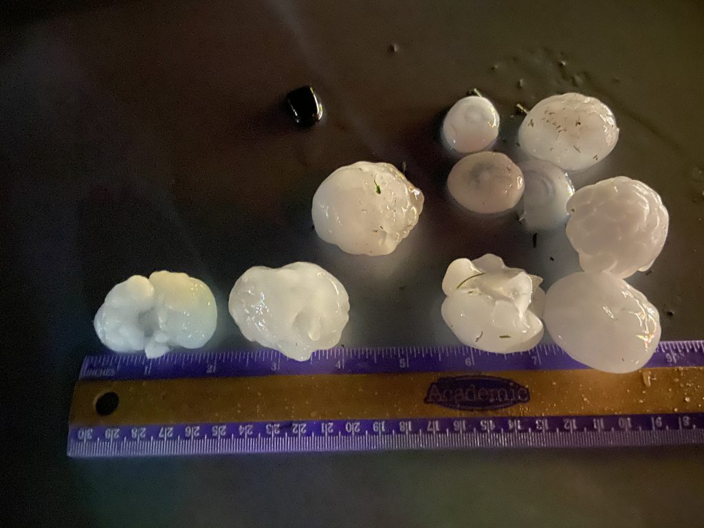
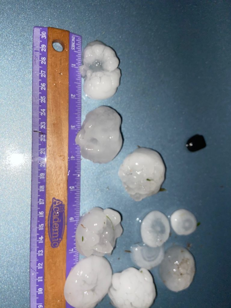
I could officially call the day a success. I could also start lobbing hailstones at James and Tyler, which I did. The shenanigans ground to a halt when I got a bit too excited and stepped into a DEEP puddle, soaking myself all the way to the waist. My socks were still completely saturated the next morning when I woke up, for the record. Not that I minded too much, I was having a ton of fun.
Storms were filling in all across the warm frontal zone from Cheyenne all the way toward the west part of the metro. They weren’t moving too fast, and we thought it would be funny to beat them back to Norman and meet people on a parking garage to watch them come in. So, despite the fact that all I had eaten since lunch ten hours ago was half a bag of bacon jerky, we decided to get on 40 and head back home. I pulled out of the Love’s pulled through the intersection and merged onto 40. It was completely dark and rather serene. Anvil crawlers lit up the sky in front of me. We drove on in silence for a few minutes until James spoke up from the back: “Which way are we going?”
“Uh… east?”
“No, we’re going west.”
When I pulled through the stoplight after getting out of Love’s, I had unwittingly merged onto I-40 west. Instead of heading toward Clinton, we were on a collision course with a supercell over Sayre. No sooner had we realized this than the rain began to pick up. “How close is my nearest exit?”
James told me it was still another three miles down the road. I made haste to reach the off ramp. As we approached, the thrum of heavy raindrops gave way to the plinking of hail. I got off the highway and got turned around as fast as I could. Outside of a few thwacks, fortunately, the hail seemed to be pretty small where we were.
When we got back to where we started in Elk City, common sense dictated that we not try to beat the storms to Norman. Instead, we stopped at the Braum’s drive-through. Quarantine drive-through lines are the worst, but eventually we had our food. James and I switched drivers, and he eased onto Business 40 one more time… except he turned the wrong way and headed west. Fortunately we caught this one relatively quick, but I was still pretty sure we were never going to get home:
*Finally*, we got headed the right way back. Our last adventure would be dropping everyone off in Norman, where a… fair amount of rain had fallen.
We had to pick our way to State to drop James and Moriah off, heading down Imhoff to Jenkins to get less flooded roads. Dropping Tyler off was a bit easier, and, a little before 1:00 am, I was back. Lightning was still lighting the sky off to the south. We had seen a beast of a supercell, and the largest hailstone I had ever held. Tomorrow was another storm day. I wasn’t bored anymore.