The top of the continent was windy. Yeah, I know that hardly qualifies as a surprise. Piegan Pass sits at 7,600 feet, well above the tempering influence of any trees this close to the international border. That’s part of why the view here was so incredible. The views to the south and east of Piegan Pass are no doubt incredible, and I shared many pictures that I took on the way up to the pass. Maybe it’s the fact that the view looking over the north side of the pass comes at you all at once over the crest. Maybe it was the sense of reward for a long and tense hike. And maybe the north side is just more beautiful, though I doubt that’s it. But whatever it was, whenever I think of “Piegan Pass” I think of those views to the north, with wonders looking as far as the eye could see.
I really don’t know the most logical way to display all of the pictures and features that Elizabeth and I had all to ourselves. Maybe the best way to do it is to show that whole wide scene like we saw it for the first time, then to show the individual features from left to right across the panorama.

Breathtaking. And not just because of the wind, either.
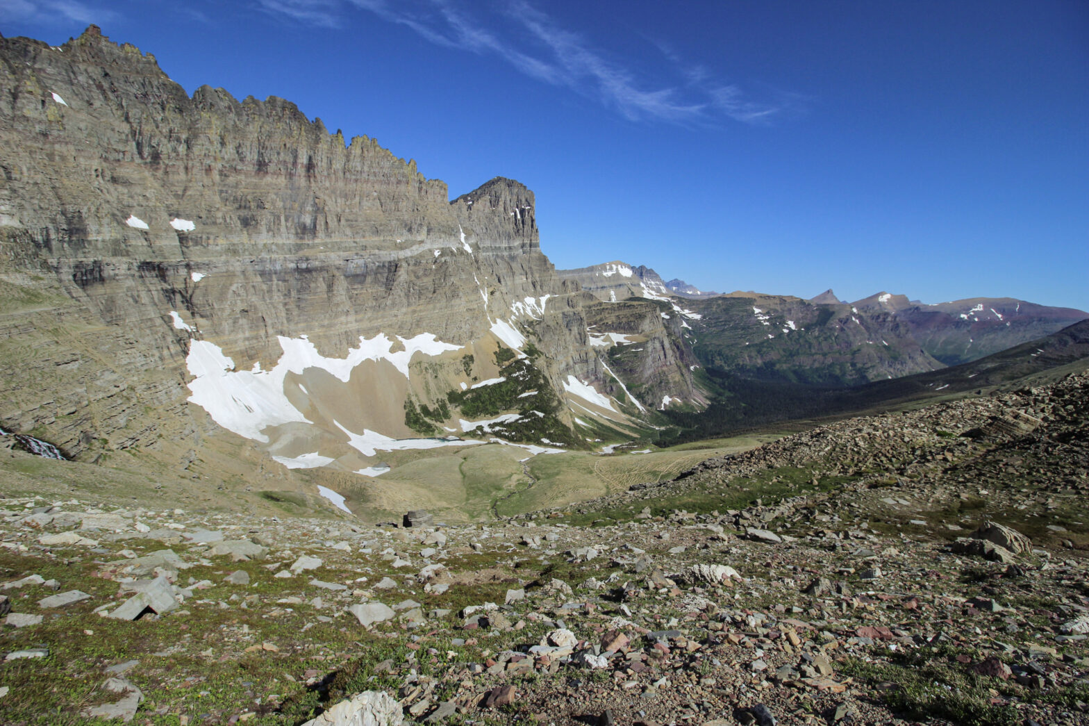
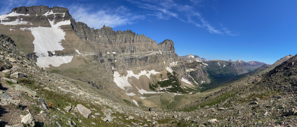
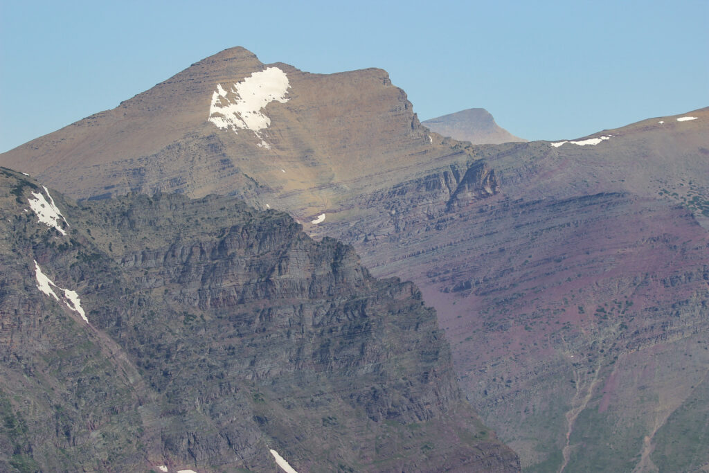
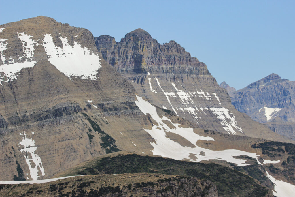
Within that panorama was a smorgasbord of amazing individual features. After I’d drank in the view for a few minutes, I got started snapping them. All the way behind us loomed the imposing presence of Piegan Mountain, in whose saddle we sat. To its west was a broad downslope that connected to the next mountain over, Pollock Mountain. It has the broad, flat peak in the upper left of the panorama. To its right is the famed Garden Wall. On the far side of the Wall, on the other side of the continental divide, the Highline Trail loomed far above Going-to-the-Sun Road, closed by the many remaining snowfields. The Garden Wall keeps going to the north until it terminated from our view at Mount Gould, which we would get a much better view of in 2 days.
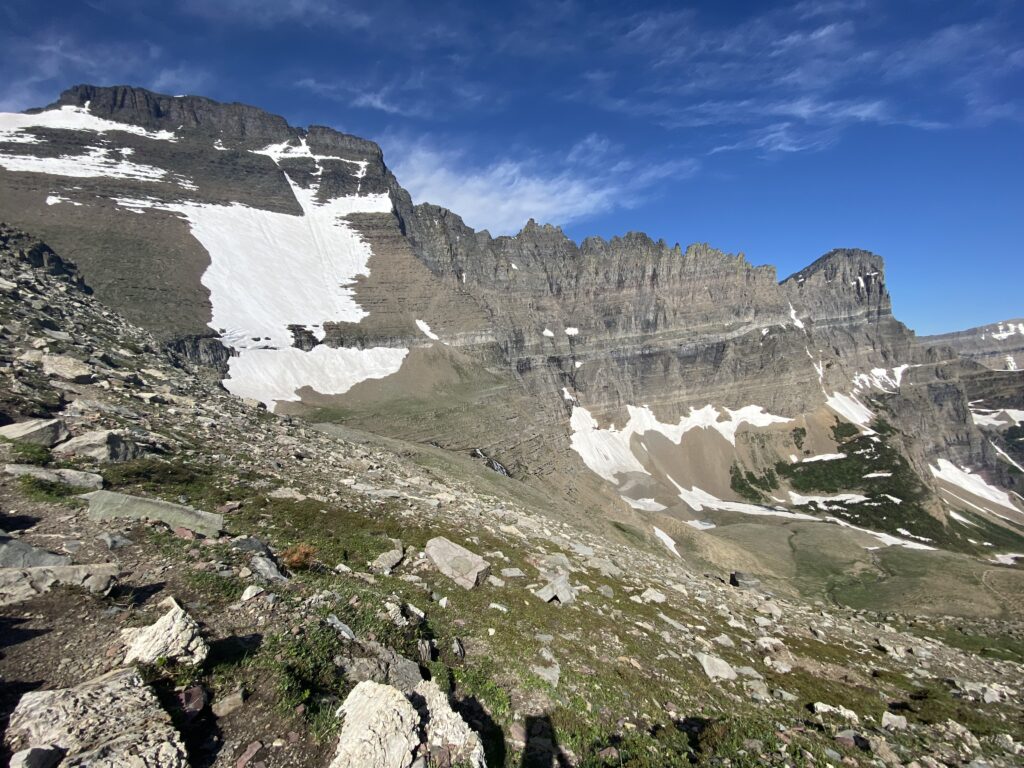
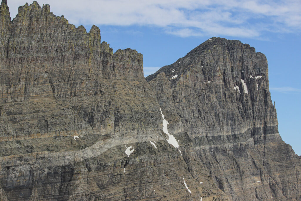
The geology of those rocks, too. Look at the stripes. That’s just so freaking cool. There were red, yellow, grey stripes across the rocks as centuries upon centuries got exposed by the Ice Age glaciers into these insane aretes. This spot really repaid both the long view and the detailed inspection.
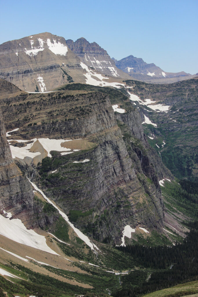
Beyond the Garden Wall and Mount Gould, the land rapidly slopes down to a valley. That valley captures the one created by the Pollock/Piegan/Cataract valley we sat at the top of, and it is thickly forested. This valley is one of the two that meet down at Many Glacier. On July 12, Elizabeth and I had explored the northern of the two, which are separated by the triangular Grinnell Point. This one, on the near side of the point (the mountain on the far side of the valley you can see) leads up to Grinnell Glacier. We would hike that valley in two days.
I made liberal use of the Big Dog lens to take pictures of the far-off peaks in Glacier’s northern section. A lot of them came out incredibly, and I had to choose very carefully which ones I actually shared here. This was a lesson for me: mountains are awesome if you get really far away with a close-up lens.
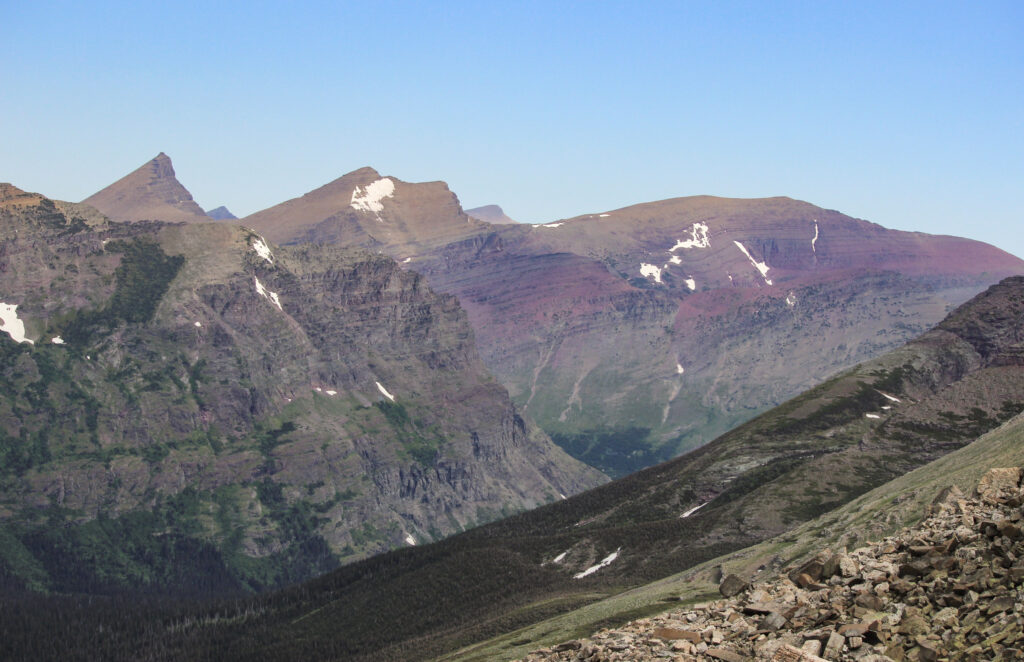
One of the defining features of Glacier, in my eyes, was the abundance of extraordinarily colorful rock. Although the bands of lemon-yellow were amazing on the Garden Wall, nothing could quite match the brick-red slapped liberally onto the peaks in the northern part of the park. It was just iconic in a way. When I tell people about Glacier, the color red really should be one of the first few things I mention, after the bears and the ice and the mountain shapes and the crowds and the general awesomeness.
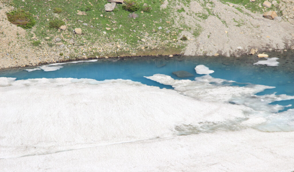
Working our way back around the arc, the epic view swung around to Cataract Mountain, which we had just been hiking up. That brought us all the way around the arc – but not inside of it. Far, far below us, several waterfalls and rivulets fell out of the mountainsides into the tundra valley. One spot in particular caught my eye – a terminal moraine from an ancient (or, hell, maybe small modern-day) glacier that had melted away and left behind a brilliant blue pond. This pond was mostly frozen over still, but Elizabeth and I could squint and see that distinctive glacier-melt cobalt.
And that sort of completes a zoomed-in picture tour of Piegan Pass. I used 700 words to describe it, but the 9 pictures do better than I could in 9,000 words. And those pictures can only do a fraction of the true justice that belongs to a place like this. There’s no way to truly get the scope for how small you feel, how wild it seems, and how much it just feels like you’re in a cathedral or something. Elizabeth and I had this pass to ourselves (for at least 15 or 20 minutes, before the third hiking group of the day arrived. Shortly after that, the first hiking group from Many Glacier made their tortuous way up the valley as well). I wanted to shout at the top of my lungs with excitement and I wanted to be totally silent and listen to the wind, all at once. I wanted to take a million pictures and I wanted to put the camera away and drink in the late-morning view. Those choices make me agonize and eat away at me a bit.
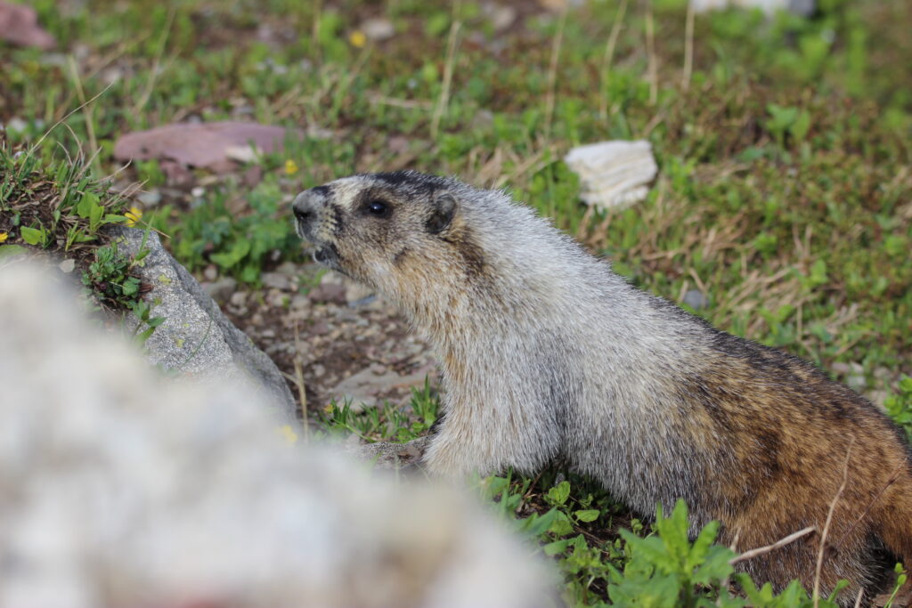
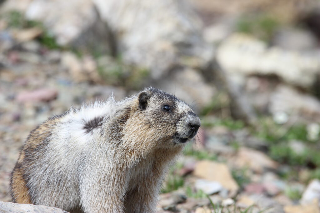
Elizabeth harbors no such internal struggles. She goes somewhere beautiful like this and plops down on a rock and eats a PB&J (“summit sandwich” – it was all the rage on Instagram). Then she points out things she likes. In this case, it was the ground squirrels and chipmunks and especially the marmots. They all darted in and out among the colorful rocks, searching for the budding grasses and clovers and even small flowers that bravely grew in the rocky soil. It struck me how fleeting this habitat is – in all of the land cover of North America, not much of it is above 7,000 feet. A lot of that land above 7,000 feet is well below treelines; alpine tundra makes up a fraction of a fraction of a percent of the continental U.S. And that alpine tundra gets to have a growing season that lasts at most a few months out of the year before another harsh winter sets in. And yet, here these animals were, unwittingly getting to be the guardians of a beautiful statistical anomaly.
Marmots are like Elizabeth – they also don’t have an overanalyzing, over-sentimentalizing mind like I do. In fact, those little rascals are some cold, calculating bastards. There’s videos of marmots being jerks to bears. Who does that? For the most part, the marmots at Piegan Pass were interested in slinking among the rocks and looking for food. They paid little attention to the two humans sitting on a rock and sharing Goldfish. But a few of them got close enough to give me a good look at their big old chompers.

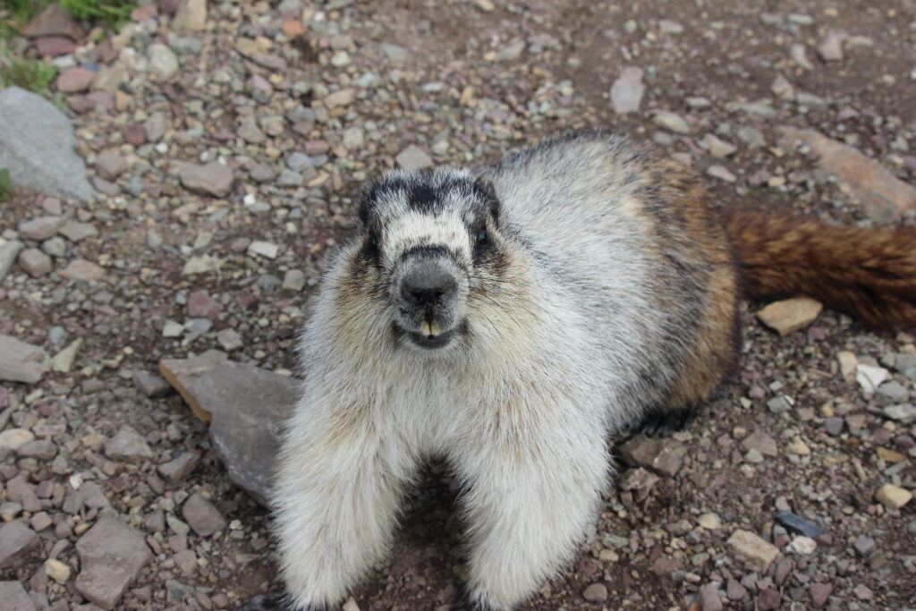
That last picture was from the most aggressive marmot yet. It kept walking at us until Elizabeth was squealing and backing away while I (an idiot, as we learned with the bear earlier) kept snapping away at it with the Big Dog. Then it was literally on my boots and I started to back away. The marmot gave me a disdainful look (I swear it did) and then started to pick up Elizabeth’s hiking pole from the rock she’d laid it against. Elizabeth squealed again and then grabbed the other end of the pole. For about 3 seconds, the two of them were playing a comical game of tug-of-war on top of the continent. I wasn’t sure who was going to win, but Elizabeth managed to use her unfair opposable thumb advantage to win the wrestle. I know the bear is the better story to tell people, but this was a way wilder National Geographic moment in my opinion.
The age-old question – how long is long enough at the top of a hike? In this case, we stayed up for maybe a bit over a half hour. That was long enough for me to study the geography, marvel at the beauty, and try to commit the view to both memory and camera. It was enough time for the next couple of hiking pairs to make it up to Piegan Pass as well. Talking to them felt like talking to fellow members of an exclusive club. Nobody else had seen the bear, which made us members of the VIP section of the exclusive club in Elizabeth’s eyes. It helped with my imposter syndrome when talking to these seasoned, grizzled hikers to have a story like that.
It was still short of noon by the time I stood up and took one last look at the yellows, reds, greens, and blue of the sky. That’s a once-in-a-lifetime experience, and I knew it. Next time we go to Glacier, Elizabeth and I will hike the Highline Trail on the other side of the Garden Wall. That’s more famous, but I wasn’t feeling the lack – far from it.
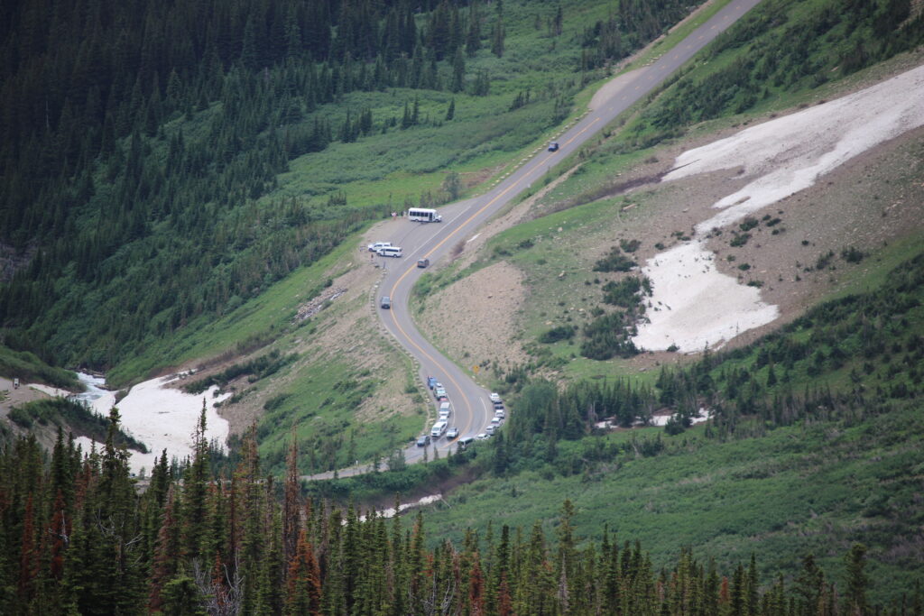
We started our way briskly back down the trail. I marveled at the energy we were showing on this hike. After struggling up Avalanche Lake two days ago and showing an alarming amount of trouble getting up to the Foys Lake Overlook yesterday, part of me was concerned that I had just lost my magic. Nope – we were *moving* today. I kept the more-zoomed lens on my camera on the way down as opposed to the way up, hoping (inside my head, not aloud) that I might be able to actually capture the bear encounter this time. Spoilers – no such luck, but I did get this kind of fun picture of Siyeh Bend far below with all the little piggies driving past it.
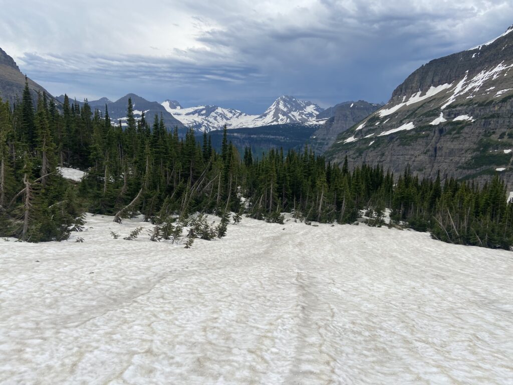
First we had to matriculate the narrow portion of the trail along the flank of Cataract, then the snowfields loomed – all the slipperier from today’s nascent snowmelt. Somehow making the trip back downhill across the snowfields was so much harder than going uphill. I slipped on one and had to half-crawl my way across it. A few moments later, Elizabeth slipped a lot worse. For a scary moment it looked like she might tumble her way down a hundred-foot-long slide of pure ice, but she desperately managed to defeat gravity and crawl to a halt. Unfortunately, in the save, our sunscreen bottle popped out of the side pocket of her Camelbak and began tumbling down the snowfield. I watched it glumly until it clanked to a halt at the bottom among the scree that the trail was carved into. Maybe this isn’t something I should admit, but there was a moment where I wondered whether I should just leave the sunscreen there to rot until the end of eternity or until a marmot ate it. But no. Who could leave trash in this literal paradise and then be able to look themselves in the mirror? So that’s how I ended up picking my way through a field of loose scree to get a bottle of Coppertone. It was treacherous, arduous work, and then it was even more arduous to get back up to the trail. You can imagine that I was less than amused when I turned around and saw that instead of tracking me to see if I was alive, Elizabeth was talking to some hikers heading up to the pass. Yes, she was talking about the bear again.
That sort of became Elizabeth’s whole schtick. At the slightest prompting (oftentimes no prompting), she brought the bear up. It turned out that the Piegan Pass trail isn’t as “backcountry” as I thought it was, we had just started the hike early. With each mile back down the mountain, the crowds became larger. I wouldn’t necessarily call these hikers the little piggies – they weren’t as hardcore as the early groups Elizabeth and I had a permanent kindred bond with, but they were certainly all in shape and none of them were what I would call “Instagram girls” that flooded Avalanche Lake – but the dude carrying his baby in a front pack was a pretty impressive feat, at least.
A punishing pace up, and a punishing pace back down. The sunny day on the continental divide had once again faded in a burst of cirrus and wispy clouds that gradually faded into an ice blue off to the southwest. I’d seen that story before on Lake McDonald. That story meant a thunderstorm was coming.
You could tell Elizabeth was a) tired from the early morning, and b) dreading the moment we went below the treeline. I felt a lot less nervous than I had during the splendid isolation of the sunrise, especially during the long southward stretch after we hooked back up with the Siyeh Pass trail where we traveled unobtrusively behind another couple. You could practically see the thought bubble in Elizabeth’s head: Let them be the bear magnets. A brief rain started falling when we still had about a mile to go, but it was no more than just enough to serve as a splendid cool-off. The only nature we saw was a ground squirrel carrying a baby in its mouth.
Things got a little more tense after the trail reached the southern junction, where we doubled back to hike down to Siyeh Bend. There, the vegetative cover increased and the hiking traffic decreased. Elizabeth started singing “where the bears at, bears at” a little bit louder and kept sneaking looks downhill to her left. In my mind, I was judging where the bear had been. Right about… there. Of course it wasn’t still in the same spot it had been 4 hours earlier. I breathed a sigh of relief regardless.
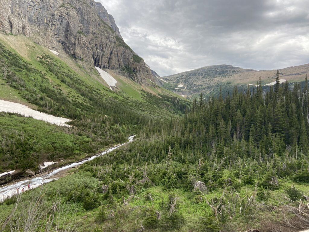
Then it was on to the final stretch, back in the relatively open ground along Siyeh Creek. I stopped for a second and marveled that we were down in this valley, but just an hour before we’d been hiking way up near the crest of the mountain.
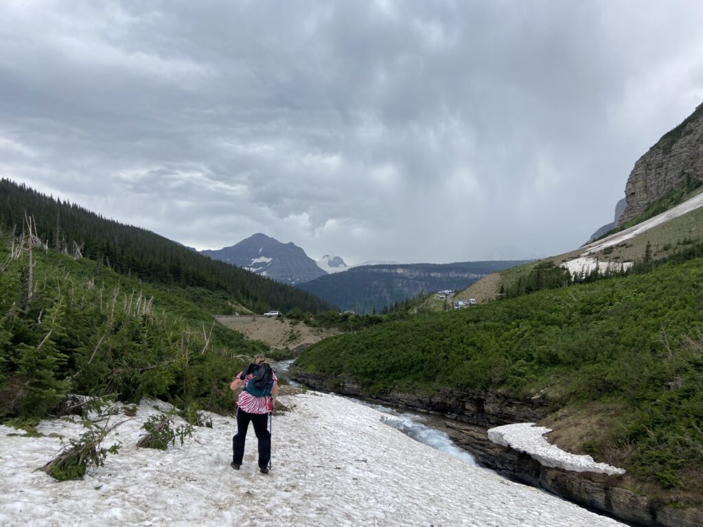
Not much time to stop and smell the metaphorical roses, though. With less than a quarter mile to go, the weather switched from “ominous” to “uh oh”. A big wind kicked up the valley and blew in our faces, flapping Elizabeth’s hat and making it that much harder to keep our footing on the snowfields. Rain spat into our faces in fits and bursts. The best part of being in the mountains is having no clue if it’s going to get worse. The end of the trail and the climb back up to GTSR at Siyeh Bend was less of a triumphant stroll and more of an eager-beaver scramble.
We had completed the trail to Piegan Pass! It was still early in the afternoon on July 15. Once the two of us had had some time to eat more Goldfish and catch our breaths in the car, there was a whole afternoon to explore, hike, drive, do whatever we wanted. And that’s a pretty precious commodity in the national park game.
This hike definitely has gone down in history as one of my favorite two, along with Delta Lake in Grand Teton. I couldn’t tell you which one had a better view – probably Delta Lake, but that’s like comparing the Mona Lisa to Michaelangelo’s David. I don’t think there’s a loser. Our bear encounter was certainly one of the all-time great adrenaline moments I’ve had in nature. It turns out that my fear of bears is healthy and not paralyzing, as long as the bear is dozens of yards away and sitting on a log with no inclination to get up. I don’t think I need to repeat that moment anytime soon, but if it happens again it won’t be the end of the world. For me, at least. Guest post coming soon on the other side of things.
The most underrated part of this hike was definitely getting to watch the marmots. Those are some funny-ass buggers. Elizabeth got to literally play tug of war with one! If I could do it again, I think we would still get to the trailhead as early as we did, simply because being out there so early made it more special. It felt like being in an elite club, and the early morning sunlight made for some epic photography.
For now, we had a storm to wait out, which we might as well do up at Logan Pass, where we could find out if the Hidden Lake trail would open before we left.