I’m on my 6th year living in Oklahoma, and have seen quite a bit of what I wanted to see storm chasing. I’ve caught tornadoes in 5 states, seen giant hail, and seen some of the greatest storm structure days of the last decade. I’ve had the chance to participate in field projects that made me feel like Bill Paxton in Twister, had to push a muddy car up a hill, and felt the jaw-clenching tension of a positive lightning barrage all around my car. Most of the storm chasing experiences I wanted have occurred, but there’s one that still eludes me. The career shot. A beautiful tornado from up close, or else an insane structure shot with a tornado at the bottom. Something I can happily frame to hang in my living room and guarantee that people will comment on it. Some close experiences include the Imperial, Nebraska storm in 2019, or the Protection, Kansas storm in 2018. The tornadoes came close to legendary in Springer, Oklahoma in 2020 or Clarendon, Texas in 2021. But nothing yet has been the career shot that I can hang up my atlases happily after catching. That’s what 2022’s goal was for me.
Early spring was not particularly kind for this. In March and April, I was often deployed with the PERiLS project prior to any potential severe weather on the Plains. As annoying as this was, I didn’t really miss anything across Kansas, Oklahoma, or north Texas throughout the entire project. The Plains remained quiet, with weak forcing or capping ruining the few opportunities that existed for events. Finally, on April 22, we got in our first chase of the year. Elizabeth, Stephen, and myself headed to the Panhandle in the strongest southerly winds I had ever experienced, which kicked up a classic High Plains dust storm to obscure the visual of storms themselves.
Things improved toward sunset and we were rewarded for a day of dust-busting and hard driving with a decent LP supercell near Spearman, Texas:
All in all, it was a pretty good day to start the storm season. Nothing epic, but not a bust by any means.
The next day, I chased solo with Scipio on a supercell that developed near the town of Verden, Oklahoma and tracked basically right over Will Rogers Airport. Despite weak-ish low-level instability, it managed to wrap up and produce a tornado near the town of Amber. I was in perfect position to see the tornado from the notch – but the tornado was entirely wrapped in rain.
And then last Friday, April 29, Sam, Elizabeth, Maresa, and myself waited for CI north of Oklahoma City along a bubbling dryline that promptly stopped bubbling at 6:00. We were left with a complete cap bust.
And that brings me to Monday, May 2, in the middle of an obviously underwhelming season. Models showed the looming specter of a Death Ridge cutting off much of the peak season, so time was running low. But obviously a chance existed, since I am sitting here writing a log about it. It was sort of one of those “compact shortwave trough impinges on an unstable environment with a sharpening triple point” sort of days. In other words, one of those “drive here, dummy” days.

We need to make sure not to mess these kinds of days up. They’re a precious commodity.
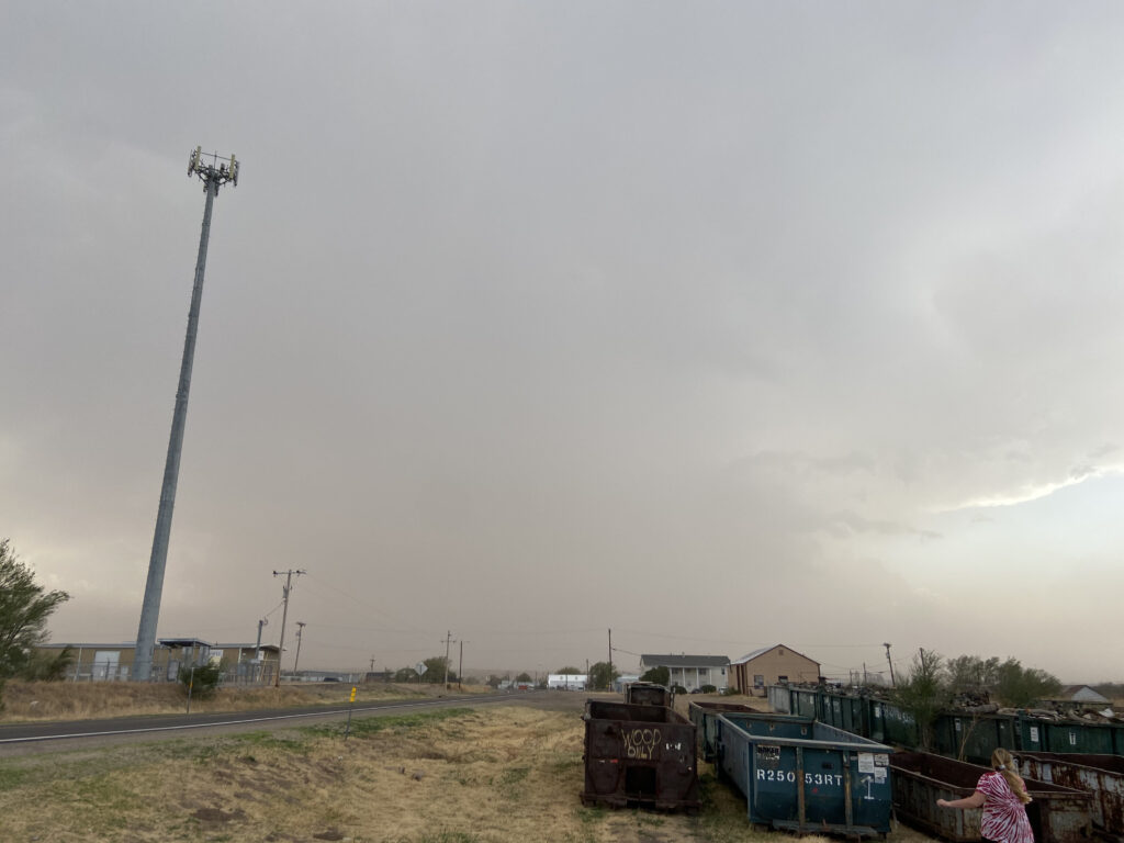
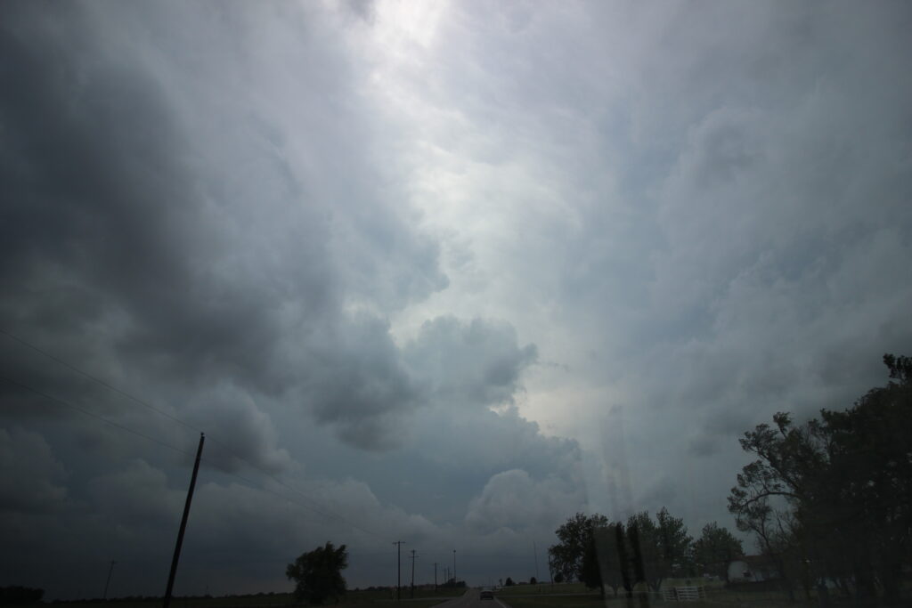
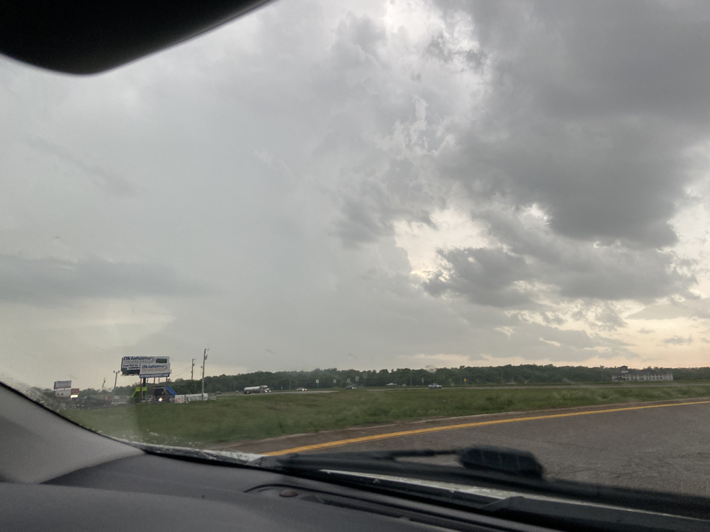
Unfortunately, my final presentation in boundary layer didn’t occur until 1:00 in the afternoon. If you know anything about triple point events, it’s that you don’t want to be late. So I was feeling tense all the way up until it was time to leave. Oh, and it didn’t help that I spent the morning at Enterprise Rentals picking up a rental car for TORUS 2022, which was a little tough to do thanks to a deluging MCS:
So I was nowhere near as optimistic on Monday as I had been before cap busting 3 days prior. But optimism is for chumps, and so is pessimism. The weather does what it wants. For a while Sam and I floundered to find anyone else to join us – Elizabeth had a paper due the next day, and grad students are notoriously not thrilled about storm chasing – but eventually we found Maresa and Arianna looking for people to chase with as well. Maresa offered up her Corolla and Arianna offered to drive it (not sure why they went with that orientation, but whatever). We agreed to meet at the Asp Parking Garage immediately after boundary layer presentations. I hoped class would let out early, but instead my classmates spent 15 minutes grilling me (and only me) over my talk. So I was already in a bad mood by the time I arrived at the garage to put my car in safety. It didn’t help that blips were going up on radar near Woodward before we had even left Norman. Furthermore, in a communication mix-up Arianna ended up at the Jenkins garage instead of the Asp one. Precious minutes ticked away while we hustled over to meet her there. Precious more minutes ticked away in traffic on campus. Finally, we got on I-35 in time to see a big-probability tornado watch get issued.
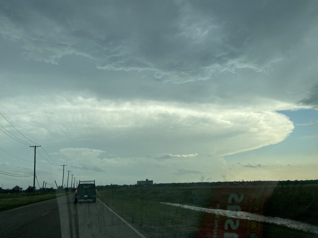
I told Arianna we needed to get on our horses to catch up to the convection and she took me to heart – perhaps too much so. We made excellent time up I-35 while I studied the road network in and around Enid – the rendezvous point of choice for Sam and myself. The triple point convection continued to bubble and acquire those classic strong mesos that triple point storms form while they’re still small, from the Oklahoma-Kansas border down towards Seiling. Of more immediate importance were the blips showing on radar down the dryline. If the dryline went, that could very well be the play, particularly given the messy look to the line of storms on the triple point. The blip I was really liking was near Weatherford and Custer City, drifting northeastward toward Watonga. That was the blip that gave me the confidence to adjust our target area southward, and I directed Arianna to get off on OK-51 near Mulhall instead of continuing all the way to US-412. Apparently being freed from the constraints of the Interstate allowed Arianna to follow my “blast” instructions even further, to the point where I was a little bit uncomfortable. But also, there was no doubt we were closing on the southern end of the cluster and the blip near Watonga.
By the time we neared Hennessey, the crisp cumulus field gave way to skyscraper towers. The anvil from the stuff to the northwest was visible and I had a course we could take to play it near Ames. However, Sam and I were feeling more and more confident that the move was to take the developing storm northeast of Watonga. If it rooted and turned right like I thought, it would pass somewhere just north of the city of Kingfisher. County Road 2830 just west of Hennessey was the perfect route – paved almost all the way to OK-3 near Kingfisher, we could use it to get into the inflow region well ahead of the other chasers and set up in primo position for the tornadoes that now felt like this storm could produce. My spirits had been rising with each mile north and west – now I was ebullient.
Arianna bombed down 2830, only getting slowed briefly by a tractor heading southbound on the 2-lane road. The supercell was definitely still in its growth phase on radar, but that didn’t stop it from having a strong meso. Tinie Tempah’s “Written In the Stars”, my 2022 chasing pump-up song of choice, blasted through Maresa’s car while we slowly rounded the core. The song was interrupted by the shrill, constant tone of my phone’s WEA as NWS Norman issued a tornado warning. So far, we were some of the only chasers on the storm as everyone else was just now collapsing down from Fairview. Up close, it was getting better, though with much further to go before it was ready to pop.
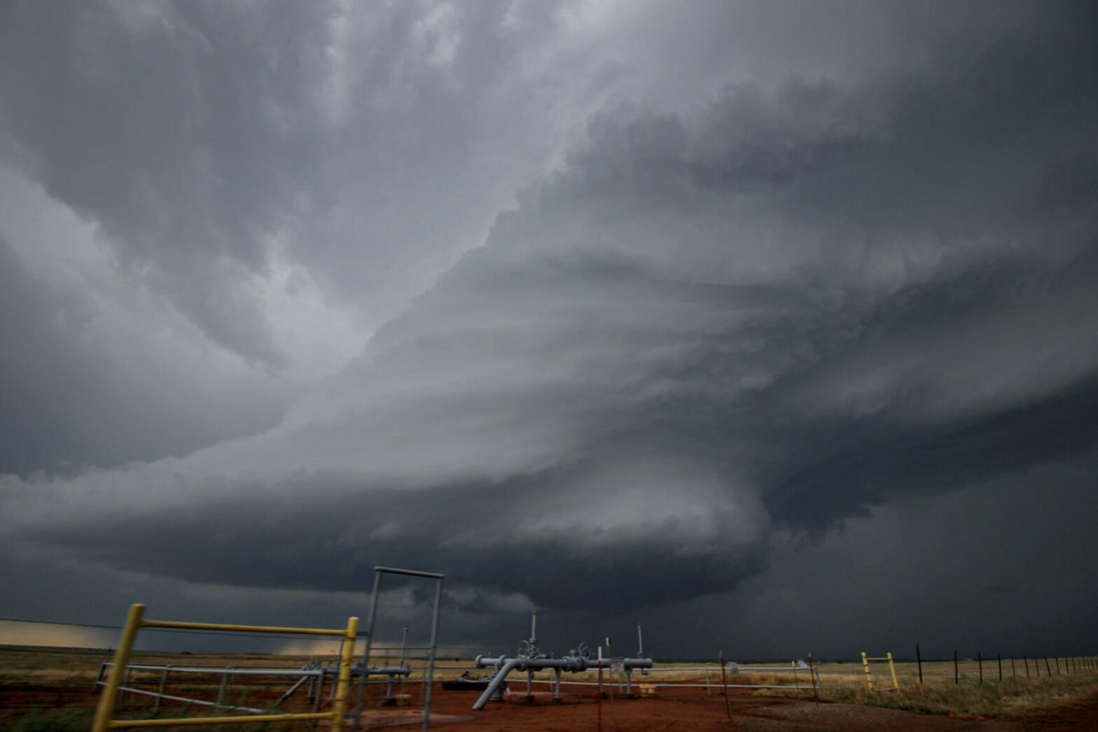
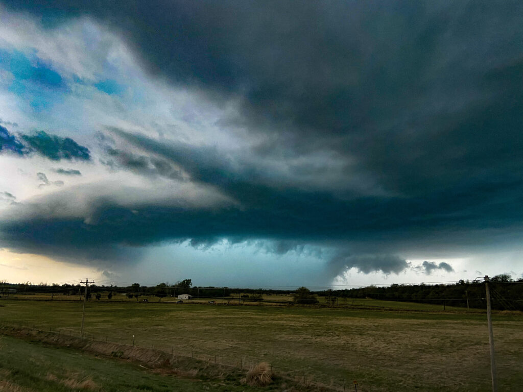
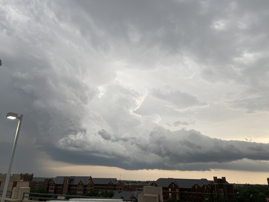
From our perspective, a bell-shaped meso was just now emerging from the gloom of the core.
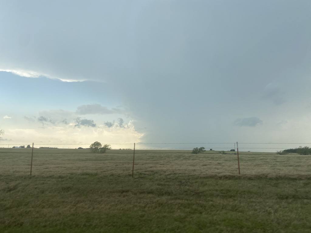
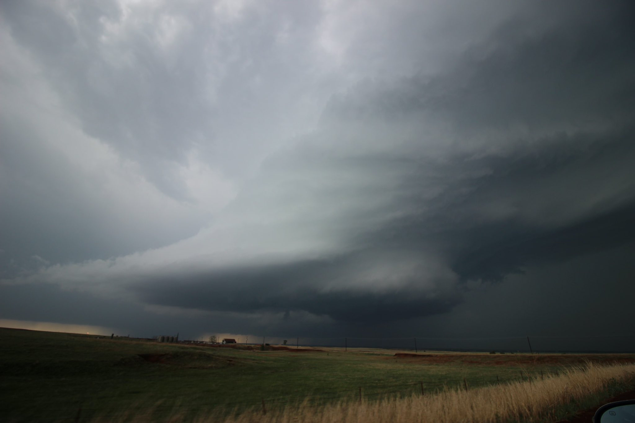
Arianna, who had never seen a tornado before, was freaking out. Even I figured there was a 50-60 percent chance this storm got the job done, which is alarmingly high for my often-bitten self. Our southbound road briefly became gravel and I had to let Arianna know we were going to get her a vantage point as soon as possible to keep her eyes from wandering too much. County Road 780 was paved and offered a path west to the storm which was now directly in front of us. The full view of the storm structure was insane – it was a classic supercell with a rock-hard meso. There wasn’t anything at the bottom that seemed to indicate an imminent tornado, but the base showed signs of a big RFD that could cut out a tornado in the next few minutes. We looked and looked for a spot to pull off, and found one 3 miles to the west along County Road 2800 just north of the intersection. The entire mesocyclone was spread out to our west.
While we stood there, gawking at the insanity beginning to unfold, a sporadic rain began, ripping in from the southeast. Arianna was in awe. Sam and I were giddy. Maresa was probably happy as well, although somewhat less demonstrative. The right side of the updraft came into view – it had that lifted vault on the north side that you sometimes see in violent tornado pictures. I wasn’t expecting a violent tornado, but the odds of an actual tornado seemed strong.
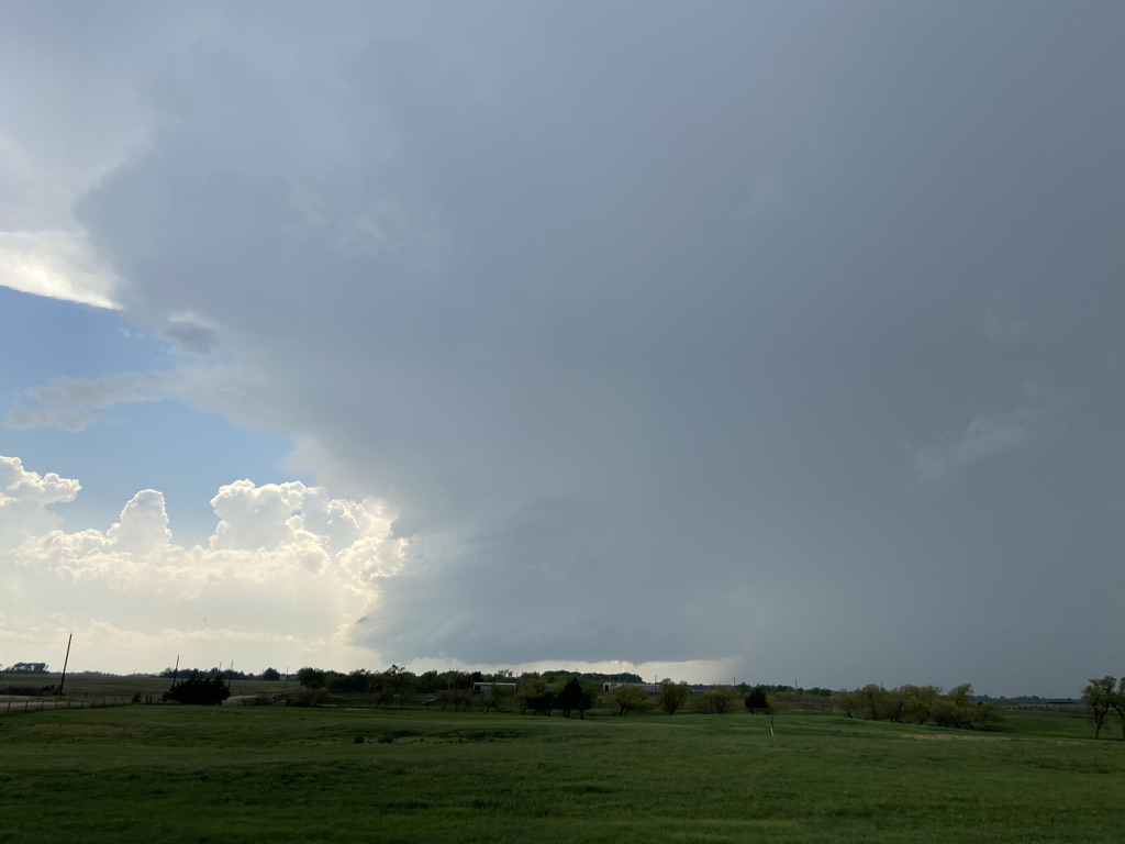
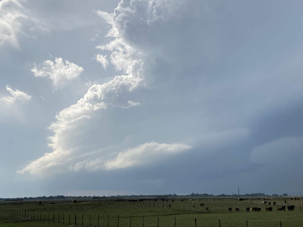
*That* is grade-A supercell structure. That’s the stuff I wait all winter for. Maybe not *the* retirement shot, but nothing to sneeze at. In the few minutes we sat there, getting edged by the core with no cell service, the storm continued to kick up little wall clouds and wispy things. It was pretty hard to tell because of the trees in the distance, but after a while I was pretty sure we were looking at Arianna’s first-ever tornado.
I suggested that we relocate a hundred yards or so to the north to get a better view under the wall cloud. We all got in the car and moved to the edge of a pasture with a better viewpoint to the west-northwest. If anything, the incredible structure was getting even better with slightly decreased distance. Two farmers stopped alongside us in a truck with Oklahoma State plates towing a flatbed. They did the typical farmer thing where they ask if we’re the storm chasers, and then ran through the local tornado history of Kingfisher County. Meanwhile, the storm churned.
While we talked, we watched the attempts at what NWS Norman would initially quantify as 4 tornadoes, but revise down to 2 later on. Most were wispy funnels beneath the transient wall cloud that had tiny ground circulations if you were sitting right under the meso, which storm chasers bailing from the Fairview storm were beginning to do. While the farmers continued to ramble about their extensive knowledge of tornadoes, the sun came out behind the updraft and immediately ruined the contrast. This was unfortunate timing, because…
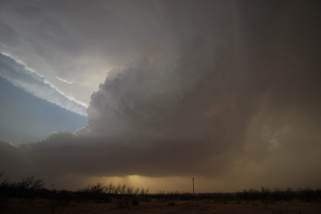
“Big cone!” I pointed to the northwest across the horses, where a grey tornado was visible. It was tough to see because of the sunshine and the distance (shouldn’t the storm be closing on us?), but it was definitely, 100% a tornado. Fortunately for me, I have a 200 mm lens and a Lightroom subscription to prove it.
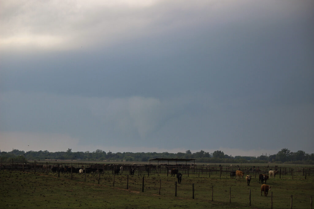
Sort of like Springer if the contrast sucked, and the tornado sucked, but at least the RFD cuts were kind of similar.
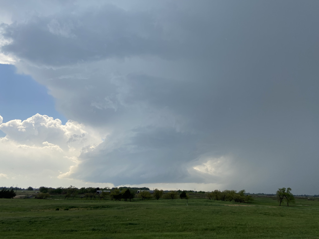
The meso kept occluding away from us, and it seemed we would have to pursue northward. If I had my wits about me, I would wonder why a supercell that we had set up due east of was now somewhere northwest of us when we’d expected near due-east motions. But in the heat of the moment and without much cell coverage, we were playing purely by visual, which said to go for it. The farmers let us know that the dirt road we were on was well-packed for another 4 miles up to the next paved road. Foreshadow time: we really should have listened to them. But we wanted to gain a little bit of ground to the west, so once Arianna had gone north a mile we had her go west another mile and close on the meso.
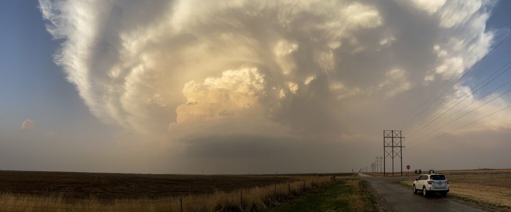
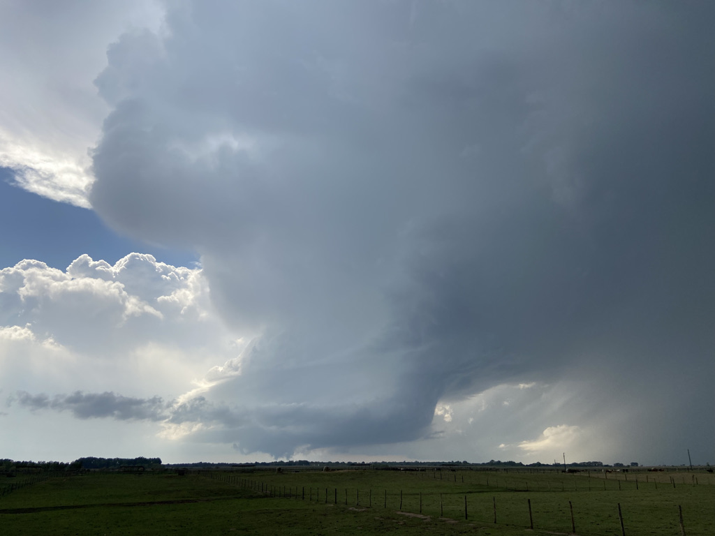
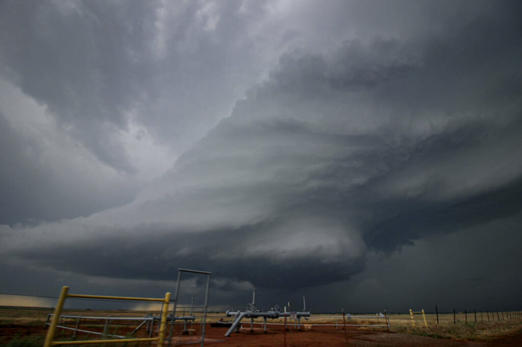
We entered back into the dark, gloomy skies under the meso, which somehow was getting even more sculpted. This road was a lot less good than the one a mile east had been, but I was optimistic we could get to where we needed to go. This was especially true since the storm didn’t seem to be moving much. There were updrafts going up behind it that threatened to bonk into this one and make the whole line go upscale, but for now it was still discrete. Arianna was going a little faster than I would have liked, and at one point when blasting through a puddle that kicked red clay all over Maresa’s car. But importantly, we were staying out of the core to our north and the incredible mesocyclone was just off to our left. Sam got my camera out the window with the 10 mm lens and did work. Check this out:
Storms are pretty cool.
We raced alongside the meso for a couple of miles on County Road 2790, which was wet from the forward flank but supporting Maresa’s car. Arianna crested a little hill and started to go down… except our road was ending at County Road 730, one mile short of pavement. Guess we shouldn’t have gone west. Arianna tried to throw the car onto 730, but was going way too fast on the slick road and we spun right towards a fence. Fortunately, what the mud took away, it also gave us, and our momentum stopped before we careened into a fence in a ditch at 15 mph. After taking a moment to catch our breath, she tried to go east on 730. Unfortunately, that road was pure, wet clay. There was absolutely no traction, and Maresa’s traction control kept autoengaging the brakes.
We had one mile to go before the next north option that reached pavement. There wasn’t much of an option to turn around now that we were committed and shimmying down the road. There wasn’t much of an option for anything, in fact, other than watching the storm churn to our north while Arianna slowly eased down the road. She never managed to get above 10 mph, and at times the car slowed to a total crawl. It was a white-knuckle situation, knowing that if the car came to a rest in the soupy clay it may not get out until someone came to tow it. About 1/3 of the mile down, we reached a small rise where that actually happened. Earlier, I had joked that because I was wearing presenter’s clothes, including my Sperry’s, that I was exempt from pushing the car due to Scott Reinhardt’s “boat shoes” rule of 2017. Turns out it wasn’t a joke. Sam got out and put some muscle into it. The car churned as Arianna tried to get the wheels turning. Slowly, we got going again and crested the rise. The car gained speed. Only one problem: Sam was running behind it. He came around, threw open the door, and tried to jump in while it was moving. I watched as Sam teetered on the edge of the car for a second before he actually managed to get in and avoid the disaster of landing in the mud. Huge sigh of relief.
In fact, we had to repeat the process of pushing over the hill once more over the 15 or so interminable minutes before we hit the intersection. By this point, it had become clear that storms were growing upscale into a nasty MCS right behind this supercell and were going to engulf it before it could produce another tornado. The sigh of relief I issued when we hit firmer gravel was especially loud because I was worried about the amount of rain the road was still yet to take. The meso had occluded to the northeast by the time we got back in the chase, and this portion of the chase looked dead. It was time to look ahead to the next process – a storm had developed in the “danger zone” for the south Metro around Apache and was gaining a mean look as it traveled northeast. If we got back to US-81 and dove south fast, we could play it before the storm impacted Norman, Noble, or Purcell.
Once more, Arianna was more than up to the task of closing the distance on a supercell. We took 81 to Okarche, barely beating a mesovortex from the developing MCS into town, and then took OK-3 to OK-4 and headed toward Yukon.
The supercell drifted northeast, with Jason Myers and few other people on it. At one point, it produced a brief tornado.
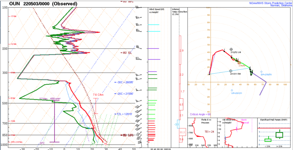
But then something weird happened. Much like our storm before, which had looked primed to go, this storm’s meso wandered to the northwest side of the core and essentially formed an upside down supercell. That orientation allowed the storm to suck in a lot of rain-cooled air and kept it from going big. Why was this? I’m not entirely sure, but the 0Z Norman sounding (which got some beautiful electrical feedback from the storm) shows what could have been:
Instead, the storm clearly withered by the time we made it out of traffic and got to Highway 9 in Blanchard. I could see the updraft from the north side, which is not necessarily a great sign for supercell longevity. We paralleled it for a while down Highway 9 while also keeping an eye to the northwest, where a giant shelf proclaimed that we were about to get whacked. The conundrum when we got to Riverwind: on the one hand, the supercell looked like it was making a last, dying LP gasp at doing something before getting absorbed. On the other hand, going after it meant riding out the MCS in a field somewhere near Slaughterville or Purcell.
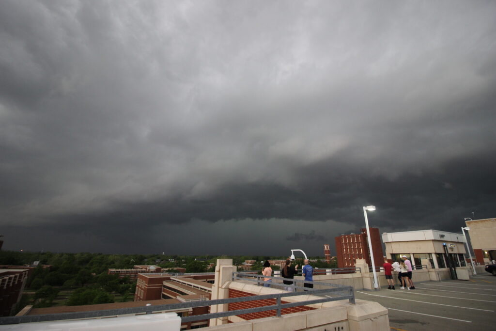
We decided to go to the Asp Garage and ride the MCS out there. Only one issue: in a post April-2021-hailstorm world, everyone on campus freaks out when a severe thunderstorm warning is issued. Traffic was completely backed up everywhere in the garage. There were no spots available, and people just parking willy nilly in the margins where they could, and frat guys milling about. Sam went on up to the roof and texted me to get up asap. Finally, I told Arianna just to get to the roof since nobody was going to park there. As long as we shielded ourselves from the wind, it would be fine, right?
Turns out this was the right move. NWS Norman issued a tornado warning for our supercell, which was hanging out just south of Norman and somehow becoming even more LP with time. Right at the time I got up to the top, the supercell split for the last time. The view from the garage roof was beautiful.
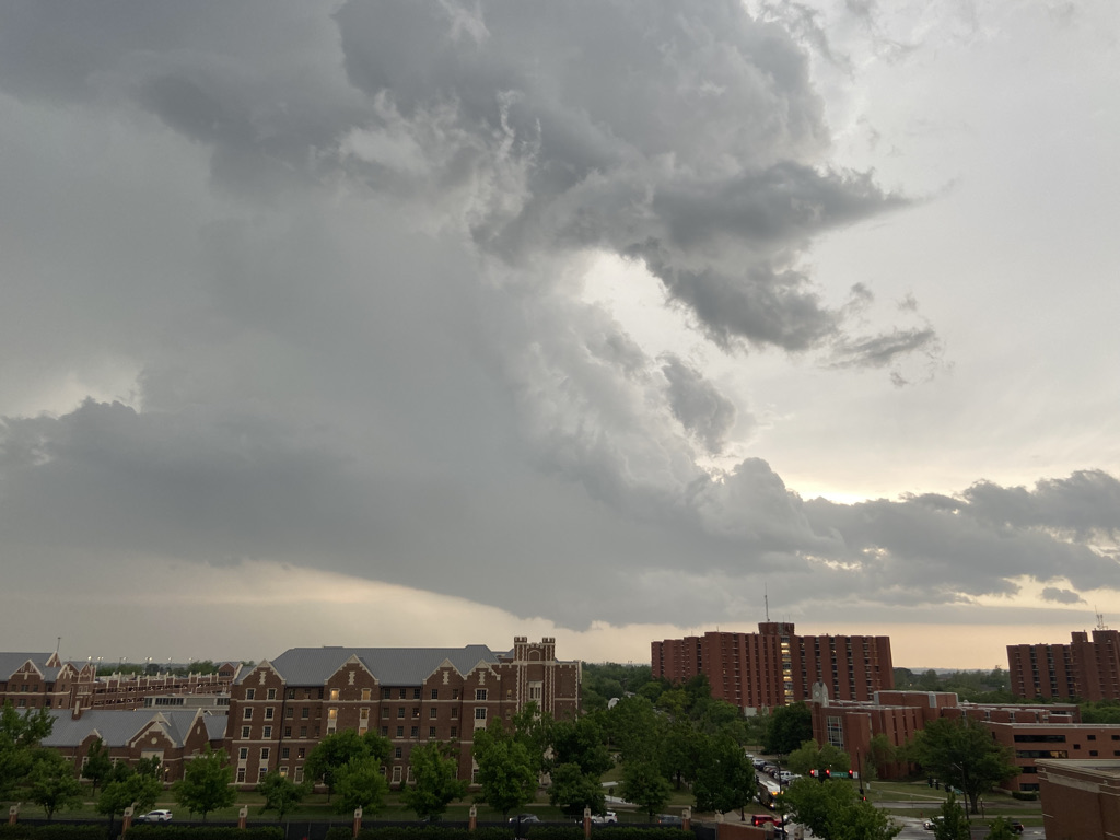
Gradually, as the storm’s base began to shrivel up and die, the left split got out of the way so that we could see the updrafts. It was a beautiful, unique view: splitting supercells still joined in the middle with a full view underneath them. Elizabeth was sitting right under them in south Norman and said the right split was spinning like a top.
What a homecoming view. On the other side, there was quite the shelf bearing down on the 10-20 or so meteorology students crowding the roof.
And here came the outflow, rushing ahead of the MCS. The warm, humid day quickly turned chilly and breezy. The four of us retreated back into the safety of the garage as the heavens opened forth with a big old droughtbuster. After a few minutes of listening to the deluge, I got bored and decided to head home (I needed dinner, after all). Probably should have rushed a little less to get back to the comfort of bed, because I left my backpack in Maresa’s trunk. Oops!
Elizabeth and Scipio greeted a soaked Nolan at home, where water was already ponding over our sidewalk. I ate some food and waited for the skies to turn that tell-tale yellow color that means the MCS is passing by and its rainbow time. After a while, I saw it – weak sunlight filtering through. Even though the rain was still coming down, I leashed up Scipio and headed out to the front. We were greeted with a vibrant double rainbow.
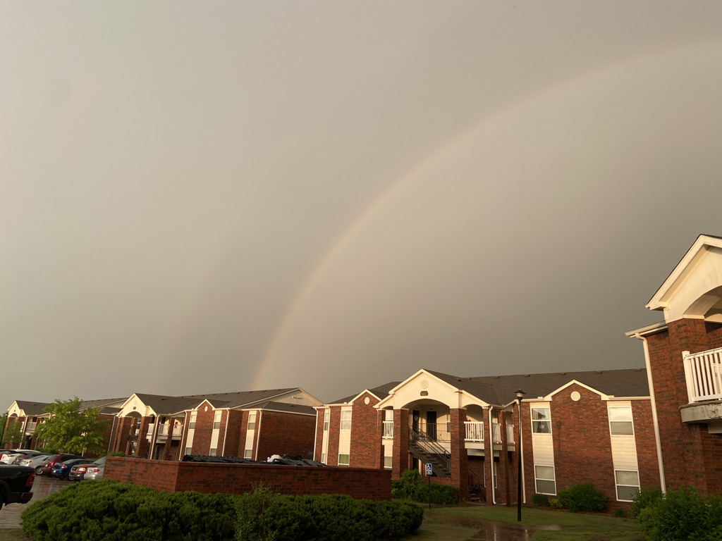
I was more excited than him, to be fair.
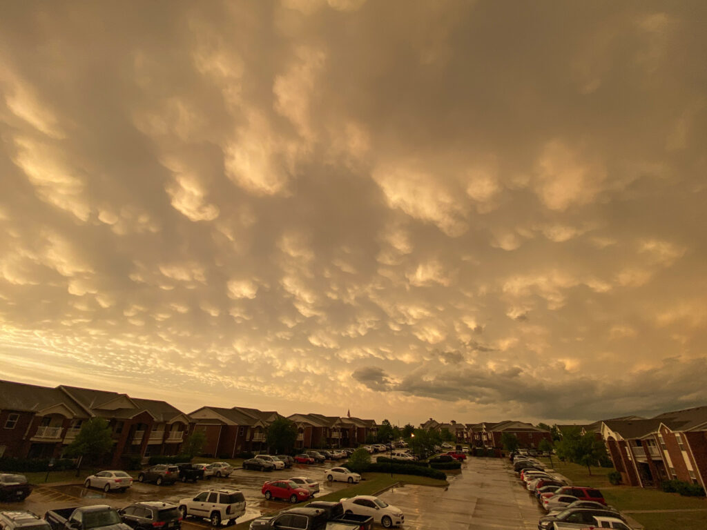
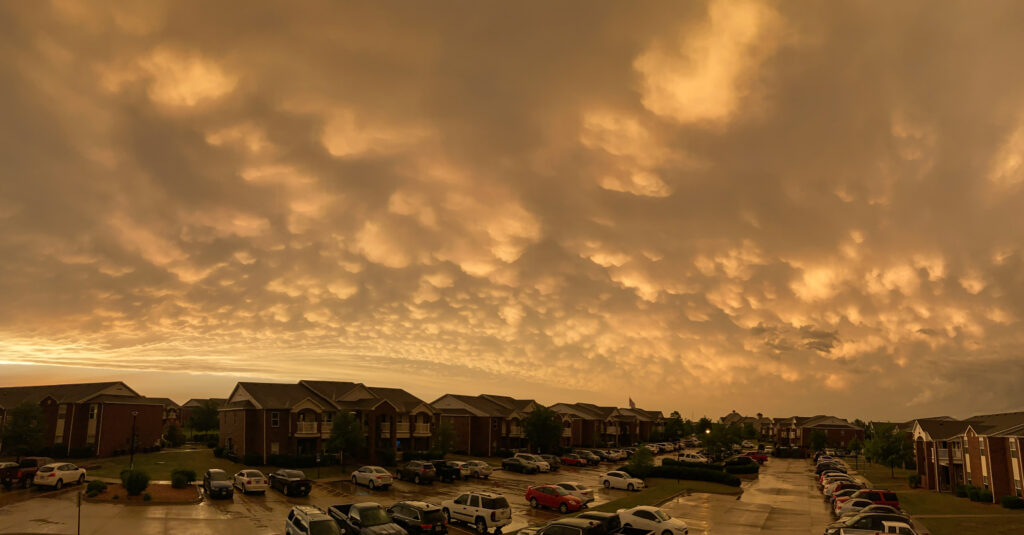
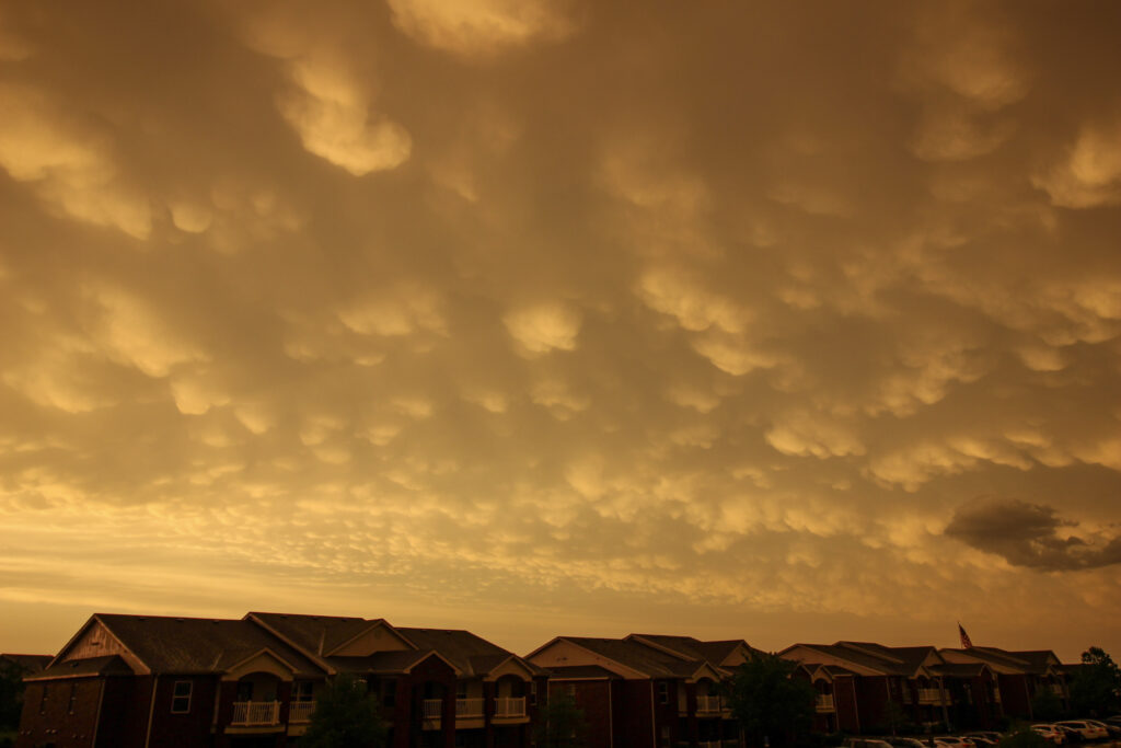
If I thought that was all the night had to offer, I was mistaken. The mammatus show that began at sunset was actually top-tier. Maybe some smoke from the ever-present New Mexico wildfires was mixing in behind the dryline or something, because the whole sky went from the bathwater color to yellow to a vibrant orange right at mammatus time.
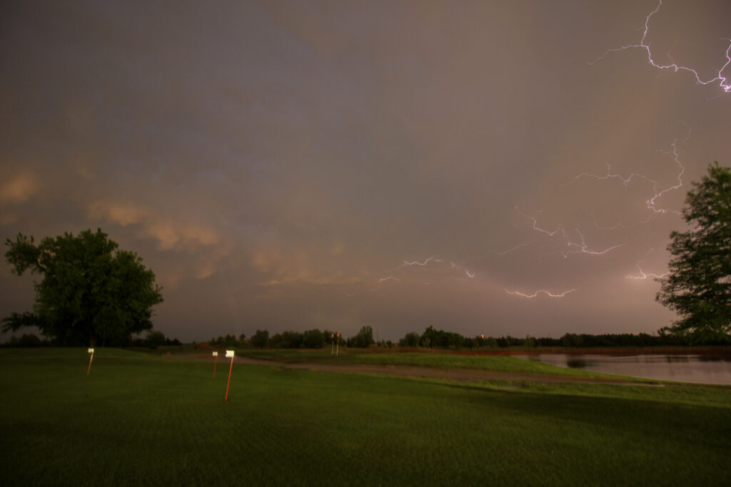
And somehow, the night still had time to put on a show. I met Sam at The Links’ pro shop at twilight so we could enjoy the intense anvil crawler show the MCS was putting on. This was also one of the best crawler events of my life. I was even able to get a few strikes on the Canon, although with no skill because I remain a terrible photographer.
So no, May 2, 2022 was not the day that I got a career shot. Instead, I had to settle for some of the best supercell structure I have seen with a couple of not-terrible tornadoes, as well as another beautiful LP supercell, followed by a great rainbow and mammatus show and beautiful lightning. In a way, I’d gotten the whole Plains experience in 1 day. With such a busy schedule and TORUS/thesis defenses approaching, it’s like life wanted to hand me all at once.