Our clockwise loop from Midway Geyser basin back to the return point was complete. It had been a busy, rainy, and cold day – the kind of day that could really be rescued by a nice dinner. Unfortunately, our experience two nights ago in Canyon Village underscored how difficult it might be to actually get dinner at Canyon. The Eatery had had a full hour wait to get food, and Elizabeth still wanted to visit the Grand Canyon of Yellowstone before the end of the night. It was a bit of an irony that we were staying in Canyon Village, less than a mile from one of the great natural wonders of the U.S, and yet at the end of the third day we hadn’t seen the canyon itself. I was willing to go check it out once I’d been fortified with a little bit of dinner.
Which… proved to be difficult. After ruling out the Canyon Eatery, and with our expected restaurant for the night (the Canyon Fountain and Grill) being closed due to covid/staffing shortages, we were left with little choice except to scavenge whatever we could from the Canyon General Store. Which was… not much. The general store at long-ago Colter Bay knocked this one completely out of the park. What little saving grace this general store had was mostly tied up in the fact that at least there was a microwave. That meant I could get a can of Chef Boyardee, and Elizabeth could get a cup of ramen, and we could heat up our sad dinners to eat outside. At least there was a type of beer I’d been looking for ever since my dad mentioned having it a week prior.
This is a delicious beer, I remember.
After the three of us had our meal (one of, if not the very saddest, of the entire trip), Elizabeth prevailed on us to head over to the Grand Canyon and at least check out the North Rim.

The Canyon is kind of a weird thing. The Yellowstone River meanders picturesquely through Hayden Valley, its waters in no particular rush to begin the downward trek to the Gulf of Mexico thousands of miles away. The Grand Loop Road follows the river through the valley from the lake all the way to within a half mile or so of the Upper Falls, where it bends away slightly while the river enters a more restrained channel. From the little parking lot leading to the Brink of the Upper Falls, it’s clear that there’s a geological change in the air. A little creek sluices by the trail heading to the Upper Falls, and it’s got a gorge of its own. Still, the terrain is mostly flat leading down to the viewing platform right alongside the waterfall.
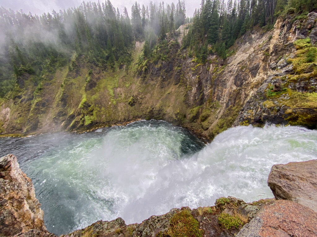
I could hear it first – a steady, roaring rush of water plummeting over 100 feet into a pool far below. A roar that has continued nonstop since long before any primate ever thought about standing up on their back legs. Mist ripped up onto the viewing platform, thousands of gallons of water being tossed by gravity and disintegrating far below. It was pretty incredible. Off to the right, the river gets constricted into a narrow gorge and becomes a whitewater torrent – but it’s still a river. It’s not until you look straight ahead from the viewing platform and see the green waters froth and foam right at the brink that you realize whoa, the ground stops just left of me. And then – cascade. Far below, a circular pool of churning green foamy river water rages before it enters the slightly calmer channel to its left. On all sides of this pool and the river are cliff faces covered in mossy green rock – the head of the Grand Canyon of the Yellowstone.

I seem to say this in every post, but: this was absolutely breathtaking. And somehow, this was both the most unique and arguably the worst view we would have of the Grand Canyon. From here we were going to see the canyon at its deepest, with the walls that put the “yellow” into “Yellowstone”. But even this view of the Upper Falls, with its rising steam, green water and Mordor moss vibes, probably rivals any other waterfall I’d seen in my life until then.
We backtracked to the Grand Loop Road and traveled a bit north until we came upon the one-way North Rim Drive. It leads back into Canyon Village in a counterclockwise direction, making stops at some of the most famous locations along the Grand Canyon. The first was the arduous hike down to the Brink of the Lower Falls. Unlike its brother at the Upper Falls, this one tumbles hundreds of feet down (paved, at least) switchbacks into the Canyon before it finally reaches the waterfall. I’d have been game to wander down there – my parents did so, and said it was beyond worth it – but it was wet and Pam only had tennis shoes, not hiking boots like me. So we decided to stay away from the big downhill climb out of an abundance of caution. Add it to the improbably long list of things I still need to do next time I’m in the park. Instead, we drove a little downstream from the Lower Falls to the aptly named Lookout Point. From here, you could walk a couple dozen yards to a viewing platform and – well – look out.
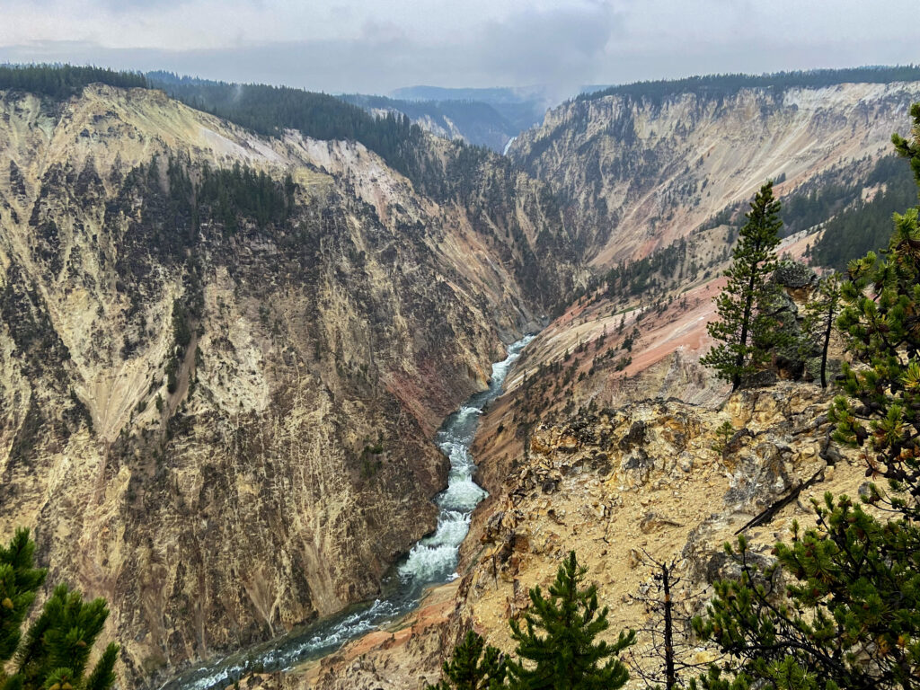
Most notably, for the first time I could actually see the famed yellow walls of the canyon. It was incredible – across the way, the world just plummeted out from under the brave trees growing along the cliffside, descending into a rift the color of a styrofoam egg carton. It was all so craggy and sharply defined, too. I think looking across the canyon to the other side is actually one of those views where you genuinely can’t get the sense of it unless you’re there, looking at it.

The downstream views, too.

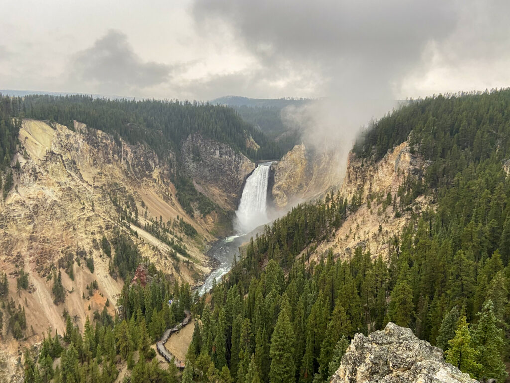
But by far, the most captivating view from this angle was the Lower Falls, roaring in the distance. From this viewing point, once could see the waters of the river come churning in from the Upper Falls, in the not-yet-fully-developed canyon. Most strikingly, you could see the entirety of the surrounding forest, which just looks like – well – a normal forest. It makes it easy to wonder what the Native Americans and first Europeans who stumbled upon this spot thought when the seemingly normal stand of woods suddenly gave way to *this*.

In between, the river continues to carve the canyon ever-deeper, exposing more of that softish yellow rock to the sky. Hot springs can be seen down near the river bed, which helps oxidize some of the rock and turn it the reddish pink that you can occasionally see in the canyon. All of this occurs on a scale that just boggles the mind, and forces you to look at innocuous features like that steam plume coming off of the waterfall just because you can’t process anything else. I know I’ve blogged this repeatedly, but I’ve never seen anything like it. In fact, the knowledge that I’d thought that so many times was why it was right about here that I started thinking of Yellowstone as my favorite national park even though I’d gotten engaged in Grand Teton 5 days ago.
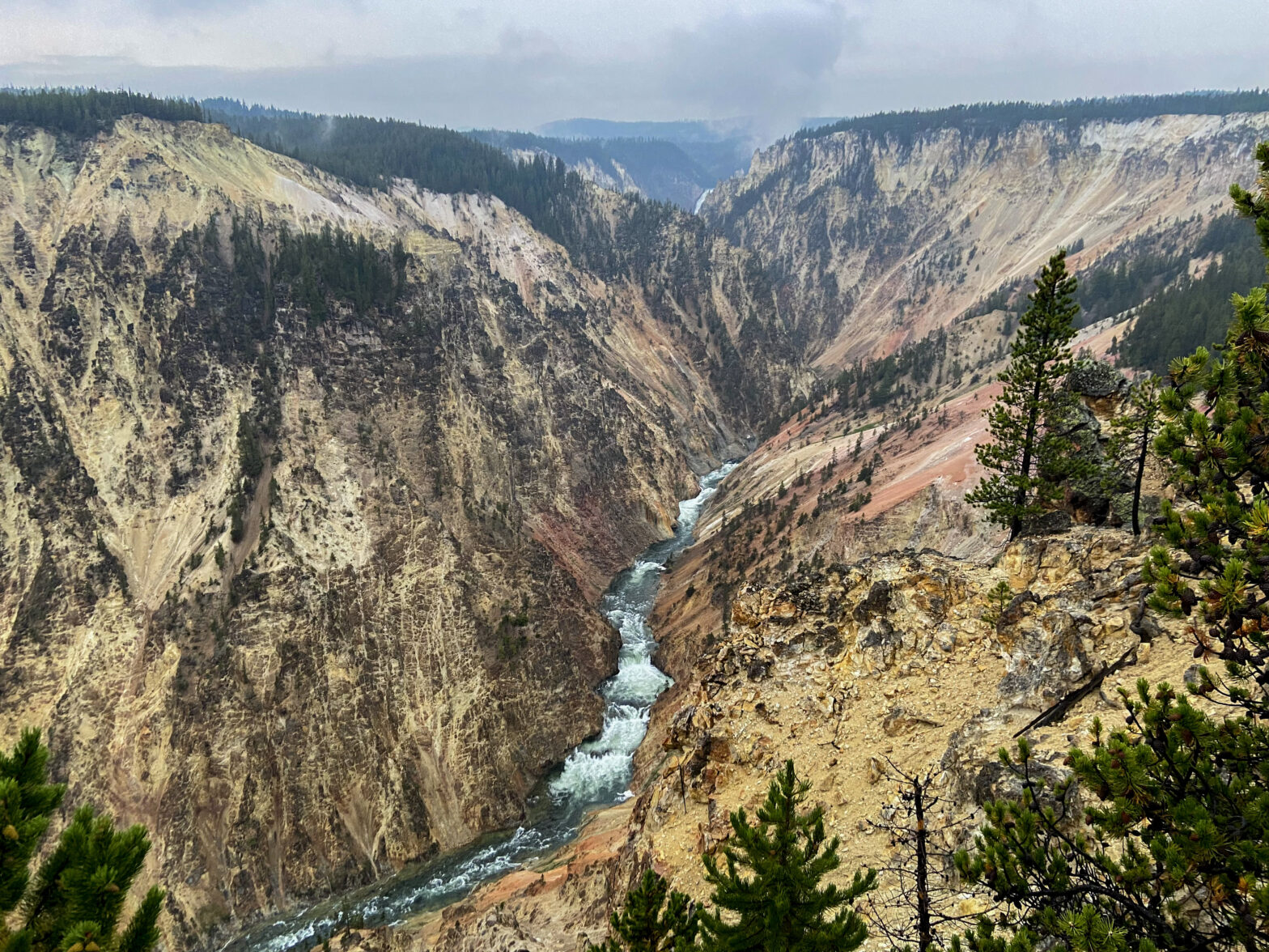
And incredibly, the North Rim still had one more spot to stop at. The close-up shots of the Lower Falls you see come from Lookout Point, but when you want to show the majesty of the Canyon you go to either Inspiration Point on the North Rim or Artist Point on the South Rim. Given that this was North Rim Drive, you’re going to see the view from the former. The dull, grey sky was just now beginning to darken by the time we got out to the rain-slicked viewing platform. Mercifully, the rain and impending sunset tamped down the crowds a ton. The three of us basically had one of the most inspirational – pun intended – views in the United States all to ourselves.

One day when I retire, I’m going to be a camp host at Canyon Campground so that I can go stare at that view every night. I hope it never gets old when I do.
The North Rim Drive terminates right inside Canyon Village. It made for a relaxing finish to the night, which was a welcome relief after the tortured drive back from Lamar Valley the evening before. We were in our tents well before I thought I could actually even fall asleep, and Pam and Elizabeth were snoring through the sprinkly evening sky before long. I had a little bit of time to reflect on a long, eventful day before the exhaustion overtook me as well. Tomorrow – hard as it was to believe – was our last full day in Yellowstone National Park.
