For the first time in a couple of days, we were going back into fully uncharted territory. Having seen most of the vantages of Grand Teton south of Colter Bay, we were now seeing the northern reaches of the Tetons and moving into the rolling terrain of Yellowstone’s southern plateaus. It was kind of hard to tell, though, since much of the northern part of Grand Teton is dominated by lodgepole pines, particularly right along the parkway. Furthermore, since the road followed the Snake River rather closely we remained in a valley. The vistas started to open up as we entered one of the primary 1988 burn scars in the Parkway area – hillsides were covered with the burnt-out remains of trees that had fallen decades prior. With a bit of low cloud cover in place and the ever-persistent smoke, it made for a bit of a miasma for our 15-minute excursion between national parks (was it really only 15 minutes? It felt longer).
We crossed the Snake River one final time here on the Parkway. It was noticeably a bit smaller than further south by the city of Jackson. Funny enough, saying good-bye to the Snake River, one of the principal features of Grand Teton, felt like saying good-bye to an old friend. Although I may have said my good-byes a bit too soon, because we ended up paralleling it right to the south entrance of Yellowstone National Park.
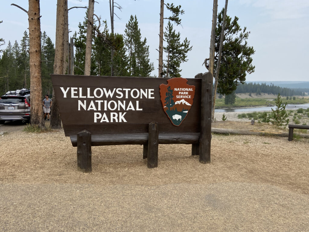
National park number 16 had a bit of special meaning, even compared to national park number 15. Grand Teton is a top 5 national park in annual visitation, so I hesitate to call it a “hipster” national park, but compared to its northern neighbor? Yellowstone is the literal grandfather of all of the world’s national parks, the first of its kind ever created. It’s where Hayden and Colter and Washburn all led their expeditions and found the insane geyser features that no one back east believed in. It’s where Sheridan and the cavalry took command, thus preserving one of the most unique locations on Earth. It’s where children for the past century and a half have been visiting the awe-inspiring thermal features, canyons, mountains, meadows, wildlife, rivers, lakes, hiking trails, cabins, lodges, campgrounds. This was Yellowstone. This was a living, breathing entity. I felt honored even to be in the park boundary.
We barely even had to wait to flash our America The Beautiful pass at the south entrance station. It was noon on August 16, and our afternoon plan was simple: drive up the southern entrance road and then around the northwest rim of Yellowstone Lake, ending the evening at the Canyon Village, our campsite for the next four nights. Along the way, we planned to stop at some of the well-known geyser basins along the way, including West Thumb and the Mud Volcano. But really, this was a day without as firm an itinerary as any of the other days on Elizabeth Leslie’s Great Vacation. It was going to be epic.
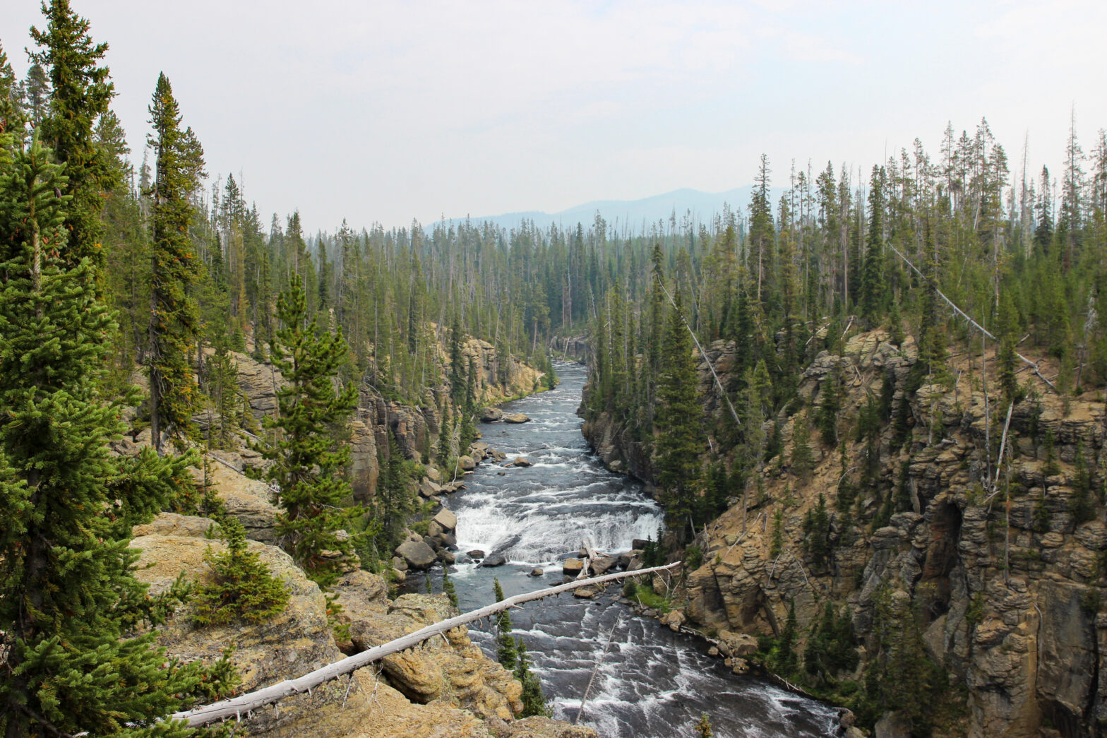
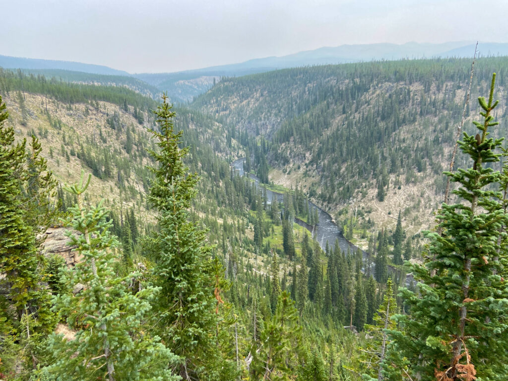
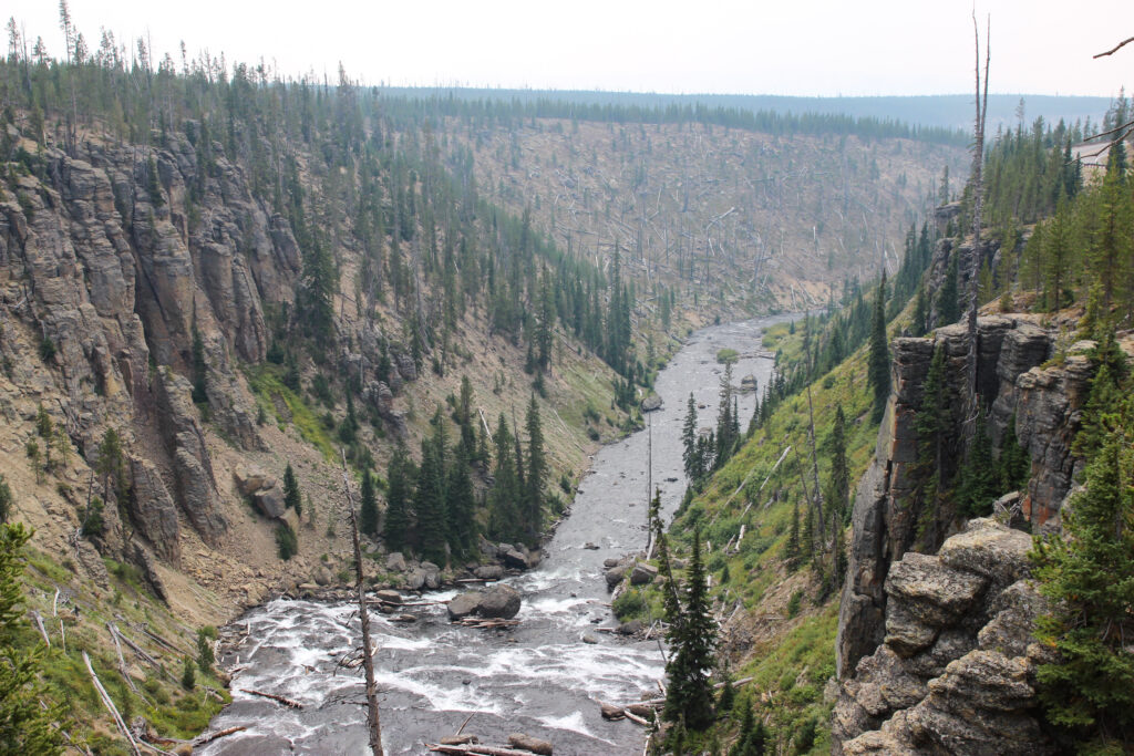
That sense of wonder was not lessened as we rolled onto the South Entrance Road. The Snake River bent away to the northeast, to be replaced by its tributary, the Lewis River. In all of my Google Maps clickthroughs, I can definitely say that the road along the Lewis River was the one that I missed out on the most. It cuts a beautiful little canyon through the Pitchstone Plateau, with the river roaring underneath. As soon as I could find a pull-off, I took it, and walked down to the edge of the canyon to get some pictures.

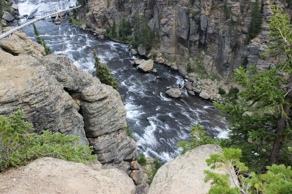
Unplanned? Hell, I was unaware this even existed. And that third shot may be one of my favorites from the entire trip. It was worth the treacherous footing down to the sheer drop-off that Elizabeth and Pam wisely opted out of. This was also probably my best vantage of the small mountain range you can see in the distance known as the Red Mountains, with the highest peak being Mount Sheridan at over 10,000 feet. It would be an introduction to something else I would learn about Yellowstone: while there may not be as topographically a prominent range as the Tetons within this park, Yellowstone’s terrain is always complex, and you’re always either rising or falling. In this case we were on our way up from the entrance station at 6,800 feet to the continental divide, all the way at 8,000 feet.
But first, we had to pass by one more vista on the Lewis River – Lewis Falls, were the water comes tumbling over the approximate caldera boundary of the Yellowstone Volcano. I crossed over the quaint bridge and saw an alluvial plain spread to our right, while the river came tumbling in from the left around a hairpin. Once again, there was roadside parking, so I could stop and enjoy the view.
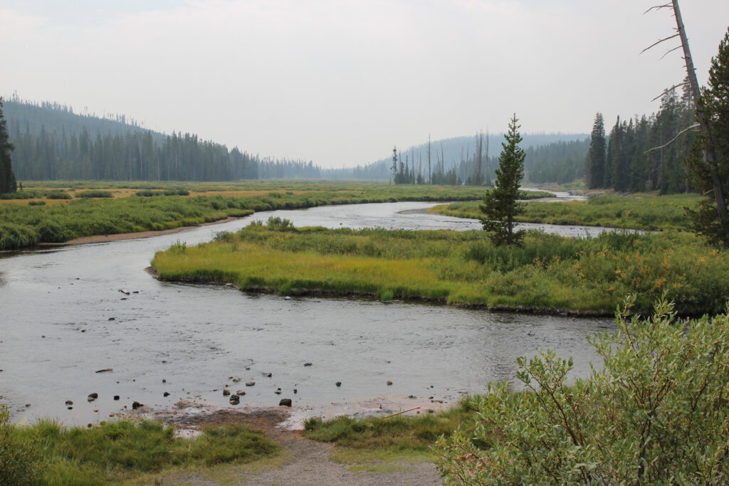
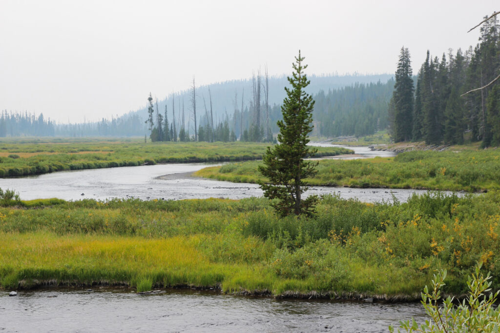
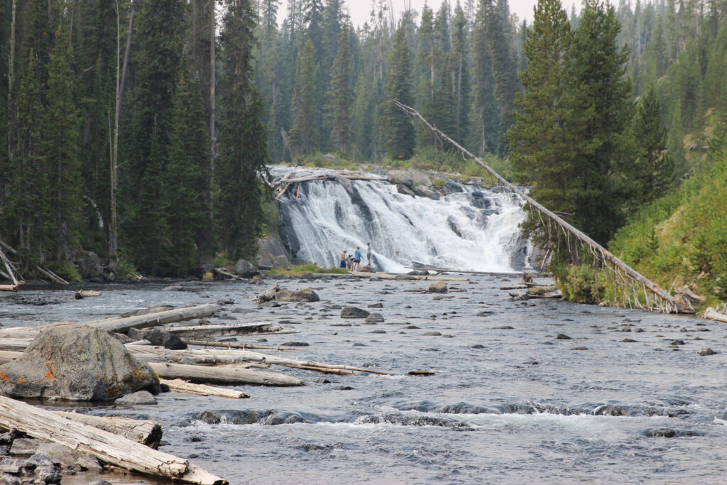
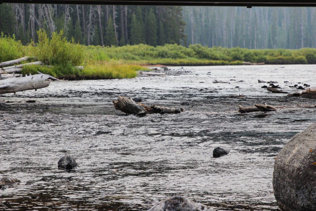
This was the kind of thing I expected to see in Yellowstone – meadows with waterfalls tumbling into wide alluvial fans, greens and yellows harmonizing in the flora, and a general sense of being on America’s public land. I think the Lewis River area would be a very underrated place to spend a few days whenever I go back to Yellowstone for a whole month.
Back in the car, I gunned it uphill past the lake that Lewis River flows out of – you guessed it, Lewis Lake. We kept climbing until we made it all the way up to the continental divide – for the first time in three days, we were back on the Atlantic side of the divide. The top of the ridge gave us a smoky view of hundreds of square miles of mountain, hill, ridge, and lodgepole. It cannot be stated enough how vast Yellowstone is.
Signs appeared on the downhill side, informing us that we were nearing Grant Village and West Thumb Geyser Basin. It was nearing 1:00 and Elizabeth was hungry, so we tried to pull into Grant Village to grab a bite to eat. Grant Village has a mini-store, a gas station, and a visitor’s center – all amenities that led me to believe we could go to the bathroom and possibly grub up. Unfortunately, this would be our first experience with the critically low staffing levels at Yellowstone in the summer of 2021 – partially due to covid and its fallout, they just had to out-and-out close a ton of things, including basically all of Grant Village. With empty stomachs and full bladders, we were forced to turn around.
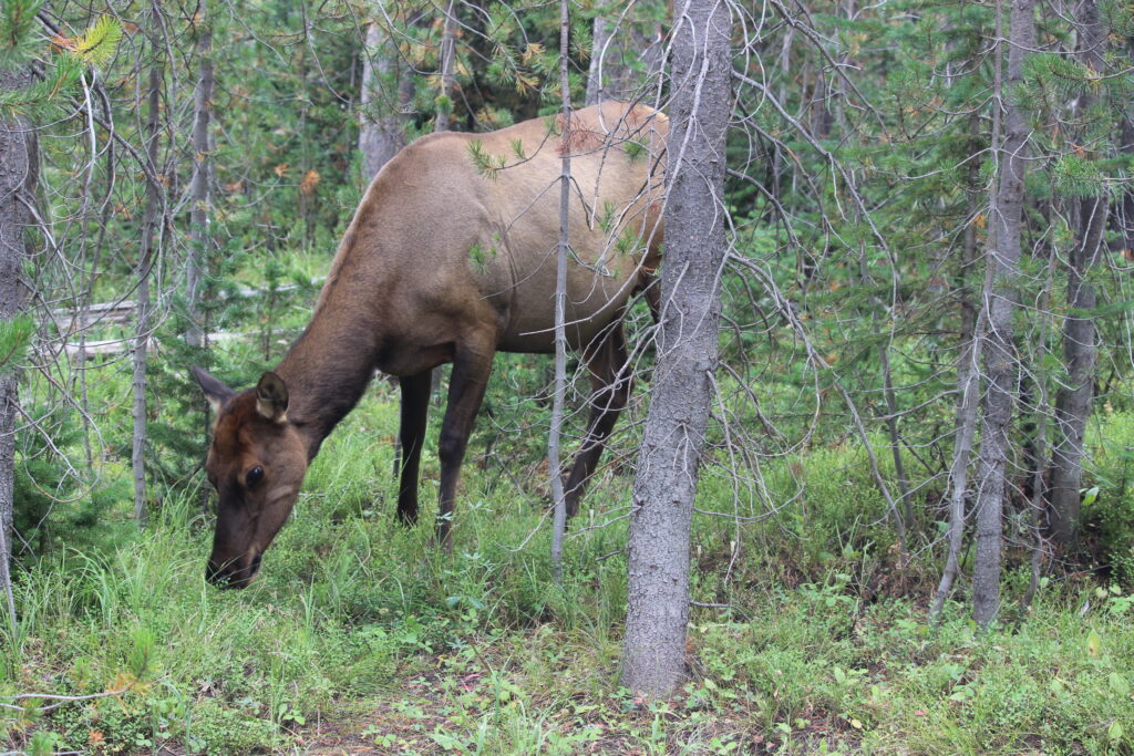
Even the turn around was eventful. Elizabeth claimed to see something big sitting out in the woods near the road, and my inner Big Mammal Hunter was piqued – after all, I was still 0 for 6 on Big Mammals despite catching a bonus coyote in Grand Teton. I drove ever so slowly back out the road from Grant Village, scanning the woods to my left. There! Just a couple of yards off the road, there was an elk munching contentedly on the underbrush. I pulled out the camera and rapidly spun on my 200 mm lens, but the elk was still blocked from a perfect shot by the trees. I clicked picture after picture, but couldn’t get a good shot. Luck was on my side – it ambled through the forest until the elk was literally just a few feet away. Was the 200 mm sensor overkill from this distance? It didn’t matter, I was going to get my shot.
Look how close I came to a true money shot here:
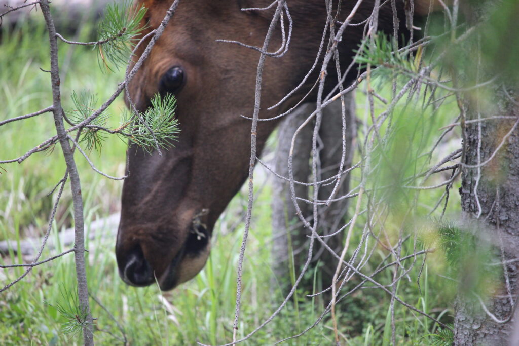
I was on the board. I always expected bison and elk to be easy to see, but I did not necessarily expect to film an elk from 20 feet away. I couldn’t revel in it for too long, because cars were piling up behind from Grant Village and honking. I get it, people, you don’t want to see an elk from that close. Maybe they’d been in the park for a week and were sick of it. If so, they had to deal with this group of newbies.
The good news for us is that the West Thumb Geyser Basin is just a mile or two beyond Grant Village. It only took a moment for me to drive to the West Thumb entrance road and swing into the parking lot. Our first Yellowstone parking experience was phenomenal – not only did we see our very first thermal feature cordoned off in the parking lot (a little mudpot cordoned off by the entrance and exits to the lot, of which we could only see the steam rising from) but I found a parking spot right in front of the boardwalks. It was time to check out our first geyser basin.