
Check out the previous post:
It had already been an eventful trip to Colorado. Getting to see Elizabeth’s reaction to the Rockies in the distance, staying downtown in Denver, a camping mutiny over campsite locations, and a literal derecho – somehow, despite the fact that we hadn’t really been on a big hike in the 60 hours we’d been here, I knew already that this trip was going to be a legendary one. And we hadn’t even reached the culminating moment – Rocky Mountain National Park. I’d been to Rocky Mountain once, back in the summer of 2014, for just a day. We’d driven Trail Ridge Road from the Grand Lake entrance all the way to the other side of the park before departing for Rapid City, so my experience in Rocky Mountain was limited. Still, that put me a leg up on Elizabeth.
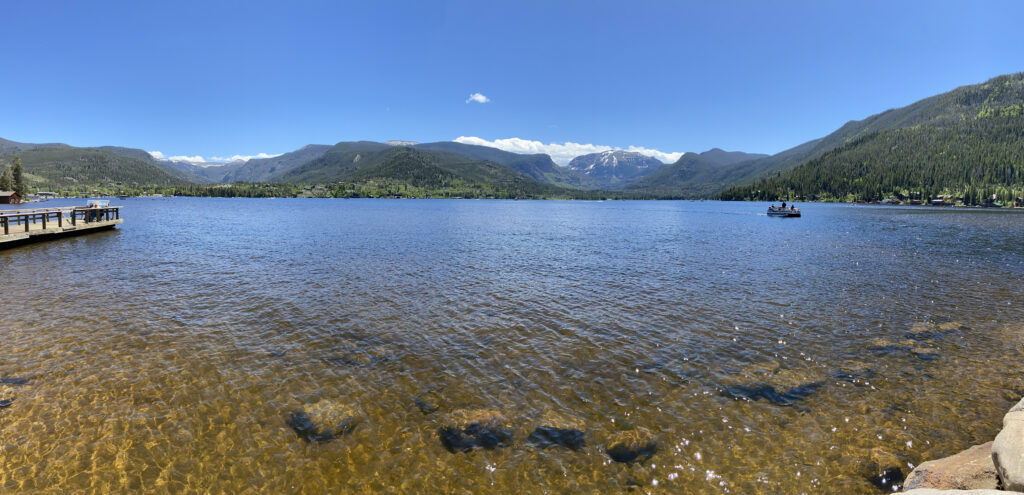
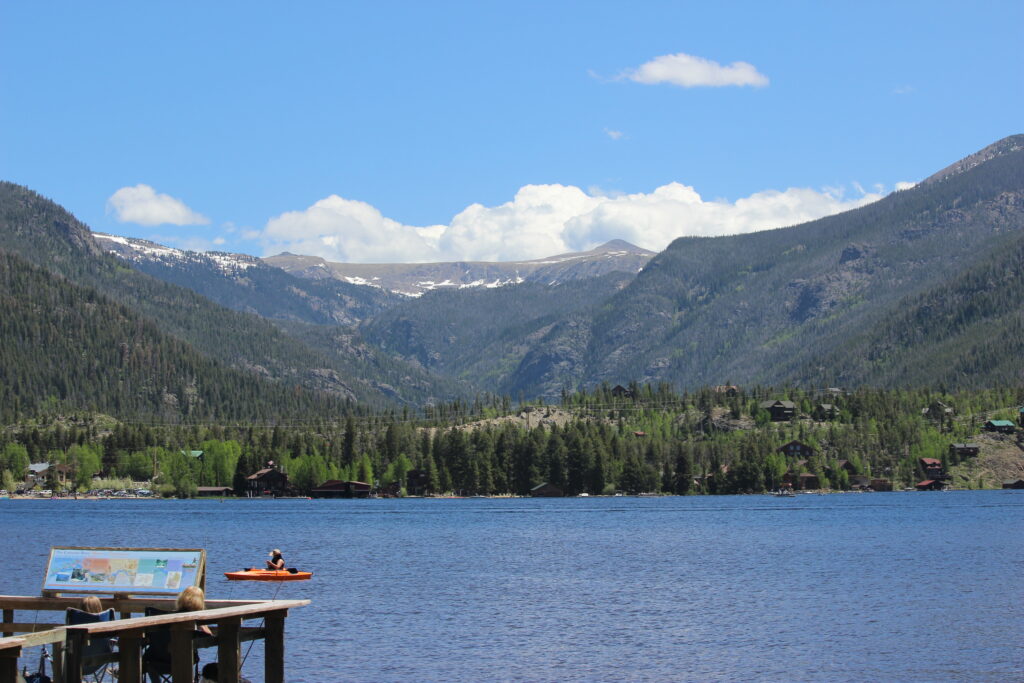
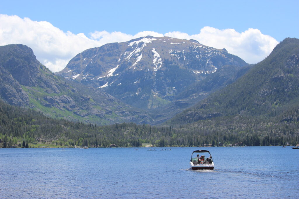
We drove away from our little self-made campsite up in the mountains, heading down into Fraser one final time. After restocking on ice and using a gas station bathroom, we headed northbound out of Fraser, bound for US-34 and Grand Lake. Some of the prettiest country in the world was outside my window as I stared, transfixed, at meadows, mountains, and reservoirs. We passed the campsite on Lake Granby we had driven to in our ill-fated effort to find a place to sleep two nights before. Then it was all new, incredible terrain. Into the tiny town of Grand Lake we drove, where Elizabeth followed Michael and Irene through the side roads to Point Park, right on the lake. After a short, masked walk down to the beach, we got a good look at heaven on Earth.
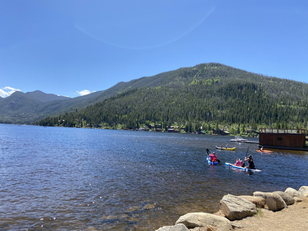
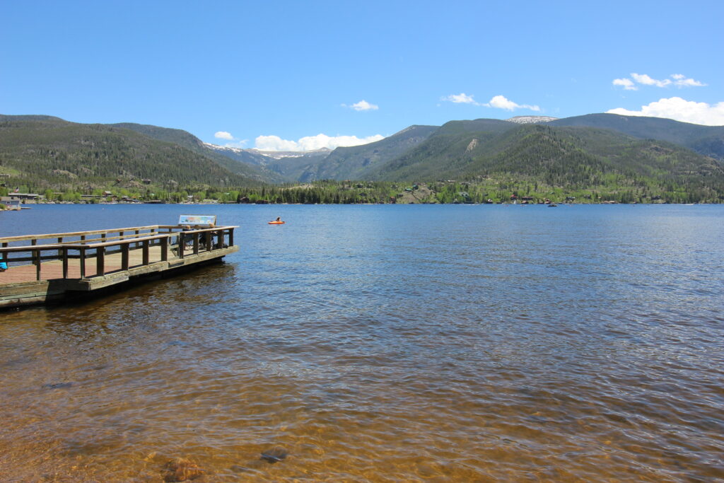
Grand Lake is *beautiful*. Tucked into the rockiest of Rockies right on the edge of the National Park, it is the deepest natural lake in the state of Colorado. Right at the western edge of the tiny beach, there was a foot bridge that led over a canal. This canal led to a larger man-made lake named Shadow Mountain Lake, which in turn led to Lake Granby. Interestingly enough, as a sign right by the canal informed me, these lakes are part of a water diversion project that can actually reroute water from Grand Lake (on the west side of the Rockies) to the Big Thompson River on the other side of the continental divide via a tunnel! So not only was it one of the most beautiful places I saw in 2020, it was a hydrologic miracle as well. This is going to be a large photo dump for which I have no regrets.
This was the backdrop for our lunch-type meal. The trusty blue cooler that we always bring camping was in rather disorganized chambles by this point, with food and drink floating about in the icy water amid larger chunks of ice. The egg carton we had bought had completely disintegrated, meaning our eggs were protected by no more than plastic bags. And Michael’s insistence on bringing like 30 beers was really hogging some of the prime real estate at the bottom. Our decision was thus: a smorgasbord of what was left available – eggs, turkey bacon, cheese – all cooked in Michael’s cast iron until it was the perfect consistency for breakfast burritos. To do so, I had to help him gather driftwood and sticks to burn on a little open-air grill. There was even a little covered picnic area with tables to eat at – perfection all around.
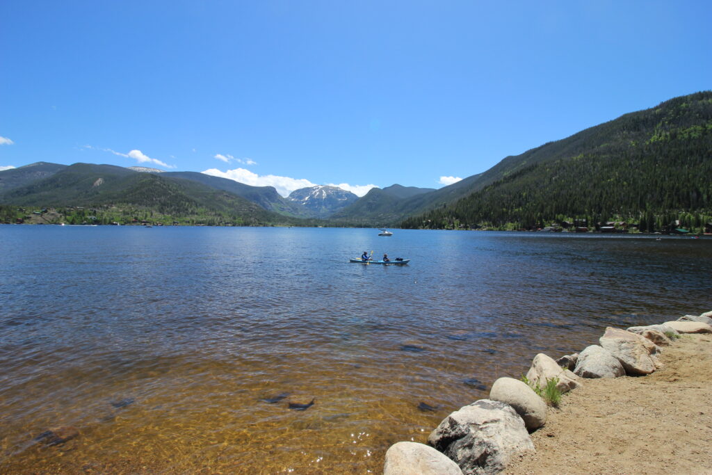
We still had some time to kill before our designated time to enter the national park, so we walked back down to the beach. I splashed into some of the iciest water I’ve ever felt, while Michael felt emboldened to jump all the way in and dunk himself. Good thing I didn’t have a spare pair of shorts or I might have felt compelled to join him.
Finally, it was time. We lugged all of our cooler stuff back into the car, and after Elizabeth and I sneaked a quick bathroom break in at the park, we were off once more. This time, the drive to our destination was short – just a couple of small town roads, then back onto US-34 – soon to be Trail Ridge Road. I drove so that Elizabeth could take in the sights undisturbed. She was so excited she was practically vibrating in the passenger seat.
We passed by the visitor’s center, unfortunately closed due to covid. The national park had literally just reopened – we were some of the first guests allowed back in the park. Furthermore, they were selling entry passes by time slot to manage crowd size, so we were incredibly lucky to have a campsite and guaranteed entry. I drove up to the Grand Lake Entrance Station. Park rangers wore masks and had us pass our debit cards over via butterfly nets to avoid human contact. We got our official park map that way, as well. Still, the park rangers were brimming with obvious excitement that people were reentering their beloved park. The feeling was infectious.
“I’m so happy!” Elizabeth said after I’d paid the fee and we were easing onto Trail Ridge Road proper. And seriously. She sounded *so* happy. The first half of 2020 had not been easy for either of us, but Elizabeth especially – trying to find jobs in both Norman and southeast Louisiana, applying to grad schools, wrapping up graduation, beginning a once-in-a-generation pandemic – I can’t describe how happy her words made me. That was seriously my favorite memory of 2020, right there.
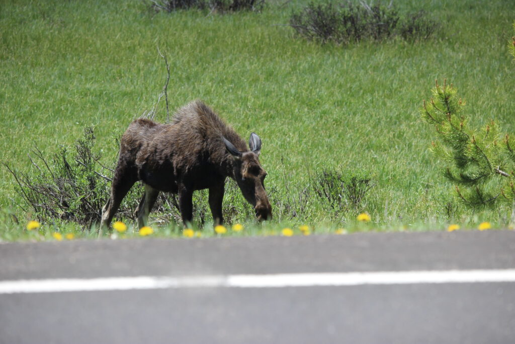
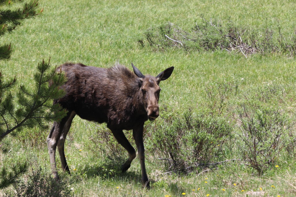
The happiness did not fade immediately. Mere minutes after entering the park, we came upon a cluster of cars parked on the shoulder. A quick glance to the left told me what they were looking at – a moose! Up close and in person! I pulled off without stopping to think twice and pulled out the camera. Other people were getting out of cars to say hi to the moose, which I personally would not advise, but I decided that they offered a screen enough for me to cross the road and take pictures from behind the bolder individuals.
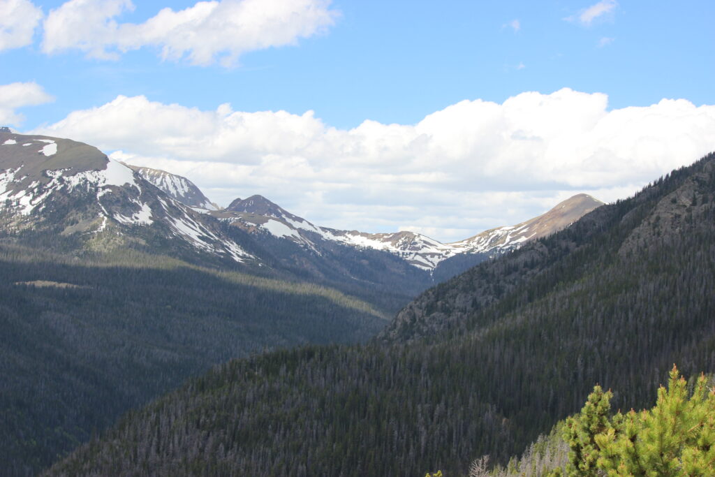
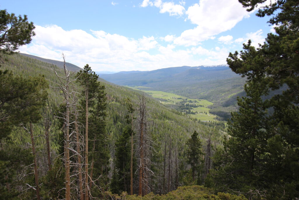
After our experience with my new moose friend, we continued up Trail Ridge Road. The first stretch makes its way generally northward through the park through the Colorado River Valley. It’s a beautiful meadowy valley, with immediate mountains on your right and large, imposing peaks (the Never Summer Range) to the left. Each spot feels like you can’t blink or you might miss something incredible. But, as I have reason to remember, it somehow gets even more incredible.

I hit the switchbacks and started to hit the steadily inclining switchbacks. The view was partially obstructed by trees and the mountain we were climbing, but Elizabeth was still appropriately oohing and ahhhing. I was slightly overwhelmed – trying not to lose Michael’s car behind me, trying not to run off the road, trying to enjoy the view – a lot was going on! Fortunately, we reached the overlook at Fairview Curve and I had time to take in the beauty before me.
And then it was time to rev Elizabeth’s car’s poor, overworked engine yet again – this time, to the next stop on Trail Ridge Road at Milner Pass. The continental divide!
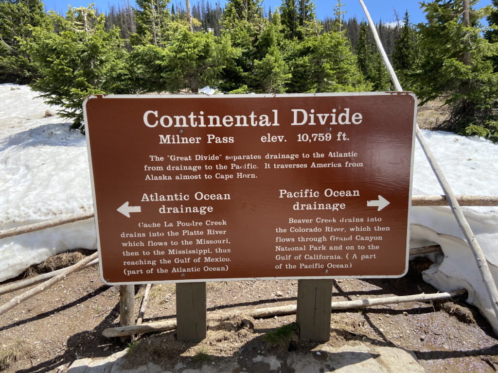
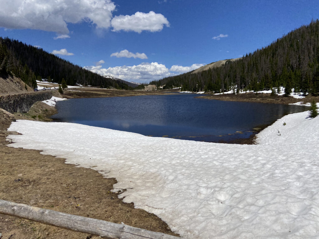
There was even a decent amount of snow left here at the continental divide, even though at 10,758 feet we still had a decent ways to go up. I made a snowball and chucked it across the continental divide, thus fundamentally shifting the paradigm of how much water reached each ocean basin in the year 2020 and possibly changing the world climate system irreparably. Meanwhile, Michael wandered down to the little lake and got himself stuck in a deep snowbank.
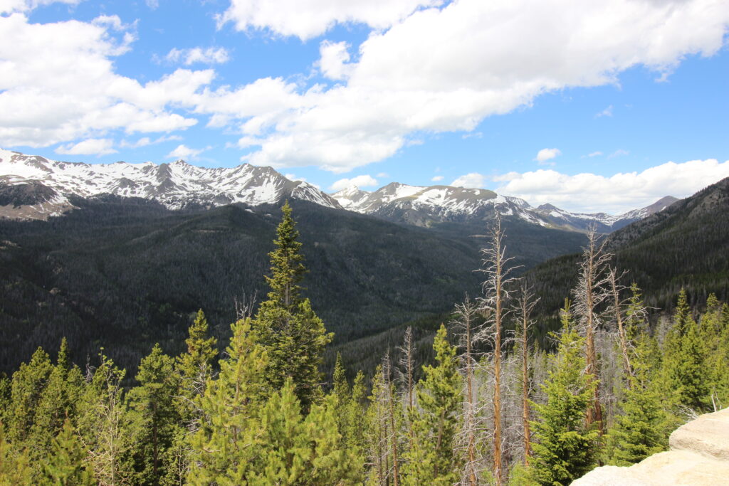
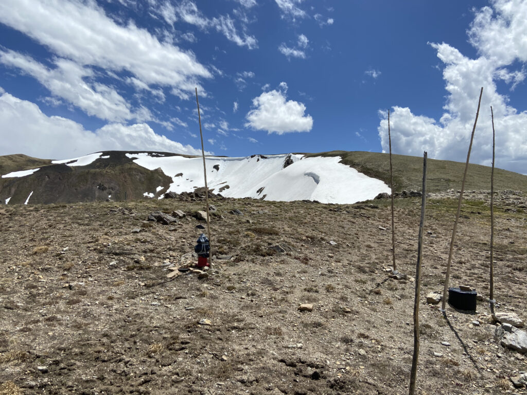
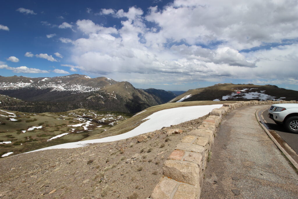
Now we were getting into the highest parts of the highest continuous road in the United States. The snowpack on the side of the road continued to get deeper and deeper, until we were driving past 3-foot deep piles on each side. The Subaru gamely continued to climb past 11,000 feet, and then towards 11,500 the trees began to thin out. Finally, we were fully above the tree line into the true alpine habitat. I remember the alpine habitat from a few years back – a rocky area covered in what looks like grass but is actually moss, with few other plants and mostly just the hardiest of mammals. We pulled off not far past the tree line. Irene was asleep in Michael’s car and didn’t get out, but the other three of us stepped out into an incredibly windy (and chilly! I needed to put on a sweatshirt!) scene. Those big mountains in the Never Summer Range? Now I was looking at them on a level field. Off to the right in the distance, we could even see Wyoming!
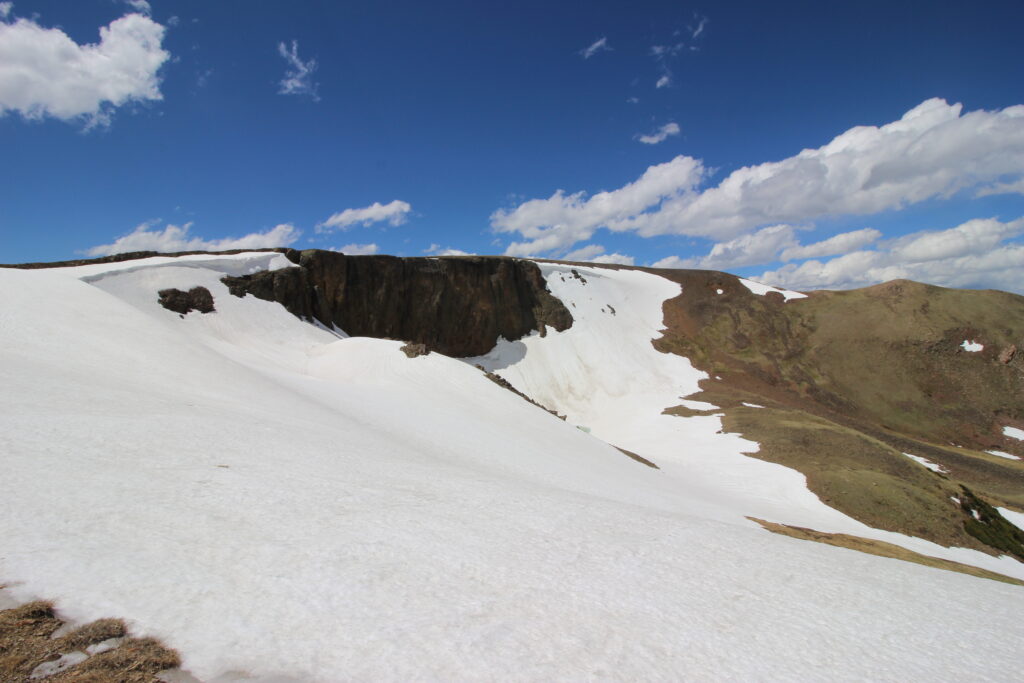
And when we got in the car, Trail Ridge Road *still* went up. Now I was full-on white-knuckle driving. As you can see from the pictures below, there weren’t necessarily cliffs that I could fall off of, but it certainly would be hard to stop. We continued to climb up to the Alpine Visitor’s Center. Of all of the NPS covid closures in 2020, this is the one that hurts the most. They put a visitor’s center on top of a mountain and stuck a road right alongside of it! There’s a huge cliff in the back of the visitor’s center and a little sidewalk you can take to see it. Unfortunately, because of the snow cover everything was closed, but park rangers were posted outside of the visitor’s center to provide guidance to people in a safe, socially distanced fashion. And I could get a picture of the cliff, just not fall off of it.
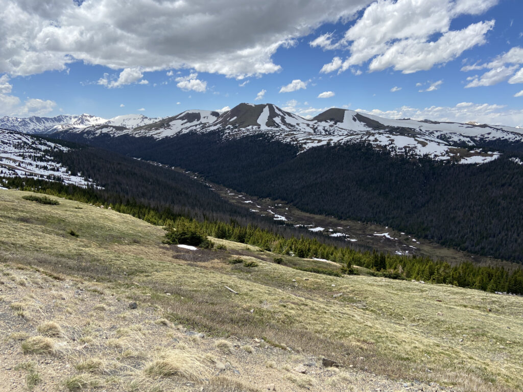
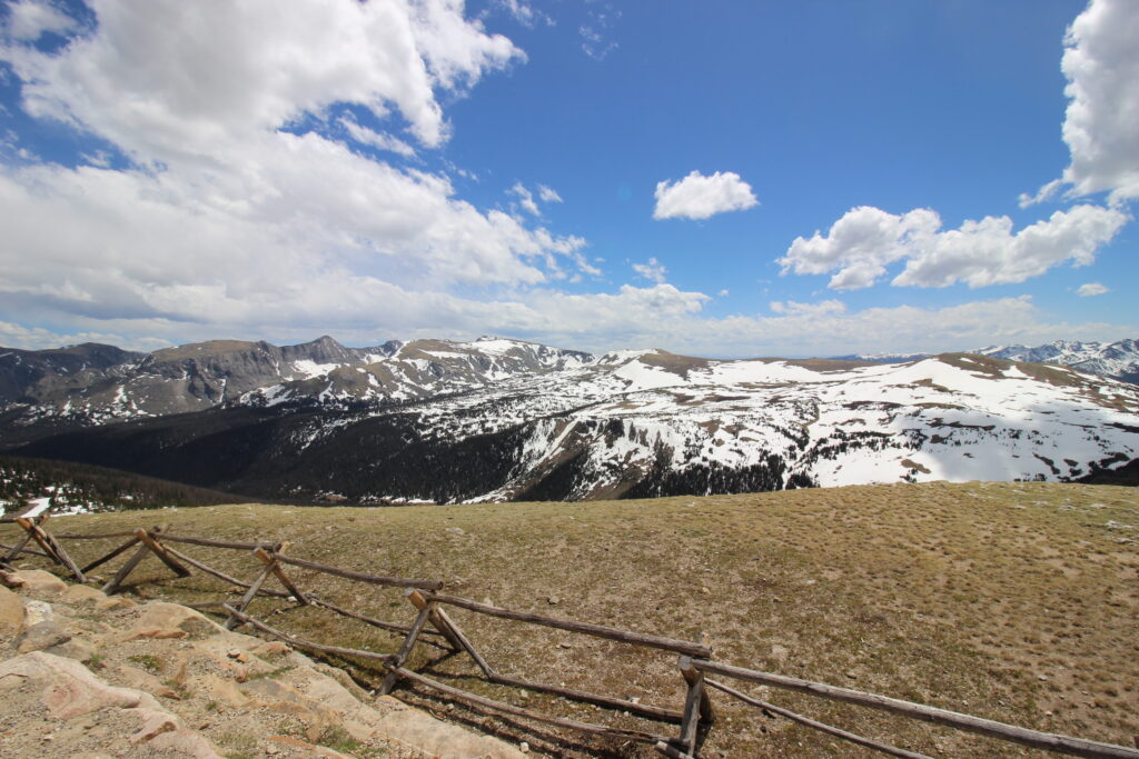
And after that we continued on, still climbing! At this point we were putting the “ridge” in Trail Ridge Road – following the mountaintops of the Gore Range through the central part of the National Park. The next overlook, the Gore Range overlook, was something to behold:
But the wind was absolutely ripping. And when I say ripping, I mean *ripping* (this tweet is from months later, when a tragic wildfire swept in from Grand Lake all the way to Bear Lake, jumping the continental divide just south of Trail Ridge Road):
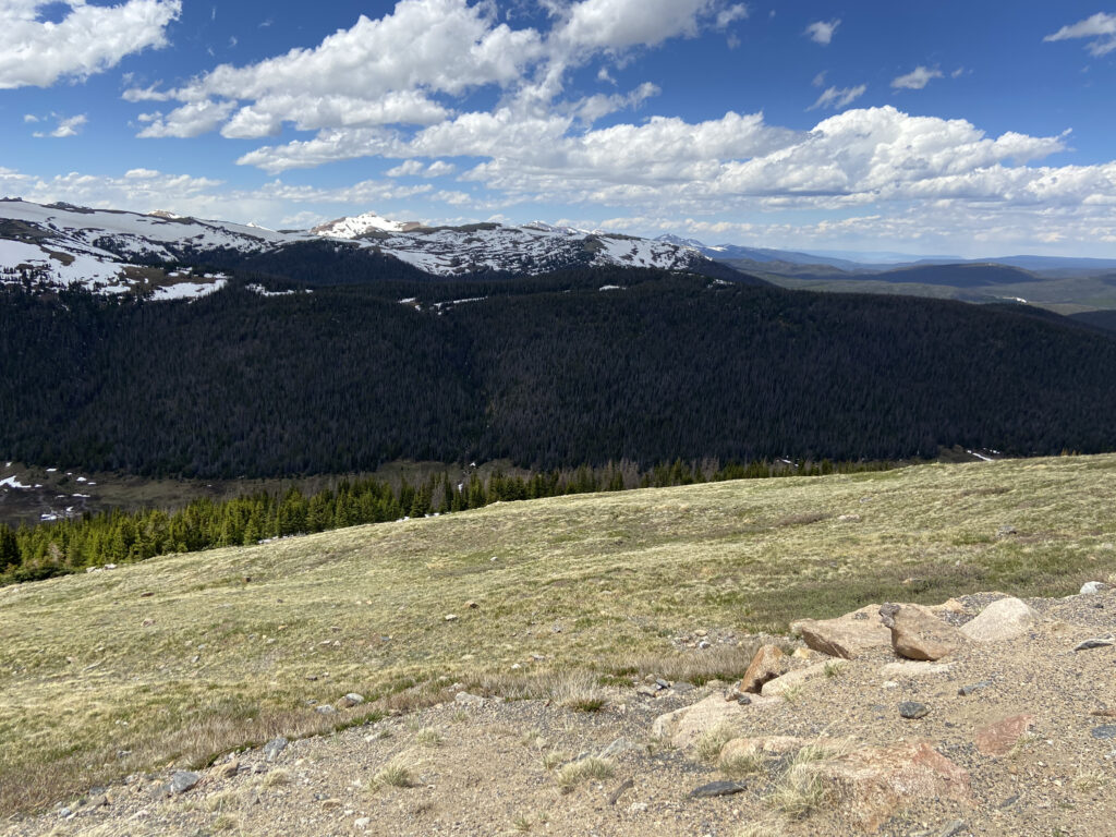
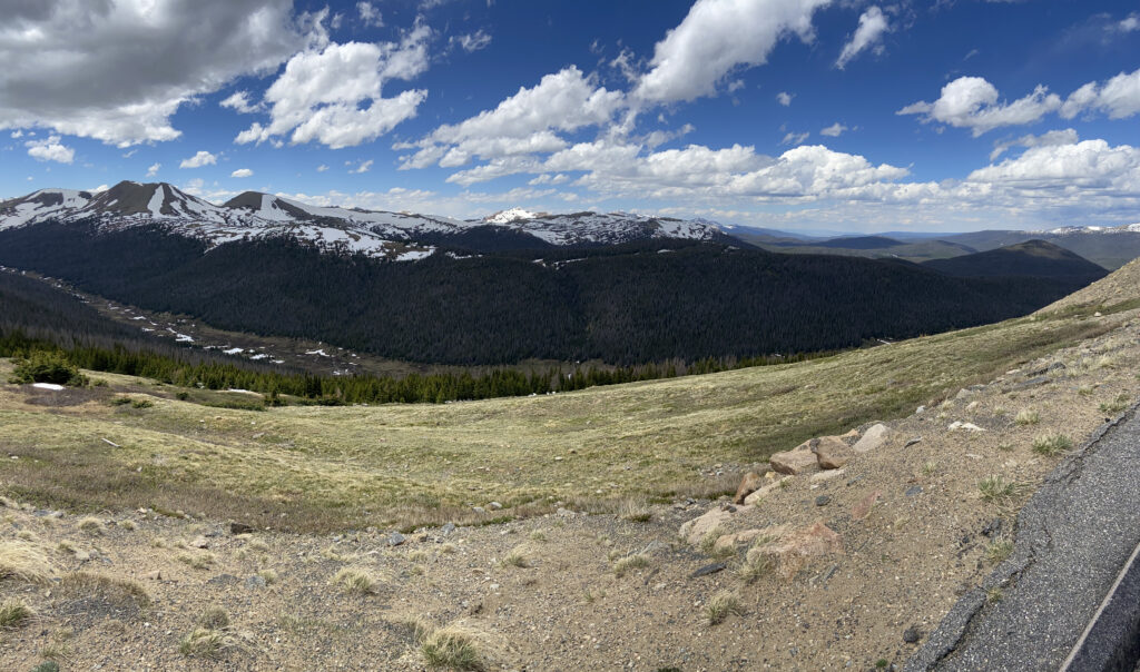
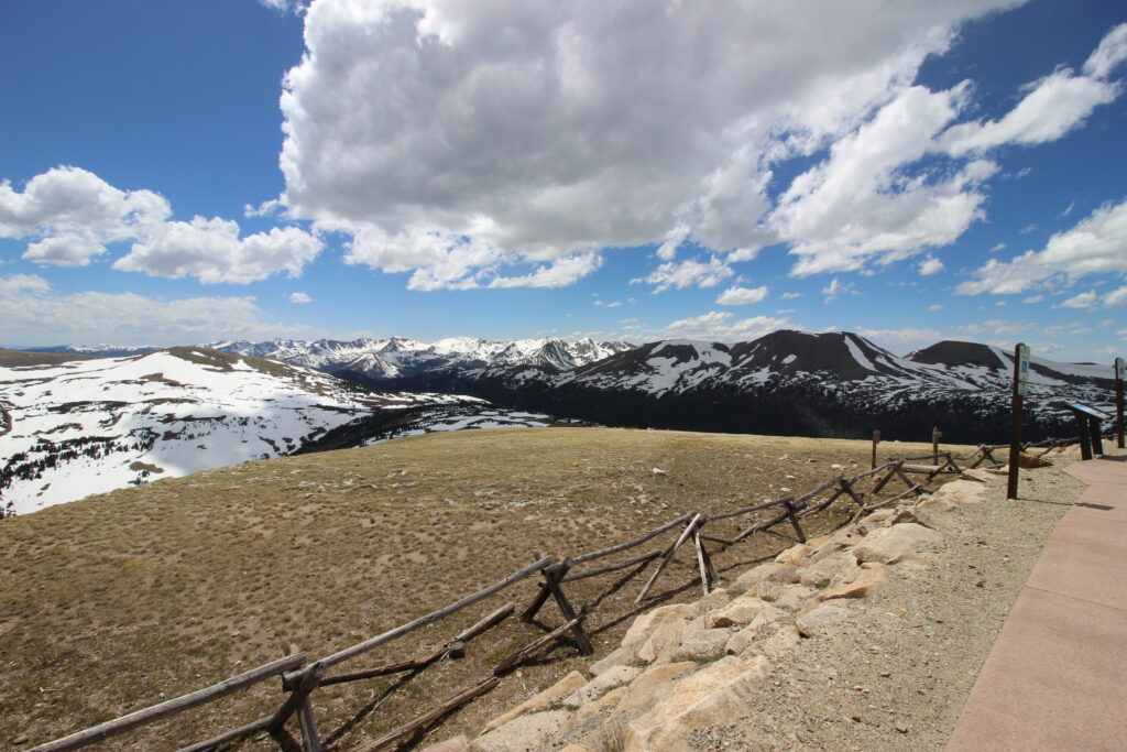
I don’t know if the winds were quite as strong as Michael said there, but it certainly was gusty! I kept an iron clamp down on the (now-sweaty) steering wheel as we continued a few more minutes to the next overlook. This one looked at the other side of the cliff on the backside of the Alpine Visitor’s Center:
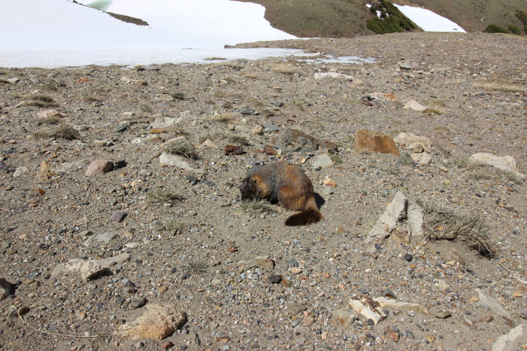
We were joined up at our vantage point by a giant, furry rodent that I shockingly was correct in identifying as a marmot. The marmot drew Tucker’s attention, but was fortunate enough to not have to run for its life and instead enjoyed a feast of scrub brush right in front of us.
At last, we had crested Trail Ridge Road. At over 12,000 feet, it might have a legitimate claim to being the highest elevation Elizabeth has ever been. There’s a trail near that highest point, but it was swarming with people so we decided to descend instead. The last major excitement in the alpine tundra area was a large herd of some large mammal, of which I have no pictures (but can be seen at the 10:45 mark here: https://www.youtube.com/watch?v=G33Ch2JN5VE).
And then, we were descending back into the alpine forest, with peaks no longer level with us but rising imposingly into the sky around us. We had reached the other (the busy) side of the national park, and were descending towards the Glacier Basin campground.