
First of all, I apologize for how long this post will inevitably be. We’re about to take a trip through one of the most magical drives in the continental United States. I took a billion pictures. When I go through the pictures, I wish I’d taken 10 billion. There’s basically no way to shorten the narrative on GTSR without cheapening it.
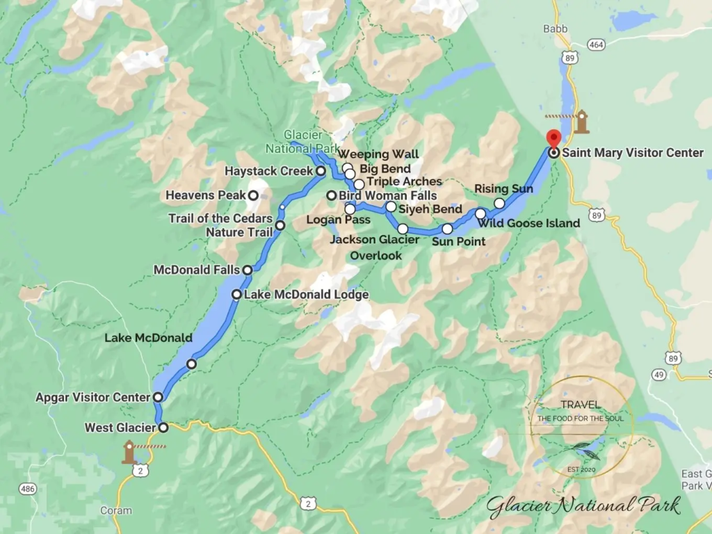
This map is actually a perfect way to show all of the main features of GTSR. We would drive it from east to west on the morning of July 13. That had originally been the plan Elizabeth and I had laid out months prior, but in the desperate wait-are-we-actually-going-to-have-one-of-the-latest-openings-in-the-history-of-the-road weeks prior to arriving at Glacier, we’d decided the best course of action was to take the roundabout US-2 route to the west side of the park. Context is key – our hotel for the next night was in West Glacier, so crossing the Lewis and Livingston Ranges was a non-optional part of our July 13. But GTSR was the ultimate TBD.
Back in the cabin, I gasped at the text on my phone claiming that the road had just opened for the season. “What?” asked a bleary Elizabeth. My voice shaking, I read the text word-for-word to her. Elizabeth sat bolt upright.
“Are you serious?”
We stared at each other for a few seconds. Then I sprang to action.
“Let’s go!”
As I said, parking at Logan Pass is some of the most competitive parking in the NPS. If we left *right now*, we could beat everyone else who didn’t even know the road had opened up from the east side. Should we hike the Highline Trail today if we had parking availability? We could figure that out later. Just pack for now, worry about the details when the details need to be worried about. I opened the door and stepped into the fresh mountain air, ready to open up the back of the car so that we could throw suitcases in and drive away. Turns out I wasn’t alone.
If you see those horses going by your cabin at 6:06 a.m. after you’ve just woken up, what’s your reaction? Mine was confusion, but I’m open to other reactions being the proper one. A little later, when turning in the keys, we relayed the story to the property owners. They didn’t seem all that perturbed to hear that some random horses had spawned in the creek behind their land and gone for a morning stroll. Instead, they just said that the horses probably belonged to the neighboring farm and would find their way back. Okay!
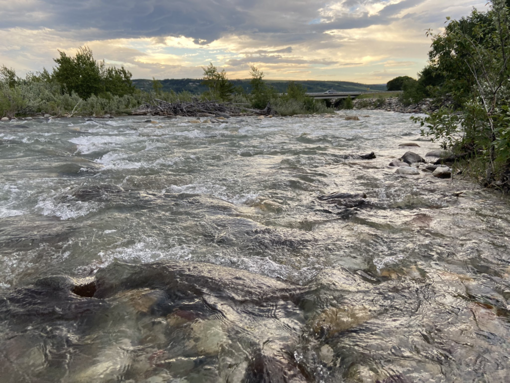
After the equestrian surprise, Elizabeth and I quickly got all of our stuff loaded back up. To be honest, it’s pretty easy to keep most of your stuffed packed when you’re using the cabin for a place to sleep and literally nothing else. We’d seen the text at 6:00 a.m, gotten jump-scared by the horses at 6:06, and by 6:36 the RAV was loaded up and the key to the cabin had been returned. Once again, a quick shoutout to Elizabeth for finding the cabin through AirBNB. It was a little costly for how we tend to travel in national parks, but it was also a super hassle-free first night and the property managers were fantastic. I can confidently say it was one of the best wake-up views I’ve ever had from an AirBnB. The sunrise over a babbling Kennedy Creek was *chef’s kiss* when I went out there to fill up my LifeStraw bottle.
Serenity. Colorful sunrise. Colorful rocks. And also some delicious glacial water to drink.
Even cooler for this meteorologist, there was also a funnel cloud (!) coming off of some weird convective mountain wave thing.
Undefeated, indeed!
And then, in a blink of an eye, I was behind the wheel and getting ready to drive one of America’s most scenic roads. Much like Trail Ridge Road, Elizabeth preferred if I drove because it would be stressful for her. I was okay, as long as we stopped many times.
We took US-89 back south the way we’d come the day before, listening to country radio once more along the way. The highway climbs the flank of the St. Mary Ridge that we’d seen the moon rise over the night before, backing away and giving a sweeping vista of the big, granite peaks that jut out in long eastward ridges in this part of the park. Between those eastward juts lies a valley with a string of lakes, rivers, and creeks. The Many Glacier Valley is one jut north of the St. Mary Valley, which came into view a few minutes later. This was another “whoa” view. If I wasn’t driving, I would have stopped for a picture. But it was clear that if things only got better from here, we were in for an incredible morning.
First thing first, we stopped in the little outpost of St. Mary on the eastern fringe of the national park. A few reasons necessitated this: first of all, I needed to wipe a crapton of Montana’s finest bugs off of the windshield. More importantly, Elizabeth needed coffee, and the Park Cafe and Grocery was available to give her what she needed. I stayed outside and wiped the windshield while she got her drink, all the while munching a Pop-Tart to fuel up for the day. The sun hadn’t come up over the St. Mary Ridge yet and it was just a beautifully cool morning compared to the horror of Oklahoma in July.
Elizabeth got back in the car. The GPS directed us to “turn left on Going To The Sun Highway”. The road briefly leads northwest through a meadow, crossing a little creek. And just like that, you have officially entered Glacier National Park on Going-to-the-Sun Road. If yesterday was the appetizer, the main course was served. Surprisingly, the entrance station at St. Mary was unmanned. We figured it was just because we got there early, but unmanned entrance stations especially on the St. Mary side would be the rule over the following week, not the exception.
The road crossed a bubbling St. Mary River and passed our upcoming campground before taking a 90-degree bend to the left and entering a stand of trees. To the right was one of those long, ridgelike mountains that extend outward from the continental divide, with a stark granite top. To the left, St. Mary Lake gradually widened as we traveled up alongside of it. A low ridge on the far side of the lake gradually rose until you could definitely say we were in the St. Mary Valley. To this point, the scenery was good but not epic. It’s funny how quickly things can change.
The very first stops along GTSR are a few pull-offs along the lower shores of St. Mary Lake that we did not stop at. The road didn’t feel real or official until we got to a crossroads several miles in. To the right was a small campground complex – Rising Sun. The GTSR reservation system goes into effect at Rising Sun, and people were standing in the road to slow up traffic and check for reservations at this point. Elizabeth doesn’t go anywhere without a folder for all important travel documents – she swiftly produced them and showed our credentials to the workers, who waved us onwards. *Now* it felt official. Although the road had been open past Rising Sun prior to this morning, you still needed a reservation to get there. It was like being in an exclusive club with the other patrons who knew how to recreation.gov.
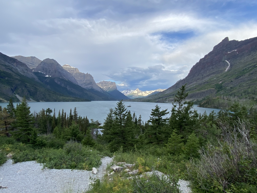
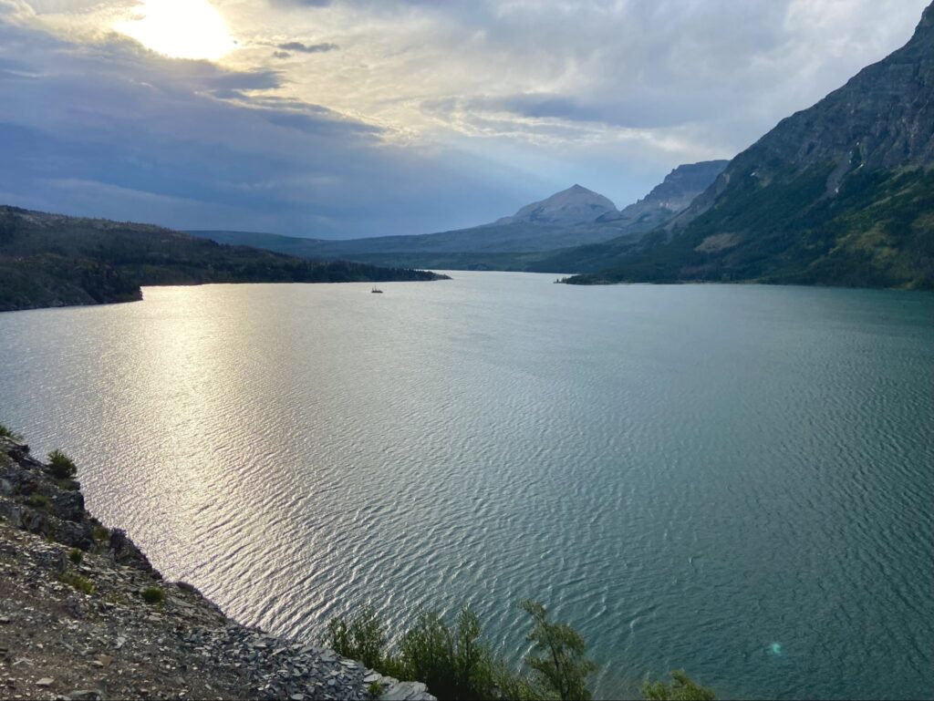
The road continued past Rising Sun, and instantly became that much cooler. The right edge of the valley pressed right down to the lakeshore at a hairpin right bend called the St. Mary Overlook. Just around the corner is one of the more famous views within Glacier – Wild Goose Island. At this viewpoint, you get a straight shot view down the upper half of St. Mary Lake and the snowcapped mountains along the Divide behind them. In the foreground, a tiny island dots the lake. I’ve seen many pictures/videos/timelapses from Wild Goose Island in spite of my promise not to research Glacier as much as Grand Teton. What I was not prepared for was to be the only two people at the viewpoint.
The view was great. Maybe I thought it was a step below the “incredible” I’d hoped for, but that might have just been a reaction to the genuinely incredible Many Glacier area the night before. Either way, I wasn’t complaining. From a photographic perspective, I have ended up a little disappointed. For a most photo’d spot in the park, my pictures kind of were pedestrian. There’s a decent chance that reflects more on me than the Wild Goose Island overlook though.
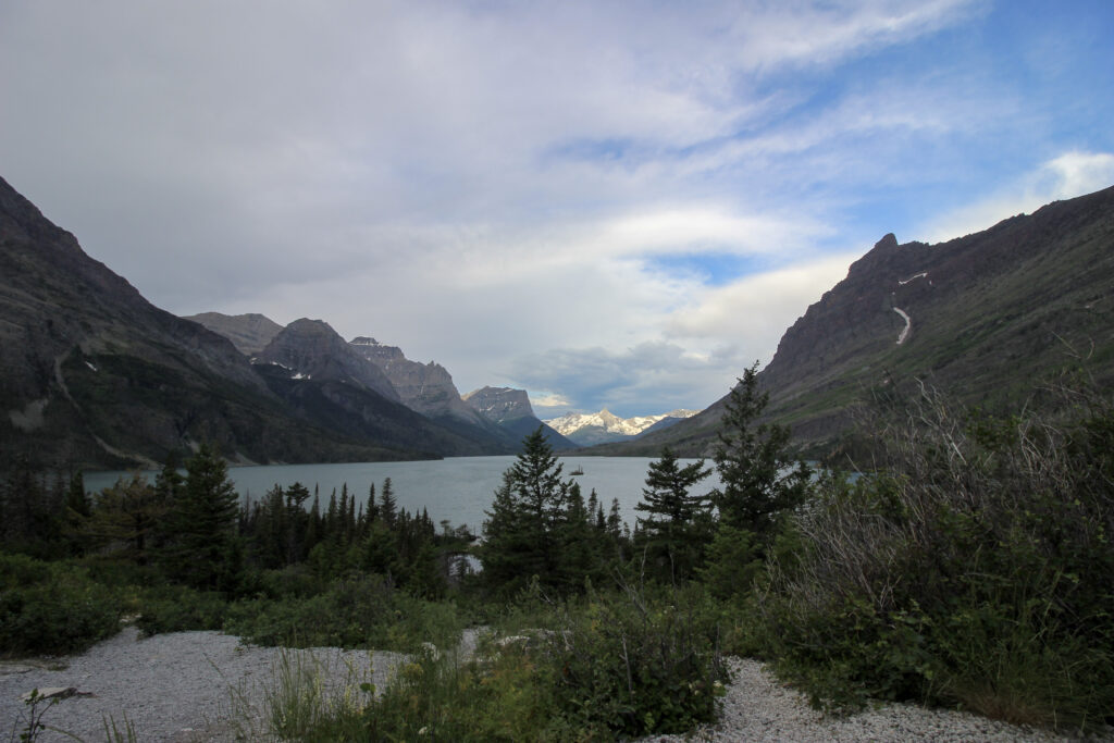
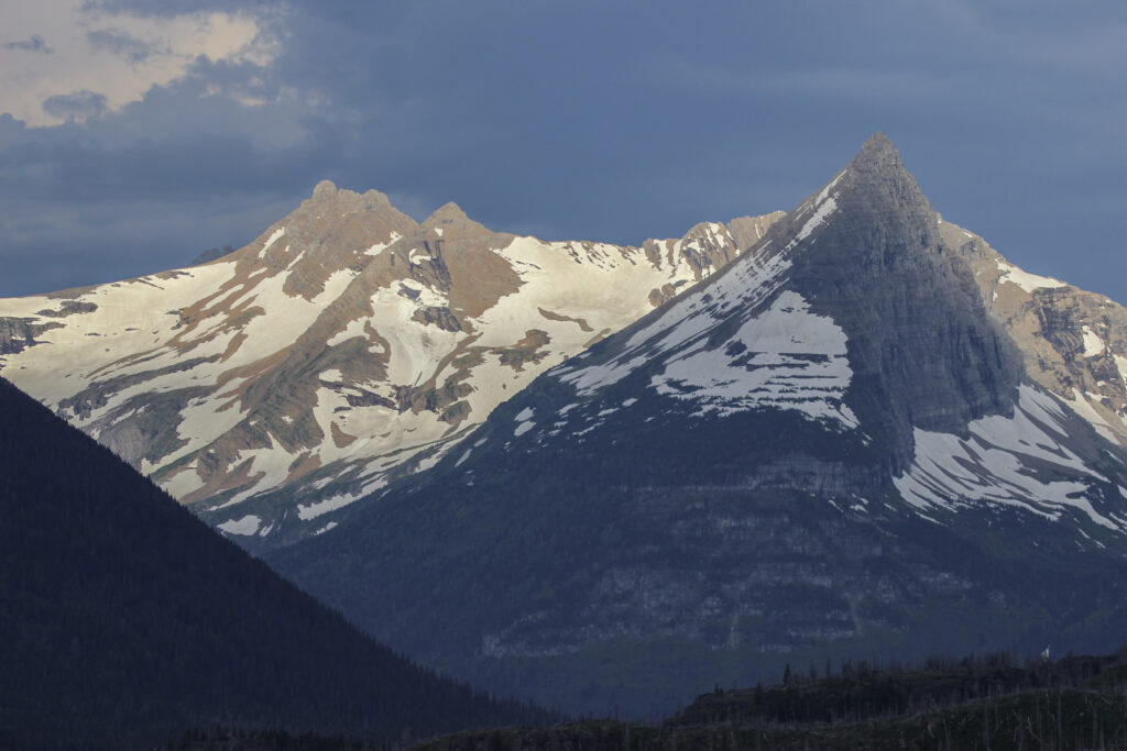
The peaks of Gunsight and Fusillade Mountains shone in the early morning light, though, which was very cool.
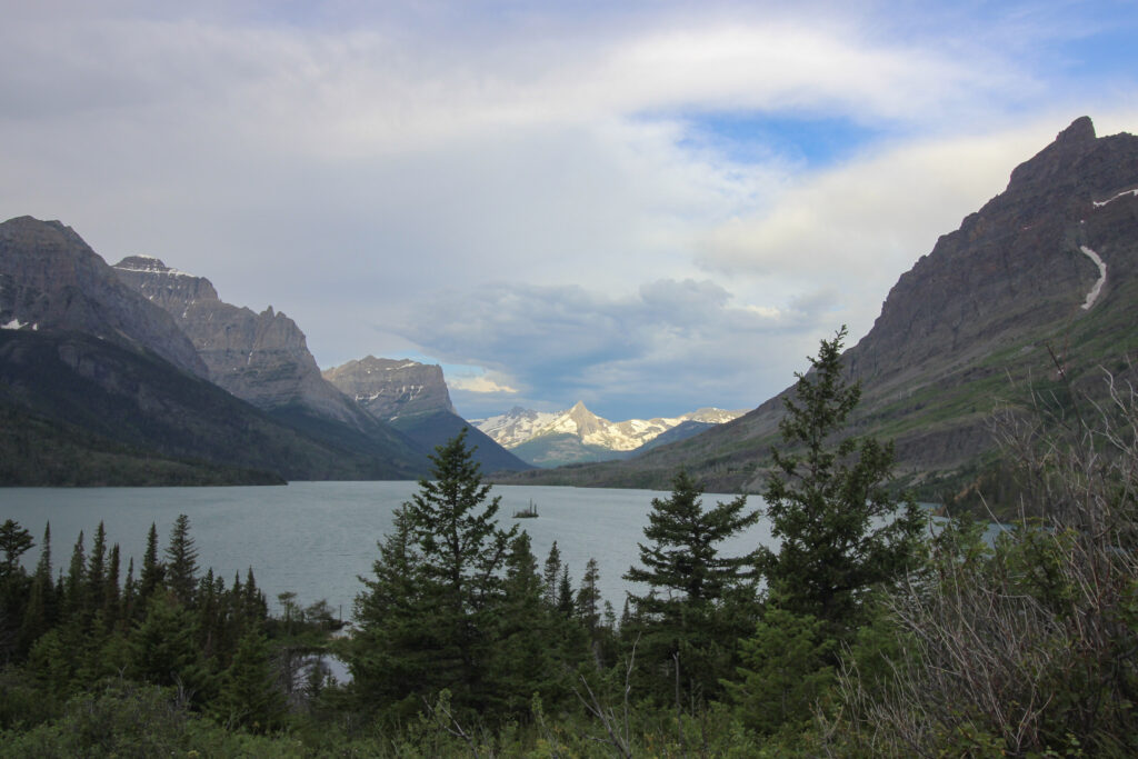
And here’s an iPhone shot to prove that maybe the issue was more to do with my photography:
The road continues along the right side of the lake in the images above, toward a choke point on the far side of Wild Goose Island known as Sun Point. About halfway in between, the road goes around a small bend in the lake and pops out at an overlook with a parking spot. I’m gonna guess usually in mid-July it’s impossible to get to that after sunrise. But at 7:30 a.m. on this glorious morning, before anyone had figured out that they could drive the road this far, the two of us had the pullout to ourselves. And we had a sweeping vista that for the first time made me feel like I was seeing a national park beyond some of my other favorites.
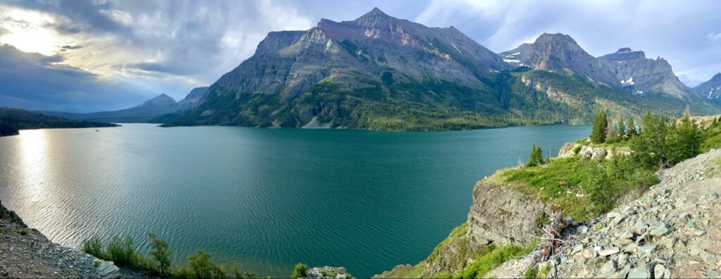
The color was astounding to me. The lake was a brilliant teal, while the mountains gleamed with grey, brown, and rusty red. Red mountains are insanely cool. Seeing snow in July was also insanely cool. It was all insanely cool.
GTSR continues further down the north side of St. Mary Lake, climbing ever further above the water level as it goes. After all, the engineers wouldn’t want to waste a chance at free elevation gain. That meant that I could see more of the scenery around, including a truly surreal view of a waterfall just tumbling out of nowhere across the lake. (I did not know that we would hike to that very waterfall in two days). Speaking of waterfalls… I eased into another little parking area a few miles further down. Elizabeth disagreed with my decision to do so. Our ultimate destination was Avalanche Creek, a few dozen miles yonder on the other side of Logan Pass. The west side of the park had been open for weeks, and we figured the crowds would be heaviest there, so she was concerned about finding parking. By contrast, I just wanted to drive GTSR slowly and take in all the sights. We compromised by going through some of the stops quickly, including this one.
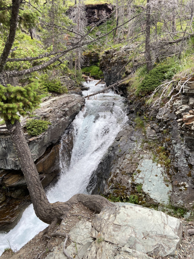
“This one” is Sunrift Gorge. At Sunrift Gorge, Baring Creek comes roaring off of Matahpi Peak to the north and passes under GTSR on its tumultuous path toward St. Mary Lake. After the late-season snowstorms, everywhere we went in Glacier was cheerfully gurgling with plenty of water, and Baring Creek was no early exception. Now, we did not actually take the two-minute walk up to the top of the path to view down Sunrift Gorge. That’s a combination of my fault and Elizabeth’s. She was implicitly rushing us, and I thought this attraction was actually Baring Falls. Turns out Baring Falls is closer to the lake, and the Gorge was right at the top of a short paved path that we didn’t complete. Lesson learned. However, we did walk underneath a sick stone bridge that GTSR is paved over – a motif that’s often repeated along the road, with stone and brick used to make it look more “natural”. And the cascading Baring Creek may not have been a true “waterfall” (everything in Glacier is kind of a waterfall) – but it was pretty, and when I dipped my toe in the roaring water it was cold. Enjoy my one iPhone picture from our four-minute stop at Baring Creek:
Next up after Sunrift Gorge is the St. Mary Falls trailhead, all the way up at the head of St. Mary Lake. We briefly discussed stopping and hiking out to St. Mary Falls, which is traditionally one of the hardest-to-find-parking locations in Glacier. Even though there was plenty of space, Elizabeth insisted on pushing onward. So I drove onward as GTSR bent to the right away from St. Mary Lake.
The next overlook was right before a giant gate that had obviously just been swung open. This overlook is the Jackson Glacier Overlook, and the gate demarcates the alpine section of GTSR on the east side, or the previous road closure line. It was also a must-stop, as far as I was concerned. Outside of the obvious beauty of the park, Elizabeth and I were here to see the damn glaciers before they melted. Nowhere was that more clear to see than Jackson Glacier, which used to be one of the biggest in the lower 48. Like everything else in the park, climate change has drastically reduced its size. If the Internet is still around in 50 years, I might get to look at these pictures I took of a glacier that no longer exists. It should have been depressing to look at. It’s depressing to write about. Hell, it was kind of depressing to look at. But my mood was way too high on our first day in the park to let the inevitable demise of Jackson Glacier ruin my enjoyment of its view.
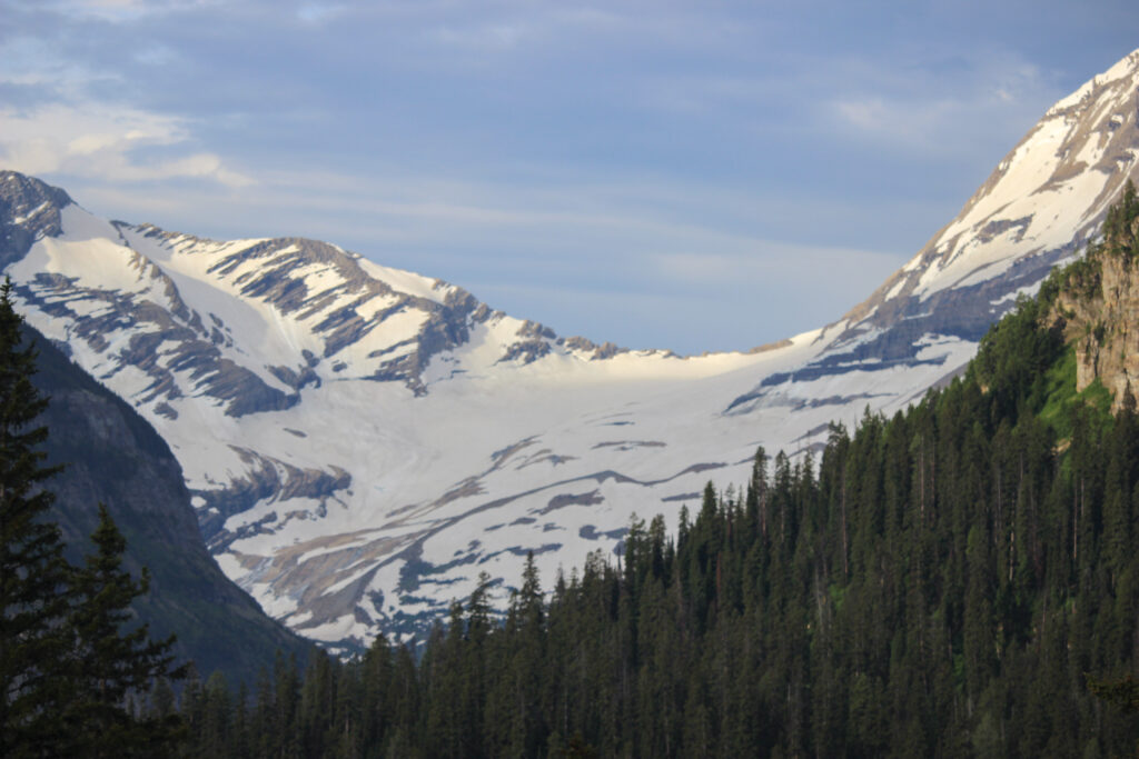
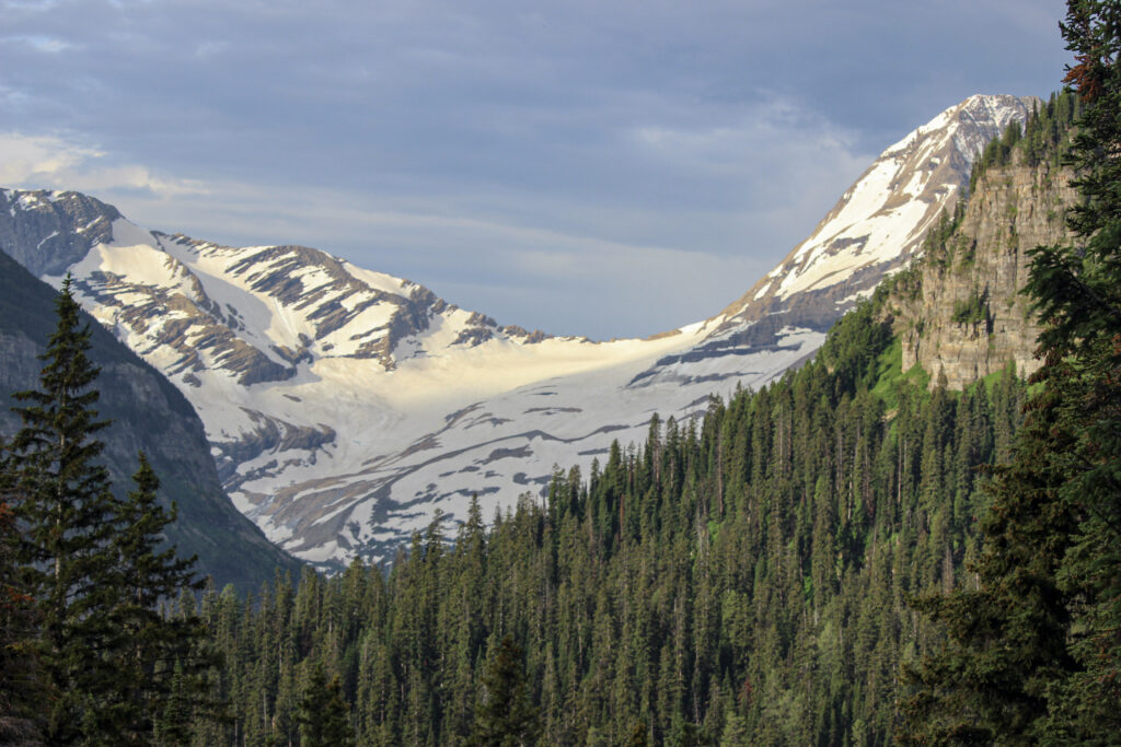
I mean… that’s pretty damn cool. Pun sort of intended.
We got back in the car and I drove at the reduced alpine speed limit of 25 mph toward Logan Pass. GTSR rises dramatically beyond this point as it genuinely makes a push toward the top of the continent. Not long after the glacier overlook, we reached a sharp bend in the road known as Siyeh Bend. I keep saying it, but the scenery was awesome. Waterfalls tumbled off of Piegan and Going-to-the-Sun Mountains, all collecting at the bottom of the valley that the bend hairpins over where Siyeh Creek goes thundering beneath the road. We didn’t stop for pictures here, but (spoiler!) this location will be covered in more detail from our hike a few days later. For the moment, the sun began peaking through the cloudy sky as we rose ever higher into the sky. Now, instead of sitting in valleys and looking up at the mountains around, we were somewhere in between – the valleys were sweeping beneath us, while peaks soared above. A whole new perspective, if you will.
Alright. You’ve stuck with me this long. It was a long build-up, but I was still kind of surprised to realize how close we were to Logan Pass. Only a few miles of genuine alpine driving remained. I was happy to be on the right side of the two lanes, because the left side of GTSR was nothing but pure cliff. We did make one final stop at a pull-off just before the East Tunnel bored through Piegan Mountain. Let me tell you… before this stop, I’d thought Glacier was incredible. When I took in the view on a bright summer morning… there was nothing else I’d ever seen that compared. I didn’t take a zoomed out picture and there’s no reason for it. Instead, I’ll just have to direct you to check out the video clip of it on my vacation video. Because genuinely, this view was stunning. Here’s the upper part of the valley with several waterfalls just causally cascading off the side:
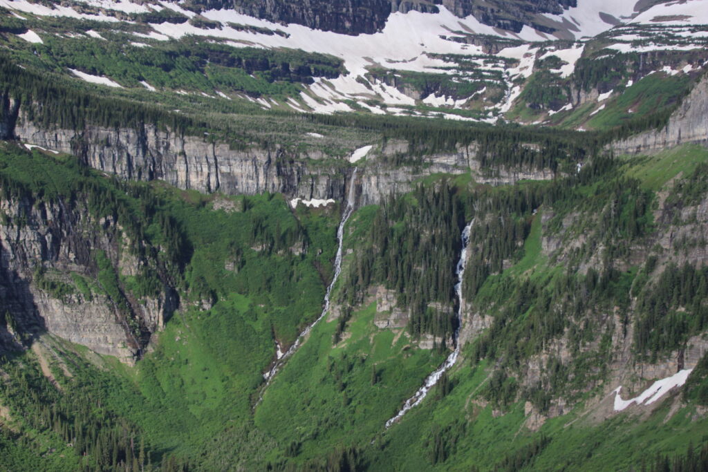
I was unprepared for the sheer number of times I’d get to see something astonishing like that.
The road continued onward through the East Tunnel (I held my breath all the way through it), and past the Big Drift. As the Big Drift’s name implies, it is generally the deepest and highest-elevation obstacle to the opening of GTSR every spring. It was still deep and foreboding on the inside part of the road, but as long as the pavement was clear, the two of us were game to continue. The road bent around the Big Drift. Up ahead on the left, I saw a few squat alpine buildings and a broad parking lot. To Elizabeth’s joy, there was plenty of parking to be found at the Logan Pass Visitor’s Center. To my joy, we had arrived at the Crown of the Continent.