
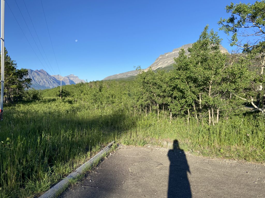
Another early morning. July 16 at the St. Mary Campground dawned bright and sunny, with a near-full-moon setting back over the Lewis Range to the west.
And I awoke in desperate need of more rest than we were allowing ourselves on this trip. Some context, if you’ve forgotten in the near-full-year that I’ve been writing this never-going-to-finish narrative: I had just defended my Master’s thesis on June 28, nearly wrapping up months of grueling preparation for graduation. Now I had about 2 more weeks to turn in my completed thesis (redolent with the many, many edits that were suggested at my defense) in order to receive my degree. I was working all day and exhausted. And that was *before* we came to Montana and I’d hiked 15+ miles the day before. So when something that will go down to history as “definitely not a big deal” went wrong in packing the car on the morning of July 16 (I’ve forgotten what), I had a brief nervous breakdown. Elizabeth was the real MVP of the trip for dealing with my very fragile mental state.
At least today, I was able to bounce back quickly mentally (foreshadowing events that would take place a few days from now). In this case, we were able to get the trip back on track with a quick stop at a coffee place right in the little St. Mary village area, aptly named “Glacier Perk”. Elizabeth got her huckleberry latte, and I got some time to remind myself that we were in God’s country and this was no time to mope.
God’s country, it so happens, knows no geopolitical boundaries. Glacier National Park is snuck all the way up against the 49th parallel (it sort of makes sense – where would you expect the glaciers in our country to concentrate if not right up against the border with our northern neighbor?), but the glaciers themselves don’t stop at the 49th. Rather, some of the most stunning views of the whole ecosystem end up on the other side of the border. Thus the Canadians created their own national park to rub up against Glacier. They named it after the large lakes that they set the townsite alongside within the park – Waterton Lakes National Park. Together, these two locations form the Glacier-Waterton International Peace Park.
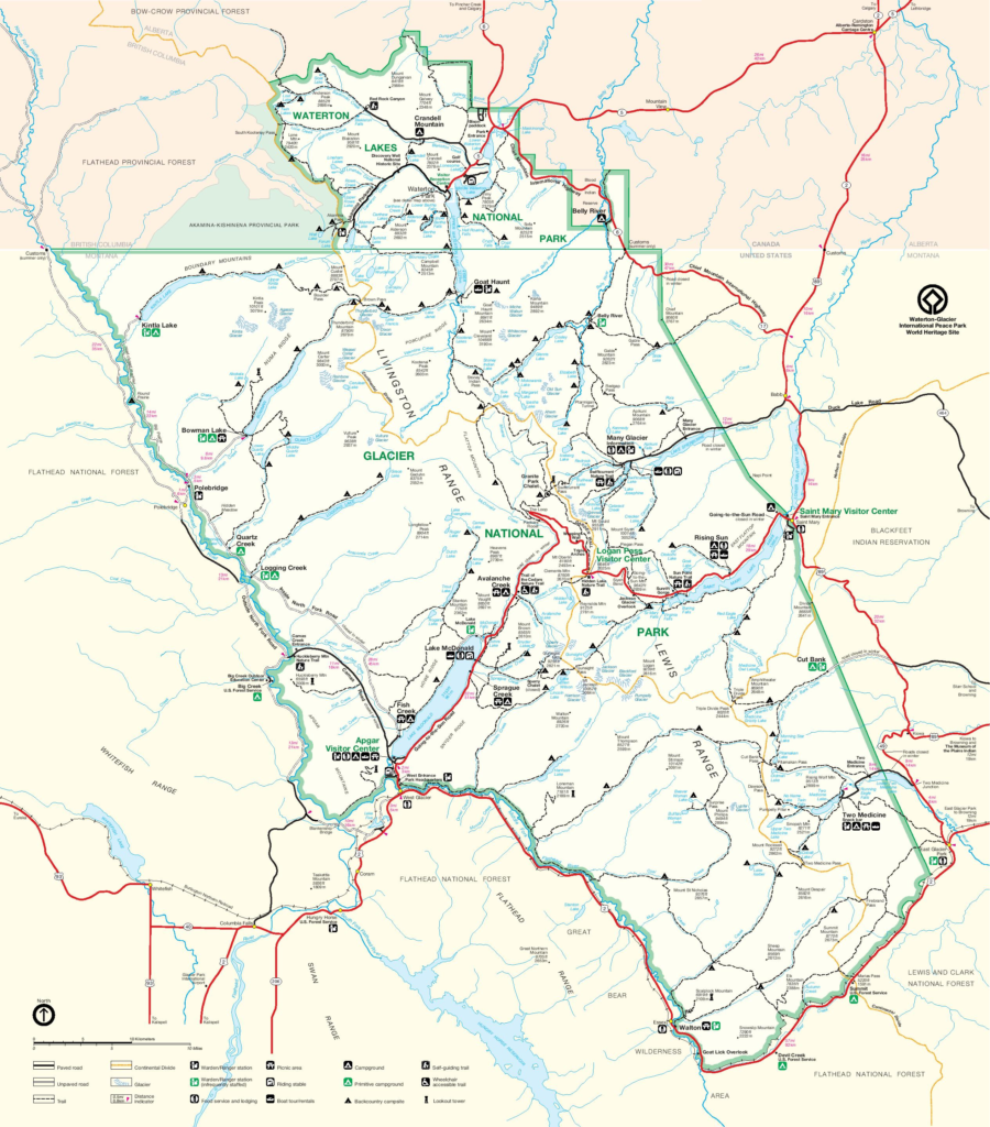
Despite the shared border, you can see that it’s actually quite a roundabout route to get from St. Mary all the way up to Waterton – especially since the Chief Mountain Highway was closed in 2022. We’d have to track northward along the prairie all the way up to Cardston, Alberta, before we could head west into Waterton.
After several days of being deep in the mountains, it was a little bit jarring to drive north out of Babb (past our AirBNB from 4 nights ago) and into the open Montana prairie. Just like a few days ago… this was heaven. The sky was so, so blue, it was a beautiful morning that promised a pleasant summer day, and the wheat fields we were driving past were a brilliant green, only broken up by the vivid yellow of blooming canola. It legit looked like the Windows screensaver. Off to the left, the Lewis Range beckoned like it had the other day – hazy bluish peaks sticking up at rakish angles, with Chief Mountain becoming ever more prominent in front of us. I drove, so no pictures here, but you get the idea.
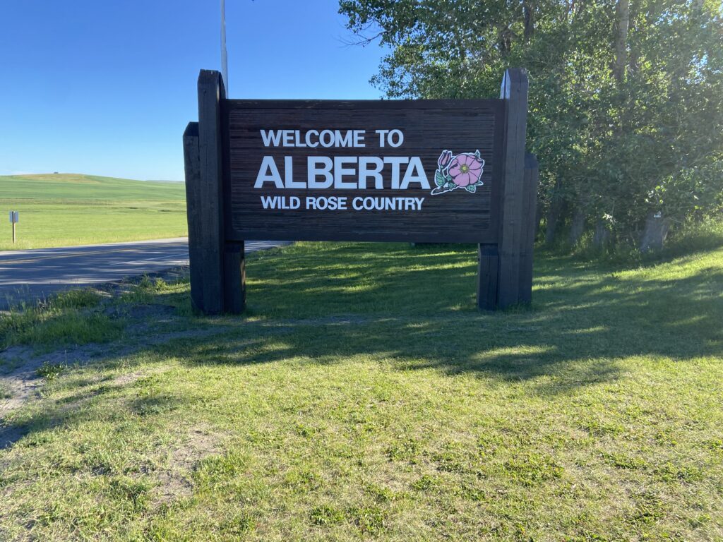
It was about 20 minutes from the St. Mary Village to the Piegan Port of Entry at the far end of US-89. This was an exciting moment for us – a brand new province! Before, I’d only ever been to Ontario, so it was time to give Alberta a whirl. There was essentially no line out in this desolate stretch of nowhere this early in the morning. Elizabeth and I had prepped extensively for our little excursion into Canada – with lingering effects of the pandemic, the government had created an app called ArriveCAN that allowed you to pre-register your border crossing, upload an image of your passport, and self-certify your covid vaccine status. I recall being slightly disappointed after all that build-up that the Canadian Border Service agent merely took our passports. He waved us through with a friendly (and extremely Canadian-accented) word of advice: the American side of the Port of Entry closed at 6:00, and they closed at 6:00 *sharp*. Given that we had reservations at the extremely swanky Prince of Wales Hotel (more on that later) in Waterton that night… our dinner plans were screwed. Elizabeth tried not to look too disappointed.
And just like that, we were through, into a land of maple syrup and… canola fields.
It was still another hour to go before we made it Waterton Lakes National Park. First, the road continued to travel north through a rolling prairie that you could almost imagine being carved by the long, glaciated winters of the Ice Age. No signs of glaciers on a beautiful day like today. The Rockies (oh my god those were the Canadian Rockies) receded in the distance to a smudge. Then we got to Cardston, a small Mormon settlement most notable to me for its lack of Tim Horton’s (what kind of Canadian town doesn’t have Tim Horton’s???), turned left, and started back toward those distant mountains. Along the way toward Waterton, we got another glimpse of life on the Rocky Mountain Front – rolling hills covered with the greenest vegetation an Oklahoman could imagine, wide-open pastures, and one memorable home that sat in a bend of the rushing Belly River below. Meanwhile, I got a better view of the southern Canadian Rockies off to our north, and ever since then I’ve had a desire to go back. *This* is the place I want to live.
The Waterton Lakes entrance sign is incredibly nondescript compared to its American counterparts – so much so that I kept driving on the assumption we’d get to the real sign later. It sits in the last stretch of prairie before you enter the mountains – and if anything, the geography here is even more dramatic than down by Glacier. At least in Glacier, there are ridges and divides between watersheds before you enter the mountains. In this case, the prairie pretty much runs all the way up to the spot that the Waterton River drains out of Lower Waterton Lake.
We got a jolt at the entrance station (printed in both English and French for those crazy Quebecois) – apparently there is something that Elizabeth and Nolan are capable of forgetting to pack. Canadian cash! It turns out that in Canadian National Parks they sort of expect you to pay your entry fee in the national tender as opposed to American cash. Fortunately, this didn’t seem to be the first time that they’d dealt with a stupid American tourist – the guy at the kiosk asked for $20 USD since that would cover $21 Canadian with ease. In fact, we even got change back, but I’m not sure that I ever found the use for the loonie or the toonie that we put back into our cash bag. Just like that, the two of us were officially in our first-ever Canadian national park.
As the name implies, Waterton Lakes National Park contains more than one Waterton Lake. Lower Waterton Lake genuinely does sit in more of a flat, prairie-type location at the foot of the national park. We drove by the northern bank of it on the way in, framed in the distance by – I wish I was kidding – Sofa Mountain (yeah, the name is apt). The road continued through burned-out undergrowth toward the Waterton Valley and townsite, now passing Middle Waterton Lake. Then it was a much shorter gap from Middle Waterton Lake to the shore of the most famous of the three – Upper Waterton Lake and the townsite.
We were definitely back inside the mountains. The valley is similar in shape to Lake McDonald, but much longer, with the mountains far on the opposite shore being all the way back on the American side of the border. One of the cool things about a lake with an international boundary if that boundary is within an international peace park, you can actually take a boat across it and back. One of the great tourist attractions within Waterton is to take an hour-long scenic boat cruise from the harbor in town to the international border and back. This was the top thing Elizabeth wanted to do in the park, and so our first stop in town was to purchase tickets to take a cruise. As I pulled into the parking lot at the dock, we were greeted by a deer sitting along the lakeshore. Wildlife in this area, still undefeated.
*Picture of the deer will be added here when I get my SD card*
Now that we had our tickets for late morning, we needed to decide what to do with the next few hours. Sit around and relax? Or go to the visitor’s center and find something we could do with our next few hours?
It wasn’t a question. I drove toward the visitor’s center.