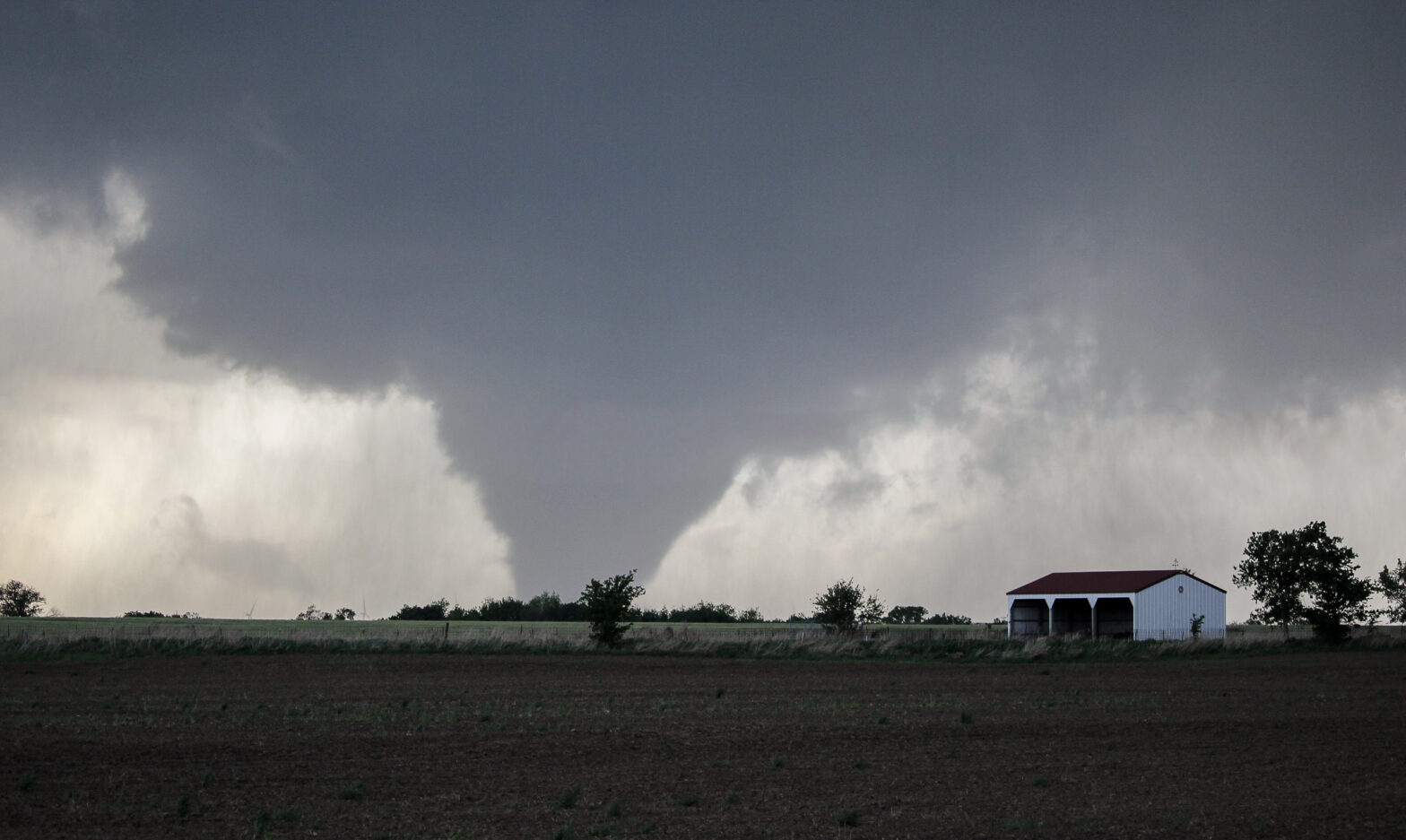
I’ve seen a lot of things in my nearly 10 years in Oklahoma. Presidential elections, big football games, big storms – you name it, it’s probably happened between 2016 and 2026. As Elizabeth and I reach our late 20s and face some decisions about what to do with our futures, I’ve had some time to reflect on what I have yet to do or see in Oklahoma. The number one remaining item on the list seems simple: a great, close-in picture of a photogenic tornado. Having seen plenty of tornadoes in my time, this one already has to have been done, right?
Over the last decade I have been snakebitten by just about anything that could happen in storm chasing: work conflicts, prior travel, my own crappy forecasts, my own crappy situational awareness. Hell, five years to the day before this blog post was set, there was an extremely easy tornado-fest in western north Texas only a few hours from Norman – but I was stuck at home while my dog recovered from a mite infestation. And so the quest for the mythical “retirement shot” – the one which, if I never storm chased again, I could hang my hat on for years to come – has remained. The pursuit of that quest has ebbed and flowed; I spent the early 2020s chasing the retirement shot in the anticipation that Elizabeth and I would be leaving Oklahoma after undergrad or surely once I finished my Master’s. Conversely, since joining the NWS in late 2022, the only tornadoes I had seen were from a lovely but not-particularly road-accessible storm in Kansas in 2023. Oklahoma had finally awoken from its late-2010s slumber, but I was content to work the events at the NWS and try to do my best to keep the public safe.
But in 2026, that quest felt as pressing as ever. Who’s to say which chase will be the last one out here? After every cap bust or crappy event, it felt like there was a clock ticking somewhere just offstage.
After April 23, 2026, the clock ticks no longer. The quest is over, the retirement shot secured. And in an anticlimax that defies the storybook way we imagine things, this was as simple as it could possibly get. See storm –> drive to tornado. Let’s dig into how James and I managed to have career days.
To really understand 4/23/26, you have to go back to April 29, 2022. I was eager to get the retirement shot even back then with a career in the NWS looming. A classic mid-spring dryline setup ensued with a trough ejecting over Kansas/Oklahoma, a surface low in central Kansas with a cold front trailing southwestward, and a dryline knifing through the center of Oklahoma. The greatest tornado risk looked to be in Kansas along or just ahead of that surface low, but the dryline also looked promising. Elizabeth, Sam, and I camped out in Guthrie, Oklahoma, where WoFS showed discrete dryline initiation as being increasingly likely. Big cumulus towers developed north to south across the state and hung menacingly in the late-afternoon sun. The SPC issued a tornado watch for Oklahoma, famously calling out the potential for 5+ inch hailstones in addition to intense tornadoes with any storms that developed along the dryline.
And therein lay the rub. No storms developed along the dryline. The primary jet and forcing remained concentrated in Kansas and thus the storms occurred in – you guessed it – Kansas. A hell of a lot of chasers ended up along the cold front where a low-grade landspout outbreak (landspoutbreak?) occurred, but one supercell formed right off of the triple point and tore through the south side of Wichita before dropping one of the tornadoes of the decade in Andover. Here it is in excruciating detail from the perspective of one of my future coworkers, Max:
That kind of stuff galled me. To miss out on tornadoes because life gets in the way is one thing, and not worth your time to get mad over. To miss them because of your own inability to read the signals? That one hurts. You have two options: pout over it, or put it in your memory bank and try to not make the same mistake next time.
So that brings us to April 2026. Already I had tried a pair of chases this year: first on March 5, when a fairly promising-looking warm frontal event in southwest Oklahoma turned into a diurnal cap bust and a nocturnal killer tornado 100 miles to my north in Fairview; and then on April 14, when crappy storm mode straight off of initiation turned a crappy setup into a downright crap setup.
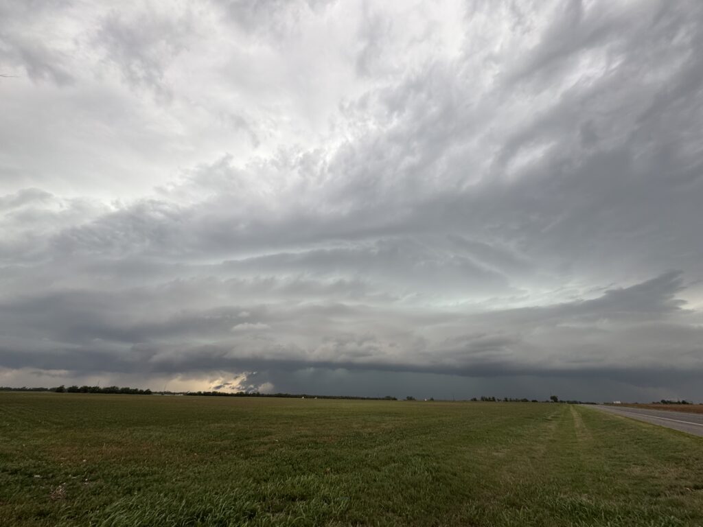
It was mid-April and I was faced with the prospect of getting skunked again for the 3rd straight spring. I hadn’t even gotten 3 chases in during the 2024-2025 seasons, and with a bachelor party in California and a trip to Korea for almost half of May coming up, prudence said I’d need to work upcoming events. The period leading into April 23 was one of those “it’s most likely going to have storms” kind of patterns, and closer proximity revealed a Thursday – Monday sequence with multiple days of severe weather possible. I was scheduled to work Friday – Monday, so keeping Thursday off actually looked pretty plausible. I kept one eye on forecast trends for Thursday the 23rd. Just in case.
By the 22nd enough evidence had piled up to point toward a storm chase the next day. There was sort of a rub with that; Elizabeth was on her way to DC that Wednesday for her 10-year high school reunion. She wasn’t available to chase with or to watch Scipio. Therefore, I had to play this really smart. Fortunately, I have a friend who lives in southern Kansas. Even better, James had already noted that April 23rd reminded him of 4/29/22. And best of all, he was off for the weekend once his mids were done on the morning of the 23rd. As long as I was willing to drive, we could link up and see what we could see.
The morning of the 23rd dawned grey and damp in Norman. Plenty of moisture was streaming northward past our house, clinging to the leaves of our garden, and hanging in a low mist over the pond behind our property. The layperson would assume that severe weather was off the table in these kind of conditions. On the contrary, I figured that if we could keep the stratus until about noon then break it out, things would be tracking perfectly. The morning outlook from the SPC continued to suggest that southern Kansas would be the bullseye target for tornado probabilities.
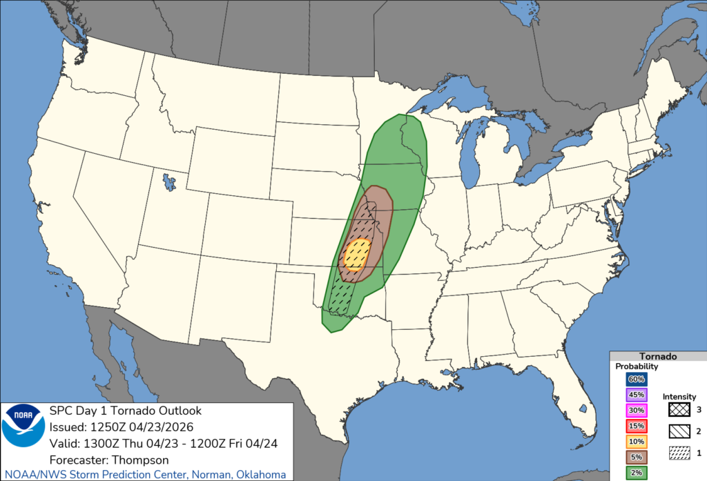
But… it also followed the cue of the some of the CAMs that were trying to fire one or two storms in southern/southwest Oklahoma off of the dryline. I genuinely don’t know what it is – maybe the mystique of the great dryline monsters of yesteryear and FOMO over missing the one time that it goes huge? – but a lot of OKC-based chasers will bias themselves again and again toward this direction when the main wave ejects into Kansas. Just think of 4/29/22! Elizabeth, Sam and I tried to play the dryline monster only for nothing to happen. At some point I had to learn my lesson and go for the triple point, right?
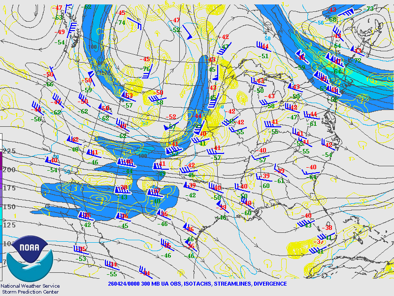
I wasn’t the only one fighting against myself. The target clearly was bifurcating, with the 300 mb jet showing a polar maximum in lift in southern Kansas and a potential subtropical zone of diffluence in the Red River valley. Between it, the OKC metro looked pretty safe. That was good for stashing Scipio in Norman, at least.
Speaking of… I took a break from agonizing over the target to take him for a nice long run. That way, I would be less likely to come home to a ball of angst who had torn the house apart.
Through the early afternoon I continued to sit in Norman, watching the stratus break up into billows and then HCRs, so that both options remained open.
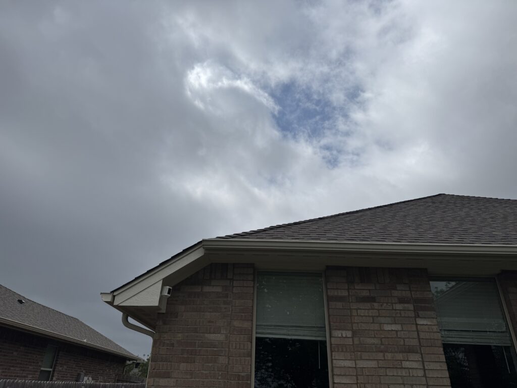
But at some point one must piss or get off of the proverbial pot. At 1:00 I sighed, resolved myself to not make the same mistake and miss another Andover, and texted James I was on my way up I-35. We would meet in Blackwell, Oklahoma to prevent any backtracking for me dropping him off after the chase. Blackwell seemed sufficiently far south of the zone of the tail-end Charlie along the surface low. All around me in the OKC metro, other chasers made their decision between north and south. The majority chose to go north to the state line. A substantial minority, including the NSSL LIFT project and several friends of mine, chose to head toward the Red River. With every mile northbound on I-35, I grappled with the uncomfortable knowledge that a missed forecast here would lead not just to the ignominy of missing a tornado in my own backyard, but also some very pointed questions from Elizabeth about leaving Scipio in the path of supercells. At least the Tigers broke the tension by winning on a walk-off home run as I cruised by Perry.
I arrived at the rendezvous point – the Braum’s along I-35 in Blackwell, Oklahoma – a couple of minutes after 3:00, any guilt about not being on time assuaged by James being 20 minutes further behind schedule than me. The blue sky of a prairie spring afternoon had broken through the stratus. All that remained were wispy filaments of altocumulus that gave the promise of chaos later. Any layperson looking at these skies in Oklahoma would immediately check their tornado shelter for spiders and snakes in case it’s needed in a few hours.
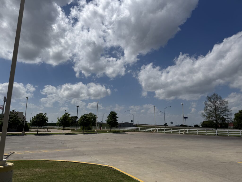
Well beyond the horizon afforded in this parking lot, a similar cumulus field was setting up in southwest Oklahoma. Farther to the north-northeast behind James’s tardy vehicle, the cold front was slowly unzipping. A couple of storms had already produced early-afternoon tornadoes along the Nebraska/Iowa border and activity was moving southward into eastern Kansas. There was much to track, including the satellite view of the whole region, surface observations (which were actually quite discouraging in north central Oklahoma, holding around 86/62), and radar up to the north.
James arrived presently and made a whole production out of getting his stuff moved into my car. Armed with a $7 bag of jerky from Casey’s, I was ready to roll, and the atmosphere looked ever more like it was too. The cumulus field was withering some along the dryline from central to northern Oklahoma, which wasn’t a great sign. If tail-end Charlie could get going off of the dryline just south of the triple point instead of on the triple point itself, it would have much longer before being undercut by the cold front later in the evening, and perhaps a longer window to be discrete. But signs were pointing away from that at least for now, so James and I started hedging slightly north out of Blackwell. First we drove about 15 minutes north, crossing the state border into Kansas near South Haven. Then we hopscotched north again to the east side of Wellington. US-160 and Seneca Road, to be specific. The sky didn’t look amazing.
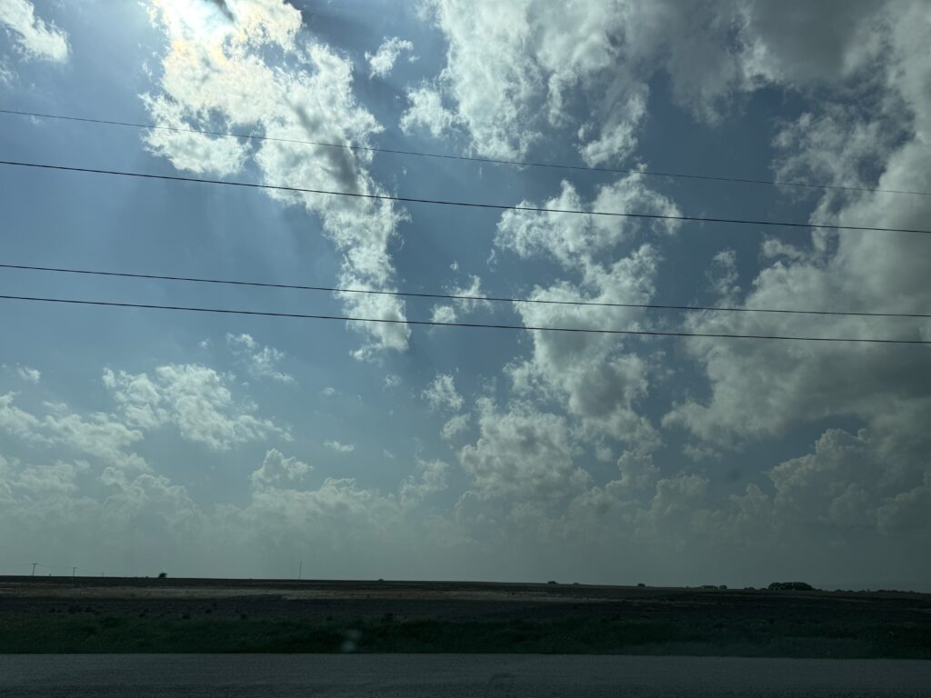
But it was 4:15, so we didn’t need to panic unless things still looked like that in about 90 minutes. At the very least, it was clear that I had chosen right in not going to southwest Oklahoma. The cumulus field had entirely died there and the dryline was about to be socked in by thick cirrus, usually a death knell to anyone waiting for storms to develop.
I set to killing the intervening time in the most Nolan way possible. James and I were pulled off of the side of the road in a gravel parking pad, so I entertained myself by throwing small rocks at a power pole 30 feet away. In between bouts of catching up between old friends and talking about our upcoming Korea trip, James noted that if I needed to leave my toss 2 feet right of the pole for the wind to draw the stone on-target, then the low-level winds must indeed already be backed. It was airtight logic, really. Bill Paxton dropped dirt in the original Twister movie, but in today’s age of lawlessness we now can test the wind direction by throwing rocks at things.
Just as I started to get a little fidgety just before 5:00, the cumulus field started deepening again to the west. Max was seated back home in Norman and noticed a broader view on satellite that suggested that we weren’t far away now.
I couldn’t help but agree. Even in the 5 minutes between 4:55 and 5:00, towers continued to pulse up into the milky-blue Kansas sky in a way that told me this was no false attempt.
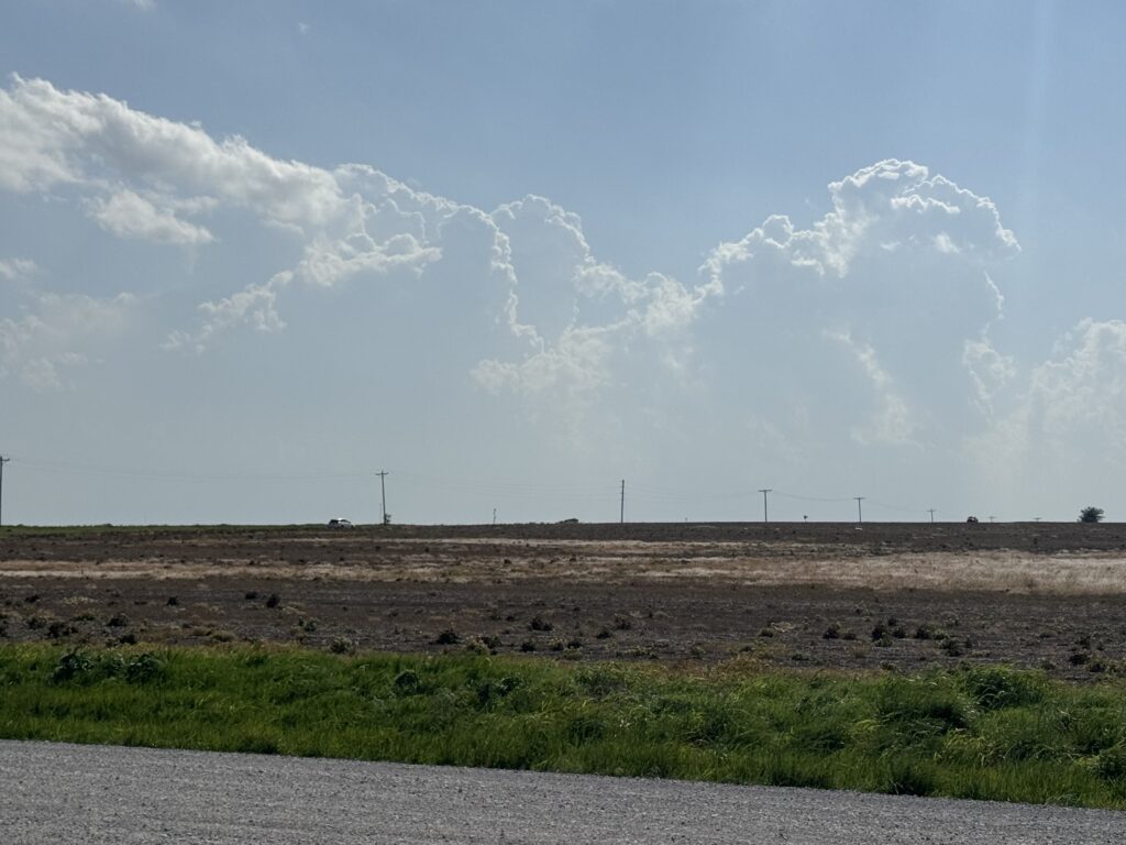
James threw on his sunglasses and peered into the distance. Those of us not wearing contacts contented themselves with his report on the depth and blockiness of various cumulus towers. The best part of all: these attempts were going up west and south of us, increasing our distance from the surface cold front and its associated over-forcing potential. I picked up 10 more rocks and told James that if I hit the telephone pole at least 4 times, we would be seeing a tornado that evening. Miss. Miss. Miss. Hit! Miss. Well, now I needed to hit 3 of the last 5. Hit. Miss. 2 of the last 3? I focused all of my severely overbearing energy on those final tosses, and succeeded in getting rocks number 8 and 9 to clank off of the center of the pole. Tornadoes were now guaranteed.
If they were, we were probably going to have to move some to find them. The cumulus field extended well into northern Oklahoma. To keep tail-end Charlie in play, we’d have to backtrack to the south. Not on I-35 this time, because the toll road didn’t leave a lot of options for choosing where to get off. Instead, James directed me into Wellington and southbound on US-81. The tower just to our southwest continued to grow, with an icy translucent-white beginning of an anvil beginning to spread downstream far, far above. “The Middle” by Jimmy Eat World played on 103.7 FM out of Wichita. Who needs a pump-up playlist for storm chasing when you have that? Shortly after, the station ran an advertisement for delivering Jimmy’s Egg breakfast to your office if you won a contest. I asked James if he’d ever gotten Jimmy’s Egg catered to him at his office by a radio station. He replied “Huh?”, thus indicating that perhaps he has a better ability to remain focused on the task at hand (storm chasing) than I do.
We stopped at 80th Street 8 miles south of Wellington around 5:20 pm. Just to our southwest, the nearest updraft was in the middle of its metamorphosis into becoming a supercell. The anvil spread over the sun, mercifully giving my eyes a break from squinting. The storm’s core initially looked pretty weak to nonexistent, but gradually it filled in and the cloud mass in the updraft darkened from ivory to a deep blue-grey. James turned to me and warned “Just fyi, this has lightning nearby” about 5 seconds before the first rumble of thunder came crashing down the prairie. He gets points for giving me the warning ahead of time, but not many points for the amount of lead time.
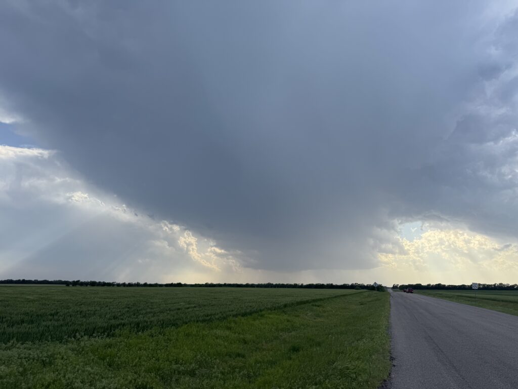
Somewhere in the distance, one of James’s coworkers pulled the trigger on the first severe thunderstorm warning of the day for the triple point/northern dryline regime. It seemed unlikely to be the last; several other updrafts had developed almost exactly where the two of us would have wanted them to.
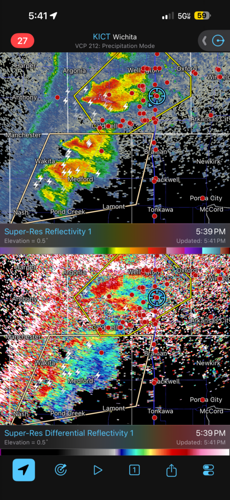
Conventional wisdom would suggest that we wanted to keep the southernmost of the updrafts in play with the 6:00-8:00 pm low-level jet window rapidly approaching. For now, though, the storm in southern Kansas had by far the strongest ZDR column, so we made the tactical decision to get a little bit east across I-35 without gaining or losing latitude. With storm motions just north of due east (once storms became mature, at least), this would keep all options in play.
What our east option (90th Street) did not give was a solid paved option back onto the highways if needed. James and I came to regret that lack rapidly. Not that the dirt roads were poor in the area; I made close to 50 mph on 90th Street and would make close to 50 mph to get us back to pavement. But if, for example, it started to become clear that a constructive updraft merger was occurring in northern Grant County, so now you wanted to get back toward Blackwell or Braman… then perhaps the 7-mile drive down Broadway Road to US-166 and South Haven would be a long, long 10 minutes of driving. Admittedly, for us to have thrown such a bullseye on the general target, James and I were floundering a little bit on the tactical level.
But we emerged in South Haven at about 6:00 pm and made a quick stop at the Motel 6 just off of I-35 to take a look at both storms. Our original supercell was heading northeast still into Wellington and points beyond. It had a blocky little wall cloud but also a rather skinny and unimpressive updraft base. Meanwhile, James was starting to sound really enthusiastic about the supercell in Grant County. Trying to let go of my own control issues when chasing, I asked James “Do you want to commit to the south one?” His answer came about as close as you’ll ever get to a direct affirmative while storm chasing. Then he tried to second-guess himself, but to buttress his own self-confidence in the choice I was already merging onto I-35 southbound back into Oklahoma.
With each passing mile, it became clearer just visually that we’d chosen right. The northern storm’s base shriveled in the rear-view, while James sounded correspondingly more upbeat about the southern storm on radar with each mile. We passed the state line and reentered the Sooner State. James plotted a course assuming the storm, whose base was still 15 miles west of the Interstate, decided to hook a hard right turn. We were heading to… Blackwell, then east on OK-11, then north on US-177.
I wasn’t so sure about that plan. We were starting to get a visual of the storm’s base by the time we reached Braman, halfway between South Haven and Blackwell. Wouldn’t it be better to get off here and go west, not east? It was after 6:00. At a certain point you have to take the chance and actually play the storm. But again: I don’t have to be in charge of everything all the time. Swallowing misgivings, I gunned Sara back down I-35 to Blackwell. Off to the right, the storm’s updraft and base came into view. This thing was a tank. Even in the time it took to merge off of the Interstate, a small inflow tail/wall cloud feature started to take shape.
It took a couple of minutes to clear the small residential area of Blackwell along the state highway and get onto the US highway going back north. Immediately a problem presented itself. 177 crosses the Chikaskia River just north of Blackwell, and big stands of white oaks dot the bottomlands along the river. Sitting on the east side of the river and looking back to the west was not going to stand, since our horizon view was blocked.
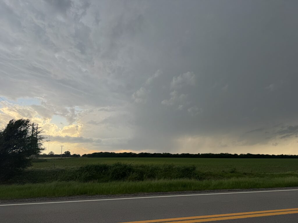
So I convinced James that we needed to get a bit north and then find a west road that would cross the river to try and get better sightlines. In north central Oklahoma, that’s usually not too hard to find. Two miles north of Blackwell on Brake Road, we found our route and edged a little west. It was now about 6:30 as I pulled off, turned off the car, and we stopped to relax and enjoy the view for the first time in over an hour of repositioning. While we’d been dicking around, the supercell hadn’t. That low-level jet window was becoming more and more evident. We still had about 90 minutes to go before sunset, although I was increasingly sure we wouldn’t need to wait that long. The updraft had a crisp left edge with blue sky above it and that watery-orange light that so many legendary tornadoes have been backlit by.
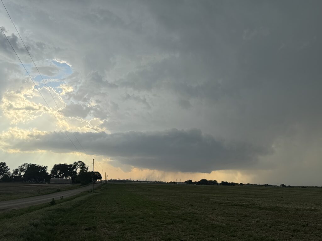
Even as James and I watched transfixed, a huge inflow band had developed in advance of the updraft base, and a huge area of dust looped behind the base in one of the more emphatic appearances of the RFD you’ll ever see. A few more minutes, and a blocky wall cloud started to develop.
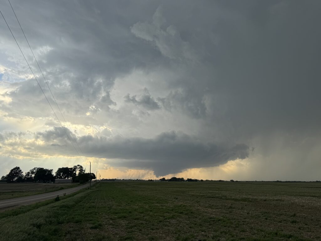
I continued to nudge James further and further toward the west, holding a feeling deep in my gut that something big was minutes away. So was Max, who had texted me “Enjoy your imminent tornadoes!” at 6:30. So we hopped back in and we drove another 3 miles west across I-35 to get the perfect foreground.
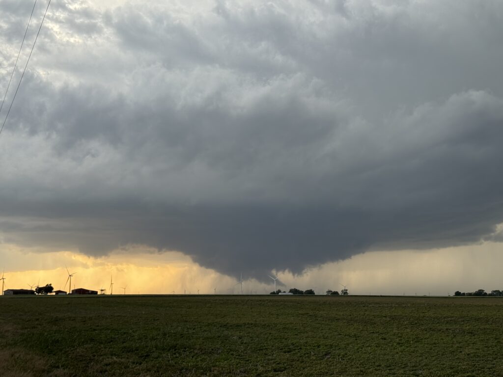
Yeah, that would work.
By 6:45, the wall cloud and inflow band region were alive with the most chaotic motion I had ever seen in person. “It kinda feels like there’s already a tornado in there,” James ventured, and I had to concur. That kind of motion doesn’t occur unless you have a ground circulation that’s imminent or has already planted. We squinted for a minute, then both exclaimed simultaneously. Tucked right there in the center of the occlusion was a funnel, far too tapered and persistent to be anything else.
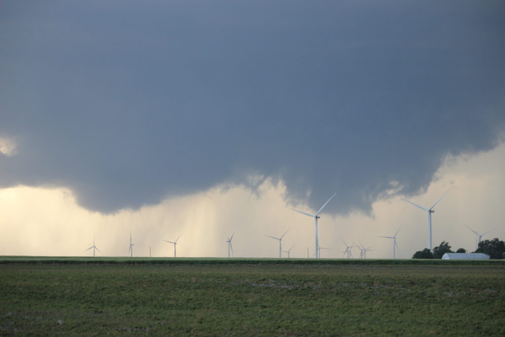
This continued intermittently for the next several minutes. We couldn’t quite make heads or tails of it, but various columns of dust and whatnot on the ground left little doubt that there was at least some sort of intermittent, suction-vortex-heavy tornado in there. After three long years, my drought was over!
But, while we kept expecting a hog to plant itself with each passing cycle, it never quite happened. Anticipation gave way to a sort of wry consternation as the wall cloud began to slow down, the chaotic motion becoming a more standard vibe of feeding inflow. While modestly perplexed, I also wasn’t too worried. The clock was just now approaching 7:00, and if any storm could take advantage of any environment in the 0Z Magic timeframe, it was the one in front of us. At this point we had a sculpted classic supercell with absolutely gorgeous anvil crawlers thousands of feet directly above. The inflow winds whistled in from the south strong enough to make the high-tension powerlines above sing. Cloud-to-ground lightning strikes slowly began ramping up, enough to make us both cower and duck.
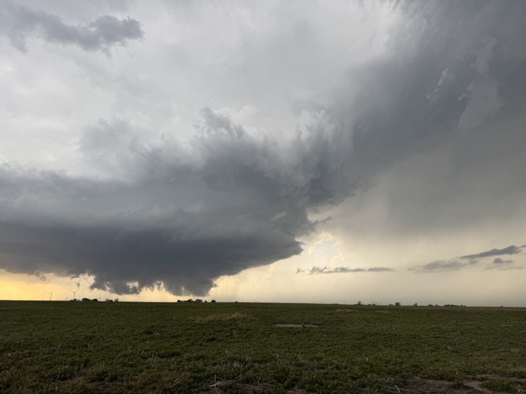
But near the surface there was still no indication of a hog after about 20 minutes of structure-teasing. At some point in the not-distant future, we would have to contend with some of the challenges that were developing, including:
-New updrafts that had developed and matured into supercells of their own in the primary storm’s southwest flanking line. A storm interaction was going to happen any moment now.
-Lack of road options east of I-35.
-Stabilization of the boundary layer.
But for now, the supercell’s base was almost level with us and about 3 miles due north of Brake Road, moving just north of due east at about 30 mph. This was a miscalculation – it was actually moving due east and traveling much more slowly. But given the circumstances, and the fact that I was uncomfortably aware that it was due to me that we had backtracked 5 miles west of James’s north-south option all thanks to my suggestion, it was feeling like time to get a little east to keep ahead. After all, the wall cloud actually looked a little worse.
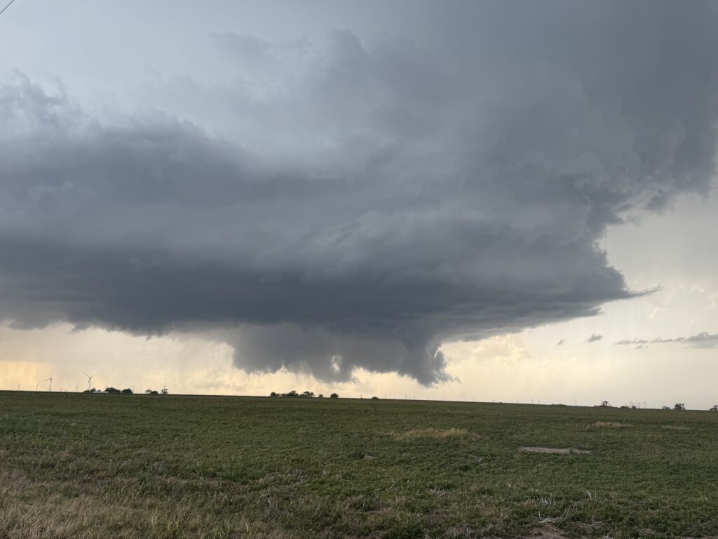
I’ve misread a lot of meteorological cues in my day, but this was one of the worst misses. Unlike two pictures ago at 6:53, the above picture at 6:56 has a big, glaring RFD cut already starting to develop. The storm interaction was occurring much faster than I could have guessed. Or James, for that matter, because he promptly agreed to move east. We got back in the car and the CRV bounced along Brake Road.
Crossing I-35, I was lamenting the miss that the first 1-2 cycles had been. “I would have bet my entire life that we were gonna get a hog.” We waited a full five seconds at the stop sign at 4th Street for the chaser coming in from the north to realize that he didn’t have a stop sign, which did little to quell my exasperation. We drove past a little property on the north side of Brake Road where the occupants were standing outside and watching the storm to their northwest, apparently indifferent to the cloud-to-ground bolts now beginning to fry random targets all around. The locals can never be defeated. About halfway to 29th Street, we passed another driveway marking the boundary in quarter-sections. I took a quick glance in the rear-view mirror to check on the storm like a parent checking in on their child. And my heart sank. James whipped his head around to look back to the left, and said in a tone much like mine, “There’s a stovepipe there”.
Right as we’d moved to reposition. Of course. At least we were on a relatively unpopulated dirt road. I whipped over to the left side of the road, remarking as I did, “James… we might be fucking morons.” I threw the hazard lights on and craned my neck back behind us. There wasn’t anything defined on the ground here at 7:04 pm, but there was a well-defined circulation to the left of the wall cloud we’d been watching, which I now realized to my slight embarrassment was actually just a blocky inflow tail.
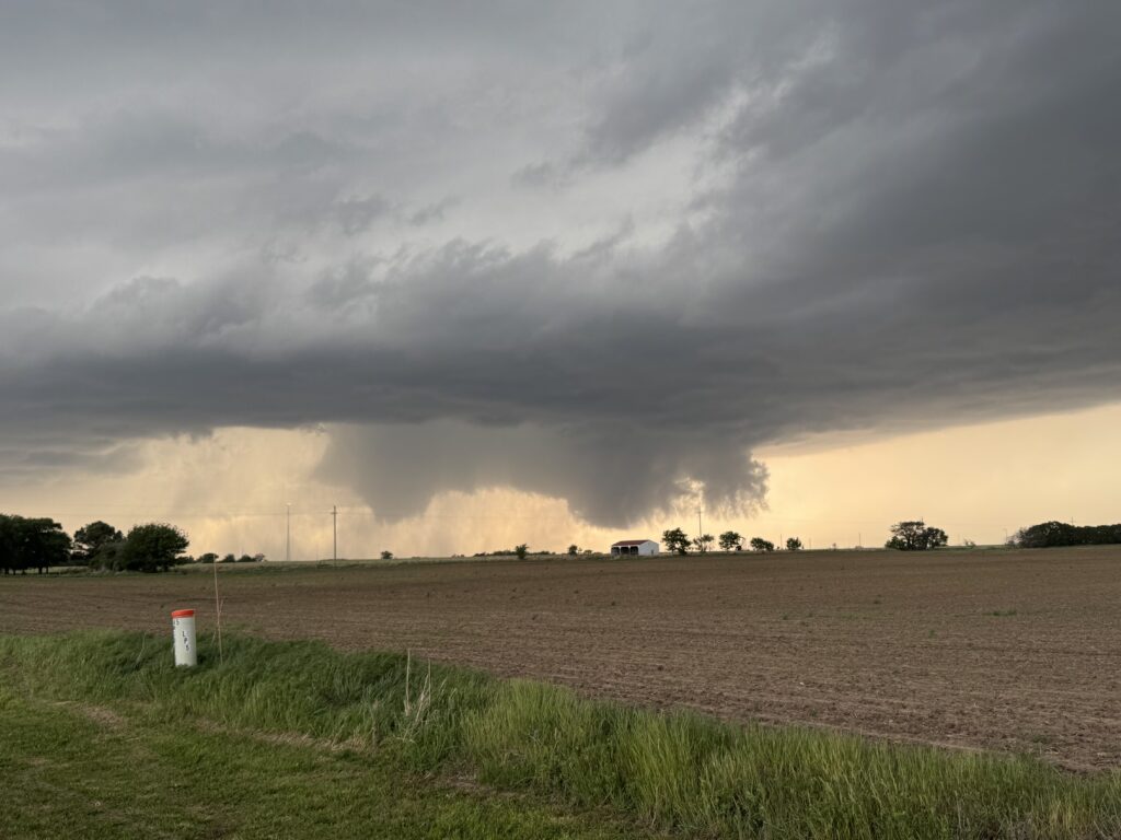
But in the next minute or so, the circulation tapered some and reached toward the ground. “Yeah… that’s a tornado.” I turned the ignition off, jumped out of the car (not five minutes after mocking those locals for standing outside in the very same lightning barrage), and James rounded the backside of the car to enjoy the view with me.
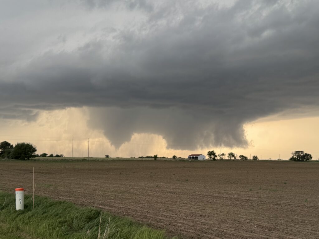
Stubbornly, the tornado refused to fully condense at first. But my unbridled optimism of about 30 minutes ago had returned. You could see a little sheath of rain hooking under the occlusion, which was absolutely classic. Once that rain worked its way into the circulation, that thing would condense and probably bomb out a little bit. I started to take a quick video to capture the entrancing atmospheric dance occurring to our northwest, but was brought up a few seconds later by the sight occurring in front of us. In the little wall cloud/inflow feature to the right of the tornado, a second little funnel had developed. It snaked its way to the ground, a little narrow elephant trunk dancing along the Oklahoma prairie. And it was moving not slowly eastward (or was it motionless?) like the primary tornado, but was moving from right to left, closing the difference with its parent.
“Twins!” I exclaimed in giddy joy, adrenaline and ardor having replaced scientific detachedness. James was polite enough not to correct me. Or perhaps he was feeling the same sort of adrenaline surge I was.
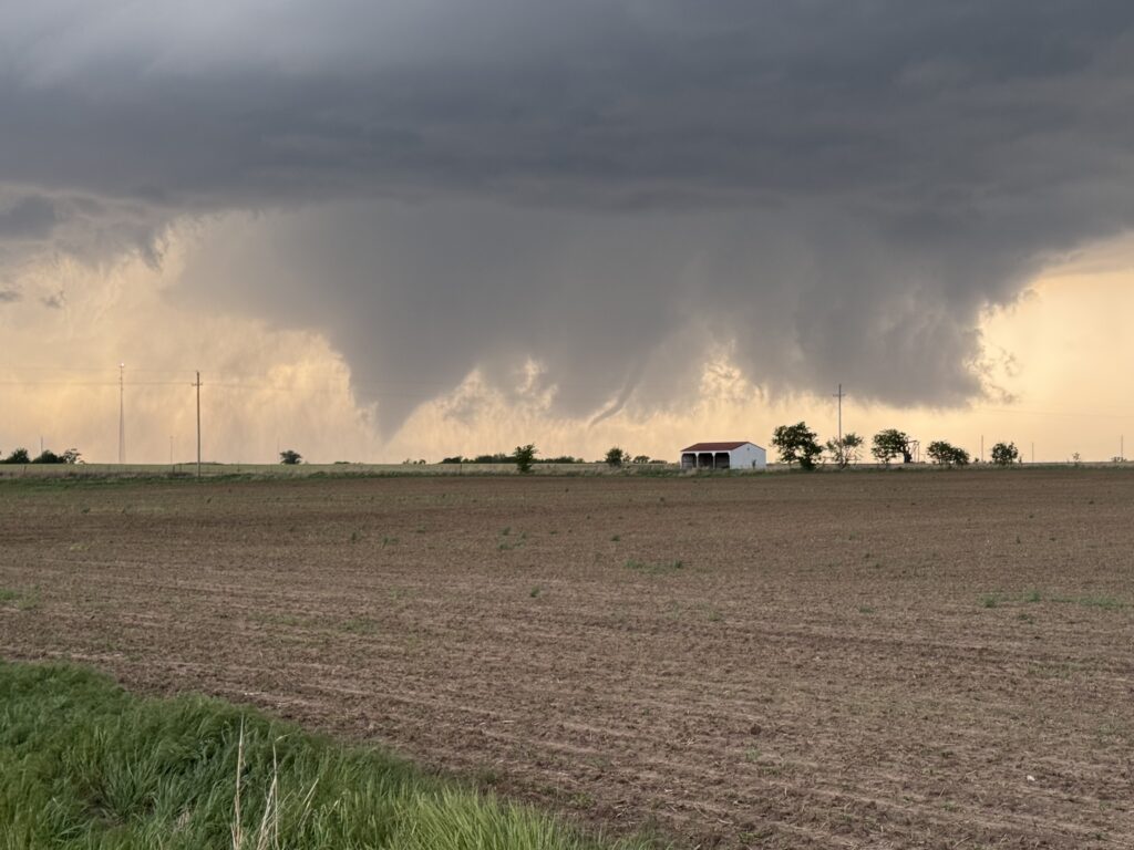
Only a single regret remained: that somehow the camera battery had chosen now of all times to die and let me down (note: I never bothered to check the battery before departing. This was 100% my fault). Here was a chance for the retirement tornado shot, and I was camera-less. Mostly camera-less. Long experience has taught me that flipping it off and back on usually buys me 2 or 3 more snaps before the battery dies for good. Much like a cowboy keeping one more in the chamber after all hell has broken loose, I needed to make my last shot count.
So in the absence of the Canon, I did what James was doing beside me with his phone: video.
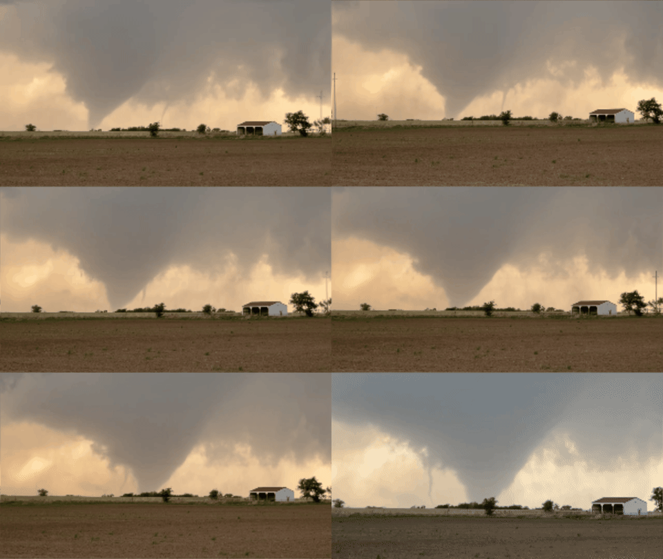
Both of us stayed silent for the entire minute that we filmed, which was hard to do because this was turning into something neither of us had ever seen before. A satellite tornado doing a partial orbit around the parent even before the parent has fully condensed? Meanwhile, the parent condensing into a highly photogenic stovepipe right as their trajectories overlapped from our vantage point? This was the dream retirement chase.
The satellite petered out after a minute or so of filming, so I cut the video at 7:07 pm. And now, safe from having to hear my voice for the rest of life while rewatching that video, I lost my shit to James: “This is INSANE”. The tornado had grown into a backlit cone that reminded me a little bit of a worse version of the Rozel, Kansas 2013 EF-4.
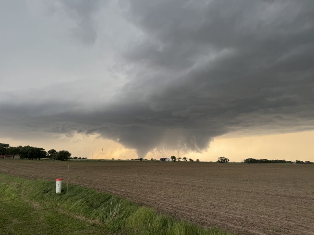
In other words, if there was ever a time to try and get The Shot, this was probably it. The camera fortunately flipped on. And here is the result of taking that one shot:
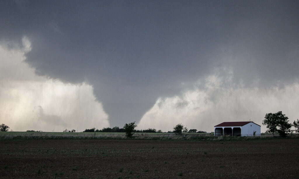
I can now retire without ever seeing another tornado, and there won’t be that same pain over never having found a Big One.
There was some ebb and flow in the shape and structure of the twister for a few minutes. It had looked for a second like it might be about to “wedge out”, as the chasers say, but that was followed by another period in between 7:08 and 7:10 where the condensation funnel seemed to taper above the ground. It was of course a little hard to tell because we were about 5 miles southeast of the action area (why, oh why had we decided to move? Our previous location was 3 miles due south of the road over which the tornado sat nearly motionless).
A couple of minutes after that, the slug of rain that had seemed to accompany the RFD surge with tornadogenesis was beginning to wrap all the way around the circulation. Once again, the funnel extended to the ground and grew to maybe 1/4 mile in width.
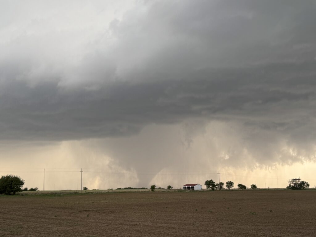
I also suspected that the rain was responsible for a new eastward surge of the tornado. James and I watched the smooth, gray vertical lines of the hog disappear into a hazy curtain. Right around 7:13, we lost a visual. It had been a mere 10 minutes since we first saw the tornado in the rearview and a mere 7 minutes since the incredible satellite orbit. Sometimes those things are in view for much, much longer, but over close to a decade on the Plains I don’t know if I’ve literally ever sat on the side of the road and watched a tornado for 10 minutes. It’s wild but true. The McCook/Stockville and Waldo/Tipton tornadoes in 2019 lasted much longer, but there was a lidar to operate for TORUS. The Springer tornado in 2020 maybe lasted longer, but it was in an inaccessible wilderness in the Arbuckles. Everything else has been brief, short-lived, not fully condensed, or some other issue. So this was a really special moment to me. And to James, too, as we both readily acknowledged that this was a career tornado and shared some adrenaline-fueled (and badly missed) high fives before getting back in the car.
We hadn’t even driven a mile to the east (still thinking of getting north and east of 177 to position for the next cycle) before the tornado briefly re-emerged from the rain at 7:15. I wryly smiled at our timing again and pulled off of the left side of the road. This time the tornado, a slightly tapered stovepipe, remained in sight for about a minute before it faded back out of sight.
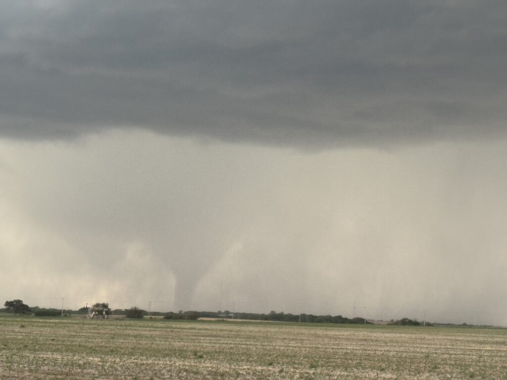
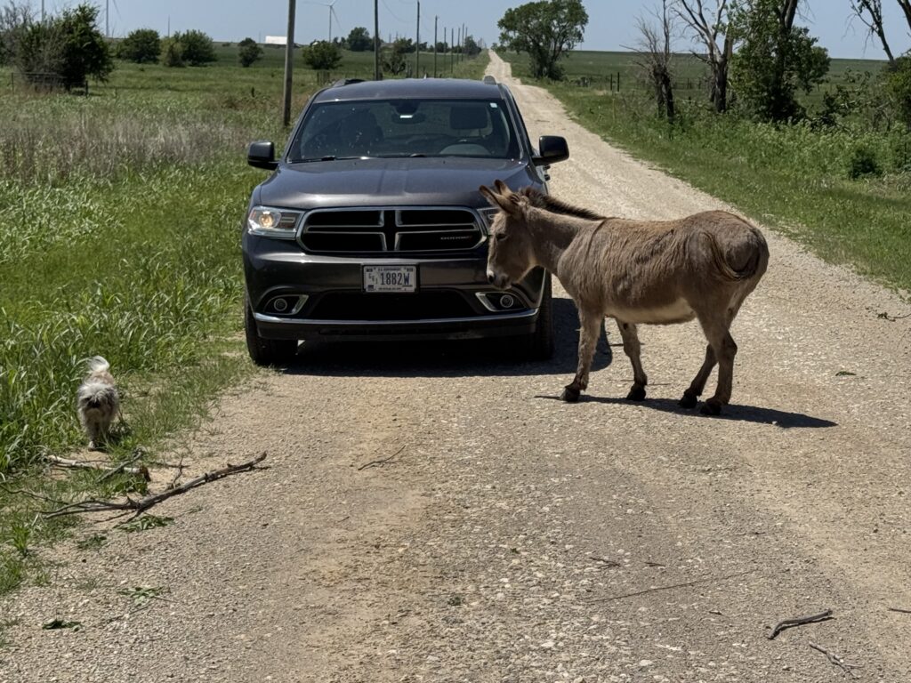
That would be our last visual of the Braman tornado, which lasted approximately 23 minutes from 7:04 to about 7:27. So it still had another 10 minutes to go, but from the south and southeast the RFD had wrapped too far around to see anything. James and I would ultimately end up back in Kay County the next day surveying the supercell’s tornado track(s) with Forrest. For one thing, I was a little surprised to find that some of the most intense damage occurred after the occlusion into the rain, which slingshotted the thing within about a half mile of downtown Braman itself. For another, the surveying experience was a whole other adventure, from meeting all of Forrest’s friends in the Braman region to meeting some other types of friends out on the hunt.
But that was the next day. For now, surveying was the last thing on our minds. We needed to get back in front of the storm before we fell into the mass of chaser hordes.
We did get back in front jumping north a mile to Canteen Road and P Street on the east side of 177. At 7:24, there was still a tornado somewhere in the mess of rain and hail in the RFD, but you couldn’t tell that from our vantage point.
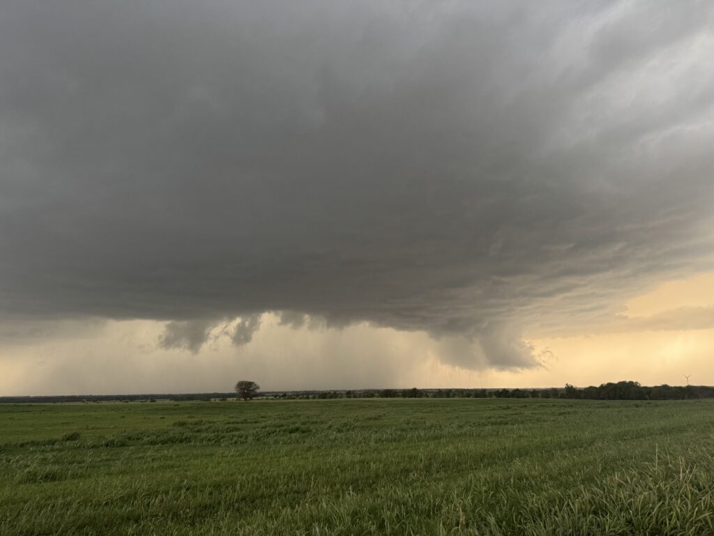
James was all for calling it. I wasn’t, at least yet. I mean, we’d been on this storm for all of what, an hour? The sun didn’t even set for another 30 minutes. But the blunt truth looking at this thing was that it was going to take some serious sorting out of the heavy blob of rain in the RFD before we could even consider another photogenic tornado, and James (perhaps trying to pre-empt my frequent assertions that I wanted to “get up in that sumbitch”) expressed no desire to wander into the bear’s cage. To be clear, I had no desire either. It was one thing when this was west of the Interstate, the hook was clean, and we had an easy sightline to the tornado. If there had been a time to play close, it was there. But somewhere to our west, radar suggested there might still be a rain-wrapped tornado that had just missed doing some serious damage in town. That’s not playing aggressive, that’s playing stupid. So with some regret and a look at radar to confirm that there were several other updrafts that would keep interfering with the cleanliness of the hook, we turned it around and headed back south, just barely beating the deluge of the southern side of the bear’s cage back to pavement.
A certain advantage of turning around (besides being able to call it a night and go home, which absolutely had to hold an appeal to James coming off of a mid shift) was that we could rescue James’s car from the Braum’s/Casey’s combo along the Interstate in Blackwell. It turned out that the dryline had fired in a limited fashion – not so down in southwest Oklahoma, where dozens of chasers and some sad NSSL field workers were watching a bunch of failed updrafts and probably trying to avoid social media at all costs – but at least in the 40 miles between Braman and Enid. Several supercell structures could be seen further down, and it wouldn’t hurt to get James back in his car before it got pelted by hail. On the way back through Blackwell, we passed a roadblock that law enforcement had already put up on 177 northbound with plenty of flashing lights heading north to Braman. I crossed my fingers that nobody was seriously hurt (nobody was. The property damage was extremely minimal from the EF-1 tornado as well, unless you were a high-tension transmission pole). We managed to grab James’s car just as rain moved into Blackwell and relocated south to Tonkawa to wait for a break for James to drive home.
I pulled into the truck stop along I-35 near Tonkawa at about 7:55. The orange glow of sunset was even more brilliant than before. Sabrina Carpenter was playing on the radio. We had been insanely successful, really beyond any reasonable expectation. I could go home and enjoy the rest of my night in peace now.
Except…
About 40 miles to the southwest of Tonkawa, the final supercell in the line was just tapping into the low-level jet over Enid. This was tail-end Charlie, not the Braman storm. One look at radar had me convinced: this could be the storm of legend. I hurriedly called James to let him know I was flying down I-35 toward Enid if he wanted to join. About 10 minutes later, a tornado developed on the southwest side of Vance Air Force Base. It was like a tornado from the 1990s had been kerplunked down into 2026.
The tornado went on a northward path from Vance to neighborhoods on the southeast side of Enid itself over the course of a highly-visible 37-minute life. It would ultimately do EF-4 damage over multiple locations, yet somehow there were no fatalities. It was a testament to my coworkers who did a phenomenal job issuing a tornado warning early, and eventually upgrading to a tornado emergency as properties came under the risk.
As for the little two-car convoy we had going at this point? Well, the stars were not to align. Perhaps if we had bailed on the Braman storm when James wanted to, or perhaps if I hadn’t been preoccupied singing Sabrina Carpenter at the truck stop, or perhaps if I had the guts to core punch a supercell with an erratically moving violent tornado at dusk without someone else in the car to keep an eye on radar, we could have popped out on the near side of Enid and seen the final stages of the tornado. As it was, I chose to play it safe in the dimming light, heading west on US_412 into a brown-grey sky that would almost fool you into thinking there was no storm nearby, then dropping south through a lashing forward-flank rain on OK-74 to the safety of clear air in Covington. Ok, so “safety” was probably a misnomer, borne out by the bolt of lightning that struck between James’s car and mine as we bombed south out of town for our west option into Douglas. And yeah, you know what? That wasn’t the only lightning strike in the neighborhood.
Personally, that is how I think a supercell with an ongoing EF-4 should behave. Nasty, mean, wild: the true beast of the Great Plains. Every single thing in that video, from the flash density in the updraft to the ominous little bright pulses in the anvil on the left to the bruise-colored sunset at the horizon – all of it screams of the power of these storms. After a full decade on the Great Plains, I didn’t think I could still get romantic about the humble supercell. Maybe I can’t, but I can get romantic about a supercell that is decidedly not humble.
Unfortunately, this nifty and safe bit of navigating took us out of play for the final act of the Enid tornado, which had about 2 minutes to go at the time of this screenshot.
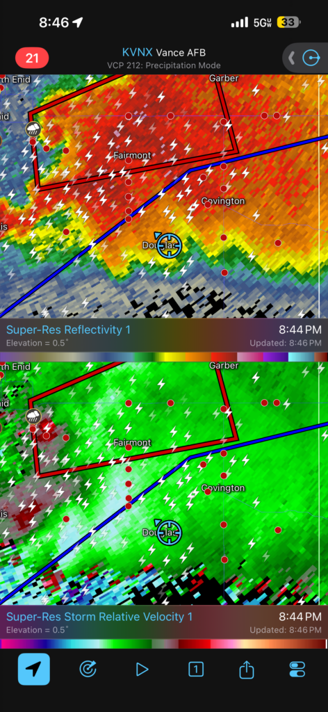
Sometimes you win, sometimes you lose, but if you play it safe you’ll at least get the chance to win or lose another time. As much as I’d been claiming I wanted to “drive into that sumbitch”, there are moments for ardor and moments for discretion. This was a moment for discretion. Especially since it looked like this supercell might put down a new monster really close to Douglas. James and I huddled our cars next to each other at a dirt road intersection like we were an old-timey wagon train hunkering down against the elements on the Oregon Trail. The lightning was genuinely as frequent and nasty-sounding as I’d ever seen.
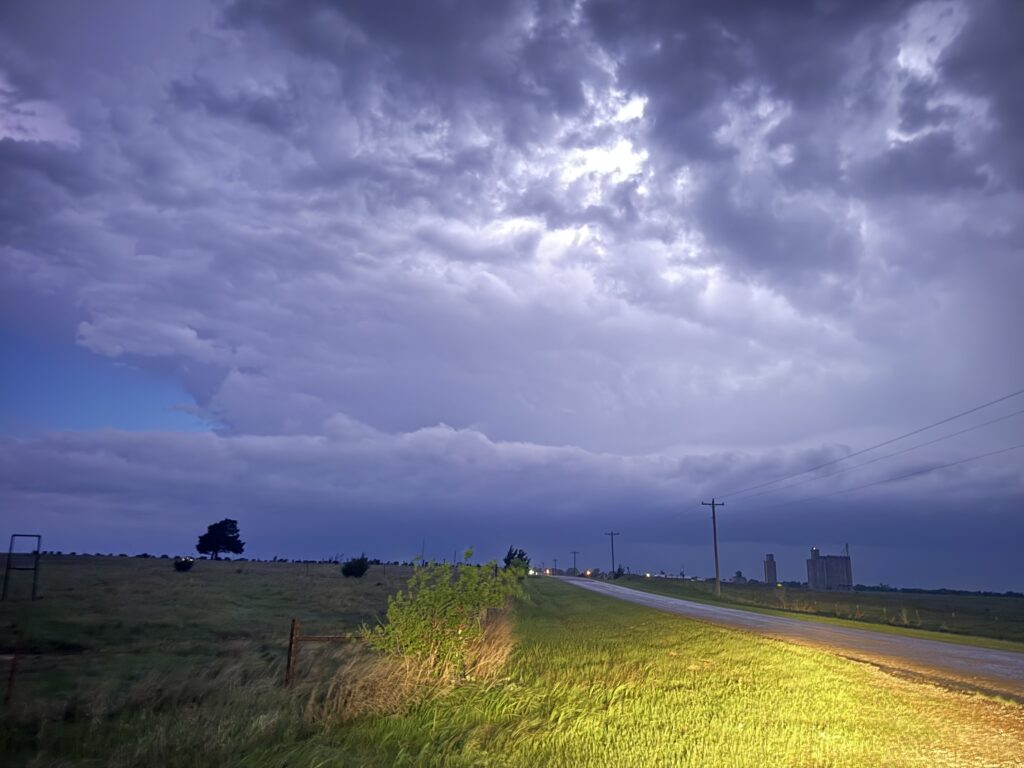
Slowly the circulation began to wrap its tendrils around the intersection. First the RFD was northwest, then due west, then southwest. The wall cloud crept closer and closer, signs of a clear southward deviation. James felt edgy, then nervous, then outright angsty. Finally, he let me know that he was going to bail on the storm altogether, having had enough of my aggressiveness. We barely had time for a quick good-bye before he was off and out of there. I am glad we got to survey together the next day, because otherwise that would have been one of the great injustices in all of storm chasing: two friends making the right call, working together to get their storm, and almost can’t hear each other over their car engines as they part ways. Fortunately, the two of us get the chance to celebrate in the near future in Busan, South Korea, so I guess maybe we aren’t victims of circumstance in this story.
It took me about 5 minutes to realize that James was right about the location. The supercell was surging south, and not fully outflow-dominant. It was time to beat another retreat back to the south. Hailstones started pinging off of the CRV as I revved it back to the east and then south. In the distance, every few minutes a wind turbine got zapped in the face by anvil crawlers. It was fully nighttime, and it was spooky, and even though there was still a really decent chance that this thing was going to be tornadic, I decided to make the call and turn around for home.
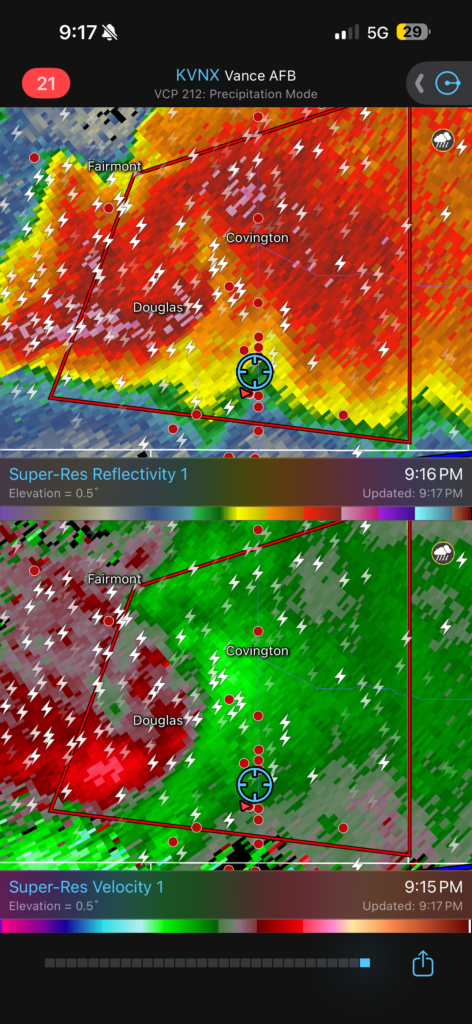
And so I did that, calling Elizabeth from her high school reunion on the way back. She had had a good day, and so had I. The hardest part of the conversation was the constant interruption the whole way back to I-35 as every emergency vehicle in central Oklahoma converged on staging locations south of Enid. By 11:00, I was safely ensconced at home with Scipio and a $10 order of Taco Bell; it is often said that the American dream consists of tornadoes, dogs, and crappy fast food.
The whole concept of the “retirement shot” while storm chasing was equal parts a silly bit and also a legitimate outlet of frustration for me. Years of misadventures and a heightened sense of self-awareness led me to miss the forest for the trees at times while chasing and get into a single-minded focus on the shot of the big tornado. Life is supposed to be about the journey and enjoying the little things, but those cliches start to ring hollow in the face of a long-lived tornado drought.
Well, that monkey is off of my back for the rest of my life. Would I like to get closer to a tornado one day? Yes. We could have done that here with the Braman storm, but given how quickly rain started wrapping in and James’s general aversion to taking unnecessary chances, staying put was probably the right call for this one. It doesn’t matter – a zoom lens will make anything seem like it’s right next to you, and the viedo angle of the orbiting satellite was sick. (“FUJIWARA,” Elizabeth screamed while I got my Taco Bell, quoting Twisters.)
Who knows where life goes from here? Maybe Elizabeth and I really are in the final stages of life in Oklahoma, and this was the retirement chase. Maybe we’ll keep saying we’re planning on leaving and never actually do it, and I get an Enid at some point in the future. Either way, I look forward to the next time I see a storm out on the open prairie – without the pressure.
