From January 23-25 of 2026, much of the United States from Oklahoma to the northeast was impacted by a winter storm that brought snow, sleet, and freezing rain to areas that rarely see that much. Here in Oklahoma we saw the highest 3-day snowfall total that I have experienced in my decade or so of living in Norman.
This post is an attempt to liveblog the event while it happened through a series of short 200 or so word entries a couple of times a day. I would love to do more stuff like this, though it can be complicated. Read on to find out how the weather taught me a valuable lesson about finding the joy in life with what’s in front of us.
Wednesday, January 21 – 2:15 pm
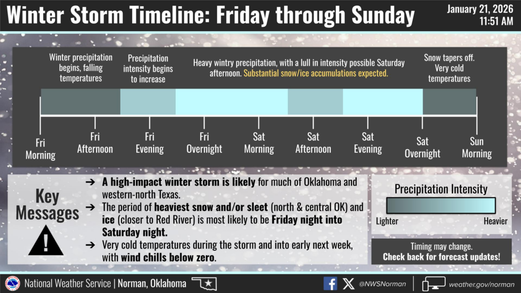
Right now we’re about 48 hours away from the start of what could be one of the most impactful winter storms I’ve seen in 10 years in Oklahoma. It should last through much of the weekend with the most fun occurring late Friday into late Saturday.
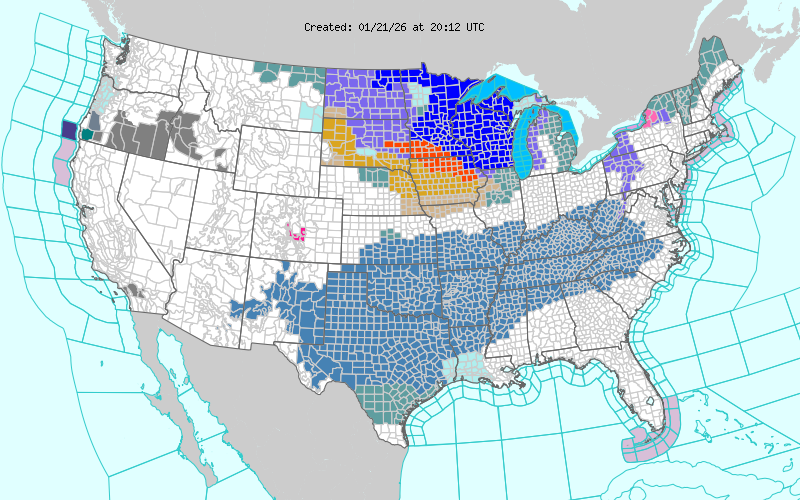
This winter storm looks widespread across the country east of the Rockies. If it won’t be snowing, or sleeting, or icing at your house, then it will probably be 30 below zero or something obscene like that. Check out the extent of winter storm watches:
What do I expect here in Norman? That’s an interesting question. The clear trend from the models the last few days has been for a solid phasing of the polar and subtropical jets across the central US, which should bring out one of the stronger midlatitude storms I’ve seen in a while. It’s been cold in Alaska forever, which means there will be plenty of extremely cold surface air. Given that, I’m quite sure we’re going to see something significant in central Oklahoma, and in fact am even more sure than I was at this time yesterday. The big question is how much the warm nose can get above zero. Right now, I’d expect around an inch (maybe an inch and a half if everything breaks right) of liquid water to fall mostly as sleet but with some snow mixed in. Given that surface temperatures are going to be in the teens and dropping on Saturday, that’s going to turn roads into a fully impassable nightmare quickly. Further to the northwest from OKC toward Woodward, a foot of snow seems more and more possible. Further to the southeast near the Red River, inches of sleet or as much as an inch of freezing rain across Texas seem more and more possible.
We’re also looking at 48 straight hours of wind chills below zero from Saturday morning to Monday morning. All told, this has the potential to be somewhere between significant and historic for Oklahoma.
Friday, January 23: 12:00 am
I begin a string of midnight shifts tonight. Will just be taking some notes at times to not interrupt the flow of the worknight. This could be one of the great storms of my career if things end up the way they look. All of the guidance coming in tonight continues to show a massive swath of 1-3 inches of water across our area in three waves. The first wave begins as early as midday tomorrow with some postfrontal freezing drizzle/sleet, then a big thump of warm advection precip from tomorrow night through Saturday morning, then the deformation band behind the storm Saturday night into Sunday morning. I still am leaning toward sleet from the warm advection round here, but it does look like the deformation band could get us to all snow.
11:30 am
Model trends continue to be further and further south with the freezing line. I assume this is because of stronger near-surface cold advection than modeled. The latest HRRR, for example, begins heavy snow in Norman as early as 8:00 pm tonight. Precipitation totals continue to trend down with the first wave, but if we get close to an inch of water still and it all falls as snow…
Could be an all-timer.
Nothing to do now but wait. The Norman Mesonet is 29/8 with a NNE wind of 23G34 mph. Elite winter weather conditions if we can just get the right type of precipitation.
6:45 pm
We continue to wait. Radar returns are suggesting that it won’t be long before Norman enters… something. There’s some grainy snow pellets outside and a nice roar to the wind.
While guidance continues to trend down on the amount of precipitation we can expect out of the first wave, we continue to see better snow ratios. Latest HRRR has us beginning accumulations around 10 pm and up to 6 or so inches by 11 am as the first wave comes to a close. The 21Z RAP gives 8 or so inches in the first wave and 6 in the 2nd. In no world do I expect those totals, but I think anything under 6 inches of snow total by the end of the weekend would have to be regarded as a disappointment.
20/3 with a wind chill of 5 degrees right now. Took the strawberry plant inside and covered the faucets. Here’s hoping we give Scipio the biggest snowstorm of his life.
7:20 pm
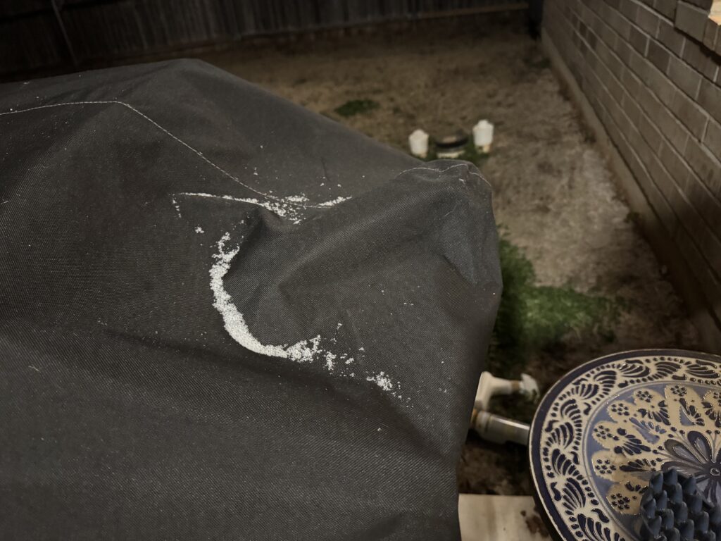
Looks like snow is going to win here. The melting layer can be seen moving south on KTLX well away from here. We’ve had fits and bursts of moderate snowflakes in the last 30 minutes. Still have a long way to go to get things really accumulating – it’s still only 19/4 at the moment – but little piles of white sandy stuff are starting to show up in our yard and on our deck on the southern aspect. Scipio just chased a bunny out of our yard, so he’s the only one out there braving the snow. Expecting the show to really get going in 2-3 hours once we saturate more.
9:00 pm
Settling into a nice thump here now. I sent this image to my family about an hour ago and we’ve only been doing better since.
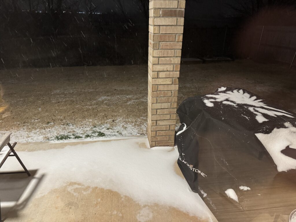
Still have some smaller rimed/pellety snow, but there are more dendrites floating around than I saw at 7:30. There’s some slush at the bottom based on my measurement on the sidewalk.
Snow Depth: 0.5 inches
Saturday, January 24 12:40 am
Safely navigated my way to work. My road was pristine and untouched snow, while secondary roads on the way in were generally snow-covered but passable.
Radar showed the really nice ripping totals from the first wave already coming to an end. This is a bit of a disappointment, though we did better in Norman than just about everyone else out there, so I guess I shouldn’t complain too much. Snow looks much nicer once you manage to cover up all of the grass, and we have done that. Totals right now are sitting about 2.6 inches per my midnight measurement. I’ll get a picture sometime later tonight when there’s more worth measuring. 13/9 with a wind chill of -2 right now.
3:30 am
Well one thing is certain: it has gotten COLD. Currently 9/5 with a strong wind, and the Norman Mesonet site is reporting a wind chill of -9. That’s much better than western Oklahoma which is uniformly sitting 10-20 degrees below zero for wind chills right now.
I took another measurement at 3:00 outside. Didn’t need to do much before because we had a several-hour-long lull, but now radar is starting to fill in with some stronger elements. One of those passed over as I was measuring and I saw some more dendrite-looking flakes. Another should be here soon. And then there’s another zone of snow out in the Panhandle/New Mexico that looks like it will arrive after daybreak and maybe clip us.
Snow Depth: 3.0 inches
11:00 pm
Haven’t been on my laptop since last night’s shift. Measured 3.3 inches for the end of the night. The dry slot did arrive after daybreak and pretty much clip us out of any snow, though areas just northwest of OKC did quite well for themselves. I should have taken Scipio out to play, but desperately needed to shovel when I got home, so I didn’t go to sleep until close to 9:00 and slept through almost the entirety of daylight.
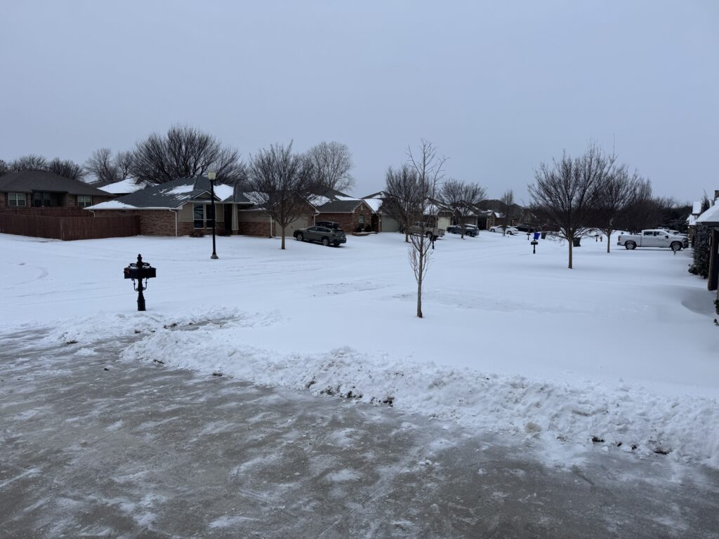
Annoyed that I’ve been this excited about a snowstorm and I didn’t enjoy it more during the day. Hopefully we get some good snowfall rates with the second wave tonight (certainly have over the last couple of hours). Snow depth is holding steady around 3-4 inches thanks to some compaction, wind, and the sleet. But rates are pretty decent and the deformation band may help us jackpot just a little more snow.
Will it be the historic event I’d hoped? No. Will Scipio and I hopefully get to play in some fresh powder when I wake up? Yes.
January 25: 5:30 am
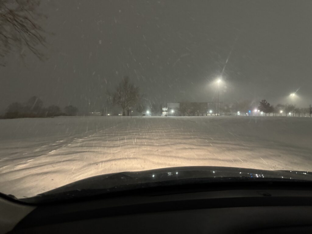
The final band of snow is coming through right now. Was pretty quiet for most of the night as a dry slot hit, but the upper low is finally kicking out and giving us the deformation band show. It won’t add on much to our total snow, but it was still stunning to go outside (5/0 for a wind chill of -10 right now) and just stand there for a few minutes, watching the snowflakes dance and twirl and flit about in the streetlight. It was completely quiet (except for the guy plowing the NWC parking lot). There were no other tracks out there except for my own footprints. I could listen to the snow hiss as it hit the ground, marvel at the loss of visibility, and just enjoy something that never happens around here.
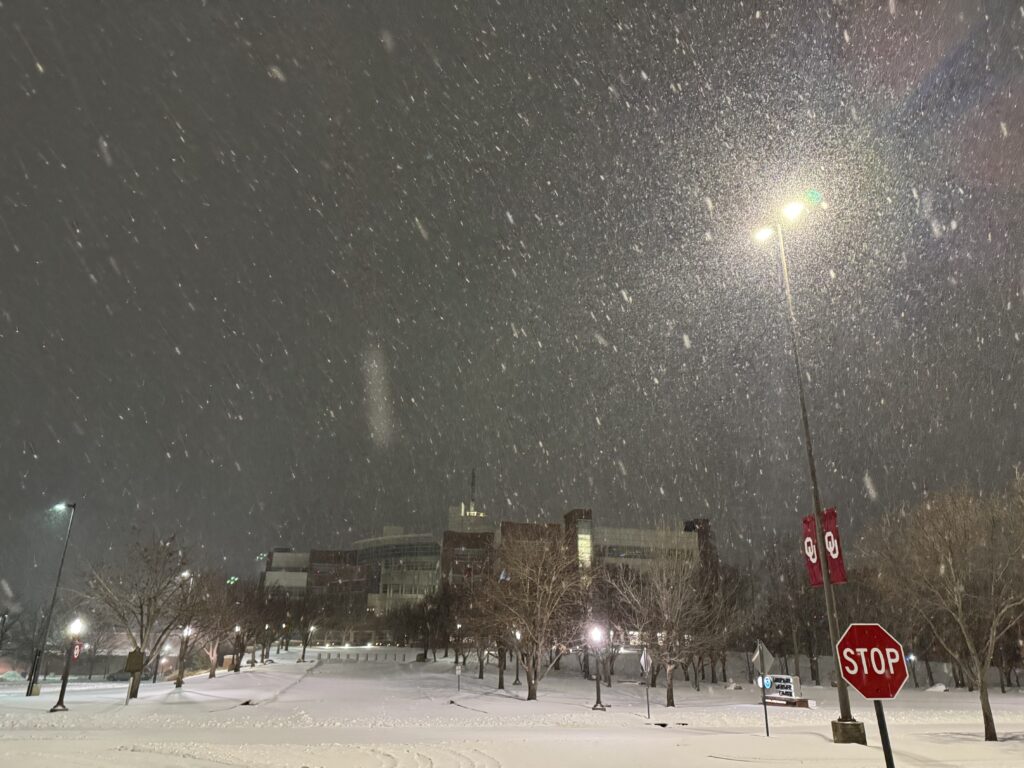
One of my biggest struggles in life is something called the expectation gap. In other words, I build things up too much in my head so that they can’t possibly live up to those expectations. It feels like a winter storm is the perfect place to do that. There’s always so much hype in the lead-up. There are weather models to check, messaging to do, and a world of endless possibilities up until the first flakes fall. This storm has reminded me that bluntly, I don’t live in a part of the country that gets a lot of snow. OKC is going to end up near 7 inches of snow in the last 3 days, something it has only done 20 times in history prior to this weekend. If my reaction to that is anything other than being impressed, then it seems likely that I am letting myself fall prey to the expectation gap.
So with all of that said, when the snow was falling a bit ago, I just stood there and enjoyed it.
Postscript
The great winter storm of January 2026 has come to a close. That final snowband was quite the last-second thump, and actually brought us reasonably close to realistic forecast expectations. Our office measured 6.9 inches of snow while OKC recorded 8.5. I think there was a little less on the ground at our house in part because of compaction and sleet, but still enough to make shoveling on Sunday afternoon a pretty tough task.
True to my word, I made sure to carve out more time to spend with Elizabeth and Scipio in the winter wonderland. It was one of those sunny post-snow afternoons known as “bluebird days” to skiers. Our house looked pretty majestic with all of the snow piled up on top of it.
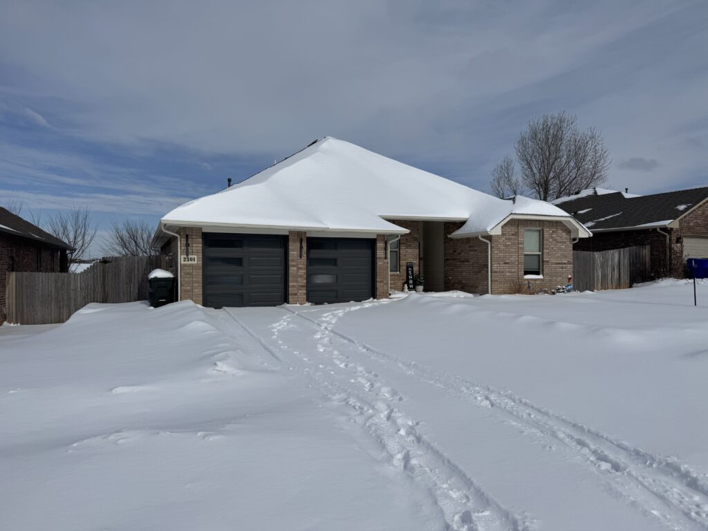
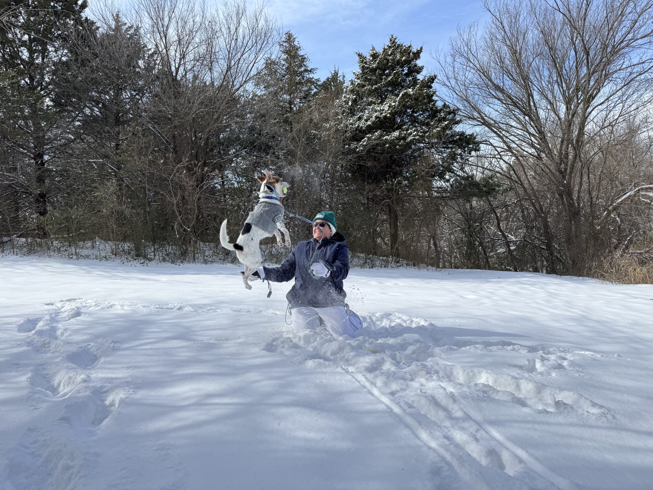
The wind chill was still below 0 despite the sun, so Elizabeth and I didn’t take our dog and his poor, bare paws very far – just to the little hill next to Alameda Park a couple hundred yard west of our house. As always, he loves the snow. He’ll eat it, zoomie in it, throw tennis balls all around and lose them inside the powder, you name it. This may be my favorite picture of him ever.
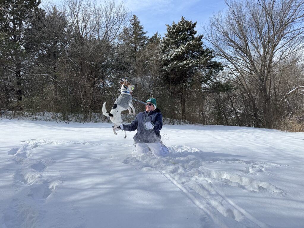
The snow didn’t really compact all that much during the day on Sunday, and roads were pretty horrendous to drive Elizabeth to the airport in (but she did make it to Houston for AMS). I was able to take Scipio for another good play at a soccer field on Monday, which he really liked. Maybe the best part of this whole event is that the warmup afterwards was slow, giving me a couple of days to look out our back window on a winter wonderland.
Living in Oklahoma has changed my perspective on winter. Growing up in Michigan it was a nuisance with the constant grey skies, cold weather, and days on end where you saw at least light snowfall. Coming out here, everything needs to go just right for God to give you a taste of what real winter looks like. This may not have been the single most incredible winter storm I’ve seen here, but it was up there. More than anything else, though, it was a good lesson to learn to enjoy life as it comes instead of always wishing for more.
